

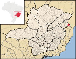
Nanuque
Encyclopedia
Minas Gerais
Minas Gerais is one of the 26 states of Brazil, of which it is the second most populous, the third richest, and the fourth largest in area. Minas Gerais is the Brazilian state with the largest number of Presidents of Brazil, the current one, Dilma Rousseff, being one of them. The capital is the...
. As of 2007 the population was 40,307 in a total area of 1,515 km². It is part of the IBGE statistical meso-region of Vale do Mucuri and the micro-region of Nanuque. It became a municipality in 1948.
Micro-region
Nanuque is a statistical micro-region with 10 municipalities: Águas FormosasÁguas Formosas
Águas Formosas is a Brazilian municipality located in the north-east of the state of Minas Gerais. Its population as of 2007 was 18,518 living in a total area of 817 km². The city belongs to the statistical mesoregion of Vale do Mucuri and to the statistical microregion of Nanuque. It became...
, Bertópolis
Bertópolis
Bertópolis is a municipality in the northeast of the Brazilian state of Minas Gerais. As of 2007 the population was 4,588 in a total area of 426 km². The elevation is 278 meters. It became a municipality in 1962. The postal code is 39875-000....
, Carlos Chagas
Carlos Chagas, Minas Gerais
Carlos Chagas is a Brazilian municipality located in the northeast of the state of Minas Gerais. Its population as of 2007 was 20,812 living in a total area of 3,199 km². The city belongs to the statistical mesoregion of Vale do Mucuri and to the statistical microregion of Nanuque. It became a...
, Crisólita
Crisólita
Crisólita is a municipality in the northeast of the Brazilian state of Minas Gerais. As of 2007 the population was 5,659 in a total area of 970 km². The elevation is 282 meters. It is part of the IBGE statistical microregion of Nanuque. The postal code is 39885-000.Crisólita is on the Rio...
, Fronteira dos Vales
Fronteira dos Vales
Fronteira dos Vales is a Brazilian municipality located in the north-east of the state of Minas Gerais. Its population as of 2007 was 4,835 living in a total area of 318 km². The city belongs to the statistical mesoregion of Vale do Mucuri and to the statistical microregion of Nanuque. It became a...
, Machacalis
Machacalis
Machacalis is a Brazilian municipality located in the northeast of the state of Minas Gerais. Its population as of 2007 was 6,855 living in a total area of 329 km². The city belongs to the statistical mesoregion of Vale do Mucuri and to the statistical microregion of Nanuque. It became a...
, Nanuque, Santa Helena de Minas
Santa Helena de Minas
Santa Helena de Minas is a municipality in the northeast of the Brazilian state of Minas Gerais. As of 2007 the population was 5,892 in a total area of 277 km². The elevation is 312 meters. It became a municipality in 1997....
, Serra dos Aimorés
Serra dos Aimorés, Minas Gerais
Serra dos Aimorés is a Brazilian municipality located in the north-east of the state of Minas Gerais. Its population as of 2007 was 8,345 living in a total area of 215 km². The city belongs to the statistical mesoregion of Vale do Mucuri and to the statistical microregion of Nanuque. It...
, and Umburatiba
Umburatiba
Umburatiba is a Brazilian municipality located in the north-east of the state of Minas Gerais. Its population as of 2007 was 2,776 living in a total area of 405 km². The city belongs to the statistical mesoregion of Vale do Mucuri and to the statistical microregion of Nanuque. It became a...
. In 2000 the area was 8,495.90 km² with a population of 117,595 inhabitants. The population density (2000) was 13.84 inhab/km².
Location and neighboring municipalities
Nanuque is located in the valley of the Mucuri River at an elevation of 131 meters. It lies in a corner of Minas Gerais with the boundary lines of BahiaBahia
Bahia is one of the 26 states of Brazil, and is located in the northeastern part of the country on the Atlantic coast. It is the fourth most populous Brazilian state after São Paulo, Minas Gerais and Rio de Janeiro, and the fifth-largest in size...
to the north and east, and that of Espírito Santo
Espírito Santo
Espírito Santo is one of the states of southeastern Brazil, often referred to by the abbreviation "ES". Its capital is Vitória and the largest city is Vila Velha. The name of the state means literally "holy spirit" after the Holy Ghost of Christianity...
to the south. The Serra dos Aimorés lies to the north.
Neighboring municipalities are: Medeiros Neto
Medeiros Neto
Medeiros Neto is a town and municipality in the state of Bahia in the North-East region of Brazil.-References:...
(BA), Lajedão
Lajedão
Lajedão is a town and municipality in the state of Bahia in the North-East region of Brazil.-References:...
(BA) (north); Montanha (ES), Mucurici (ES) (south); Serra dos Aimorés
Serra dos Aimorés
Serra dos Aimorés is a mountainous area in eastern Brazil straddling the border between Espírito Santo and Minas Gerais....
(MG), Mucuri
Mucuri
Mucuri is a city in the state of Bahia in Brazil. The estimated population in 2008 was 34,836 inhabitants. It is the southernmost city in Bahia, and the only one from that state to border Espírito Santo....
(BA) (east) and Carlos Chagas
Carlos Chagas, Minas Gerais
Carlos Chagas is a Brazilian municipality located in the northeast of the state of Minas Gerais. Its population as of 2007 was 20,812 living in a total area of 3,199 km². The city belongs to the statistical mesoregion of Vale do Mucuri and to the statistical microregion of Nanuque. It became a...
(MG) (west). The distance to Belo Horizonte
Belo Horizonte
Belo Horizonte is the capital of and largest city in the state of Minas Gerais, located in the southeastern region of Brazil. It is the third largest metropolitan area in the country...
is 603 km.
The climate is humid tropical with temperatures varying between maximums of 39º and minimums of 20º. The annual rainfall is around 1,064 mm.
Economic activities
The economy is based on cattle raising, small industries, services, and agriculture, with the main crops being beans, sugarcane (2,128 ha.), soybeans, and corn. There was an alcohol distilling plant using the sugarcane produced locally. The cattle industry was very important with 143,000 head in 2005. In 2005 there were 372 rural producers but only 106 tractors. 1,200 persons were dependent on agriculture. There were 4,264 automobiles in 2006, giving a ratio of 5 inhabitants per automobile (there were 4,600 motorcycles). There were 5 banks in 2007.Health and education
Health assistance (2004)is provided by three hospitals with 154 beds and six health clinics in the urban area, two in the rural area and five teams of the Program called Health in the Family. There are also five laboratories and nine pharmacies. According to the local government there were 39 doctores, 32 dentists, 8 pharmacists, seven nurses, and 68 nursing assistants.Educational needs were met by 22 primary schools (6 private), 6 middle schools (2 private), and 17 pre-schools (6 private). There was three branches of higher education: Fundação Educacional de Caratinga-FUNEC, Sociedade de Ensino Superior de Nanuque, and Unipac.
Nanuque is ranked in the lower-middle on the MHDI.
- MHDI: .708 (2000)
- State ranking: 512 out of 853 municipalities
- National ranking: 2,861 out of 5,138 municipalities in 2000
- Life expectancy: 63
- Literacy rate: 80
- Combined primary, secondary and tertiary gross enrolment ratio: .796
- Per capita income (monthly): R$226.00
- Degree of urbanization: 90.78
- Percentage of urban residences connected to sewage system: 80.10
- Infant mortality rate: 9.71
The above figures can be compared with those of Poços de Caldas
Poços de Caldas
Poços de Caldas is a city and municipality in south-western Minas Gerais state, Brazil, in the microregion of the same name. Its estimated population in 2009 was 151,449 inhabitants...
, which had an MHDI of .841, the highest in the state of Minas Gerais
Minas Gerais
Minas Gerais is one of the 26 states of Brazil, of which it is the second most populous, the third richest, and the fourth largest in area. Minas Gerais is the Brazilian state with the largest number of Presidents of Brazil, the current one, Dilma Rousseff, being one of them. The capital is the...
. The highest in the country was São Caetano do Sul
São Caetano do Sul
São Caetano do Sul is a city in São Paulo state in Brazil, located in the Greater São Paulo Metropolitan Area. It is the city with the highest per capita income in Brazil and it also has the highest Human Development Index .-Geography:São Caetano do Sul is located on a plateau that is part of the...
in the state of São Paulo
São Paulo
São Paulo is the largest city in Brazil, the largest city in the southern hemisphere and South America, and the world's seventh largest city by population. The metropolis is anchor to the São Paulo metropolitan area, ranked as the second-most populous metropolitan area in the Americas and among...
with an MHDI of .919. The lowest was Manari in the state of Pernambuco
Pernambuco
Pernambuco is a state of Brazil, located in the Northeast region of the country. To the north are the states of Paraíba and Ceará, to the west is Piauí, to the south are Alagoas and Bahia, and to the east is the Atlantic Ocean. There are about of beaches, some of the most beautiful in the...
with an MHDI of .467 out of a total of 5504 municipalities in the country as of 2004. At last count Brazil had 5,561 municipalities so this might have changed at the time of this writing.