

U.S. Route 31E in Kentucky
Encyclopedia
Kentucky
The Commonwealth of Kentucky is a state located in the East Central United States of America. As classified by the United States Census Bureau, Kentucky is a Southern state, more specifically in the East South Central region. Kentucky is one of four U.S. states constituted as a commonwealth...
, in between each is Interstate 65 in Kentucky
Interstate 65 in Kentucky
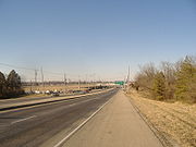
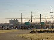
In the U.S. state of Kentucky, Interstate 65 enters the state five miles south of Franklin. It passes by the major cities of Bowling Green, Elizabethtown, and Louisville before exiting the state.- Route description :...
. At the north end is Louisville
Louisville, Kentucky
Louisville is the largest city in the U.S. state of Kentucky, and the county seat of Jefferson County. Since 2003, the city's borders have been coterminous with those of the county because of a city-county merger. The city's population at the 2010 census was 741,096...
, Kentucky
Kentucky
The Commonwealth of Kentucky is a state located in the East Central United States of America. As classified by the United States Census Bureau, Kentucky is a Southern state, more specifically in the East South Central region. Kentucky is one of four U.S. states constituted as a commonwealth...
, starting at the George Rogers Clark Memorial Bridge. Going south, it goes through the towns of Mount Washington
Mount Washington, Kentucky
Mount Washington is a city in northeast Bullitt County, Kentucky, United States. The population was 8,485 at the 2000 census. The estimated population as of 2006 was 11,761. It is located at what was once the crossroads of two stagecoach routes, which spurred early population growth and the...
, Bardstown
Bardstown, Kentucky
As of the census of 2010, there were 11,700 people, 4,712 households, and 2,949 families residing in the city. The population density was . There were 5,113 housing units at an average density of...
, New Haven
New Haven, Kentucky
New Haven is a city in Nelson County, Kentucky, United States. The population was 849 at the 2000 census.New Haven was founded as Pottinger's Landing in 1781 and later named New Haven by Samuel Pottinger after the Connecticut town...
, Hodgenville
Hodgenville, Kentucky
Hodgenville is a city in and the county seat of LaRue County, Kentucky, United States. It sits along the North Fork of the Nolin River. The population was 2,874 at the 2000 census...
, Glasgow
Glasgow, Kentucky
Glasgow is a city in and the county seat of Barren County, Kentucky, United States. The population was 14,200 at the 2000 census. The city is well-known for its annual Scottish Highland Games. In 2007, Barren County was named the number one rural place to live by Progressive Farmer magazine...
, and Scottsville
Scottsville, Kentucky
Scottsville is a city in and the county seat of Allen County, Kentucky, United States. The population was 4,327 at the 2000 census.-Geography:Scottsville is located at ....
before arriving at the Tennessee
Tennessee
Tennessee is a U.S. state located in the Southeastern United States. It has a population of 6,346,105, making it the nation's 17th-largest state by population, and covers , making it the 36th-largest by total land area...
border. In the 19th century the same route was a stagecoach
Stagecoach
A stagecoach is a type of covered wagon for passengers and goods, strongly sprung and drawn by four horses, usually four-in-hand. Widely used before the introduction of railway transport, it made regular trips between stages or stations, which were places of rest provided for stagecoach travelers...
path between Louisville and Nashville, Tennessee
Nashville, Tennessee
Nashville is the capital of the U.S. state of Tennessee and the county seat of Davidson County. It is located on the Cumberland River in Davidson County, in the north-central part of the state. The city is a center for the health care, publishing, banking and transportation industries, and is home...
, and before that a postal route at least by 1820. Originally part of the Jackson Highway
Jackson Highway
The Jackson Highway was a National Auto Trail in the United States connecting Chicago and New Orleans via Nashville. It was named after General and U.S...
, the Works Progress Administration
Works Progress Administration
The Works Progress Administration was the largest and most ambitious New Deal agency, employing millions of unskilled workers to carry out public works projects, including the construction of public buildings and roads, and operated large arts, drama, media, and literacy projects...
measured the total distance on 31E in Kentucky as 147.8 miles (237.9 km).
Jefferson County, Kentucky
As of the census of 2000, there were 693,604 people, 287,012 households, and 183,113 families residing in the county. The population density was . There were 305,835 housing units at an average density of...
; both of which are beltways: (Interstate 264 (Watterson Expressway
Interstate 264 (Kentucky)
The Henry Watterson Expressway, also known as the Georgia Davis Powers/Shawnee Expressway west of US 31W, is one of two Interstate Highways in the United States designated as Interstate 264 . It is 22.93 miles in length, and runs an open circle around central Louisville, Kentucky...
) and the I-265/Gene Snyder Expressway
Interstate 265
Interstate 265 is an Interstate Highway ringing the Louisville, Kentucky metropolitan area, which includes southern Indiana, although the Indiana and Kentucky segments remain separate at the present time. In Kentucky it only runs through Jefferson County, from Interstate 71 in northeastern...
. However, it has intersections with the state freeways of Martha Layne Collins Blue Grass Parkway (in Nelson County
Nelson County, Kentucky
Nelson County is a county located in the U.S. state of Kentucky. As of 2010, the population was 43,437. Its county seat is Bardstown. The county is part of the Louisville/Jefferson County, KY–IN Metropolitan Statistical Area.- History :...
) and with the Louie B. Nunn Cumberland Parkway in Barren County
Barren County, Kentucky
As of the census of 2000, there were 38,033 people, 15,346 households, and 10,941 families residing in the county. The population density was . There were 17,095 housing units at an average density of...
.
There are various historical sites along 31E in Kentucky. Among them are Cave Hill Cemetery and Farmington Historic Plantation in Louisville, My Old Kentucky Home State Park
My Old Kentucky Home State Park
My Old Kentucky Home State Park is a state park located in Bardstown, Kentucky. The park's centerpiece is Federal Hill, a former plantation built by United States Senator John Rowan in 1795. During Rowan's life, the mansion became a meeting place for local politicians and hosted several visiting...
in Bardstown, and Abraham Lincoln Birthplace National Historic Site
Abraham Lincoln Birthplace National Historic Site
Abraham Lincoln Birthplace National Historical Park preserves two farm sites where Abraham Lincoln lived as a child.In the fall of 1808, Thomas and Nancy Lincoln settled on Sinking Spring Farm. Two months later on February 12, 1809, Abraham Lincoln was born there in a one-room log cabin. Today...
just south of Hodgenville. Also, five historic monuments to the Civil War are along the path: three in Louisville, one in Bardstown, and one in Glasgow.
31E has been known as a dangerous road, with many risky spots. A historic one was at Coxs Creek
Coxs Creek, Kentucky
Coxs Creek is an unincorporated community along U.S. Routes 31E/150 in Nelson County, Kentucky, United States, 4½ miles north of the county seat of Bardstown...
in Nelson County, where a post office had to be relocated so traffic could see each other. Other dangerous spots in Nelson County where emergency personnel consider notorious are Gobel Lake Curve, Hibbs Lane, and High Grove.
When the rerouting of 31E in Nelson and Spencer Counties was being planned, a survey of historic sites that could have been affected by the new route was studied, especially if the sites could one day become listed on the National Register of Historic Places
National Register of Historic Places
The National Register of Historic Places is the United States government's official list of districts, sites, buildings, structures, and objects deemed worthy of preservation...
.