

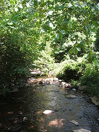
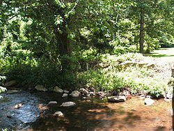
Thornton River
Encyclopedia
Virginia
The Commonwealth of Virginia , is a U.S. state on the Atlantic Coast of the Southern United States. Virginia is nicknamed the "Old Dominion" and sometimes the "Mother of Presidents" after the eight U.S. presidents born there...
. It rises at Thornton Gap
Thornton Gap
Thornton Gap is a wind gap located in the Blue Ridge Mountains in Virginia separating the Shenandoah Valley from the Piedmont region of the state.-History:...
in Shenandoah National Park
Shenandoah National Park
Shenandoah National Park encompasses part of the Blue Ridge Mountains in the U.S. state of Virginia. This national park is long and narrow, with the broad Shenandoah River and valley on the west side, and the rolling hills of the Virginia Piedmont on the east...
and flows east through Rappahannock County
Rappahannock County, Virginia
As of the census of 2010, there were 7,373 people, 2,788 households, and 2,004 families residing in the county. The population density was 26 people per square mile . There were 3,303 housing units at an average density of 12 per square mile...
, running parallel to U.S. Route 211
U.S. Route 211
U.S. Route 211 is a spur of US 11 in the U.S. state of Virginia. Known for most of its length as Lee Highway, the U.S. Highway runs from Interstate 81 and Virginia State Route 211 in New Market east to US 15 Business, US 29 Business, and US 211 Business in Warrenton...
until it reaches the town of Sperryville
Sperryville, Virginia
Sperryville is a census-designated place in Rappahannock County, Virginia, United States. The population as of the 2010 Census was 342.- History :...
. Continuing east into Culpeper County
Culpeper County, Virginia
As of the census of 2000, there were 34,262 people, 12,141 households, and 9,045 families residing in the county. The population density was 90 people per square mile . There were 12,871 housing units at an average density of 34 per square mile...
, the Thornton River joins the Hazel River
Hazel River
The Hazel River is a tributary of the Rappahannock River in northern Virginia in the United States. Via the Rappahannock, it is part of the Chesapeake Bay watershed. It rises in Shenandoah National Park and flows generally eastwardly through Rappahannock and Culpeper counties. It joins the...
, a tributary of the Rappahannock River
Rappahannock River
The Rappahannock River is a river in eastern Virginia, in the United States, approximately in length. It traverses the entire northern part of the state, from the Blue Ridge Mountains in the west, across the Piedmont, to the Chesapeake Bay, south of the Potomac River.An important river in American...
, and thus part of the Chesapeake Bay
Chesapeake Bay
The Chesapeake Bay is the largest estuary in the United States. It lies off the Atlantic Ocean, surrounded by Maryland and Virginia. The Chesapeake Bay's drainage basin covers in the District of Columbia and parts of six states: New York, Pennsylvania, Delaware, Maryland, Virginia, and West...
watershed
Drainage basin
A drainage basin is an extent or an area of land where surface water from rain and melting snow or ice converges to a single point, usually the exit of the basin, where the waters join another waterbody, such as a river, lake, reservoir, estuary, wetland, sea, or ocean...
.