
Thailand Route 403
Encyclopedia
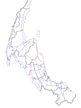
Route 403 is a road in Thailand that is divided into 3 sections. The first section starts at Amphoe Mueang Nakhon Si Thammarat
. It goes south-westward and join Route 41
at Suan Pak junction. The 2nd section starts at Chong Khao junction. It goes westward to Amphoe Thung Song
, then goes southward and join with Route 4
near Amphoe Huai Yot
. The 3rd sections starts at Amphoe Mueang Trang
. It goes south-westward and ends at Amphoe Kantang
 Route 403 is main road that connect Nakhon Si Thammarat and Trang. The 1st section starts at Hua Thanon junction in Amphoe Mueang Nakhon Si Thammarat. The junction also the start of Route 408 and route 4013. All of first section is 4-land (2 lane per direction) asphalt with island as median between direction. It goes south-westward with almost level. It joins Route 41 at Suan Pak junction. Total length is about 35 km.
Second section starts at Chong Khao junction. It separate from Route 41 on the north. It goes westward parallel to Route 41. First few kilometer of this section is 2-lane asphalt and run along hill shoulder. Then, it is widen to 4-lane and goes into Amphoe Thung Song
. It turns left to the south, pass Route 41 and goes into Trang Province
. It finally ends by joining with Route 4 near Amphoe Huai Yot
. Total length is about 44 km.
Third section start at Amphoe Mueang Trang
. It goes south-westward and ends at Amphoe Kantang
. Total length is about 20 km.
Originally, the first and second sections were connected. However, when Route 41 section Surat Thani - Thung Song - Phatthalung was constructed, Route 403 from Suan Pak junction to Chong Khao junction, which is the section that cross the mountain, was reassign as part of Route 41.
Amphoe Mueang Nakhon Si Thammarat
Nakhon Si Thammarat is the capital district of Nakhon Si Thammarat Province in southern Thailand.-Geography:Neighboring districts are Pak Phanang, Chaloem Phra Kiat, Phra Phrom, Lan Saka, Phrom Khiri and Tha Sala...
. It goes south-westward and join Route 41
Thailand Route 41
Route 41 starts at intersection with Route 4 in Chumphon Province. It goes southward passing through Surat Thani Province and Nakhon Si Thammarat Province. It ends at Phatthalung Province joining Route 4 again.-Route Details:...
at Suan Pak junction. The 2nd section starts at Chong Khao junction. It goes westward to Amphoe Thung Song
Amphoe Thung Song
Thung Song is a district in the southwestern part of Nakhon Si Thammarat Province, southern Thailand.-Geography:Neighboring districts are Bang Khan, Thung Yai, Na Bon, Chang Klang, Lan Saka, Ron Phibun, Chulabhorn, Cha-uat of Nakhon Si Thammarat Province, Huai Yot and Ratsada of Trang...
, then goes southward and join with Route 4
Phetkasem highway
Phetkasem Road or Thailand Route 4 is one of the four major highways in Thailand, along with Phahonyothin Road , Mittraphap Road , and Sukhumvit Road . At 1,274 km, it is the longest highway in Thailand. It begins at Naowa Chamnian bridge in Bangkok Yai, Bangkok...
near Amphoe Huai Yot
Amphoe Huai Yot
Huai Yot is a district in the northern part of Trang Province, Thailand.-Geography:Neighboring districts are Ratsada of Trang Province, Thung Song of Nakhon Si Thammarat Province, Pa Phayom, Si Banphot of Phatthalung Province, Mueang Trang, Wang Wiset of Trang Province again and Bang Khan of...
. The 3rd sections starts at Amphoe Mueang Trang
Amphoe Mueang Trang
Mueang Trang Mueang Trang Mueang Trang ( , also Mueang Thap Thiang ( ) is the capital district ( Amphoe Mueang ) of Trang Province, Thailand. The city (thesaban nakhon) has a population of 59,637 (2005) and covers the whole tambon Thap Thiang of Mueang Trang district....
. It goes south-westward and ends at Amphoe Kantang
Amphoe Kantang
Kantang is a district in the western part of Trang Province, Thailand.-History:Kantang was the original capital of Trang Province, at first in Khuan Thani, and then from 1893-1916 to the coastal Kantang itself. As the area was prone to floodings the capital was finally moved further inland to...
Route Details
Second section starts at Chong Khao junction. It separate from Route 41 on the north. It goes westward parallel to Route 41. First few kilometer of this section is 2-lane asphalt and run along hill shoulder. Then, it is widen to 4-lane and goes into Amphoe Thung Song
Amphoe Thung Song
Thung Song is a district in the southwestern part of Nakhon Si Thammarat Province, southern Thailand.-Geography:Neighboring districts are Bang Khan, Thung Yai, Na Bon, Chang Klang, Lan Saka, Ron Phibun, Chulabhorn, Cha-uat of Nakhon Si Thammarat Province, Huai Yot and Ratsada of Trang...
. It turns left to the south, pass Route 41 and goes into Trang Province
Trang Province
Trang is one of the southern provinces of Thailand, at the western shore of the Malay Peninsula to the Andaman Sea. Neighboring provinces are Krabi, Nakhon Si Thammarat, Phatthalung and Satun....
. It finally ends by joining with Route 4 near Amphoe Huai Yot
Amphoe Huai Yot
Huai Yot is a district in the northern part of Trang Province, Thailand.-Geography:Neighboring districts are Ratsada of Trang Province, Thung Song of Nakhon Si Thammarat Province, Pa Phayom, Si Banphot of Phatthalung Province, Mueang Trang, Wang Wiset of Trang Province again and Bang Khan of...
. Total length is about 44 km.
Third section start at Amphoe Mueang Trang
Amphoe Mueang Trang
Mueang Trang Mueang Trang Mueang Trang ( , also Mueang Thap Thiang ( ) is the capital district ( Amphoe Mueang ) of Trang Province, Thailand. The city (thesaban nakhon) has a population of 59,637 (2005) and covers the whole tambon Thap Thiang of Mueang Trang district....
. It goes south-westward and ends at Amphoe Kantang
Amphoe Kantang
Kantang is a district in the western part of Trang Province, Thailand.-History:Kantang was the original capital of Trang Province, at first in Khuan Thani, and then from 1893-1916 to the coastal Kantang itself. As the area was prone to floodings the capital was finally moved further inland to...
. Total length is about 20 km.
Originally, the first and second sections were connected. However, when Route 41 section Surat Thani - Thung Song - Phatthalung was constructed, Route 403 from Suan Pak junction to Chong Khao junction, which is the section that cross the mountain, was reassign as part of Route 41.
List of Intersection
- Nakhon Si Thammarat Province
- (Start 1st section) Ratchadamnuen Rd. (northward to Nakhon Si ThammaratNakhon Si ThammaratNakhon Si Thammarat is a town in southern Thailand, capital of the Nakhon Si Thammarat Province and the Nakhon Si Thammarat district. It is about south of Bangkok, on the east coast of the Malay Peninsula. The city was the administrative center of southern Thailand during most of its history. ...
), Route 408 (southward to Amphoe Chaloem Phra KiatAmphoe Chaloem Phra Kiat, Nakhon Si Thammarat ProvinceChaloem Phra Kiat is a district of Nakhon Si Thammarat Province, southern Thailand.-History:The district was created on December 5, 1996, together with four other districts named Chaloem Phra Kiat in celebration of the 50th anniversary of King Bhumibol Adulyadej ascension to the throne.The...
, Songkhla ProvinceSongkhla ProvinceSongkhla is one of the southern provinces of Thailand. Neighboring provinces are Satun, Phatthalung, Nakhon Si Thammarat, Pattani and Yala. To the south it borders Kedah and Perlis of Malaysia....
), Route 4013 (eastward to Amphoe Pak PhanangAmphoe Pak PhanangPak Phanang is a district of Nakhon Si Thammarat Province, southern Thailand.The name of district means Sheltered Mouth, referring to the mouth of the Pak Phanang river protected from the open sea by a long peninsula.- History :...
) - Route 4103 (northward to Amphoe Tha SalaAmphoe Tha SalaTha Sala is a district of Nakhon Si Thammarat Province, southern Thailand.-Geography:Neighboring districts are Mueang Nakhon Si Thammarat, Phrom Khiri, Nopphitam and Sichon...
, south-eastward to Amphoe Chaloem Phra Kiat, Songkhla Province) - Route 4238 (north-westward to Amphoe Lan SakaAmphoe Lan SakaLan Saka is a district of Nakhon Si Thammarat Province, southern Thailand.-History:The district was at first a minor district named Khao Kaeo , which was a subordinate of Mueang Nakhon Si Thammarat. When the district office was moved to tambon Lan Saka, the district was renamed accordingly...
) - Route 4018 (southward to Amphoe ChulabhornAmphoe ChulabhornChulabhorn is a district of Nakhon Si Thammarat Province, southern Thailand.The district is named in honor of HRH Princess Chulabhorn, the youngest daughter of King Bhumipol Adulyadej, at her 36th birthday.-History:...
) - (End 1st section) Route 41Thailand Route 41Route 41 starts at intersection with Route 4 in Chumphon Province. It goes southward passing through Surat Thani Province and Nakhon Si Thammarat Province. It ends at Phatthalung Province joining Route 4 again.-Route Details:...
#1 (westward to Amphoe Thung SongAmphoe Thung SongThung Song is a district in the southwestern part of Nakhon Si Thammarat Province, southern Thailand.-Geography:Neighboring districts are Bang Khan, Thung Yai, Na Bon, Chang Klang, Lan Saka, Ron Phibun, Chulabhorn, Cha-uat of Nakhon Si Thammarat Province, Huai Yot and Ratsada of Trang...
, Surat Thani ProvinceSurat Thani ProvinceSurat Thani is the largest of the southern provinces of Thailand, on the eastern shore of the Gulf of Thailand. Surat Thani means City of Good People, the title given to the city by King Vajiravudh ....
, eastward to Amphoe Chulabhorn, Phatthalung ProvincePhatthalung ProvincePhatthalung is one of the southern provinces of Thailand. Neighboring provinces are Nakhon Si Thammarat, Songkhla, Satun and Trang.-Geography:...
) - (Start 2nd section) Route 41 #2 (westward to Amphoe Thung Song, Surat Thani Province, eastward to Amphoe Ron PhibunAmphoe Ron PhibunRon Phibun is a district in the southern part of Nakhon Si Thammarat Province, southern Thailand.-Geography:Neighboring districts are Thung Song, Lan Saka, Phra Phrom, Chaloem Phra Kiat, Cha-uat and Chulabhorn of Nakhon Si Thammarat Province.-Administration:The district is subdivided into 6...
, Phatthalung Province) - Route 41 #3 (westward to Surat Thani Province, eastward to Amphoe Ron Phibun, Phatthalung Province)
- Route 4151 (westward to Amphoe Bang KhanAmphoe Bang KhanBang Khan is a district of Nakhon Si Thammarat Province, southern Thailand.-Geography:Neighboring districts are Thung Yai and Thung Song of Nakhon Si Thammarat, Ratsada, Huai Yot and Wang Wiset of Trang Province, and Lam Thap of Krabi Province.-History:The district was created as a minor...
, eastward to Amphoe Chulabhorn)
- (Start 1st section) Ratchadamnuen Rd. (northward to Nakhon Si Thammarat
- Trang Province
- (End 2nd section) Route 4Phetkasem highwayPhetkasem Road or Thailand Route 4 is one of the four major highways in Thailand, along with Phahonyothin Road , Mittraphap Road , and Sukhumvit Road . At 1,274 km, it is the longest highway in Thailand. It begins at Naowa Chamnian bridge in Bangkok Yai, Bangkok...
(westward to Amphoe Wang WisetAmphoe Wang Wiset-History:The minor district Wang Wiset was established on July 15 1981 by splitting off five tambon from Sikao district. The first temporary district office within the temple Rat Rangsan was opened on November 2 1981.It was upgraded to a full district on May 21 1990.-Geography:Neighboring...
, Krabi ProvinceKrabi ProvinceKrabi is one of the southern provinces of Thailand, at the shore of the Andaman Sea. Neighbouring provinces are Phang Nga, Surat Thani, Nakhon Si Thammarat and Trang. The Phuket province to the west is also neighbouring, but without any land boundary...
, eastward to Amphoe Huai YotAmphoe Huai YotHuai Yot is a district in the northern part of Trang Province, Thailand.-Geography:Neighboring districts are Ratsada of Trang Province, Thung Song of Nakhon Si Thammarat Province, Pa Phayom, Si Banphot of Phatthalung Province, Mueang Trang, Wang Wiset of Trang Province again and Bang Khan of...
, Trang ProvinceTrang ProvinceTrang is one of the southern provinces of Thailand, at the western shore of the Malay Peninsula to the Andaman Sea. Neighboring provinces are Krabi, Nakhon Si Thammarat, Phatthalung and Satun....
)
- (End 2nd section) Route 4