
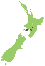
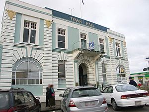
Taihape
Encyclopedia
Rangitikei
Rangitikei is an area in New Zealand that follows the course of State Highway 1, from just south of Waiouru with the QEII Army Memorial Museum, through Taihape, Mangaweka, Hunterville, Marton and Bulls, and then winds down a minor road to the coast at Turakina & Scott’s Ferry...
District, located near the middle of the North Island
North Island
The North Island is one of the two main islands of New Zealand, separated from the much less populous South Island by Cook Strait. The island is in area, making it the world's 14th-largest island...
of New Zealand
New Zealand
New Zealand is an island country in the south-western Pacific Ocean comprising two main landmasses and numerous smaller islands. The country is situated some east of Australia across the Tasman Sea, and roughly south of the Pacific island nations of New Caledonia, Fiji, and Tonga...
. It services a large rural community and lies on State Highway 1
State Highway 1 (New Zealand)
State Highway 1 is the longest and most significant road in the New Zealand roading network, running the length of both main islands. It appears on road maps as SH 1 and on road signs as a white number 1 on a red shield, but it has the official designations SH 1N in the North Island, SH 1S in the...
, which runs through the centre of the North Island.
Economy
Taihape is a rural supply town and was at its peak during the 1960s when it was a railway and transport hub for the surrounding farming community. Much of its economic activity revolved around the railway and rural communities. A major decline occurred in the 1980s due to a restructure and electrification of the railway system and a general downturn in the farming sector. In recent years with the advent of major tourist attractions Taihape is now experiencing an upturn in local commerce. Its location on the North Island Main Trunk Railway and on State Highway 1State Highway 1 (New Zealand)
State Highway 1 is the longest and most significant road in the New Zealand roading network, running the length of both main islands. It appears on road maps as SH 1 and on road signs as a white number 1 on a red shield, but it has the official designations SH 1N in the North Island, SH 1S in the...
has ensured its economic survival. Taihape's main claim to fame is as the "Gumboot Capital of the World", and it attracts large numbers of people to the annual gumboot-throwing contest.
Geography
Taihape is near the confluence of the Hautapu and Rangitikei rivers about 500 m (1500 ft) above sea level. It lies in a sheltered valley among the high country of the central North Island, close to the Rangitikei RiverRangitikei River
The Rangitikei River is one of New Zealand's longest rivers, 185 kilometers long.Its headwaters are to the southeast of Lake Taupo in the Kaimanawa Ranges. It flows from the Central Plateau south past Taihape, Mangaweka, Hunterville, Marton, and Bulls, to the South Taranaki Bight at Tangimoana, 40...
and the Ruahine Ranges. Despite its transport links. Few towns in New Zealand have a steeper street profile, which provides spectacular views across to the Ruahine Ranges. It is surrounded by fertile high country utilised for sheep and deer farming. Its location close to the mountains, rivers and lakes has made it ideal as a service point for hunting and outdoor tourism. The town is at the southern edge of the volcanic plateau
North Island Volcanic Plateau
The North Island Volcanic Plateau is a volcanic plateau covering much of central North Island of New Zealand with volcanoes, lava plateaus, and crater lakes....
.
Transport routes in and out of Taihape have improved over the years. What were once twisting and treacherous roads through the high country, State Highway 1 is now an easy and fast set of deviations through the hills to Mangaweka in the south and Waiouru to the north. North of Taihape the road and railway first cross the wide volcanic plateau
North Island Volcanic Plateau
The North Island Volcanic Plateau is a volcanic plateau covering much of central North Island of New Zealand with volcanoes, lava plateaus, and crater lakes....
(with the volcano
Volcano
2. Bedrock3. Conduit 4. Base5. Sill6. Dike7. Layers of ash emitted by the volcano8. Flank| 9. Layers of lava emitted by the volcano10. Throat11. Parasitic cone12. Lava flow13. Vent14. Crater15...
es Mount Ruapehu
Mount Ruapehu
Mount Ruapehu, or just Ruapehu, is an active stratovolcano at the southern end of the Taupo Volcanic Zone in New Zealand. It is 23 kilometres northeast of Ohakune and 40 kilometres southwest of the southern shore of Lake Taupo, within Tongariro National Park...
, Mount Ngauruhoe
Mount Ngauruhoe
Mount Ngauruhoe is an active stratovolcano or composite cone in New Zealand, made from layers of lava and tephra. It is the youngest vent in the Tongariro volcanic complex on the Central Plateau of the North Island, and first erupted about 2,500 years ago...
, and Mount Tongariro
Mount Tongariro
Mount Tongariro is a volcanic complex in the North Island of New Zealand. It is located 20 kilometres to the southwest of Lake Taupo, and is the northernmost of the three active volcanoes that dominate the landscape of the central North Island....
) and the Rangipo Desert
Rangipo Desert
Rangipo Desert is a barren desert-like environment in New Zealand, located in the Ruapehu District on the North Island Volcanic Plateau; to the east of the three active peaks of Mount Tongariro, Mount Ngauruhoe, and Mount Ruapehu, and to the west of the Kaimanawa Range.The Rangipo Desert receives...
before the road reaches Lake Taupo
Lake Taupo
Lake Taupo is a lake situated in the North Island of New Zealand. With a surface area of , it is the largest lake by surface area in New Zealand, and the second largest freshwater lake by surface area in geopolitical Oceania after Lake Murray ....
and the more hospitable country beyond Taupo
Taupo
Taupo is a town on the shore of Lake Taupo in the centre of the North Island of New Zealand. It is the seat of the Taupo District Council and lies in the southern Waikato Region....
at the north end of the lake, while the railway turns briefly westward through Ohakune
Ohakune
Ohakune is a town in the North Island of New Zealand. It is located at the southern end of the Tongariro National Park, close to the southwestern slopes of the active volcano Mount Ruapehu. Part of the Manawatu-Wanganui region, the town is 70 kilometres northeast of Wanganui, and 25 kilometres west...
on its way to the Raurimu Spiral
Raurimu Spiral
The Raurimu Spiral is a single-track railway spiral, starting with a horseshoe curve, overcoming a 132 m height difference, in the central North Island of New Zealand, on the North Island Main Trunk Railway. It is a notable feat of civil engineering, having been called an 'engineering masterpiece'...
at the north-west edge of the plateau.
There are no transport links to the west, owing to rugged hill country, and only the Gentle Annie Road to the east over a mountain range to the port city of Napier
Napier, New Zealand
Napier is a New Zealand city with a seaport, located in Hawke's Bay on the eastern coast of the North Island. The population of Napier is about About 18 kilometres south of Napier is the inland city of Hastings. These two neighboring cities are often called "The Twin Cities" or "The Bay Cities"...
. Before State Highway 1 and the railway were built the latter road was the main route in or out of what was then an extremely isolated community.
History
The Taihape region was originally inhabited by local Maori tribes who settled the area well before the arrival of Europeans; descendants of these tribes still live in the area. The first record of a European to the region is William Colenso's visit in 1845. In 1884, the surveyor's party for the Main Trunk railway line cut a rough track through the district.The town was founded in 1894, when European settlers arrived from Canterbury
Canterbury, New Zealand
The New Zealand region of Canterbury is mainly composed of the Canterbury Plains and the surrounding mountains. Its main city, Christchurch, hosts the main office of the Christchurch City Council, the Canterbury Regional Council - called Environment Canterbury - and the University of Canterbury.-...
in the South Island. The site of the town was a small natural clearing in dense native bush, which the first settlers set about clearing. Many of the original families have descendants still living in the area. The settlement was first called Hautapu
Hautapu River
The Hautapu River is a river in the Manawatu-Wanganui region of New Zealand. It originates from Ngamatea Swamp in the New Zealand Army's Waiouru Training area...
after the local river, then Otaihape ("the place of Tai the Hunchback"), and finally Taihape.
Before the establishment of the railway, the bulk of farming produce (wool) had to be transported east by horse and bullock cart to Napier
Napier, New Zealand
Napier is a New Zealand city with a seaport, located in Hawke's Bay on the eastern coast of the North Island. The population of Napier is about About 18 kilometres south of Napier is the inland city of Hastings. These two neighboring cities are often called "The Twin Cities" or "The Bay Cities"...
, from where it was exported. Until the establishment of roads and railways in the early 1900s, Taihape, like other rural towns, remained largely an isolated pioneer settlement. It developed as a key railway and transport town, reaching its peak of population and activity during the heyday of the 1950s and 1960s. The town declined during the downturn of the 1980s and today it is largely a refreshment stop for travellers and a service point for the local farming community.
People
Taihape has a population of about 2,000 people. Population peaked at around 3,500 in the late 1960s, but declined in parallel with many other rural towns after that time.The town has five primary schools including St Joseph's Catholic School established in 1916, and the Taihape Area School. All the schools service a rural community scattered over a wide area. In April 2004 the education minister, Trevor Mallard
Trevor Mallard
Trevor Colin Mallard is a New Zealand politician. He was a Cabinet Minister in the Fifth Labour Government of New Zealand holding portfolios including Environment, Labour, Broadcasting, State Owned Enterprises, Rugby World Cup and Education. He was also Associate Minister of Finance.-Early...
, decided that the state secondary and primary schools were to recombine and pool their resources to become an Area School. This caused much angst in the town, especially regarding the choice of site.
The Taihape local government ward is part of the wider Rangitikei District Council, with the current Mayor Chalky Leary and is served by 3 ward councillors, Cr Ed Cherry, Cr Jan Byford, and Mangaweka
Mangaweka
Mangaweka is a township on State Highway One , in the North Island of New Zealand, with a population of just over 200. It is between Taihape to the north and Hunterville to the south...
based Cr Richard Aslett.
Fame
Taihape is home of the annual Gumboot DayGumboot Day
Gumboot Day is a native celebration of Taihape, New Zealand. It occurs the Tuesday after Easter, and has been a regular event since 1985. It is a celebration of all things to do with gumboots, and includes the famous gumboot throwing contest....
, first celebrated on 9 April 1985. This festival was devised by local business people who decided to capitalise on its rural image.
Entertainer John Clarke
John Clarke (satirist)
John Morrison Clarke is a New Zealand-born Australian comedian, writer, and satirist. He was born in Palmerston North, New Zealand, and has lived in Australia since the late 1970s...
used Taihape as a location for his Fred Dagg
Fred Dagg
Fred Dagg is a fictional archetype satirist from New Zealand created and acted on stage, film and television by satirist John Clarke. Clarke graced New Zealand TV screens as Dagg during the mid to late 1970s, "taking the piss" out of the post-pioneering Kiwi bloke and ‘blokesses’.When Clarke first...
comedy persona.
Railways
Taihape was a major railway marshaling yard until the late 1970s.There were many railway houses situated along the length of Mataroa Road; now only three remain. At one time Taihape had two lodges of the Royal Antediluvian Order of Buffaloes
Royal Antediluvian Order of Buffaloes
The Royal Antediluvian Order of Buffaloes is a Fraternal, Benevolent and Social Organisation in the United Kingdom. It has no Royal patronage; it was founded after the Flood, it is not a recognised Order of chivalry and has no connection with buffaloes...
. One of the lodges was named Kaikoura Lodge No 226 (after the local Kaikoura River) this lodge survived until 2007. The lodge once had its own lodge rooms. The former railways house painted purple located on the highway traveling south into Taihape was once one of the two buffaloes halls. The lodge in Taihape once boasted a good strong membership due in part to the Railways and Post Office.
Trains would receive an additional engine to help in the long incline over the central plateau. A turntable was installed to turn around smaller, weaker engines. This turntable was dismantled and removed in the early 1980s. After a long period of fund-raising by the Rotary, the turntable was re-purchased and installed; now specials can be run to Taihape and turned around for the return run.
In 1999 Tranz Rail
Tranz Rail
Tranz Rail, formally Tranz Rail Holdings Ltd , was the main rail operator in New Zealand from 1991 until it was purchased by Toll Holdings in 2003.- Formation :...
demolished the historic Taihape Railway Station. The station had existed before the North Island Main Trunk had been completed. The Refreshment Rooms still stand on the former station platform and also the old Goods shed and the locomotive depot compound at the south end of the Yard. The New Zealand Railways Road Services
New Zealand Railways Road Services
The New Zealand Railways Road Services was a branch of the New Zealand Railways Department and later the New Zealand Railways Corporation. It operated long-distance, tourist and suburban bus services and freight trucking and parcel services.-History:...
were a major presence in the town alongside the railway station.
A local engineering company has an old steam whistle attached to compressed air. It has become the town smoko
Smoko
"Smoko" is a term used in Australian English, New Zealand English and Falkland Islands English for a short, often informal, cigarette break taken during work or military duty, although the term can also be used to describe any short break such as a rest or a coffee/tea break...
signal sounding at 10am, noon, and 3pm. Tourists often mistake the sound for a steam engine being in the town.