
Sunnyside, Oregon
Encyclopedia
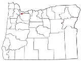
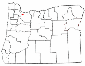
Sunnyside is a census-designated place
in Clackamas County
in the U.S. state of Oregon
. Located in the Portland metropolitan area
along Interstate 205, the population was 6,791 at the 2000 census.
 According to the United States Census Bureau
, the CDP has a total area of 2.6 square miles (6.7 km²), all land.
of 2000, there were 6,791 people, 2,751 households, and 1,735 families residing in the CDP. The population density
was 2,620.9 people per square mile (1,012.4/km²). There were 2,900 housing units at an average density of 1,119.2/sq mi (432.3/km²). The racial makeup of the CDP was 84.91% White, 1.38% African American, 0.69% Native American, 7.05% Asian, 0.31% Pacific Islander, 2.12% from other races
, and 3.53% from two or more races. Hispanic or Latino of any race were 4.56% of the population.
There were 2,751 households out of which 30.9% had children under the age of 18 living with them, 49.1% were married couples
living together, 10.4% had a female householder with no husband present, and 36.9% were non-families. 25.2% of all households were made up of individuals and 2.8% had someone living alone who was 65 years of age or older. The average household size was 2.47 and the average family size was 3.01.
In the CDP the population was spread out with 23.5% under the age of 18, 15.3% from 18 to 24, 31.3% from 25 to 44, 23.1% from 45 to 64, and 6.7% who were 65 years of age or older. The median age was 31 years. For every 100 females there were 98.1 males. For every 100 females age 18 and over, there were 99.9 males.
The median income for a household in the CDP was $45,395, and the median income for a family was $52,500. Males had a median income of $37,435 versus $31,284 for females. The per capita income
for the CDP was $25,276. About 8.3% of families and 8.5% of the population were below the poverty line, including 10.0% of those under age 18 and 7.0% of those age 65 or over.
Census-designated place
A census-designated place is a concentration of population identified by the United States Census Bureau for statistical purposes. CDPs are delineated for each decennial census as the statistical counterparts of incorporated places such as cities, towns and villages...
in Clackamas County
Clackamas County, Oregon
Clackamas County is a county located in the U.S. state of Oregon. The county was named after the Native Americans living in the area, the Clackamas Indians, who were part of the Chinookan people. As of 2010, the population was 375,992...
in the U.S. state of Oregon
Oregon
Oregon is a state in the Pacific Northwest region of the United States. It is located on the Pacific coast, with Washington to the north, California to the south, Nevada on the southeast and Idaho to the east. The Columbia and Snake rivers delineate much of Oregon's northern and eastern...
. Located in the Portland metropolitan area
Portland metropolitan area
The Portland-Vancouver-Hillsboro, OR-WA Metropolitan Statistical Area , also known as the Portland metropolitan area or Greater Portland, is an urban area in the U.S. states of Oregon and Washington centered around the city of Portland, Oregon. The U.S...
along Interstate 205, the population was 6,791 at the 2000 census.
Geography
United States Census Bureau
The United States Census Bureau is the government agency that is responsible for the United States Census. It also gathers other national demographic and economic data...
, the CDP has a total area of 2.6 square miles (6.7 km²), all land.
Demographics
As of the censusCensus
A census is the procedure of systematically acquiring and recording information about the members of a given population. It is a regularly occurring and official count of a particular population. The term is used mostly in connection with national population and housing censuses; other common...
of 2000, there were 6,791 people, 2,751 households, and 1,735 families residing in the CDP. The population density
Population density
Population density is a measurement of population per unit area or unit volume. It is frequently applied to living organisms, and particularly to humans...
was 2,620.9 people per square mile (1,012.4/km²). There were 2,900 housing units at an average density of 1,119.2/sq mi (432.3/km²). The racial makeup of the CDP was 84.91% White, 1.38% African American, 0.69% Native American, 7.05% Asian, 0.31% Pacific Islander, 2.12% from other races
Race (United States Census)
Race and ethnicity in the United States Census, as defined by the Federal Office of Management and Budget and the United States Census Bureau, are self-identification data items in which residents choose the race or races with which they most closely identify, and indicate whether or not they are...
, and 3.53% from two or more races. Hispanic or Latino of any race were 4.56% of the population.
There were 2,751 households out of which 30.9% had children under the age of 18 living with them, 49.1% were married couples
Marriage
Marriage is a social union or legal contract between people that creates kinship. It is an institution in which interpersonal relationships, usually intimate and sexual, are acknowledged in a variety of ways, depending on the culture or subculture in which it is found...
living together, 10.4% had a female householder with no husband present, and 36.9% were non-families. 25.2% of all households were made up of individuals and 2.8% had someone living alone who was 65 years of age or older. The average household size was 2.47 and the average family size was 3.01.
In the CDP the population was spread out with 23.5% under the age of 18, 15.3% from 18 to 24, 31.3% from 25 to 44, 23.1% from 45 to 64, and 6.7% who were 65 years of age or older. The median age was 31 years. For every 100 females there were 98.1 males. For every 100 females age 18 and over, there were 99.9 males.
The median income for a household in the CDP was $45,395, and the median income for a family was $52,500. Males had a median income of $37,435 versus $31,284 for females. The per capita income
Per capita income
Per capita income or income per person is a measure of mean income within an economic aggregate, such as a country or city. It is calculated by taking a measure of all sources of income in the aggregate and dividing it by the total population...
for the CDP was $25,276. About 8.3% of families and 8.5% of the population were below the poverty line, including 10.0% of those under age 18 and 7.0% of those age 65 or over.
See also
- Clackamas Town CenterClackamas Town CenterClackamas Town Center is a shopping mall in Clackamas, Oregon . It opened in 1981. It is managed and co-owned by General Growth Properties and is currently anchored by J.C. Penney, Macy's , Nordstrom, and Sears...
- MAX Green LineMAX Green LineThe MAX Green Line is a light rail route in the MAX Light Rail system in Portland, Oregon, United States, extending to Clackamas, Oregon. Construction began in early 2007, and the line opened on September 12, 2009. The average daily ridership in June 2010 was 19,500 increasing to 23,200 by April...
- Library Information Network of Clackamas CountyLibrary Information Network of Clackamas CountyLibraries in Clackamas County is a consortium of the public libraries of Clackamas County, Oregon. It was established in 1977 when the first county-wide funding levy was approved by county voters...
(details on the Clackamas Corner library)