
Stonebridge, Saskatoon
Encyclopedia
Stonebridge is a mostly residential neighbourhood located in south-central Saskatoon
, Saskatchewan
, Canada
. It is a suburb
an subdivision
, consisting of low-density, single detached dwellings and a mix of medium-density apartment and semi-detached dwellings. As of 2009, the area is home to 994 residents. The neighbourhood is considered a middle-income area, with an average family income of $67,642, an average dwelling value of $321,004 and a home ownership rate of 72.4%.
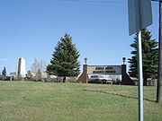 The first development in the area occurred with the purchase of land in 1976 by the University Drive Alliance Church. The congregation moved into their newly built facility, Circle Drive Alliance Church, in November 1979. Two adjacent buildings, a personal care home and senior citizens' home, were completed in 1986.
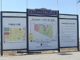
The city formally annexed the land in the 1980s. However, development did not begin until the mid-2000s, with the construction of the Stonegate Shopping Centre. Stonegate's development was tied to the construction of an overpass at Clarence Avenue South over Circle Drive
. Home building began at about the same time as the Stonegate construction. The Clarence Avenue interchange was completed and opened to traffic on November 20, 2007. Another interchange at Preston Avenue is planned as part of the South Circle Drive
project.
of the Conservative Party of Canada
, first elected in 2000 and re-elected in 2004, 2006 and 2008.
Provincially, the area is within the constituency of Saskatoon Southeast
. It is currently represented by Don Morgan
of the Saskatchewan Party
, first elected in 2003 and re-elected in 2007.
In Saskatoon's non-partisan municipal politics, Stonebridge lies within ward 7. The council seat is held by Mairin Loewen, elected in 2011.
The Stonebridge Community Association was formed in 2009 to advocate on civic and property development matters, and run affordable sport and recreation programs for children, youth and adults.
to the east, Clarence Avenue to the west, Circle Drive
to the north, and the Canadian National Railway
tracks to the south, . Streets are laid out in a typical hierarchy
of arterial
, collector
and local roads.
Saskatoon
Saskatoon is a city in central Saskatchewan, Canada, on the South Saskatchewan River. Residents of the city of Saskatoon are called Saskatonians. The city is surrounded by the Rural Municipality of Corman Park No. 344....
, Saskatchewan
Saskatchewan
Saskatchewan is a prairie province in Canada, which has an area of . Saskatchewan is bordered on the west by Alberta, on the north by the Northwest Territories, on the east by Manitoba, and on the south by the U.S. states of Montana and North Dakota....
, Canada
Canada
Canada is a North American country consisting of ten provinces and three territories. Located in the northern part of the continent, it extends from the Atlantic Ocean in the east to the Pacific Ocean in the west, and northward into the Arctic Ocean...
. It is a suburb
Suburb
The word suburb mostly refers to a residential area, either existing as part of a city or as a separate residential community within commuting distance of a city . Some suburbs have a degree of administrative autonomy, and most have lower population density than inner city neighborhoods...
an subdivision
Subdivision (land)
Subdivision is the act of dividing land into pieces that are easier to sell or otherwise develop, usually via a plat. The former single piece as a whole is then known in the United States as a subdivision...
, consisting of low-density, single detached dwellings and a mix of medium-density apartment and semi-detached dwellings. As of 2009, the area is home to 994 residents. The neighbourhood is considered a middle-income area, with an average family income of $67,642, an average dwelling value of $321,004 and a home ownership rate of 72.4%.
History
The city formally annexed the land in the 1980s. However, development did not begin until the mid-2000s, with the construction of the Stonegate Shopping Centre. Stonegate's development was tied to the construction of an overpass at Clarence Avenue South over Circle Drive
Circle Drive
Circle Drive is a major road constructed as a ring road in Saskatoon, Saskatchewan, Canada. The northeastern portion of the road is part of the Yellowhead Highway.-History:...
. Home building began at about the same time as the Stonegate construction. The Clarence Avenue interchange was completed and opened to traffic on November 20, 2007. Another interchange at Preston Avenue is planned as part of the South Circle Drive
Circle Drive
Circle Drive is a major road constructed as a ring road in Saskatoon, Saskatchewan, Canada. The northeastern portion of the road is part of the Yellowhead Highway.-History:...
project.
Government and politics
Stonebridge exists within the federal electoral district of Blackstrap. It is currently represented by Lynne YelichLynne Yelich
Lynne Yelich , PC, MP is a third-generation Croatian-Canadian politician and the MP for the riding of Blackstrap. The riding of Blackstrap includes Yelich's home town of Kenaston, Saskatchewan, identified as the largest Croatian farming settlement in Canada...
of the Conservative Party of Canada
Conservative Party of Canada
The Conservative Party of Canada , is a political party in Canada which was formed by the merger of the Canadian Alliance and the Progressive Conservative Party of Canada in 2003. It is positioned on the right of the Canadian political spectrum...
, first elected in 2000 and re-elected in 2004, 2006 and 2008.
Provincially, the area is within the constituency of Saskatoon Southeast
Saskatoon Southeast
Saskatoon Southeast is a provincial electoral district for the Legislative Assembly of Saskatchewan, Canada.Created for the 22nd Saskatchewan general election in 1991 as "Saskatoon Wildwood", today the district encompasses the Wildwood, Rosewood, Lakewood, Briarwood, The Willows and Stonebridge...
. It is currently represented by Don Morgan
Don Morgan
Don Morgan, QC is a Canadian provincial politician. He is the Saskatchewan Party member of the Legislative Assembly of Saskatchewan for the constituency of Saskatoon Southeast. He is also the Minister of Justice & Attorney General of Saskatchewan and the Minister of Labour Relations and Workplace...
of the Saskatchewan Party
Saskatchewan Party
The Saskatchewan Party is a conservative liberal political party in the Canadian province of Saskatchewan. The party was established in 1997 by a coalition of former provincial Progressive Conservative and Liberal party members and supporters who sought to remove the Saskatchewan New Democratic...
, first elected in 2003 and re-elected in 2007.
In Saskatoon's non-partisan municipal politics, Stonebridge lies within ward 7. The council seat is held by Mairin Loewen, elected in 2011.
Education
As yet, no schools exist in Stonebridge. The community plan shows space allocated for schools in the center of neighbourhood, if the school boards decide to build facilities there.Other
Samaritan Place - long term care facility operated by Amicus Health Care Inc., a subsidiary of the Catholic Health Ministry of Saskatchewan. Currently under construction.Parks and recreation
- Alexander MacGillivray Young Park - 9.9 acres (4 ha)
- Alfred Bence Park - 0.3 acre (0.1214058 ha)
- Blair Nelson Park - 4.3 acres (1.7 ha)
- Cecil A. Wheaton Park - 0.4 acre (0.1618744 ha)
- Donald Koyl Park - 0.5 acre (0.202343 ha)
- Evelyn G. Edwards Park - 0.5 acre (0.202343 ha)
- Howard Harding Park - 0.8 acre (0.3237488 ha)
- John Cameron Park - 0.4 acre (0.1618744 ha)
- Mark Thompson Park - 3.4 acres (1.4 ha)
- Marshall Hawthorne Park - 8.2 acres (3.3 ha)
- Oren Willson Park - 0.5 acre (0.202343 ha)
- Owen Mann Park - 0.5 acre (0.202343 ha)
- Patricia Roe Park - 0.8 acre (0.3237488 ha)
- Peter Zakreski Park - 20.2 acres (8.2 ha)
- Robert H. Freeland Park - 0.7 acre (0.2832802 ha)
- Walter Wood Park - 0.3 acre (0.1214058 ha)
- William Anderson Park - 0.3 acre (0.1214058 ha)
The Stonebridge Community Association was formed in 2009 to advocate on civic and property development matters, and run affordable sport and recreation programs for children, youth and adults.
Public services
Stonebridge is a part of the east division of the Saskatoon Police Services patrol system. Saskatoon Fire & Protective Services' east division covers the neighbourhood. Transit services to Stonebridge are provided by Saskatoon Transit on route No. 17 (University - Stonebridge via Clarence).Commercial
At present, the major commercial district of Stonebridge is the Stonegate Shopping Centre, a big box commercial development in the northwest corner. Additional businesses are located south of Stonegate in an area called the Stonebridge Business Park, along Gordon Road. Other mixed-used districts that include retail space are planned for the center of the neighbourhood.Location
Stonebridge is located within the Nutana Suburban Development Area. It is bounded by Highway 11Saskatchewan Highway 11
Highway 11 is a major north-south highway in Saskatchewan, Canada that connects the province's three largest cities: Regina, Saskatoon and Prince Albert. It is a structural pavement major arterial highway which is approximately long. It is also known as the Louis Riel Trail after the 19th century...
to the east, Clarence Avenue to the west, Circle Drive
Circle Drive
Circle Drive is a major road constructed as a ring road in Saskatoon, Saskatchewan, Canada. The northeastern portion of the road is part of the Yellowhead Highway.-History:...
to the north, and the Canadian National Railway
Canadian National Railway
The Canadian National Railway Company is a Canadian Class I railway headquartered in Montreal, Quebec. CN's slogan is "North America's Railroad"....
tracks to the south, . Streets are laid out in a typical hierarchy
Hierarchy of roads
The hierarchy of roads categorizes roads according to their functions and capacities. While sources differ on the exact nomenclature, the basic hierarchy comprises freeways, arterials, collectors, and local roads....
of arterial
Arterial road
An arterial road, or arterial thoroughfare, is a high-capacity urban road. The primary function of an arterial road is to deliver traffic from collector roads to freeways, and between urban centres at the highest level of service possible. As such, many arteries are limited-access roads, or feature...
, collector
Collector road
A collector road or distributor road is a low to moderate-capacity road which serve to move traffic from local streets to arterial roads. Unlike arterials, collectors are also designed to provide access to residential properties...
and local roads.