
.gif)
State Route 171 (Utah)
Encyclopedia
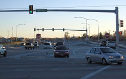
State Route 171 is a state highway in the Salt Lake City metropolitan area in northern Utah
that runs from SR-111 in Magna
in the west side of the city to Interstate 215
in the East Benches in the eastern part of the city. In its sixteen-mile span, the route is named 3500 South and 3300 South.
. The route passes through the former towns (now neighborhoods) of Hunter and Granger as well as West Valley City's modern downtown area near I-215 (which overlaps with historic Granger). The intersection with SR-154 was the first Continuous flow intersection
built in Utah. At the intersection with 2700 West just west of I-215, the route crosses UTA TRAX Green Line light rail tracks near their terminus at the West Valley Intermodal Hub
. Between about SR-154 and Market Street (near 2700 West and I-215), dedicated bus lanes for UTA
's bus rapid transit service
run in the median.
East of SR-68 and the curve where it becomes 3300 South, SR-171 continues due east with two to three lanes in each direction, passing through South Salt Lake
and Millcreek Township
(and very small segments near former SR-181 bordering Salt Lake City), until its terminus. It is the first road south of 2100 South that provides access, for travelers from the west, to I-15
or other points east of the Union Pacific-UTA FrontRunner railroad right-of-way; other roads in the area are blocked by Union Pacific's Roper rail yard. About two blocks east of the bridges carrying the Union Pacific railroad, FrontRunner railroad, and I-15 over the route, there is also a grade crossing with TRAX
's Blue and Red
lines next to Millcreek station
. Just before reaching former SR-181, SR-171 becomes much steeper than at any point to the west (other than when it ducks under the Union Pacific-FrontRunner right-of-way), and from there it continues to climb the East Bench foothills until its terminus.
 3300 South/3500 South was added to the state highway system west of State Street on April 24, 1916, along with 8400 West north to 2100 South (which was already a state highway); on November 13 of that year, East 3300 South to a connection with the old Territorial Road in Parley's Canyon
(also already part of the system) became a state highway. In 1919, when the state legislature redefined the state road system to include only a short list given in the law and any federal aid projects, West 3300 South remained as part of the Lincoln Highway
, and became part of SR-4 and US-40 in the 1920s, but East 3300 South was given back to the county until 1935. That year, the legislature created State Route 171, occupying that street from State Street (by then designated SR-1 and US-91) east to Wasatch Boulevard (just east of present I-215). SR-210 was created in 1941, beginning at SR-4 (now I-80) at the mouth of Parley's Canyon and running south on Wasatch Boulevard to Little Cottonwood Canyon
; that route was truncated in 1945, and the portion on Wasatch Boulevard between SR-171 and SR-4 became an extension of SR-171. In 1962, SR-171 was extended west to SR-111 in Magna, replacing SR-4 (which was moved to present I-80 as SR-2); in 1965, the eastern terminus was reverted to the interchange with I-215 at Wasatch Boulevard (as I-215 had replaced the purpose of Wasatch Boulevard).
Utah
Utah is a state in the Western United States. It was the 45th state to join the Union, on January 4, 1896. Approximately 80% of Utah's 2,763,885 people live along the Wasatch Front, centering on Salt Lake City. This leaves vast expanses of the state nearly uninhabited, making the population the...
that runs from SR-111 in Magna
Magna, Utah
Magna is a census-designated place and township in Salt Lake County, Utah, United States. The population was 26,505 at the 2010 census, a moderate increase over the 2000 figure of 22,770...
in the west side of the city to Interstate 215
Interstate 215 (Utah)
Interstate 215 , also known locally as the belt route or two-fifteen, is an auxiliary interstate in the U.S. state of Utah that forms a 270-degree loop around Salt Lake City and many of its suburbs...
in the East Benches in the eastern part of the city. In its sixteen-mile span, the route is named 3500 South and 3300 South.
Route description
From SR-111 in Magna, the highway (known as 3500 South) runs due east with between one and four general-purpose lanes in each direction until its junction with SR-68, where it veers to the northeast before again straightening out to the east. Other than the west end, this portion is entirely within West Valley CityWest Valley City, Utah
West Valley City is a city in Salt Lake County and a suburb of Salt Lake City in the U.S. state of Utah. The population was 129,480 at the 2010 census,...
. The route passes through the former towns (now neighborhoods) of Hunter and Granger as well as West Valley City's modern downtown area near I-215 (which overlaps with historic Granger). The intersection with SR-154 was the first Continuous flow intersection
Continuous flow intersection
Continuous flow intersection , also called a crossover displaced left-turn , is an at-grade intersection that moves the turning vehicles, conflicting with the through-movements , out of the main intersection...
built in Utah. At the intersection with 2700 West just west of I-215, the route crosses UTA TRAX Green Line light rail tracks near their terminus at the West Valley Intermodal Hub
West Valley Intermodal Hub
The West Valley Intermodal Hub is a transportation hub located in West Valley City, Utah. It serves the Green Line of the Trax light rail system, the Max bus rapid transit line, and local buses.- Construction and opening :...
. Between about SR-154 and Market Street (near 2700 West and I-215), dedicated bus lanes for UTA
Utah Transit Authority
The Utah Transit Authority operates a public transportation system throughout the Wasatch Front of Utah, United States. It operates fixed route buses, express buses, ski buses, three light rail lines , and a commuter rail line from Salt Lake City to Pleasant View, north of Ogden. UTA is based in...
's bus rapid transit service
MAX (UTA)
Max is the name of a bus rapid transit line operated by Utah Transit Authority that opened on July 14, 2008. Max has service improvements that differ from regular bus service, such as signal priority, increased spacing between stops, high frequency service and improved stops...
run in the median.
East of SR-68 and the curve where it becomes 3300 South, SR-171 continues due east with two to three lanes in each direction, passing through South Salt Lake
South Salt Lake, Utah
South Salt Lake is a city in Salt Lake County, Utah, United States, part of the Salt Lake City, Utah Metropolitan Statistical Area. The population was 23,617 at the 2010 census.-History:...
and Millcreek Township
Millcreek, Utah
Millcreek is a census-designated place and township in Salt Lake County, Utah, United States. In the 2000 census, this area was divided among four CDPs, the westernmost of which was designated Millcreek CDP. The population of this CDP was 30,377 at the 2000 census...
(and very small segments near former SR-181 bordering Salt Lake City), until its terminus. It is the first road south of 2100 South that provides access, for travelers from the west, to I-15
Interstate 15
Interstate 15 is the fourth-longest north–south Interstate Highway in the United States, traveling through the states of California, Nevada, Arizona, Utah, Idaho, and Montana from San Diego to the Canadian border...
or other points east of the Union Pacific-UTA FrontRunner railroad right-of-way; other roads in the area are blocked by Union Pacific's Roper rail yard. About two blocks east of the bridges carrying the Union Pacific railroad, FrontRunner railroad, and I-15 over the route, there is also a grade crossing with TRAX
UTA TRAX
TRAX is a three-line light rail system in Utah's Salt Lake Valley, serving Salt Lake City and several of its suburbs throughout Salt Lake County. The system is operated by the Utah Transit Authority ....
's Blue and Red
Red Line (UTA Trax)
The Red Line is a light rail line in the Trax system in the Salt Lake Valley, Utah. It originally opened in December 2001 as the Sandy/University Line, running from the University of Utah to the city of Sandy, and was later rerouted to South Jordan and renamed the Red Line in August 2011...
lines next to Millcreek station
Millcreek (UTA station)
Millcreek is a light rail station in South Salt Lake, Utah serviced by the Blue Line and the Red Line of the Trax system. It is also the eastern terminus of the MAX bus rapid transit line. Located on 3300 South between West Temple and 300 West, it has connections to bus routes 33 and 35....
. Just before reaching former SR-181, SR-171 becomes much steeper than at any point to the west (other than when it ducks under the Union Pacific-FrontRunner right-of-way), and from there it continues to climb the East Bench foothills until its terminus.
History
Parley's Canyon
Parley's Canyon is a canyon located in the U.S. state of Utah. The canyon provides the route of Interstate 80 up the western slope of the Wasatch Mountains and is a relatively wide, straight canyon. The lower part of the canyon, however, is relatively twisty and had to be dynamited to make way for...
(also already part of the system) became a state highway. In 1919, when the state legislature redefined the state road system to include only a short list given in the law and any federal aid projects, West 3300 South remained as part of the Lincoln Highway
Lincoln Highway
The Lincoln Highway was the first road across the United States of America.Conceived and promoted by entrepreneur Carl G. Fisher, the Lincoln Highway spanned coast-to-coast from Times Square in New York City to Lincoln Park in San Francisco, originally through 13 states: New York, New Jersey,...
, and became part of SR-4 and US-40 in the 1920s, but East 3300 South was given back to the county until 1935. That year, the legislature created State Route 171, occupying that street from State Street (by then designated SR-1 and US-91) east to Wasatch Boulevard (just east of present I-215). SR-210 was created in 1941, beginning at SR-4 (now I-80) at the mouth of Parley's Canyon and running south on Wasatch Boulevard to Little Cottonwood Canyon
Little Cottonwood Canyon
Little Cottonwood Canyon lies within the Wasatch-Cache National Forest along the eastern side of the Salt Lake Valley, roughly 15 miles from Salt Lake City, Utah. The canyon is part of Granite, a CDP and “Community Council” designated by Salt Lake County. The canyon is a glacial trough , carved by...
; that route was truncated in 1945, and the portion on Wasatch Boulevard between SR-171 and SR-4 became an extension of SR-171. In 1962, SR-171 was extended west to SR-111 in Magna, replacing SR-4 (which was moved to present I-80 as SR-2); in 1965, the eastern terminus was reverted to the interchange with I-215 at Wasatch Boulevard (as I-215 had replaced the purpose of Wasatch Boulevard).
Major intersections
| County | Location | Mile | Junction | Notes |
|---|