

South Shore, Staten Island
Encyclopedia
The South Shore is a geographical term applied to the area in the New York City
borough of Staten Island
, south and east of the island's ridge of hills (and Richmond Creek
and Fresh Kills
south of Historic Richmond Town
) along the waterfront and adjacent areas from the Narrows
to the mouth of the Arthur Kill
, although many observers prefer to restrict its scope to the neighborhoods located between the shoreline of Raritan Bay
on one side and Richmond Creek and Fresh Kills on the other, thus encompassing the neighborhoods of Great Kills
to Tottenville only. Those who use this narrower definition of the "South Shore" prefer to assign the communities that lie along the Lower New York Bay, and inland for approximately 2 to 2½ miles, from Bay Terrace
and Richmondtown
to as far north as Grasmere
and Concord
, as belonging to the East Shore
.
 Geologically, the area is the outwash plain formed from the edge of the terminal moraine
, and continues as an underwater shoal into Lower New York Bay
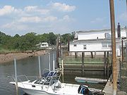
, where it was a prime oystering ground in the 19th century.
Prior to the 1960s, the South Shore was widely undeveloped, however after the building of the Verrazano Narrows Bridge, its population rose sharply.
However territorially defined, the South Shore is noted for the rapid urbanization
that took place in the area during the 1960s and 1970s. Its population is predominantly white, but according to census data has been growing more heterogeneous in recent years. Many residents are of Italian, Irish, German, Russian and Jewish descent, with a hugh boom to the Italian population in the 1980s, 1990's and 2000s in Arden Heights and spread out among all the various south shore towns. The area generally has a low crime rate except for car thefts. Truancy, however, is a recurring problem.
Commerce was previously dominated by small businesses despite the presence of Hylan Boulevard
running along the eastern boundary of the South Shore. However, a number of shopping centers have been built over the last decade. The area is still known for small businesses, including 24-hour delis, pork stores, pizzerias, cafes, gourmet food shops, and a number of independently-owned pharmacies, florists, hair and nail salon
s, paint stores, and car repair shops.
, Richmond Avenue, and New York State Route 440
, or the Staten Island Railroad (formerly SIRT.) Express train service cuts the commute time to and from the Staten Island Ferry
. Morning express trains make all local stops to New Dorp, and then express to the St. George station. In the evening, express trains travel from St. George to Great Kills, then make all local stops until Tottenville. Local trains make all stops to Great Kills.
The Charleston Bus Depot opened in January 2011 at Arthur Kill Road in Charleston
.
New York City
New York is the most populous city in the United States and the center of the New York Metropolitan Area, one of the most populous metropolitan areas in the world. New York exerts a significant impact upon global commerce, finance, media, art, fashion, research, technology, education, and...
borough of Staten Island
Staten Island
Staten Island is a borough of New York City, New York, United States, located in the southwest part of the city. Staten Island is separated from New Jersey by the Arthur Kill and the Kill Van Kull, and from the rest of New York by New York Bay...
, south and east of the island's ridge of hills (and Richmond Creek
Richmond Creek (Fresh Kills)
Richmond Creek is a stream in Staten Island, a borough of New York City in the United States. Its upper drainage basin includes the remote forested hills in the center of the island...
and Fresh Kills
Fresh Kills
Fresh Kills is a stream and freshwater estuary in the western portion of the New York City borough of Staten Island...
south of Historic Richmond Town
Historic Richmond Town
Historic Richmond Town is a living history village and museum complex in the neighborhood of Richmond, Staten Island, in New York City. It is located near the geographical center of the island, at the junction of Richmond Road and Arthur Kill Road....
) along the waterfront and adjacent areas from the Narrows
The Narrows
The Narrows is the tidal strait separating the boroughs of Staten Island and Brooklyn in New York City. It connects the Upper New York Bay and Lower New York Bay and forms the principal channel by which the Hudson River empties into the Atlantic Ocean...
to the mouth of the Arthur Kill
Arthur Kill
The Arthur Kill is a tidal strait separating Staten Island, New York from mainland New Jersey, USA, and a major navigational channel of the Port of New York and New Jersey. Kill is from the Middle Dutch word kille, meaning "riverbed" or "water channel"...
, although many observers prefer to restrict its scope to the neighborhoods located between the shoreline of Raritan Bay
Raritan Bay
Raritan Bay is a bay located at the southern portion of Lower New York Bay between the U.S. states of New York and New Jersey and is part of the New York Bight. The bay is bounded on the northwest by New York's Staten Island, on the west by Perth Amboy, New Jersey, on the south by the Raritan...
on one side and Richmond Creek and Fresh Kills on the other, thus encompassing the neighborhoods of Great Kills
Great Kills, Staten Island
Great Kills is a neighborhood within New York City's borough of Staten Island. It is located on the island's South Shore, and according to many local geographers, it is the South Shore's northernmost community...
to Tottenville only. Those who use this narrower definition of the "South Shore" prefer to assign the communities that lie along the Lower New York Bay, and inland for approximately 2 to 2½ miles, from Bay Terrace
Bay Terrace, Staten Island
Bay Terrace is the name of a street, which in turn gave its name to a neighborhood, on the East Shore of Staten Island, one of the five boroughs of New York City, USA...
and Richmondtown
Historic Richmond Town
Historic Richmond Town is a living history village and museum complex in the neighborhood of Richmond, Staten Island, in New York City. It is located near the geographical center of the island, at the junction of Richmond Road and Arthur Kill Road....
to as far north as Grasmere
Grasmere, Staten Island
Grasmere is the name of a neighborhood located on the East Shore of Staten Island, one of the five boroughs of New York City.Grasmere although crossed by major roads has retained its quiet suburban character. The area and adjoining Concord was dotted with lakes and ponds similar to the English...
and Concord
Concord, Staten Island
Concord is a neighborhood located in the Borough of Staten Island in New York City, New York, United States.Located in northeastern Staten Island, and bordered by the neighborhoods of Grasmere, Clifton, Dongan Hills, Emerson Hill, and Old Town, Concord was named Dutch Farms originally, but was...
, as belonging to the East Shore
East Shore, Staten Island
The term East Shore is frequently applied to a series of neighborhoods along the Lower New York Bay and the Raritan Bay and within New York City's borough of Staten Island....
.
Terminal moraine
A terminal moraine, also called end moraine, is a moraine that forms at the end of the glacier called the snout.Terminal moraines mark the maximum advance of the glacier. An end moraine is at the present boundary of the glacier....
, and continues as an underwater shoal into Lower New York Bay
Lower New York Bay
Lower New York Bay is that section of New York Bay south of the Narrows, the relatively narrow strait between the shores of Staten Island and Brooklyn. The southern end of the bay opens directly to the Atlantic Ocean between two spits of land, Sandy Hook, New Jersey, and Rockaway, Queens, on Long...
, where it was a prime oystering ground in the 19th century.
Prior to the 1960s, the South Shore was widely undeveloped, however after the building of the Verrazano Narrows Bridge, its population rose sharply.
However territorially defined, the South Shore is noted for the rapid urbanization
Urbanization
Urbanization, urbanisation or urban drift is the physical growth of urban areas as a result of global change. The United Nations projected that half of the world's population would live in urban areas at the end of 2008....
that took place in the area during the 1960s and 1970s. Its population is predominantly white, but according to census data has been growing more heterogeneous in recent years. Many residents are of Italian, Irish, German, Russian and Jewish descent, with a hugh boom to the Italian population in the 1980s, 1990's and 2000s in Arden Heights and spread out among all the various south shore towns. The area generally has a low crime rate except for car thefts. Truancy, however, is a recurring problem.
Commerce was previously dominated by small businesses despite the presence of Hylan Boulevard
Hylan Boulevard
Hylan Boulevard is a major northeast-southwest boulevard in the New York City borough of Staten Island. It is approximately long , and runs from the North Shore neighborhood of Rosebank to the South Shore neighborhood of Tottenville....
running along the eastern boundary of the South Shore. However, a number of shopping centers have been built over the last decade. The area is still known for small businesses, including 24-hour delis, pork stores, pizzerias, cafes, gourmet food shops, and a number of independently-owned pharmacies, florists, hair and nail salon
Nail salon
A nail salon or nail bar is a beauty services establishment that primarily offers nail care services such as manicures, pedicures, and nail enhancements. Often, nail salons also offer skin care services. There are approximately 9,900 nail salons in the U.S., up 23% from 2007 according to the ....
s, paint stores, and car repair shops.
Transportation
Staten Islanders on the South Shore have the longest average commute of anyone in New York City. Commuters to Manhattan have the option of express buses, which run along Hylan BoulevardHylan Boulevard
Hylan Boulevard is a major northeast-southwest boulevard in the New York City borough of Staten Island. It is approximately long , and runs from the North Shore neighborhood of Rosebank to the South Shore neighborhood of Tottenville....
, Richmond Avenue, and New York State Route 440
New York State Route 440
New York State Route 440 is a state highway located entirely on Staten Island in New York City. The route acts as a connector between the two segments of New Jersey Route 440, running from the Staten Island community of Richmond Valley to the south to Port Richmond to the north...
, or the Staten Island Railroad (formerly SIRT.) Express train service cuts the commute time to and from the Staten Island Ferry
Staten Island Ferry
The Staten Island Ferry is a passenger ferry service operated by the New York City Department of Transportation that runs between the boroughs of Manhattan and Staten Island.-Overview:...
. Morning express trains make all local stops to New Dorp, and then express to the St. George station. In the evening, express trains travel from St. George to Great Kills, then make all local stops until Tottenville. Local trains make all stops to Great Kills.
The Charleston Bus Depot opened in January 2011 at Arthur Kill Road in Charleston
Charleston, Staten Island
Charleston is the name of a neighborhood, or section, of New York City's borough of Staten Island. It is located on the island's South Shore, with Tottenville to the south, Pleasant Plains to the East, Rossville to the north, and the Arthur Kill to the west....
.