

New York State Route 440
Encyclopedia
New York State Route 440 (NY 440) is a state highway
located entirely on Staten Island
in New York City
. The route acts as a connector between the two segments of New Jersey Route 440, running from the Staten Island community of Richmond Valley
to the south to Port Richmond
to the north. NY 440 is connected to the two New Jersey segments by the Outerbridge Crossing
to the south and the Bayonne Bridge
to the north. It is the only other New York state highway besides NY 426
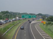
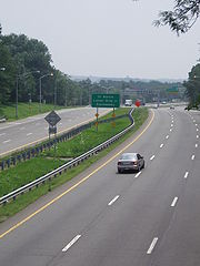
that is the middle section of another state's highway bearing the same number. Much of NY 440 is a limited-access highway. From the Korean War Veterans Parkway
to Interstate 278 (I-278), it is known as the West Shore Expressway. North of I-278, it is named the Dr. Martin Luther King Jr. Expressway (formerly the Willowbrook Expressway).
 NY 440 begins at the Outerbridge Crossing
near the southwestern region of the island, where it connects with the Middlesex County
segment of New Jersey
's Route 440. It traverses the island's largely unpopulated meadowlands along its western flank as a 7.7 miles (12.4 km) freeway called the West Shore Expressway until it joins with the Staten Island Expressway (I-278
) near the northwest corner of the island. There are nine exits between the Outerbridge Crossing and the Staten Island Expressway, including the interchanges with both the Richmond Parkway and the latter; however, two of the exits can only be accessed from one direction.
I-278 and NY 440 overlap for approximately 1.25 miles (2.01 km) before the two separate at an interchange with the Dr. Martin Luther King Jr. Expressway. NY 440 continues northward for another 2.6 miles (4.2 km) on the Dr. Martin Luther King Jr. Expressway until it reaches the Bayonne Bridge
. There are three exits in this section, one of which is accessible to southbound traffic only. On the summit of the bridge, it becomes the Hudson County
segment of New Jersey's Route 440.
 NY 440 was initially designated in 1949 as a continuation of New Jersey
's Route 440. The route began at the Outerbridge Crossing
and ended at the Bayonne Bridge
, as it does today; however, the route was originally routed on Drumgoole Boulevard and Richmond Avenue
in between the two bridges. In the early 1950s, proposals surfaced for the Willowbrook Parkway, which would extend from Staten Island Marine Park (later Great Kills Park and now part of the Gateway National Recreation Area
) on the island's East Shore
to the Bayonne Bridge via Egbertville
and Bulls Head
. A second highway, the West Shore Expressway, was proposed ca. 1961. As proposed, it would begin at the Outerbridge Crossing and run along the west shore of Staten Island
to meet the Clove Lakes Expressway (I-278
) near the Goethals Bridge
.
The first section of the Willowbrook Parkway—from I-278 north to modern exit 13—was completed by 1965. A short extension south to Victory Boulevard was opened to traffic by 1968. The highway was also renamed the Willowbrook Expressway by this time. It was never extended past Victory Boulevard as opposition from both local property owners and environmental activists prevented construction of the rest of the highway. Its original route has never been formally demapped, however. NY 440 was realigned to follow the Willowbrook Expressway by 1970.
Drumgoole Boulevard was transformed into a limited-access highway in the late 1960s and early 1970s and renamed the Richmond Parkway (now the Korean War Veterans Parkway
) ca. 1973; however, NY 440 initially continued to follow the parkway. The segment of the West Shore Expressway southwest of Huguenot Avenue was opened ca. 1973 and became part of a realigned NY 440 ca. 1974. NY 440 left the expressway at Huguenot Avenue and followed Arthur Kill Road east to Richmond Avenue, where it continued north on its original alignment. The former alignment of NY 440 on the Richmond Parkway was redesignated as Temporary NY 440. When the West Shore Expressway was completed in 1976, the Temporary NY 440 designation was eliminated while NY 440 was shifted westward to follow the West Shore and Clove Lakes Expressways between Huguenot Avenue and the Willowbrook Expressway.
In the mid-1960s, officials in New Jersey and New York considered extending the I-287
designation eastward from its current terminus at the New Jersey Turnpike
(I-95) to Staten Island via New Jersey Route 440 and the Richmond Parkway. The idea was scrapped soon afterward. In 1990, the Willowbrook Expressway was renamed the Dr. Martin Luther King Jr. Expressway in honor of Martin Luther King, the slain civil rights
leader. The West Shore Expressway was ceremonially designated the Pearl Harbor Memorial Expressway by New York Governor George Pataki
in 1999. However, the expressway's official name did not change.
|colspan=6 align="center"|Outerbridge Crossing
; NY 440 continues into New Jersey
as Route 440
|-
|rowspan=2|Richmond Valley
|
|1
|Page Avenue (north), Arthur Kill Road (south)
|
|-
|1.13
|2
|
|
|-
|Charleston
|
|3
|Woodrow Road (north), Bloomingdale Road (south)
|
|-
|Rossville
|3.73
|4
|Arthur Kill Road
, Huguenot Avenue
|
|-
|Arden Heights
|
|5
|Muldoon Avenue, Arden Avenue
|Southbound exit only
|-
|rowspan=2|Travis
|6.37
|7
|Victory Boulevard
|Former routing of NY 439A
|-
|7.29
|8
|South Avenue
|
|-
|rowspan=4|Bloomfield
|
|9
|Glen Street
|Northbound exit only (newest interchange, opened in 2001)
|-
|9.33
|9A
|
|NY 440 joins I-278 northbound and leaves southbound
|-
|colspan=4 align="center"|Begin I-278 exit numbering system northbound; resume NY 440 exit numbering system southbound
|-
|
|6
|South Avenue
|Southbound exit and entrance
|-
|rowspan=6|Graniteville
|9.54
|7
|Richmond Avenue
|Access via Fahy Avenue northbound
|-
|10.24
|8
|Victory Boulevard
|Northbound exit and southbound entrance; former routing of NY 439A
|-
|colspan=4 align="center"|Resume NY 440 exit numbering system northbound; begin I-278 exit numbering system southbound
|-
|10.43
|10
|
|NY 440 leaves I-278 northbound and joins southbound
|-
|
|11
|Victory Boulevard
|Southbound exit and northbound entrance; former routing of NY 439A
|-
|11.41
|12
|Forest Avenue
|Former routing of NY 439
|-
|Elm Park
|
|13
|Richmond Terrace
|Access via Trantor Place northbound and Morningstar Road southbound
|-
|colspan=6 align="center"|Bayonne Bridge
; NY 440 continues into New Jersey
as Route 440
State highway
State highway, state road or state route can refer to one of three related concepts, two of them related to a state or provincial government in a country that is divided into states or provinces :#A...
located entirely on Staten Island
Staten Island
Staten Island is a borough of New York City, New York, United States, located in the southwest part of the city. Staten Island is separated from New Jersey by the Arthur Kill and the Kill Van Kull, and from the rest of New York by New York Bay...
in New York City
New York City
New York is the most populous city in the United States and the center of the New York Metropolitan Area, one of the most populous metropolitan areas in the world. New York exerts a significant impact upon global commerce, finance, media, art, fashion, research, technology, education, and...
. The route acts as a connector between the two segments of New Jersey Route 440, running from the Staten Island community of Richmond Valley
Richmond Valley, Staten Island
Richmond Valley is the name of a neighborhood located on the South Shore of Staten Island, one of the five boroughs of New York City, the largest city in the United States....
to the south to Port Richmond
Port Richmond, Staten Island
Port Richmond is a neighborhood situated on the North Shore of Staten Island, one of the five boroughs of New York City, United States. It is along the waterfront of the Kill Van Kull, with the southern terminus of the Bayonne Bridge serving as the boundary between it and Mariners Harbor, the...
to the north. NY 440 is connected to the two New Jersey segments by the Outerbridge Crossing
Outerbridge Crossing
The Outerbridge Crossing is a cantilever bridge which spans the Arthur Kill. The "Outerbridge", as it is commonly known, connects Perth Amboy, New Jersey, with the New York City borough of Staten Island and carries NY-440 and NJ-440, each road ending at the respective state border.The bridge was...
to the south and the Bayonne Bridge
Bayonne Bridge
The Bayonne Bridge is the fourth longest steel arch bridge in the world, and was the longest in the world at the time of its completion. It connects Bayonne, New Jersey with Staten Island, New York, spanning the Kill Van Kull. Despite popular belief, it is not a national landmark.The bridge was...
to the north. It is the only other New York state highway besides NY 426
New York State Route 426
New York State Route 426 is a state highway located entirely within Chautauqua County, New York, United States. It runs just over from one section of the Pennsylvania state line to another, passing through two small hamlets and providing the Southern Tier Expressway with its westernmost...
that is the middle section of another state's highway bearing the same number. Much of NY 440 is a limited-access highway. From the Korean War Veterans Parkway
Korean War Veterans Parkway
The Richmond Parkway is a Parkway that traverses the South Shore of Staten Island, New York, USA from southwest to northeast...
to Interstate 278 (I-278), it is known as the West Shore Expressway. North of I-278, it is named the Dr. Martin Luther King Jr. Expressway (formerly the Willowbrook Expressway).
Route description
Outerbridge Crossing
The Outerbridge Crossing is a cantilever bridge which spans the Arthur Kill. The "Outerbridge", as it is commonly known, connects Perth Amboy, New Jersey, with the New York City borough of Staten Island and carries NY-440 and NJ-440, each road ending at the respective state border.The bridge was...
near the southwestern region of the island, where it connects with the Middlesex County
Middlesex County, New Jersey
-Demographics:As of the census of 2000, there were 750,162 people, 265,815 households, and 190,855 families residing in the county. The population density was 2,422 people per square mile . There were 273,637 housing units at an average density of 884 per square mile...
segment of New Jersey
New Jersey
New Jersey is a state in the Northeastern and Middle Atlantic regions of the United States. , its population was 8,791,894. It is bordered on the north and east by the state of New York, on the southeast and south by the Atlantic Ocean, on the west by Pennsylvania and on the southwest by Delaware...
's Route 440. It traverses the island's largely unpopulated meadowlands along its western flank as a 7.7 miles (12.4 km) freeway called the West Shore Expressway until it joins with the Staten Island Expressway (I-278
Interstate 278
Interstate 278 is an auxiliary Interstate Highway in New Jersey and New York, United States. The road runs from U.S. Route 1/9 in Linden, New Jersey to the Bruckner Interchange in the New York City borough of the Bronx...
) near the northwest corner of the island. There are nine exits between the Outerbridge Crossing and the Staten Island Expressway, including the interchanges with both the Richmond Parkway and the latter; however, two of the exits can only be accessed from one direction.
I-278 and NY 440 overlap for approximately 1.25 miles (2.01 km) before the two separate at an interchange with the Dr. Martin Luther King Jr. Expressway. NY 440 continues northward for another 2.6 miles (4.2 km) on the Dr. Martin Luther King Jr. Expressway until it reaches the Bayonne Bridge
Bayonne Bridge
The Bayonne Bridge is the fourth longest steel arch bridge in the world, and was the longest in the world at the time of its completion. It connects Bayonne, New Jersey with Staten Island, New York, spanning the Kill Van Kull. Despite popular belief, it is not a national landmark.The bridge was...
. There are three exits in this section, one of which is accessible to southbound traffic only. On the summit of the bridge, it becomes the Hudson County
Hudson County, New Jersey
Hudson County is the smallest county in New Jersey and one of the most densely populated in United States. It takes its name from the Hudson River, which creates part of its eastern border. Part of the New York metropolitan area, its county seat and largest city is Jersey City.- Municipalities...
segment of New Jersey's Route 440.
History
New Jersey
New Jersey is a state in the Northeastern and Middle Atlantic regions of the United States. , its population was 8,791,894. It is bordered on the north and east by the state of New York, on the southeast and south by the Atlantic Ocean, on the west by Pennsylvania and on the southwest by Delaware...
's Route 440. The route began at the Outerbridge Crossing
Outerbridge Crossing
The Outerbridge Crossing is a cantilever bridge which spans the Arthur Kill. The "Outerbridge", as it is commonly known, connects Perth Amboy, New Jersey, with the New York City borough of Staten Island and carries NY-440 and NJ-440, each road ending at the respective state border.The bridge was...
and ended at the Bayonne Bridge
Bayonne Bridge
The Bayonne Bridge is the fourth longest steel arch bridge in the world, and was the longest in the world at the time of its completion. It connects Bayonne, New Jersey with Staten Island, New York, spanning the Kill Van Kull. Despite popular belief, it is not a national landmark.The bridge was...
, as it does today; however, the route was originally routed on Drumgoole Boulevard and Richmond Avenue
Richmond Avenue
Richmond Avenue is an integral north-south thoroughfare on Staten Island. Measuring approximately 7.0 miles , the road runs from the community of Graniteville to the south shore community of Eltingville.- Street description :...
in between the two bridges. In the early 1950s, proposals surfaced for the Willowbrook Parkway, which would extend from Staten Island Marine Park (later Great Kills Park and now part of the Gateway National Recreation Area
Gateway National Recreation Area
Gateway National Recreation Area is a National Recreation Area in the Port of New York and New Jersey. Scattered over Brooklyn, Queens, and Staten Island, New York and Monmouth County, New Jersey, it provides recreational opportunities that are rare for a dense urban environment, including ocean...
) on the island's East Shore
East Shore, Staten Island
The term East Shore is frequently applied to a series of neighborhoods along the Lower New York Bay and the Raritan Bay and within New York City's borough of Staten Island....
to the Bayonne Bridge via Egbertville
Egbertville, Staten Island
Egbertville is the name of a neighborhood located immediately inland from, but classifiable within, the East Shore of Staten Island. The island forms one of the five boroughs of the USA's largest city, New York....
and Bulls Head
Bulls Head, Staten Island
Bulls Head is a neighborhood in west-central Staten Island, one of the five boroughs of the USA's largest city, New York.The community received its name from an 18th-century tavern located at the intersection of Victory Boulevard and Richmond Avenue , from which a sign bearing a bull's head was...
. A second highway, the West Shore Expressway, was proposed ca. 1961. As proposed, it would begin at the Outerbridge Crossing and run along the west shore of Staten Island
Staten Island
Staten Island is a borough of New York City, New York, United States, located in the southwest part of the city. Staten Island is separated from New Jersey by the Arthur Kill and the Kill Van Kull, and from the rest of New York by New York Bay...
to meet the Clove Lakes Expressway (I-278
Interstate 278
Interstate 278 is an auxiliary Interstate Highway in New Jersey and New York, United States. The road runs from U.S. Route 1/9 in Linden, New Jersey to the Bruckner Interchange in the New York City borough of the Bronx...
) near the Goethals Bridge
Goethals Bridge
The Goethals Bridge connects Elizabeth, New Jersey to Staten Island , near the Howland Hook Marine Terminal, Staten Island, New York over the Arthur Kill. Operated by the Port Authority of New York and New Jersey, the span was one of the first structures built by the authority...
.
The first section of the Willowbrook Parkway—from I-278 north to modern exit 13—was completed by 1965. A short extension south to Victory Boulevard was opened to traffic by 1968. The highway was also renamed the Willowbrook Expressway by this time. It was never extended past Victory Boulevard as opposition from both local property owners and environmental activists prevented construction of the rest of the highway. Its original route has never been formally demapped, however. NY 440 was realigned to follow the Willowbrook Expressway by 1970.
Drumgoole Boulevard was transformed into a limited-access highway in the late 1960s and early 1970s and renamed the Richmond Parkway (now the Korean War Veterans Parkway
Korean War Veterans Parkway
The Richmond Parkway is a Parkway that traverses the South Shore of Staten Island, New York, USA from southwest to northeast...
) ca. 1973; however, NY 440 initially continued to follow the parkway. The segment of the West Shore Expressway southwest of Huguenot Avenue was opened ca. 1973 and became part of a realigned NY 440 ca. 1974. NY 440 left the expressway at Huguenot Avenue and followed Arthur Kill Road east to Richmond Avenue, where it continued north on its original alignment. The former alignment of NY 440 on the Richmond Parkway was redesignated as Temporary NY 440. When the West Shore Expressway was completed in 1976, the Temporary NY 440 designation was eliminated while NY 440 was shifted westward to follow the West Shore and Clove Lakes Expressways between Huguenot Avenue and the Willowbrook Expressway.
In the mid-1960s, officials in New Jersey and New York considered extending the I-287
Interstate 287
Interstate 287 is an auxiliary Interstate Highway in the U.S. states of New Jersey and New York. It is a partial beltway around New York City, serving the northern half of New Jersey and the counties of Rockland and Westchester in New York...
designation eastward from its current terminus at the New Jersey Turnpike
New Jersey Turnpike
The New Jersey Turnpike is a toll road in New Jersey, maintained by the New Jersey Turnpike Authority. According to the International Bridge, Tunnel and Turnpike Association, the Turnpike is the nation's sixth-busiest toll road and is among one of the most heavily traveled highways in the United...
(I-95) to Staten Island via New Jersey Route 440 and the Richmond Parkway. The idea was scrapped soon afterward. In 1990, the Willowbrook Expressway was renamed the Dr. Martin Luther King Jr. Expressway in honor of Martin Luther King, the slain civil rights
Civil rights
Civil and political rights are a class of rights that protect individuals' freedom from unwarranted infringement by governments and private organizations, and ensure one's ability to participate in the civil and political life of the state without discrimination or repression.Civil rights include...
leader. The West Shore Expressway was ceremonially designated the Pearl Harbor Memorial Expressway by New York Governor George Pataki
George Pataki
George Elmer Pataki is an American politician who was the 53rd Governor of New York. A member of the Republican Party, Pataki served three consecutive four-year terms from January 1, 1995 until December 31, 2006.- Early life :...
in 1999. However, the expressway's official name did not change.
Exit list
|-|colspan=6 align="center"|Outerbridge Crossing
Outerbridge Crossing
The Outerbridge Crossing is a cantilever bridge which spans the Arthur Kill. The "Outerbridge", as it is commonly known, connects Perth Amboy, New Jersey, with the New York City borough of Staten Island and carries NY-440 and NJ-440, each road ending at the respective state border.The bridge was...
; NY 440 continues into New Jersey
New Jersey
New Jersey is a state in the Northeastern and Middle Atlantic regions of the United States. , its population was 8,791,894. It is bordered on the north and east by the state of New York, on the southeast and south by the Atlantic Ocean, on the west by Pennsylvania and on the southwest by Delaware...
as Route 440
|-
|rowspan=2|Richmond Valley
Richmond Valley, Staten Island
Richmond Valley is the name of a neighborhood located on the South Shore of Staten Island, one of the five boroughs of New York City, the largest city in the United States....
|
|1
|Page Avenue (north), Arthur Kill Road (south)
|
|-
|1.13
|2
|
|
|-
|Charleston
Charleston, Staten Island
Charleston is the name of a neighborhood, or section, of New York City's borough of Staten Island. It is located on the island's South Shore, with Tottenville to the south, Pleasant Plains to the East, Rossville to the north, and the Arthur Kill to the west....
|
|3
|Woodrow Road (north), Bloomingdale Road (south)
|
|-
|Rossville
Rossville, Staten Island
Rossville is the name of a neighborhood of Staten Island, New York, located to the west of Prince's Bay, on the island's South Shore.-Early History of the Area:...
|3.73
|4
|Arthur Kill Road
Arthur Kill Road
Arthur Kill Road is a major northeast-southwest artery along the South-West Shore of the New York City borough of Staten Island. It is approximately long, and runs through the neighborhoods of Richmondtown, Great Kills,...
, Huguenot Avenue
|
|-
|Arden Heights
Arden Heights, Staten Island
Arden Heights is a name increasingly applied to the western part of Annadale, a neighborhood located on the South Shore of Staten Island, New York, USA...
|
|5
|Muldoon Avenue, Arden Avenue
Arden Avenue
Arden Avenue is a major east-west artery in southern Staten Island, New York City. It is approximately long, and runs through the neighborhoods of Annadale, Arden Heights, and Huguenot....
|Southbound exit only
|-
|rowspan=2|Travis
Travis, Staten Island
Travis is a neighborhood at the west-central shore of Staten Island, one of the five boroughs of New York City. Some local geographers classify Travis as being on the island's West Shore, while others reckon it as a Mid-Island neighborhood.-Name:...
|6.37
|7
|Victory Boulevard
|Former routing of NY 439A
|-
|7.29
|8
|South Avenue
South Avenue
South Avenue is a major north-south artery along the West Shore of the New York City borough of Staten Island. It is approximately long, and runs through the neighborhoods of Arlington, Mariners Harbor, Graniteville, Bulls Head, Bloomfield, Chelsea, and Travis.Most of the area that South Avenue...
|
|-
|rowspan=4|Bloomfield
Bloomfield, Staten Island
Bloomfield is the name of a neighborhood on the West Shore of the New York City borough of Staten Island, New York, USA. It lies immediately to the north of Travis. Prall's Island is situated in the Arthur Kill off its coast....
|
|9
|Glen Street
|Northbound exit only (newest interchange, opened in 2001)
|-
|9.33
|9A
|
|NY 440 joins I-278 northbound and leaves southbound
|-
|colspan=4 align="center"|Begin I-278 exit numbering system northbound; resume NY 440 exit numbering system southbound
|-
|
|6
|South Avenue
South Avenue
South Avenue is a major north-south artery along the West Shore of the New York City borough of Staten Island. It is approximately long, and runs through the neighborhoods of Arlington, Mariners Harbor, Graniteville, Bulls Head, Bloomfield, Chelsea, and Travis.Most of the area that South Avenue...
|Southbound exit and entrance
|-
|rowspan=6|Graniteville
Graniteville, Staten Island
Graniteville is the name of a neighborhood in Staten Island, one of the five boroughs of New York City, USA.-History:Graniteville was originally named Bennett's Corners and Fayetteville...
|9.54
|7
|Richmond Avenue
Richmond Avenue
Richmond Avenue is an integral north-south thoroughfare on Staten Island. Measuring approximately 7.0 miles , the road runs from the community of Graniteville to the south shore community of Eltingville.- Street description :...
|Access via Fahy Avenue northbound
|-
|10.24
|8
|Victory Boulevard
Victory Boulevard
Victory Boulevard is a major thoroughfare on Staten Island, measuring approximately 8.0 miles and stretching from the west shore community of Travis to the upper east shore communities of St. George and Tompkinsville. In the late 1940s, the portion of Victory Boulevard between Richmond Avenue and...
|Northbound exit and southbound entrance; former routing of NY 439A
|-
|colspan=4 align="center"|Resume NY 440 exit numbering system northbound; begin I-278 exit numbering system southbound
|-
|10.43
|10
|
|NY 440 leaves I-278 northbound and joins southbound
|-
|
|11
|Victory Boulevard
Victory Boulevard
Victory Boulevard is a major thoroughfare on Staten Island, measuring approximately 8.0 miles and stretching from the west shore community of Travis to the upper east shore communities of St. George and Tompkinsville. In the late 1940s, the portion of Victory Boulevard between Richmond Avenue and...
|Southbound exit and northbound entrance; former routing of NY 439A
|-
|11.41
|12
|Forest Avenue
|Former routing of NY 439
New York State Route 439
New York State Route 439 was an east–west state highway on Staten Island in New York, United States. The western terminus of the route was at the Goethals Bridge, where it continued into New Jersey as its Route 439. Its eastern terminus was at the Staten Island Ferry terminal in the St....
|-
|Elm Park
Elm Park, Staten Island
Elm Park is the name of a small park in the Port Richmond section of Staten Island, one of the five boroughs of New York City, USA. The park is located across Innis Street from Port Richmond High School....
|
|13
|Richmond Terrace
Richmond Terrace
Richmond Terrace is primary east-west artery that runs through the St. George, New Brighton, Randall Manor, Port Richmond, Mariners Harbor, Elm Park, and Livingston neighborhoods of New York City, in the borough of Staten Island, New York....
|Access via Trantor Place northbound and Morningstar Road southbound
|-
|colspan=6 align="center"|Bayonne Bridge
Bayonne Bridge
The Bayonne Bridge is the fourth longest steel arch bridge in the world, and was the longest in the world at the time of its completion. It connects Bayonne, New Jersey with Staten Island, New York, spanning the Kill Van Kull. Despite popular belief, it is not a national landmark.The bridge was...
; NY 440 continues into New Jersey
New Jersey
New Jersey is a state in the Northeastern and Middle Atlantic regions of the United States. , its population was 8,791,894. It is bordered on the north and east by the state of New York, on the southeast and south by the Atlantic Ocean, on the west by Pennsylvania and on the southwest by Delaware...
as Route 440