
South Norfolk
Encyclopedia
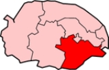
South Norfolk is a local government district
in Norfolk
, England
. Its council is based in Long Stratton
.
, as a merger of Diss Urban District, Wymondham Urban District, Depwade Rural District, Forehoe and Henstead Rural District and Loddon Rural District.
The strongest local performances from other parties were Labour in Wymondham Rustens ward with 20.1%, and the Green Party in Cringleford ward with 14.4%.
[1] Others: Independents
, UKIP and EDP
.
, the district had an area of 909 km²
, with a population of 110,710 in 46,607 households.
The district contains the following civil parishes:
Non-metropolitan district
Non-metropolitan districts, or colloquially shire districts, are a type of local government district in England. As created, they are sub-divisions of non-metropolitan counties in a so-called "two-tier" arrangement...
in Norfolk
Norfolk
Norfolk is a low-lying county in the East of England. It has borders with Lincolnshire to the west, Cambridgeshire to the west and southwest and Suffolk to the south. Its northern and eastern boundaries are the North Sea coast and to the north-west the county is bordered by The Wash. The county...
, England
England
England is a country that is part of the United Kingdom. It shares land borders with Scotland to the north and Wales to the west; the Irish Sea is to the north west, the Celtic Sea to the south west, with the North Sea to the east and the English Channel to the south separating it from continental...
. Its council is based in Long Stratton
Long Stratton
Long Stratton is a civil parish in South Norfolk, in the East of England, UK. It consists of two villages; the larger, Stratton St. Mary, is to the south, and the other, Stratton St. Michael, is to the north...
.
History
The district was formed on April 1, 1974, under the Local Government Act 1972Local Government Act 1972
The Local Government Act 1972 is an Act of Parliament in the United Kingdom that reformed local government in England and Wales on 1 April 1974....
, as a merger of Diss Urban District, Wymondham Urban District, Depwade Rural District, Forehoe and Henstead Rural District and Loddon Rural District.
History of governance
The below table outlines the composition of South Norfolk Council from 1973 to 2007.| Year | Conservative Conservative Party (UK) The Conservative Party, formally the Conservative and Unionist Party, is a centre-right political party in the United Kingdom that adheres to the philosophies of conservatism and British unionism. It is the largest political party in the UK, and is currently the largest single party in the House... |
Lib Dems Liberal Democrats The Liberal Democrats are a social liberal political party in the United Kingdom which supports constitutional and electoral reform, progressive taxation, wealth taxation, human rights laws, cultural liberalism, banking reform and civil liberties .The party was formed in 1988 by a merger of the... |
Labour Labour Party (UK) The Labour Party is a centre-left democratic socialist party in the United Kingdom. It surpassed the Liberal Party in general elections during the early 1920s, forming minority governments under Ramsay MacDonald in 1924 and 1929-1931. The party was in a wartime coalition from 1940 to 1945, after... |
Other | Governance | ||
|---|---|---|---|---|---|---|---|
| 1973 | 6 | 1 | 7 | 33 |
|||
| 1976 | 38 | 2 | 1 | 6 |
|||
| 1979 | 38 | 1 | 2 | 6 |
|||
| 1983 | 33 | 5 | 1 | 8 |
|||
| 1987 | 26 | 16 | 0 | 5 |
|||
| 1991 | 22 | 22 | 0 | 3 |
|||
| 1995 | 12 | 30 | 3 | 2 |
|||
| 1999 | 16 | 27 | 2 | 2 |
|||
| 2003 | 18 | 28 | 0 | 0 |
|||
| 2007 | 39 | 7 | 0 | 0 |
|||
| 2011 | 38 | 8 | 0 | 0 |
|||
Recent elections
2007 saw the Conservatives win 55.1% of the vote and 39 seats in total, gaining 21 seats from the Liberal Democrats, who retained 7 seats despite having 39.2% of the vote. The other parties standing received only 5.7% of the total vote, and no seats.The strongest local performances from other parties were Labour in Wymondham Rustens ward with 20.1%, and the Green Party in Cringleford ward with 14.4%.
| South Norfolk election results, May 2007 | |||||
|---|---|---|---|---|---|
| Party | Votes | Votes % | Seats | Seats % | |
| 31,126 | 55.1% | 39 | 84.8.% | ||
| 22,139 | 39.2% | 7 | 15.2% | ||
| 1,533 | 2.7% | 0 | 0% | ||
| 1,189 | 2.1% | 0 | 0% | ||
| Others [1] | 526 | 0.9% | 0 | 0% | |
| Totals | 56,513 | 46 | |||
[1] Others: Independents
Independent (politician)
In politics, an independent or non-party politician is an individual not affiliated to any political party. Independents may hold a centrist viewpoint between those of major political parties, a viewpoint more extreme than any major party, or they may have a viewpoint based on issues that they do...
, UKIP and EDP
English Democrats Party
The English Democrats are an English federalist political party, committed to the formation of a devolved English Parliament with at least the same powers as those granted to the Scottish Parliament. Whilst not supporting English Independence, the English Democrats consider themselves the English...
.
Political composition
Elections are held every four years, with the last elections occurring in May 2007. The next elections are due to take place in May 2011.| Party | Councillors | Change (on 2003) |
|
|---|---|---|---|
| 39 | +21 | ||
| 7 | -21 | ||
| Total | 46 | - | |
| Source: South Norfolk Council | |||
Electoral divisions
| Ward | Parishes | Councillor(s) Elected 2011 |
| Abbey | Wymondham Wymondham Wymondham is a historic market town and civil parish in the English county of Norfolk. It lies 9.5 miles to the south west of the city of Norwich, on the A11 road to Thetford and London.- Before The Great Fire :... |
Robert Savage |
| Beck Vale | Pulham Market Pulham Market Pulham Market and its sister village Pulham St Mary are situated approximately 9 miles north of Diss in Norfolk, England. It covers an area of and had a population of 999 in 443 households as of the 2001 census.... ; Pulham St Mary Pulham St Mary Pulham St Mary is a village in Norfolk, approximately east of Diss and south of Norwich. It covers an area of and had a population of 866 in 365 households as of the 2001 census.... ; Starston Starston Starston is a small village in Norfolk. It covers an area of and had a population of 321 in 123 households as of the 2001 census.The Starston sign features a wind pump that was used to transport water from the Beck river up to Starston Place, which was demolished during the early 1900's... |
Keith Tilcock |
| Bressingham and Burston | Bressingham Bressingham Bressingham is a village and civil parish in the English county of Norfolk.It covers an area of and had a population of 751 in 305 households as of the 2001 census. For the purposes of local government, it falls within the district of South Norfolk.... & Fersfield Fersfield Fersfield is a village in the English county of Norfolk. It was the home parish of Francis Blomefield, whose History of Norfolk documents the history of much of South Norfolk, and forms part of the parish of Bressingham and Fersfield .- Location :Fersfield is bounded on the east and south by the... ; Burston & Shimpling Burston and Shimpling Burston and Shimpling are small villages and form a united parish in the county of Norfolk, England. The parish covers an area of and had a population of 538 in 206 households at the 2001 census.... ; Gissing Gissing, Norfolk Gissing is a village and civil parish in Norfolk, England, about six miles north of Diss. It covers an area of and had a population of 254 in 95 households as of the 2001 census... ; Heywood Heywood, Norfolk Heywood is a civil parish in the English county of Norfolk. It was formed in 2003 from a part of the parish of Diss.It covers an area of and had a population of 175 in 63 households as of the 2001 census.... ; Shelfanger Shelfanger Shelfanger is a village situated about 3 miles from the town of Diss in Norfolk, England. There is a church and a village hall in the village. It covers an area of and had a population of 362 in 150 households as of the 2001 census.... ; Winfarthing Winfarthing Winfarthing is a village and civil parish in the English county of Norfolk. It is located 6 km north of the town of Diss, 20 km east of the town of Thetford, and 30 km south of the city of Norwich.... |
Keith Weeks |
| Brooke | Bergh Apton Bergh Apton Bergh Apton is a village and civil parish in the South Norfolk district of Norfolk, England, 7 miles south-east of Norwich just south of the A146 between Yelverton and Thurton... ; Brooke Brooke, Norfolk Brooke is a village and civil parish in the South Norfolk district of Norfolk, England, about 7 miles south of Norwich and roughly equidistant from Norwich and Bungay... ; Howe Howe, Norfolk Howe is a small village and civil parish in South Norfolk, England. It is situated between Poringland, Brooke and Shotesham. It covers an area of and had a population of 54 in 21 households as of the 2001 census.... ; Kirstead Kirstead Kirstead is a civil parish in the English county of Norfolk.It covers an area of and had a population of 247 in 89 households as of the 2001 census.For the purposes of local government, it falls within the district of South Norfolk.... ; Mundham Mundham, South Norfolk Mundham, South Norfolk is a civil parish in the English county of Norfolk.It covers an area of and had a population of 168 in 63 households as of the 2001 census.For the purposes of local government, it falls within the district of South Norfolk.... ; Seething Seething Seething is a small village in Norfolk, England, about 9 miles south east of Norwich. It covers an area of and had a population of 341 in 141 households as of the 2001 census.Its church, St Margaret, is one of 124 existing round-tower churches in Norfolk.... |
John Fuller |
| Bunwell | Aslacton Aslacton Aslacton is a village and civil parish in the English county of Norfolk. It is situated between Norwich and Diss, and is near Great Moulton.... ; Bunwell Bunwell Bunwell is a parish situated in the county of Norfolk, England, approximately 7 miles south-east of Attleborough. The parish includes the hamlets of Bunwell Hill, Bunwell Street, Great Green, Little Green and Low Common... ; Carleton Rode Carleton Rode Carleton Rode is a village in Norfolk, England, situated approximately five miles south-east of Attleborough. The village is extremely rural and is spread out over .... ; Tibenham Tibenham, Norfolk Tibenham is a village and civil parish in South Norfolk, England. It has a population of around 1000. The former RAF Tibenham base is nearby.-External links:... |
Beverley Spratt |
| Chedgrave and Thurton | Ashby St Mary Ashby St Mary Ashby St Mary is a village and civil parish in the English county of Norfolk. The civil parish has an area of and in the 2001 census had a population of 297 in 115 households... ; Carleton St Peter Carleton St Peter Carleton St Peter is a civil parish in South Norfolk approximately south-east of Norwich. There is no village center but the Church provides a reference point and is north-east of Thurton, and a similar distance south of Claxton, just east of Ashby St Mary.... ; Chedgrave Chedgrave Chedgrave is a small village beside the River Chet, in Norfolk, England. It covers and had a population of 985 in 430 households as of the 2001 census.The Chet is known for its interesting .... ; Claxton Claxton, Norfolk Claxton is a small village south-east of Norwich, and south of the River Yare, between Rockland St. Mary and Loddon in South Norfolk, England. In the 2001 census it contained 85 households and a population of 244... ; Langley with Hardley Langley with Hardley Langley with Hardley is a parish in the county of Norfolk, England, about a mile east of Loddon. It covers an area of and had a population of 489 in 161 households as of the 2001 census.... ; Thurton Thurton The village should not be confused with Thurlton which is 6 miles to the east.Thurton is a village in South Norfolk lying 8½ miles south-east of Norwich on the A146 Norwich to Lowestoft road between Framingham Pigot and Loddon. The A146 effectively divides the village in two; a 40 mph limit... |
Derek Blake |
| Cringleford | Bawburgh Bawburgh Bawburgh is a village and civil parish in the South Norfolk district of Norfolk, England, lying in the valley of the River Yare about west of Norwich city centre. According to the 2001 census it had a population of 466... ; Colney Colney Colney is a village in the western outskirts of Norwich in Norfolk, England. It is in the administrative district of South Norfolk. It covers an area of and had a population of 124 in 35 households at the 2001 census.... ; Cringleford Cringleford Cringleford is a village in Norfolk, England on the outskirts of Norwich. The village is in the South Norfolk local government district but the Norwich South Parliamentary constituency.... ; Keswick Keswick, South Norfolk Keswick is a village and civil parish in Norfolk, England. It is situated some to the south of the city of Norwich. It should not be mistaken for the coastal settlement of Keswick, near Bacton, which is also in Norfolk.... & Intwood Intwood Intwood is a small village in Norfolk, England, south west of Norwich. Its church, All Saints, is one of 124 extant round-tower churches in Norfolk.-External links:*, a round-tower church... ; Little Melton Little Melton Little Melton is a village on the outskirts of Norwich in the South Norfolk district of Norfolk, England. It covers an area of and had a population of 851 in 373 households as of the 2001 census.... |
Christopher Kemp |
| Garry Wheatley | ||
| Cromwells | Wymondham |
Neil Ward |
| Dickleburgh | Dickleburgh & Rushall Dickleburgh and Rushall Dickleburgh and Rushall is a parish in South Norfolk. It covers an area of and had a population of 1356 in 565 households as of the 2001 census.The church of Rushall St Mary the Virgin is one of 124 existing round-tower churches in Norfolk.... ; Great Moulton Great Moulton Great Moulton is a civil parish in the English county of Norfolk.It covers an area of and had a population of 699 in 289 households as of the 2001 census.For the purposes of local government, it falls within the district of South Norfolk.... ; Tivetshall St Margaret Tivetshall St Margaret Tivetshall St Margaret is a village and civil parish in Norfolk, England. It covers an area of and had a population of 266 in 104 households as of the 2001 census.- The church :... ; Tivetshall St Mary Tivetshall St Mary Tivetshall St Mary is a civil parish in the district of South Norfolk and county of Norfolk, England.It covers an area of and had a population of 302 in 117 households at the 2001 census.... |
Martin Wilby |
| Diss | Diss Diss Diss is a town in Norfolk, England close to the border with the neighbouring East Anglian county of Suffolk.The town lies in the valley of the River Waveney, around a mere that covers . The mere is up to deep, although there is another of mud, making it one of the deepest natural inland lakes... |
Glyn Walden |
| Tony Palmer | ||
| Keith Kiddie | ||
| Ditchingham and Broome | Broome Broome, Norfolk Broome is a village and civil parish in the English county of Norfolk. It is situated on the north bank of the River Waveney, which forms the border with Suffolk, some 2 km north of the town of Bungay and 20 km south-east of the city of Norwich.... ; Ditchingham Ditchingham Ditchingham is a village and civil parish in the English county of Norfolk. It is located across the River Waveney from Bungay, Suffolk near to The Broads National Park.- Overview :... ; Hedenham Hedenham Hedenham is a civil parish in the English county of Norfolk.It covers an area of and had a population of 173 in 70 households as of the 2001 census.For the purposes of local government, it falls within the district of South Norfolk.... ; Thwaite Thwaite St Mary Surrounded by farmland, Thwaite St Mary is a rural hamlet in the English county of Norfolk, it sits just a few miles north of the Suffolk border... |
Pauline Allen |
| Earsham | Alburgh Alburgh Alburgh is a village and civil parish in the English county of Norfolk. The village is situated about four miles north-east of Harleston.... ; Denton Denton, Norfolk Denton is a village in the county of Norfolk, England. As of 2001, it had a population of 352 inhabitants in 148 households.Located on the southern edge of the county, Denton has an area of . The nearest towns are Harleston and Bungay... ; Earsham Earsham Earsham is a small village in Norfolk, England. Its postal town is the nearby Bungay, Suffolk. It covers an area of and had a population of 907 in 357 households as of the 2001 census.Earsham has a number of local attractions, including:... ; Topcroft Topcroft Topcroft is a Village and a civil parish in the English county of Norfolk. The Village is north west of Bungay, south of Norwich and north east of London. The village lies south of the of B1527 road. The nearest railway station is at Norwich for the Great Eastern Main Line which runs between... ; Wortwell Wortwell Wortwell is a village and civil parish in the English county of Norfolk and adjoining the county of Suffolk. It is located on both the River Waveney and the A143 road, some 20 km east of Diss and 30 km west of Lowestoft... |
Murray Gray |
| Easton | Barford Barford Barford could be a reference to:Placesone of the following settlements in England:*Barford, Hampshire*Barford, Norfolk*Barford, Warwickshire*Barford St. John, Oxfordshire*Barford St Martin, Wiltshire*Barford St... ; Easton Easton, Norfolk Easton is a small village in Norfolk, to the west of Norwich. It covers an area of and had a population of 1,141 in 445 households as of the 2001 census. Located close to the Royal Norfolk Showground and the A47, it also houses Easton College, a large agricultural college... ; Great Melton Great Melton Great Melton is a civil parish in the English county of Norfolk.It covers an area of and had a population of 148 in 59 households as of the 2001 census.For the purposes of local government, it falls within the district of South Norfolk.-External links:... ; Marlingford & Colton Marlingford and Colton Marlingford and Colton is a civil parish in the English county of Norfolk.It covers an area of and had a population of 384 in 148 households as of the 2001 census.For the purposes of local government, it falls within the district of South Norfolk.... ; Wramplingham Wramplingham Wramplingham is a village and civil parish in the English county of Norfolk. It is situated on the River Tiffey some north of Wymondham and west of Norwich.... |
Margaret Dewsbury |
| Forncett | Bob McClenning | |
| Gillingham | Ellingham; Geldeston; Gillingham; Hales; Heckingham; Kirby Cane; Raveningham; Stockton |
Kay Billig |
| Harleston | Redenhall with Harleston |
Brian Riches |
| Jeremy Savage | ||
| Hempnall | Bedingham; Hempnall; Morningthorpe; Shelton & Hardwick; Woodton |
Michael Windridge |
| Hethersett | Hethersett |
David Bills |
| Leslie Dale | ||
| Hingham and Deopham | Deopham; Hingham |
Yvonne Bendle |
| Loddon | Loddon; Sisland |
Colin Gould |
| Mulbarton | Bracon Ash & Hethel; East Carleton; Ketteringham; Mulbarton; Swardeston |
Jon Herbert |
| Nigel Legg | ||
| New Costessey | Costessey |
Gerard Watt |
| Yan Hardinge | ||
| Newton Flotman | Flordon; Newton Flotman; Swainsthorpe; Wreningham |
Laura Webster |
| Northfields | Wymondham |
Joe Mooney |
| Old Costessey | Costessey |
Tim East |
| Vivienne Bell | ||
| Poringland and the Framinghams | Framingham Earl; Framingham Pigot; Poringland |
John Overton |
| Lisa Neal | ||
| Rockland | Alpington; Hellington; Holverston; Kirby Bedon; Rockland St Mary; Surlingham; Yelverton |
Sue Thomson |
| Roydon | Roydon |
David Goldson |
| Rustens | Colin Foulger | |
| Scole | Brockdish; Needham; Scole Jenny Wilby |
|
| Stoke Holy Cross | Bixley; Caistor St Edmund; Dunston; Stoke Holy Cross; Trowse with Newton |
Trevor Lewis |
| Stratton | Long Stratton; Tharston; Hapton; Wacton |
Terry Blowfield |
| Andrew Pond | ||
| Tasburgh | Saxlingham Nethergate; Shotesham; Tasburgh |
Florence Ellis |
| Thurlton | Aldeby; Burgh St Peter; Haddiscoe; Norton Subcourse; Thurlton; Toft Monks; Wheatacre |
William Kemp |
| Town | Wymondham |
Lee Hornby |
| Wicklewood | Barnham Broom; Kimberley & Carleton Forehoe; Morley; Runhall; Wicklewood |
Michael Edney |
Geographical composition
The district is entirely parished, and is made up of 119 civil parishes. At the time of the 2001 censusUnited Kingdom Census 2001
A nationwide census, known as Census 2001, was conducted in the United Kingdom on Sunday, 29 April 2001. This was the 20th UK Census and recorded a resident population of 58,789,194....
, the district had an area of 909 km²
1 E8 m²
To help compare different orders of magnitude and geographical regions, listed below are areas between 100 km2 and 1000 km2. See also areas of other orders of magnitude.* Areas less than 100 km2* 100 km2 is equal to:** 1 E+8 m²...
, with a population of 110,710 in 46,607 households.
The district contains the following civil parishes:
- AlburghAlburghAlburgh is a village and civil parish in the English county of Norfolk. The village is situated about four miles north-east of Harleston....
, AldebyAldebyAldeby is a village and civil parish in the English county of Norfolk. It is bounded to the south by the River Waveney, on the other side of which is Suffolk. The village is about five miles by road from Beccles....
, AlpingtonAlpingtonAlpington is a village and civil parish in the English county of Norfolk. It is situated about six miles south-east of Norwich and is closely associated with Yelverton just to the north....
, Ashby St. Mary, Ashwellthorpe and FundenhallAshwellthorpe and FundenhallAshwellthorpe and Fundenhall is a civil parish in the English county of Norfolk, situated some 6 km south-east of Wymondham and 20 km south-west of Norwich...
, AslactonAslactonAslacton is a village and civil parish in the English county of Norfolk. It is situated between Norwich and Diss, and is near Great Moulton.... - BarfordBarford, NorfolkBarford is a village and civil parish in the English county of Norfolk, situated some 4 miles north of Wymondham and 8 miles west of Norwich....
, Barnham BroomBarnham BroomBarnham Broom is a village and civil parish in the English county of Norfolk. The village is situated on the River Yare, 9 miles West of Norwich. and 4 miles North-West of Wymondham....
, BawburghBawburghBawburgh is a village and civil parish in the South Norfolk district of Norfolk, England, lying in the valley of the River Yare about west of Norwich city centre. According to the 2001 census it had a population of 466...
, BedinghamBedinghamBedingham is a village and civil parish in the South Norfolk district of Norfolk, England, about 11 miles south of Norwich. According to the 2001 census it had a population of 216...
, Bergh AptonBergh AptonBergh Apton is a village and civil parish in the South Norfolk district of Norfolk, England, 7 miles south-east of Norwich just south of the A146 between Yelverton and Thurton...
, BixleyBixleyBixley is a civil parish in the South Norfolk district of Norfolk, England. According to the 2001 census it contained 60 households and a population of 144. It covers an area south of Norwich including the village of Arminghall....
, Bracon AshBracon AshBracon Ash is a village and civil parish in the South Norfolk district of Norfolk, England.According to the 2001 United Kingdom national census, the Bracon Ash and Hethel Parish covered an area of 9.84 km2 and had a population of 446 people, spread between 171 households.The B1113 road runs...
, BramertonBramertonBramerton is a village in South Norfolk 4¾ miles south-east of Norwich, just north of the main A146 Norwich-Lowestoft road and on the south bank of the River Yare. In the 2001 census it contained 158 households and a population of 350.-The village:...
, BressinghamBressinghamBressingham is a village and civil parish in the English county of Norfolk.It covers an area of and had a population of 751 in 305 households as of the 2001 census. For the purposes of local government, it falls within the district of South Norfolk....
, BrockdishBrockdishBrockdish is a village and civil parish in the South Norfolk district of Norfolk, England. It is in size. According to the 2001 census the parish had a population of 605 in 265 households. The village is situated on the River Waveney , and is about three miles south-west of Harleston...
, BrookeBrooke, NorfolkBrooke is a village and civil parish in the South Norfolk district of Norfolk, England, about 7 miles south of Norwich and roughly equidistant from Norwich and Bungay...
, BroomeBroome, NorfolkBroome is a village and civil parish in the English county of Norfolk. It is situated on the north bank of the River Waveney, which forms the border with Suffolk, some 2 km north of the town of Bungay and 20 km south-east of the city of Norwich....
, BunwellBunwellBunwell is a parish situated in the county of Norfolk, England, approximately 7 miles south-east of Attleborough. The parish includes the hamlets of Bunwell Hill, Bunwell Street, Great Green, Little Green and Low Common...
, Burgh St. PeterBurgh St. PeterBurgh St Peter is a village and civil parish in the South Norfolk district of Norfolk, England. It covers an area of . According to the 2001 census it had a population of 274. It is about north-east of Beccles in Suffolk....
, Burston and ShimplingBurston and ShimplingBurston and Shimpling are small villages and form a united parish in the county of Norfolk, England. The parish covers an area of and had a population of 538 in 206 households at the 2001 census.... - Caistor St. EdmundCaistor St. EdmundCaistor St Edmund is a village on the River Tas, near Norwich, Norfolk, England. It covers an area of and had a population of 270 in 116 households at the 2001 census....
, Carleton RodeCarleton RodeCarleton Rode is a village in Norfolk, England, situated approximately five miles south-east of Attleborough. The village is extremely rural and is spread out over ....
, Carleton St. Peter, ChedgraveChedgraveChedgrave is a small village beside the River Chet, in Norfolk, England. It covers and had a population of 985 in 430 households as of the 2001 census.The Chet is known for its interesting ....
, ClaxtonClaxton, NorfolkClaxton is a small village south-east of Norwich, and south of the River Yare, between Rockland St. Mary and Loddon in South Norfolk, England. In the 2001 census it contained 85 households and a population of 244...
, ColneyColneyColney is a village in the western outskirts of Norwich in Norfolk, England. It is in the administrative district of South Norfolk. It covers an area of and had a population of 124 in 35 households at the 2001 census....
, CostesseyCostesseyCostessey is a civil parish situated west of Norwich in Norfolk, England. The parish comprises two settlements: the long-established village of Costessey , and New Costessey , which developed during the first half of the 20th century and has become a suburb of Norwich...
, CringlefordCringlefordCringleford is a village in Norfolk, England on the outskirts of Norwich. The village is in the South Norfolk local government district but the Norwich South Parliamentary constituency.... - DentonDenton, NorfolkDenton is a village in the county of Norfolk, England. As of 2001, it had a population of 352 inhabitants in 148 households.Located on the southern edge of the county, Denton has an area of . The nearest towns are Harleston and Bungay...
, Deopham and HackfordDeopham and HackfordDeopham and Hackford is a civil parish in the English county of Norfolk.It covers an area of and had a population of 505 in 209 households as of the 2001 census.For the purposes of local government, it falls within the district of South Norfolk....
, Dickleburgh and RushallDickleburgh and RushallDickleburgh and Rushall is a parish in South Norfolk. It covers an area of and had a population of 1356 in 565 households as of the 2001 census.The church of Rushall St Mary the Virgin is one of 124 existing round-tower churches in Norfolk....
, DissDissDiss is a town in Norfolk, England close to the border with the neighbouring East Anglian county of Suffolk.The town lies in the valley of the River Waveney, around a mere that covers . The mere is up to deep, although there is another of mud, making it one of the deepest natural inland lakes...
, DitchinghamDitchinghamDitchingham is a village and civil parish in the English county of Norfolk. It is located across the River Waveney from Bungay, Suffolk near to The Broads National Park.- Overview :...
, DunstonDunston, NorfolkDunston is a small village which lies approximately 3 miles south of Norwich. It is located in the valley of the River Tas between Stoke Holy Cross and Caistor St. Edmund. It has a common which is popular with walkers.... - EarshamEarshamEarsham is a small village in Norfolk, England. Its postal town is the nearby Bungay, Suffolk. It covers an area of and had a population of 907 in 357 households as of the 2001 census.Earsham has a number of local attractions, including:...
, East CarletonEast CarletonEast Carleton is a civil parish in the English county of Norfolk.It covers an area of and had a population of 358 in 115 households as of the 2001 census.For the purposes of local government, it falls within the district of South Norfolk....
, EastonEaston, NorfolkEaston is a small village in Norfolk, to the west of Norwich. It covers an area of and had a population of 1,141 in 445 households as of the 2001 census. Located close to the Royal Norfolk Showground and the A47, it also houses Easton College, a large agricultural college...
, EllinghamEllingham, NorfolkEllingham is a civil parish in Norfolk, England. It covers an area of and had a population of 532 in 238 households as of the 2001 census. It lies approximately from Bungay and from Beccles.... - FlordonFlordon-Parish data:It covers an area of and had a population of 263 in 110 households as of the 2001 census. This is not an especially significant increase from the 1881 census at which time 178 people were living there.-Village data:...
, ForncettForncettForncett is a civil parish in the English county of Norfolk.It covers an area of and had a population of 1,000 in 381 households as of the 2001 census.For the purposes of local government, it falls within the district of South Norfolk....
(comprising Forncett St MaryForncett St MaryForncett St Mary is a village in Norfolk, England. It is close to Forncett St Peter. The two shared a railway station Forncett on the main line between London and Norwich. It was closed as part of the Beeching Axe....
and Forncett St Peter), Framingham EarlFramingham EarlFramingham Earl is a small village situated south of Norwich, in the English county of Norfolk. It is next to Poringland and Framingham Pigot. It covers an area of and had a population of 834 in 354 households as of the 2001 census....
, Framingham PigotFramingham PigotFramingham Pigot is a village in South Norfolk lying about 4 miles southeast of Norwich. In the 2001 census it contained 62 households and a population of 167. It covers an area of .... - GeldestonGeldestonGeldeston is a parish in Norfolk. It is about 1 mile west of Gillingham and 2 miles north west of Beccles. Other nearby villages include Ellingham and Broome to the west. It covers an area of and had a population of 398 in 161 households as of the 2001 census....
, GillinghamGillingham, NorfolkGillingham is a small village located just off the A146 in South Norfolk, about 1 mile north of the market town of Beccles. The full name of the parish is Gillingham All Saints and St Mary...
, GissingGissing, NorfolkGissing is a village and civil parish in Norfolk, England, about six miles north of Diss. It covers an area of and had a population of 254 in 95 households as of the 2001 census...
, Great MeltonGreat MeltonGreat Melton is a civil parish in the English county of Norfolk.It covers an area of and had a population of 148 in 59 households as of the 2001 census.For the purposes of local government, it falls within the district of South Norfolk.-External links:...
, Great MoultonGreat MoultonGreat Moulton is a civil parish in the English county of Norfolk.It covers an area of and had a population of 699 in 289 households as of the 2001 census.For the purposes of local government, it falls within the district of South Norfolk.... - HaddiscoeHaddiscoeHaddiscoe is a village and civil parish in the English county of Norfolk. It is situated some 30 km south-east of the city of Norwich, but only 10 km west of the Suffolk town of Lowestoft.The civil parish has an area of...
, HalesHalesHales is a small village in Norfolk, England. It covers an area of and had a population of 479 in 192 households as of the 2001 census.-Church of St Margaret:...
, HeckinghamHeckinghamHeckingham is a small village and parish in the county of Norfolk, England, about a mile east of Loddon. It covers an area of and had a population of 143 in 53 households as of the 2001 census.-Church of St Gregory:...
, HedenhamHedenhamHedenham is a civil parish in the English county of Norfolk.It covers an area of and had a population of 173 in 70 households as of the 2001 census.For the purposes of local government, it falls within the district of South Norfolk....
, HellingtonHellingtonHellington is a small village in the county of Norfolk, England. In the 2001 census it contained 24 households and a population of 69.It is centred around a crossroads ½ mile south of Rockland St. Mary and around 6½ miles southeast of Norwich. The road north leads to Rockland St. Mary, south...
, HempnallHempnallHempnall is a civil parish in the English county of Norfolk.It covers an area of and had a population of 1,310 in 522 households as of the 2001 census.For the purposes of local government, it falls within the district of South Norfolk.-External links:...
, HeywoodHeywood, NorfolkHeywood is a civil parish in the English county of Norfolk. It was formed in 2003 from a part of the parish of Diss.It covers an area of and had a population of 175 in 63 households as of the 2001 census....
, HethersettHethersettHethersett is a large village in the county of Norfolk, England, about south-west of Norwich. It covers an area of and had a population of 5,441 in 2,321 households as of the 2001 census..-Features:...
, HinghamHingham, NorfolkHingham is a market town and civil parish in the Forehoe district in the heart of rural Norfolk, in England. The civil parish covers an area of and had a population of 2,078 in 944 households as of the 2001 census. Grand architecture surrounds the market place and village green...
, HolverstonHolverstonHolverston is a civil parish in the county of Norfolk, England ¾ mile southeast of Rockland St. Mary. It includes Holverston Hall and associated barn conversions reached by road from Hellington to the east. In the 2001 census it contained 9 households and a population of 29. All traces of the...
, HoweHowe, NorfolkHowe is a small village and civil parish in South Norfolk, England. It is situated between Poringland, Brooke and Shotesham. It covers an area of and had a population of 54 in 21 households as of the 2001 census.... - KeswickKeswick, South NorfolkKeswick is a village and civil parish in Norfolk, England. It is situated some to the south of the city of Norwich. It should not be mistaken for the coastal settlement of Keswick, near Bacton, which is also in Norfolk....
, KetteringhamKetteringhamKetteringham is a village and civil parish in the English county of Norfolk.It covers an area of and had a population of 169 in 70 households as of the 2001 census.For the purposes of local government, it falls within the district of South Norfolk....
, KimberleyKimberley, NorfolkKimberley is a village in Norfolk, in England. It is within the civil parish of Kimberley and Carleton Forehoe in South Norfolk, situated about north-west of Wymondham, around the crossroads of the B1108 and B1135....
, Kirby BedonKirby BedonKirby Bedon is a small village in South Norfolk which lies approximately 3½ miles southeast of Norwich on the road to Bramerton. It covers an area of and had a population of 186 in 77 households as of the 2001 census....
, Kirby CaneKirby CaneKirby Cane is a village and civil parish situated two miles northwest of Beccles in Norfolk. It covers an area of and had a population of 375 in 152 households as of the 2001 census.-Church of All Saints:...
, KirsteadKirsteadKirstead is a civil parish in the English county of Norfolk.It covers an area of and had a population of 247 in 89 households as of the 2001 census.For the purposes of local government, it falls within the district of South Norfolk.... - Langley with HardleyLangley with HardleyLangley with Hardley is a parish in the county of Norfolk, England, about a mile east of Loddon. It covers an area of and had a population of 489 in 161 households as of the 2001 census....
, Little MeltonLittle MeltonLittle Melton is a village on the outskirts of Norwich in the South Norfolk district of Norfolk, England. It covers an area of and had a population of 851 in 373 households as of the 2001 census....
, LoddonLoddon, NorfolkLoddon is a small market town about southeast of Norwich on the River Chet, a tributary of the River Yare within The Broads in Norfolk, England. The name "Loddon" is thought to mean muddy river in Celtic in reference to the Chet.-Origins:...
, Long StrattonLong StrattonLong Stratton is a civil parish in South Norfolk, in the East of England, UK. It consists of two villages; the larger, Stratton St. Mary, is to the south, and the other, Stratton St. Michael, is to the north... - Marlingford and ColtonMarlingford and ColtonMarlingford and Colton is a civil parish in the English county of Norfolk.It covers an area of and had a population of 384 in 148 households as of the 2001 census.For the purposes of local government, it falls within the district of South Norfolk....
, - MorleyMorley, NorfolkMorley is a civil parish in the English county of Norfolk. It covers an area of and had a population of 973 in 182 households as of the 2001 census.For the purposes of local government, it falls within the district of South Norfolk....
, Morning ThorpeMorning ThorpeMorningthorpe is a village and civil parish in the English county of Norfolk. It is situated some south of the city of Norwich. Besides the village of Morningthorpe itself, the parish also includes the village of Fritton. The two villages are 1 km apart.The civil parish has an area of and in...
, MulbartonMulbarton, NorfolkMulbarton is a village and civil parish located south of Norwich in the English county of Norfolk. It covers an area of .The population at the 2001 census was 2,827....
, MundhamMundham, South NorfolkMundham, South Norfolk is a civil parish in the English county of Norfolk.It covers an area of and had a population of 168 in 63 households as of the 2001 census.For the purposes of local government, it falls within the district of South Norfolk.... - NeedhamNeedham, NorfolkNeedham is a small village in Norfolk, England. It covers an area of and had a population of 310 in 129 households as of the 2001 census.Its church, St Peter, is one of 124 existing round-tower churches in Norfolk.-Reference in popular culture:...
, Newton FlotmanNewton FlotmanNewton Flotman is a village and civil parish in the English county of Norfolk. It lies north of Tasburgh and south of Swainsthorpe, and the River Tas flows through it.It covers an area of and had a population of 1,197 in 497 households as of the 2001 census....
, Norton SubcourseNorton SubcourseNorton Subcourse is a small village and parish in the county of Norfolk, England, about 9 miles south-west of Great Yarmouth. It covers an area of and had a population of 303 in 115 households as of the 2001 census.... - PoringlandPoringlandPoringland is a village in the constituency of South Norfolk, England. It covers an area of and had a population of 3,261 in 1,403 households as of the 2001 census....
, Pulham MarketPulham MarketPulham Market and its sister village Pulham St Mary are situated approximately 9 miles north of Diss in Norfolk, England. It covers an area of and had a population of 999 in 443 households as of the 2001 census....
, Pulham St. Mary - RaveninghamRaveninghamRaveningham is a small village and parish in the county of Norfolk, England, about 13 miles south-east of Norwich. It covers an area of and had a population of 157 in 61 households as of the 2001 census....
, Redenhall with HarlestonRedenhall with HarlestonRedenhall with Harleston is a town and civil parish in the South Norfolk District of the English county of Norfolk, comprising the villages of Redenhall and Harleston. It covers an area of , and had a population of 4,058 in 1,841 households as of the 2001 census...
, Rockland St. Mary, RoydonRoydon, South NorfolkRoydon is a small village and parish in the county of Norfolk, England, about a mile west of Diss. It covers an area of and had a population of 2,358 in 981 households as of the 2001 census....
, RunhallRunhallRunhall is a village and civil parish in Norfolk, England. It covers an area of and had a population of 365 in 137 households as of the 2001 census.Its church, All Saints, is one of 124 existing round-tower churches in Norfolk.... - Saxlingham NethergateSaxlingham NethergateSaxlingham Nethergate is a village and civil parish in the English county of Norfolk, some south of Norwich.The civil parish has an area of and in 2001 had a population of 676 in 276 households. For the purposes of local government, the parish falls within the district of South Norfolk. The...
, ScoleScoleScole is a village on the Norfolk/Suffolk border in England. It is 19 miles south of Norwich and lay on the old Roman road to Venta Icenorum, which was the main road until it was bypassed with a dual carriageway...
, SeethingSeethingSeething is a small village in Norfolk, England, about 9 miles south east of Norwich. It covers an area of and had a population of 341 in 141 households as of the 2001 census.Its church, St Margaret, is one of 124 existing round-tower churches in Norfolk....
, ShelfangerShelfangerShelfanger is a village situated about 3 miles from the town of Diss in Norfolk, England. There is a church and a village hall in the village. It covers an area of and had a population of 362 in 150 households as of the 2001 census....
, Shelton and HardwickShelton and HardwickShelton and Hardwick is a civil parish in South Norfolk, England made up of the villages of Shelton and Hardwick. It lies about 3 km southeast of Long Stratton, about 6 km north of Harleston and 10 km west of Bungay...
, ShoteshamShoteshamShotesham is a village in South Norfolk which lies approximately 5 miles south of Norwich. It sits next to Stoke Holy Cross and Saxlingham Nethergate in the valley of the River Tas. It covers an area of and had a population of 539 in 210 households as of the 2001 census....
, SislandSislandSisland is a very small village and parish in the county of Norfolk, England, about a mile west of Loddon. It covers an area of and had a population of 44 in 16 households as of the 2001 census.Its church is dedicated to St Mary....
, StarstonStarstonStarston is a small village in Norfolk. It covers an area of and had a population of 321 in 123 households as of the 2001 census.The Starston sign features a wind pump that was used to transport water from the Beck river up to Starston Place, which was demolished during the early 1900's...
, StocktonStockton, NorfolkStockton is a small village in Norfolk, England near the A146, just over 2 miles from Beccles. It covers an area of and had a population of 59 in 25 households as of the 2001 census....
, Stoke Holy CrossStoke Holy CrossStoke Holy Cross is a village in South Norfolk which lies approximately 4 miles south of Norwich.-Geography:It sits on the River Tas. It covers an area of and had a population of 1,568 in 674 households as of the 2001 census....
, SurlinghamSurlinghamSurlingham is a village and civil parish in South Norfolk situated on the Broads. It lies approximately 6½ miles south-east of Norwich on the south bank of the River Yare between Bramerton and Rockland St Mary. In the 2001 census it contained 266 households and a population of 637...
, SwainsthorpeSwainsthorpeSwainsthorpe is a village in Norfolk, England. It lies about 5 miles south of Norwich. It covers an area of and had a population of 374 in 159 households as of the 2001 census.Its church, St Peter, is one of 124 existing round-tower churches in Norfolk....
, SwardestonSwardestonSwardeston is a village four miles south of Norwich in Norfolk, England, on high ground above the Tas valley. It covers an area of and had a population of 540 in 246 households as of the 2001 census.-History:... - TacolnestonTacolnestonTacolneston is a village in Norfolk, England. Tacolneston is a civil parish within the South Norfolk District with a population of around 700. The village name has also been spelt Tacolnestone....
, TasburghTasburghTasburgh is a civil parish and a village in the south of Norfolk, England. The River Tas flows nearby and Tasburgh Hall lies to the west of the village. The local church is dedicated to St...
, Tharston and HaptonTharston and HaptonThe civil parish of Tharston and Hapton lies in the south of the county of Norfolk, England. It encompasses the two villages of Tharston and Hapton, covering a total area of . The parish had a population of 599 in 231 households as of the 2001 census....
, ThurltonThurltonThe village should not be confused with Thurton which is 6 miles to the west.Thurlton is a small village in South Norfolk, located 14 miles south-east of the city of Norwich, and 9 miles west of the Suffolk coastal town of Lowestoft.Thurlton is on the edge of the Broadland marshes to the south...
, ThurtonThurtonThe village should not be confused with Thurlton which is 6 miles to the east.Thurton is a village in South Norfolk lying 8½ miles south-east of Norwich on the A146 Norwich to Lowestoft road between Framingham Pigot and Loddon. The A146 effectively divides the village in two; a 40 mph limit...
, Thwaite, TibenhamTibenham, NorfolkTibenham is a village and civil parish in South Norfolk, England. It has a population of around 1000. The former RAF Tibenham base is nearby.-External links:...
, Tivetshall St MargaretTivetshall St MargaretTivetshall St Margaret is a village and civil parish in Norfolk, England. It covers an area of and had a population of 266 in 104 households as of the 2001 census.- The church :...
, Tivetshall St. Mary, Toft MonksToft MonksToft Monks is a village and parish in Norfolk, England. It is located on the border of Norfolk and Suffolk about eleven miles southwest of Great Yarmouth and four miles north of Beccles....
, TopcroftTopcroftTopcroft is a Village and a civil parish in the English county of Norfolk. The Village is north west of Bungay, south of Norwich and north east of London. The village lies south of the of B1527 road. The nearest railway station is at Norwich for the Great Eastern Main Line which runs between...
, TrowseTrowseTrowse, also called Trowse with Newton, is a village in South Norfolk which lies about south-east of Norwich city centre on the banks of the River Yare. It covers an area of and had a population of 479 in 233 households as of the 2001 census....
, - WactonWacton, NorfolkWacton is a village in the English county of Norfolk. It is located about one mile south-west of Long Stratton. It covers an area of and had a population of 319 in 128 households as of the 2001 census....
, WheatacreWheatacreWheatacre is a civil parish in the English county of Norfolk.It covers an area of and had a population of 112 in 43 households as of the 2001 census.For the purposes of local government, it falls within the district of South Norfolk....
, WicklewoodWicklewoodWicklewood is a village and civil parish in the South Norfolk district of Norfolk, England. It is located west of Norwich next to the Market town of Wymondham, neighbouring the villages of Deopham, Hackford and Kimberley...
, WinfarthingWinfarthingWinfarthing is a village and civil parish in the English county of Norfolk. It is located 6 km north of the town of Diss, 20 km east of the town of Thetford, and 30 km south of the city of Norwich....
, WoodtonWoodtonWoodton is a village and civil parish in the English county of Norfolk. It is situated some 7 km north-west of the Suffolk town of Bungay, and 20 km south-east of Norfolk's capital city of Norwich....
, WortwellWortwellWortwell is a village and civil parish in the English county of Norfolk and adjoining the county of Suffolk. It is located on both the River Waveney and the A143 road, some 20 km east of Diss and 30 km west of Lowestoft...
, WramplinghamWramplinghamWramplingham is a village and civil parish in the English county of Norfolk. It is situated on the River Tiffey some north of Wymondham and west of Norwich....
, WreninghamWreninghamWreningham is a village and civil parish in the English county of Norfolk. It is situated some south east of Wymondham and south west of Norwich.The civil parish has an area of 6.24 square kilometres and in 2001 had a population of 493 in 199 households...
, WymondhamWymondhamWymondham is a historic market town and civil parish in the English county of Norfolk. It lies 9.5 miles to the south west of the city of Norwich, on the A11 road to Thetford and London.- Before The Great Fire :... - YelvertonYelverton, NorfolkYelverton is a village and civil parish in the English county of Norfolk, situated some south east of Norwich and closely associated with Alpington.The civil parish has an area of and had a population of 186 in 62 households in the 2001 census...
Neighbouring districts
External links
- Diss Express - district's local newspaper website
- Long Stratton Community Forum (www.longstratton.co.nr)