
Smoke Creek Desert
Encyclopedia
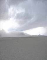
The Smoke Creek Desert is an arid region of northwestern Nevada
, USA that lies to the north of Pyramid Lake, west of the Fox Range
and east of the Smoke Creek Mountains
. The southern end of the desert lies on the Pyramid Lake Indian Reservation
, and a rail line lies at the eastern edge. The Smoke Creek Desert is southwest of the Black Rock Desert
's South Playa and is between the Granite Range
and the Fox Range.
The original Smoke Creek Desert is shown on Col. Freemont's map of the area during his 1843-44 expedition as 'Mud Flats' (and is confusing as the Black Rock Desert was originally shown as the same lake, and the Black Rock Desert has been subsequently, on various maps, shown as "Mud Lake", "Valley of Mud" or "Valley of the Mud Lakes" on maps of the 1850's and 1860's.) The Smoke Creek Desert appeared on maps as "Mud Lake" up through maps as late as the 1920's though by that time it's name had been standardized as "The Smoke Creek Desert". The other major name for the desert which has been shown on many maps starting in the early 1850's is "Alaki Lake". This is also the first found map reference on which the name "Smoke Creek Desert" appears, though Helen S. Carlson states that it has been found on a map from 1853
It is interesting to note that a sister basin of the Smoke Creek area complex of basins and ranges, Winnemucca Lake (also known as Lake Winnemucca), now a dry alkali flat, is first shown on an 1850 map[3] as filled with either mud or water and continues up through maps of the 1890's[4] and by the early 1900's no longer appears as filled, but as simply another alkali basin.
The Railroad line on the Eastern edge was originally shown on a map of 1876[5] as being on the right of way of the Southern Pacific Railroad, though on an 1877[6] map is shown as being constructed by the Western Pacific Railroad Company. Other sources state that the railroad was originally started in 1883 as a 3 foot gauge by the Nevada, California, and Oregon Railroad which was later bought and standardized by the Western Pacific Railroad in 1917[7]
There is controversy as to the origin of the name "Smoke Creek". Some believe it to be named after the Smoke Creek, a creek which lies along the Western edge of the basin and flows Eastward from near the California-Nevada border into the Smoke Creek basin. It was along this route that the Lassen and Nobels Trails were explored from the Honey Lake Valley (Susanville, California area) Eastward, eventually following along the Smoke Creek to the basin now called "Smoke Creek Desert". Other history says that it was named variously for the appearance of the basin to fill in the colder months with steam from the hot springs, or show columns of 'smoke' (water vapor) from the individual hot springs as they rose into the cold clear air of the valley. Alternately it is said that the name comes from the dust and 'dust devils' which the wind would pick up during the hot summer months and make the basin appear as though it was filled with 'smoke'. Pgalioni (talk) 23:47, 30 September 2011 (UTC)
Nevada
Nevada is a state in the western, mountain west, and southwestern regions of the United States. With an area of and a population of about 2.7 million, it is the 7th-largest and 35th-most populous state. Over two-thirds of Nevada's people live in the Las Vegas metropolitan area, which contains its...
, USA that lies to the north of Pyramid Lake, west of the Fox Range
Fox Range
The Fox Range is a mountain range in Washoe County, Nevada.The Granite Range is adjacent to the north. The Selenite Range is to the east. Pyramid Lake is to the south. The Smoke Creek Desert is to the west....
and east of the Smoke Creek Mountains
Smoke Creek Mountains
The Smoke Creek Mountains is a mountain range in Washoe County, Nevada at the California border, west of the Smoke Creek Desert....
. The southern end of the desert lies on the Pyramid Lake Indian Reservation
Pyramid Lake Indian Reservation
The Pyramid Lake Indian Reservation is a United States reservation in northwestern Nevada ~approximately northeast of Reno, in Washoe, Storey, and Lyon Counties. It lies almost entirely in Washoe County , with but tiny amounts of land in the other two counties . It is governed by the Pyramid Lake...
, and a rail line lies at the eastern edge. The Smoke Creek Desert is southwest of the Black Rock Desert
Black Rock Desert
The Black Rock Desert is an arid region in the northern Nevada section of the Great Basin with a lakebed that is a dry remnant of Pleistocene Lake Lahontan...
's South Playa and is between the Granite Range
Granite Range (Washoe County)
The Granite Range is a mountain range in Washoe County, Nevada west of the town of Gerlach and the lower Black Rock Desert playa.Adjacent mountain ranges are the Fox Range and Calico Mountains....
and the Fox Range.
The original Smoke Creek Desert is shown on Col. Freemont's map of the area during his 1843-44 expedition as 'Mud Flats' (and is confusing as the Black Rock Desert was originally shown as the same lake, and the Black Rock Desert has been subsequently, on various maps, shown as "Mud Lake", "Valley of Mud" or "Valley of the Mud Lakes" on maps of the 1850's and 1860's.) The Smoke Creek Desert appeared on maps as "Mud Lake" up through maps as late as the 1920's though by that time it's name had been standardized as "The Smoke Creek Desert". The other major name for the desert which has been shown on many maps starting in the early 1850's is "Alaki Lake". This is also the first found map reference on which the name "Smoke Creek Desert" appears, though Helen S. Carlson states that it has been found on a map from 1853
It is interesting to note that a sister basin of the Smoke Creek area complex of basins and ranges, Winnemucca Lake (also known as Lake Winnemucca), now a dry alkali flat, is first shown on an 1850 map[3] as filled with either mud or water and continues up through maps of the 1890's[4] and by the early 1900's no longer appears as filled, but as simply another alkali basin.
The Railroad line on the Eastern edge was originally shown on a map of 1876[5] as being on the right of way of the Southern Pacific Railroad, though on an 1877[6] map is shown as being constructed by the Western Pacific Railroad Company. Other sources state that the railroad was originally started in 1883 as a 3 foot gauge by the Nevada, California, and Oregon Railroad which was later bought and standardized by the Western Pacific Railroad in 1917[7]
There is controversy as to the origin of the name "Smoke Creek". Some believe it to be named after the Smoke Creek, a creek which lies along the Western edge of the basin and flows Eastward from near the California-Nevada border into the Smoke Creek basin. It was along this route that the Lassen and Nobels Trails were explored from the Honey Lake Valley (Susanville, California area) Eastward, eventually following along the Smoke Creek to the basin now called "Smoke Creek Desert". Other history says that it was named variously for the appearance of the basin to fill in the colder months with steam from the hot springs, or show columns of 'smoke' (water vapor) from the individual hot springs as they rose into the cold clear air of the valley. Alternately it is said that the name comes from the dust and 'dust devils' which the wind would pick up during the hot summer months and make the basin appear as though it was filled with 'smoke'. Pgalioni (talk) 23:47, 30 September 2011 (UTC)
External links
- Geophysical Investigations of the Smoke Creek Desert and their Geologic Implications, Northwest Nevada and Northeast California, USGSUnited States Geological SurveyThe United States Geological Survey is a scientific agency of the United States government. The scientists of the USGS study the landscape of the United States, its natural resources, and the natural hazards that threaten it. The organization has four major science disciplines, concerning biology,...
, 2006 - Gravity, Magnetic, and Physical Property Data in the Smoke Creek Desert Area, Northwest Nevada, USGSUnited States Geological SurveyThe United States Geological Survey is a scientific agency of the United States government. The scientists of the USGS study the landscape of the United States, its natural resources, and the natural hazards that threaten it. The organization has four major science disciplines, concerning biology,...
, 2006 - Smoke Creek Desert, Nevada Bureau of Mines and Geology, University of Nevada, RenoUniversity of Nevada, RenoThe University of Nevada, Reno , is a teaching and research university established in 1874 and located in Reno, Nevada, USA...
, 2005 - Nobles Trail, California-Nevada chapter of the Oregon-California Trails AssociationOregon-California Trails AssociationThe Oregon-California Trails Association is an interdisciplinary organization based at Independence, Missouri, United States. OCTA is dedicated to the preservation and protection of overland emigrant trails and the emigrant experience....