

Sine-Saloum
Encyclopedia
Sine-Saloum is a region in Senegal
located north of The Gambia
and south of the Petite Côte
. It encompasses an area of 24,000 square kilometers, about 12% of Senegal, with a population in the 1990s of 1,060,000.
The western portion contains the Saloum Delta
, a river delta
at the junction of the Saloum
and the North Atlantic. It is in this region that the Saloum Delta National Park
is located. 145,811 hectares of the Delta were designated a UNESCO Heritage Site in 2011. Because it flows so slowly, this delta allows saltwater to travel deep inland.
Long ago, the Serer
kingdoms of Sine
and Saloum
were rivals. In 1984, the area was divided into two administrative regions: Kaolack
and Fatick
.
farming, and millet
farming.
Transportation is difficult because of the many islands.
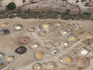
A secondary economy is the construction of fishing boats.
 Much of the region consists of mangrove swamps. The upper reaches of the rivers adjoin the Sahel
region and are affected by its desertification
. The salinity of the water increased during the 1970s instance of the Sahel drought
and mismanagement of the rivers upstream has been described as a factor. Mangroves are disappearing, and freshwater fish
are disappearing with them. The villagers have difficulty obtaining freshwater
. Sometimes water pumps are donated by international organizations, but spare parts are difficult to find when the pumps fail. The change in water salinity is affecting the ecosystem as much as it is changing the lifestyle of the inhabitants of the region.
Senegal
Senegal , officially the Republic of Senegal , is a country in western Africa. It owes its name to the Sénégal River that borders it to the east and north...
located north of The Gambia
The Gambia
The Republic of The Gambia, commonly referred to as The Gambia, or Gambia , is a country in West Africa. Gambia is the smallest country on mainland Africa, surrounded by Senegal except for a short coastline on the Atlantic Ocean in the west....
and south of the Petite Côte
Petite Côte
The Petite Côte is a stretch of coast in Senegal, running south from the Cap Vert peninsula to the Sine-Saloum delta.The northern section near Dakar contains popular seaside resorts such as Saly-Portudal, Rufisque, Nianing and Popenguire, while the entire coast is home to the city of M'Bour and...
. It encompasses an area of 24,000 square kilometers, about 12% of Senegal, with a population in the 1990s of 1,060,000.
The western portion contains the Saloum Delta
Saloum Delta
Saloum Delta or Sine-Saloum Delta is a river delta in Senegal at the mouth of the Saloum River where it flows into the North Atlantic Ocean. The delta covers 180,000 hectares. It extends 72.5 kilometers along the coastline and 35 kilometers inland....
, a river delta
River delta
A delta is a landform that is formed at the mouth of a river where that river flows into an ocean, sea, estuary, lake, reservoir, flat arid area, or another river. Deltas are formed from the deposition of the sediment carried by the river as the flow leaves the mouth of the river...
at the junction of the Saloum
Saloum River
The Saloum River rises about 105 kilometers east of Kaolack, Senegal, and flows into the Atlantic Ocean. The significant Saloum Delta is located at its mouth, which is protected as Saloum Delta National Park. The river basin lies within the Kingdom of Saloum....
and the North Atlantic. It is in this region that the Saloum Delta National Park
Saloum Delta National Park
Saloum Delta National Park or Parc National du Delta du Saloum in Senegal is a 76,000 - hectare national park in Senegal. Established in 1976, it is situated within the Saloum Delta at the juncture of the Saloum River and the North Atlantic....
is located. 145,811 hectares of the Delta were designated a UNESCO Heritage Site in 2011. Because it flows so slowly, this delta allows saltwater to travel deep inland.
Long ago, the Serer
Serer people
The Serer people along with the Jola people are acknowledged to be the oldest inhabitants of The Senegambia....
kingdoms of Sine
Kingdom of Sine
The Kingdom of Sine was a pre-colonial Serer kingdom along the north bank of the Saloum River delta in modern Senegal. Much of the kingdom's population was and still is Serer.-History:...
and Saloum
Saloum
The Kingdom of Saloum in Senegal is a traditional kingdom which was renamed Saloum in the late 15th century by the son of a Serer and a Guelowar from the kingdom of Kaabu to the south. The ancient and present capital of the Kingdom of Saloum is the city of Kahone. Previous to that, it was known...
were rivals. In 1984, the area was divided into two administrative regions: Kaolack
Kaolack Region
The Kaolack region is a region in Senegal. It borders Gambia and is a common stopping point for travel between Dakar and Banjul. Its borders correspond roughly to the Saalum Kingdom of precolonial days, and the area is still spoken of as the Saalum in Wolof, and its inhabitants are called...
and Fatick
Fatick Region
Fatick is the southwest region of the northern outcrop of Senegal. Its alternative name is Jinnak Bolon. The region is named for its capital city, Fatick.Fatick region is divided into 3 departments:*Fatick*Foundiougne*Gossas-References: ....
.
Economy
Primary economic activities in the 2000s consisted of fishing, salt production, peanutPeanut
The peanut, or groundnut , is a species in the legume or "bean" family , so it is not a nut. The peanut was probably first cultivated in the valleys of Peru. It is an annual herbaceous plant growing tall...
farming, and millet
Millet
The millets are a group of small-seeded species of cereal crops or grains, widely grown around the world for food and fodder. They do not form a taxonomic group, but rather a functional or agronomic one. Their essential similarities are that they are small-seeded grasses grown in difficult...
farming.
Transportation is difficult because of the many islands.
A secondary economy is the construction of fishing boats.
Ecosystem
Sahel
The Sahel is the ecoclimatic and biogeographic zone of transition between the Sahara desert in the North and the Sudanian Savannas in the south.It stretches across the North African continent between the Atlantic Ocean and the Red Sea....
region and are affected by its desertification
Desertification
Desertification is the degradation of land in drylands. Caused by a variety of factors, such as climate change and human activities, desertification is one of the most significant global environmental problems.-Definitions:...
. The salinity of the water increased during the 1970s instance of the Sahel drought
Sahel drought
[[File:Greening Sahel 1982-1999.jpg|thumb|300px|Recent "Greening" of the Sahel: The results of trend analyses of time series over the Sahel region of seasonally integrated NDVI using NOAA AVHRR NDVI-data from 1982 to 1999...
and mismanagement of the rivers upstream has been described as a factor. Mangroves are disappearing, and freshwater fish
Freshwater fish
Freshwater fish are fish that spend some or all of their lives in freshwater, such as rivers and lakes, with a salinity of less than 0.05%. These environments differ from marine conditions in many ways, the most obvious being the difference in levels of salinity...
are disappearing with them. The villagers have difficulty obtaining freshwater
Freshwater
Fresh water is naturally occurring water on the Earth's surface in ice sheets, ice caps, glaciers, bogs, ponds, lakes, rivers and streams, and underground as groundwater in aquifers and underground streams. Fresh water is generally characterized by having low concentrations of dissolved salts and...
. Sometimes water pumps are donated by international organizations, but spare parts are difficult to find when the pumps fail. The change in water salinity is affecting the ecosystem as much as it is changing the lifestyle of the inhabitants of the region.