

Sayer Nunatak
Encyclopedia
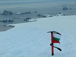
Williams Point
Williams Point is the point forming both the north extremity of Varna Peninsula and the northeast tip of Livingston Island in the South Shetland Islands, Antarctica...
on Varna Peninsula
Varna Peninsula
Varna Peninsula is a roughly rectangular predominantly ice-covered peninsula forming the northeast extremity of Livingston Island in the South Shetland Islands, Antarctica...
, at the north edge of the ice cap of Livingston Island in the South Shetland Islands
South Shetland Islands
The South Shetland Islands are a group of Antarctic islands, lying about north of the Antarctic Peninsula, with a total area of . By the Antarctic Treaty of 1959, the Islands' sovereignty is neither recognized nor disputed by the signatories and they are free for use by any signatory for...
, Antarctica. The nunatak is surmounting Dragon Cove
Dragon Cove
Dragon Cove is a 550 m wide cove indenting for 600 m the northeast coast of Varna Peninsula, Livingston Island in the South Shetland Islands, Antarctica entered between Sigritsa Point and Ficheto Point. Surmounted by Sayer Nunatak on the southwest...
to the northeast, Griffin Cove
Griffin Cove
Griffin Cove is the 800 m wide cove indenting for 260 m the northwest coast of Varna Peninsula, Livingston Island in the South Shetland Islands, Antarctica and entered between Gargoyle Bastion to the northeast and Organpipe Point to the southwest....
to the north-northwest and Charybdis Cove
Charybdis Cove
Charybdis Cove is the 1.2 km wide cove indenting for 580 m the northwest coast of Varna Peninsula, Livingston Island in the South Shetland Islands, Antarctica and entered between Organpipe Point to the north and Slab Point to the south....
to the southwest.
The feature is named after the American Captain Sayer, Master of the brig General Scott, who carried out sealing operations in this area in 1821-22.
Location
The peak is located at 62°28′21.5"S 60°08′04.8"W which is 2.3 km south of Williams PointWilliams Point
Williams Point is the point forming both the north extremity of Varna Peninsula and the northeast tip of Livingston Island in the South Shetland Islands, Antarctica...
, 3.8 km west-northwest of Pomorie Point
Pomorie Point
Pomorie Point is a point on the coast of McFarlane Strait forming the north side of the entrance to Lister Cove, Varna Peninsula, Livingston Island in the South Shetland Islands, Antarctica....
, 5.92 km north-northwest of Rakovski Nunatak
Rakovski Nunatak
Rakovski Nunatak is a rocky peak of elevation 430 m in Vidin Heights on Varna Peninsula, Livingston Island in the South Shetland Islands, Antarctica. Surmounting Rose Valley Glacier to the north....
, 7.18 km north by east of Miziya Peak
Miziya Peak
Miziya Peak is the 604 m summit of Vidin Heights on Varna Peninsula, eastern Livingston Island in the South Shetland Islands, Antarctica...
and 4.9 km northeast of Kotis Point
Kotis Point
Kotis Point is a point on the northwest coast of Varna Peninsula on Livingston Island in the South Shetland Islands, Antarctica forming the south side of the entrance to Eliseyna Cove...
(British mapping in 1968, Spanish in 1991, and Bulgarian in 2005 and 2009).
Maps
- L.L. Ivanov et al. Antarctica: Livingston Island and Greenwich Island, South Shetland Islands. Scale 1:100000 topographic map. Sofia: Antarctic Place-names Commission of Bulgaria, 2005.
- L.L. Ivanov. Antarctica: Livingston Island and Greenwich, Robert, Snow and Smith Islands. Scale 1:120000 topographic map. Troyan: Manfred Wörner Foundation, 2009. ISBN 978-954-92032-6-4