

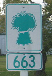
Saskatchewan Highway 663
Encyclopedia
Highway
A highway is any public road. In American English, the term is common and almost always designates major roads. In British English, the term designates any road open to the public. Any interconnected set of highways can be variously referred to as a "highway system", a "highway network", or a...
in the Canadian
Canada
Canada is a North American country consisting of ten provinces and three territories. Located in the northern part of the continent, it extends from the Atlantic Ocean in the east to the Pacific Ocean in the west, and northward into the Arctic Ocean...
province of Saskatchewan
Saskatchewan
Saskatchewan is a prairie province in Canada, which has an area of . Saskatchewan is bordered on the west by Alberta, on the north by the Northwest Territories, on the east by Manitoba, and on the south by the U.S. states of Montana and North Dakota....
. It runs from Highway 11
Saskatchewan Highway 11
Highway 11 is a major north-south highway in Saskatchewan, Canada that connects the province's three largest cities: Regina, Saskatoon and Prince Albert. It is a structural pavement major arterial highway which is approximately long. It is also known as the Louis Riel Trail after the 19th century...
to Highway 16
Saskatchewan Highway 16
Highway 16 is a provincial paved highway in the Canadian province of Saskatchewan. It is the Saskatchewan section of the Yellowhead Highway, and also the Trans-Canada Highway Yellowhead section. The main purpose of this highway is to connect Saskatchewan with Canadian cities such as Edmonton and...
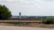
. Highway 663 is about 31 km (19 mi.) long and runs along the routing of Range Road 3042.
Intersections from south to north
{| {| class="wikitable"|-
!width="15%"|Municipality
!width="20%"|km from southern end
!width="65%"|Intersecting Roads
|-
|Dundurn RM
Dundurn No. 314, Saskatchewan
Dundurn No. 314 is a rural municipality in north-central Saskatchewan on the South Saskatchewan River. RM Dundurn is an administrative division for the rural area around the town of Dundurn. It is located in Census Division No. 11 for enumeration purposes...
|0
|Highway 11
Saskatchewan Highway 11
Highway 11 is a major north-south highway in Saskatchewan, Canada that connects the province's three largest cities: Regina, Saskatoon and Prince Albert. It is a structural pavement major arterial highway which is approximately long. It is also known as the Louis Riel Trail after the 19th century...
(start)
|-
|Dundurn RM
Dundurn No. 314, Saskatchewan
Dundurn No. 314 is a rural municipality in north-central Saskatchewan on the South Saskatchewan River. RM Dundurn is an administrative division for the rural area around the town of Dundurn. It is located in Census Division No. 11 for enumeration purposes...
|1
|Township Road 330 to Thode
Thode, Saskatchewan
Thode is a community in Saskatchewan....
|-
|Dundurn RM
Dundurn No. 314, Saskatchewan
Dundurn No. 314 is a rural municipality in north-central Saskatchewan on the South Saskatchewan River. RM Dundurn is an administrative division for the rural area around the town of Dundurn. It is located in Census Division No. 11 for enumeration purposes...
|3
|Highway 211
Saskatchewan Highway 211
Highway 211 is a highway in the Canadian province of Saskatchewan. It connects Highway 11 near Dundurn to the main access road for Blackstrap Provincial Park and Township Road 330...
|-
|Dundurn RM
Dundurn No. 314, Saskatchewan
Dundurn No. 314 is a rural municipality in north-central Saskatchewan on the South Saskatchewan River. RM Dundurn is an administrative division for the rural area around the town of Dundurn. It is located in Census Division No. 11 for enumeration purposes...
|5
|Township Road 332 to Shields
Shields, Saskatchewan
-Statistics:-External links:*...
|-
|Dundurn RM
Dundurn No. 314, Saskatchewan
Dundurn No. 314 is a rural municipality in north-central Saskatchewan on the South Saskatchewan River. RM Dundurn is an administrative division for the rural area around the town of Dundurn. It is located in Census Division No. 11 for enumeration purposes...
|8
|Township Road 334
|-
|Dundurn RM
Dundurn No. 314, Saskatchewan
Dundurn No. 314 is a rural municipality in north-central Saskatchewan on the South Saskatchewan River. RM Dundurn is an administrative division for the rural area around the town of Dundurn. It is located in Census Division No. 11 for enumeration purposes...
|11
|Township Road 340
|-
|Dundurn RM
Dundurn No. 314, Saskatchewan
Dundurn No. 314 is a rural municipality in north-central Saskatchewan on the South Saskatchewan River. RM Dundurn is an administrative division for the rural area around the town of Dundurn. It is located in Census Division No. 11 for enumeration purposes...
|14
|Township Road 342
|-
|Dundurn RM
Dundurn No. 314, Saskatchewan
Dundurn No. 314 is a rural municipality in north-central Saskatchewan on the South Saskatchewan River. RM Dundurn is an administrative division for the rural area around the town of Dundurn. It is located in Census Division No. 11 for enumeration purposes...
|17
|Township Road 344
|-
|Corman Park RM
Corman Park No. 344, Saskatchewan
The area's German Canadian population is much higher proportionately than the national or provincial averages: 43.4% .-Government of the RM:...
|21
|Tamke Road (Township Road 350)
|-
|Corman Park RM
Corman Park No. 344, Saskatchewan
The area's German Canadian population is much higher proportionately than the national or provincial averages: 43.4% .-Government of the RM:...
|24
|Melness Road (Township Road 352)
|-
|Corman Park RM
Corman Park No. 344, Saskatchewan
The area's German Canadian population is much higher proportionately than the national or provincial averages: 43.4% .-Government of the RM:...
|27
|Baker Road (Township Road 354)
|-
|Corman Park RM
Corman Park No. 344, Saskatchewan
The area's German Canadian population is much higher proportionately than the national or provincial averages: 43.4% .-Government of the RM:...
|29
|Cheviot Road (Township Road 355)
|-
|Corman Park RM
Corman Park No. 344, Saskatchewan
The area's German Canadian population is much higher proportionately than the national or provincial averages: 43.4% .-Government of the RM:...
|31
|Highway 16
Saskatchewan Highway 16
Highway 16 is a provincial paved highway in the Canadian province of Saskatchewan. It is the Saskatchewan section of the Yellowhead Highway, and also the Trans-Canada Highway Yellowhead section. The main purpose of this highway is to connect Saskatchewan with Canadian cities such as Edmonton and...
/Floral Road (Township Road 360) (end)
|-
!colspan="3" |Continues northward as Freeborn Road (Range Road 3042)
|}