
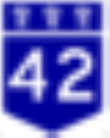
Saskatchewan Highway 42
Encyclopedia
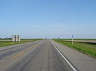
Highway 42 is a highway
in the Canadian
province of Saskatchewan
. It runs from the intersecion of Highway 2
and Highway 202
near Tuxford
until Highway 15
. Highway 42 is about 199 km (124 mi.) long.
The highway also passes the communities of Marquis
, Keeler
, Brownlee
, Eyebrow
, Central Butte
, Lawson, Riverhurst
and Lucky Lake, Saskatchewan
.
Highway 42 crosses Lake Diefenbaker
on the 3-km long Riverhurst Ferry
route and ice road
in the winter.
Highway
A highway is any public road. In American English, the term is common and almost always designates major roads. In British English, the term designates any road open to the public. Any interconnected set of highways can be variously referred to as a "highway system", a "highway network", or a...
in the Canadian
Canada
Canada is a North American country consisting of ten provinces and three territories. Located in the northern part of the continent, it extends from the Atlantic Ocean in the east to the Pacific Ocean in the west, and northward into the Arctic Ocean...
province of Saskatchewan
Saskatchewan
Saskatchewan is a prairie province in Canada, which has an area of . Saskatchewan is bordered on the west by Alberta, on the north by the Northwest Territories, on the east by Manitoba, and on the south by the U.S. states of Montana and North Dakota....
. It runs from the intersecion of Highway 2
Saskatchewan Highway 2
Highway 2 is a provincial highway in the Canadian province of Saskatchewan. It is the longest Saskatchewan Highway, at 809 km . The highway is partially divided and undivided. However, only about near Moose Jaw, near Chamberlain, and near Prince Albert are divided highway...
and Highway 202
Saskatchewan Highway 202
Highway 202 is a highway in the Canadian province of Saskatchewan. It runs from Highway 2 at Tuxford to Highway 301 near the Buffalo Pound Provincial Park. Highway 202 is about 11 km long.-External links:*...
near Tuxford
Tuxford, Saskatchewan
Tuxford is a community in Saskatchewan. Moose Jaw is 14 km south and Buffalo Pound Lake is 16 km north. Highway 2, Highway 42 and Highway 202 all intersect in the community. Highway 202 connects the community to Buffalo Pound Provincial Park 11 km east...
until Highway 15
Saskatchewan Highway 15
Highway 15 is a highway in the Canadian province of Saskatchewan. It runs from Highway 4, 5 km south of Rosetown, to Highway 16 near Bredenbury. Highway 15 is about 444 km long. The Outlook Bridge caries Highway 15 across the South Saskatchewan River.Major communities that Highway 15 passes near...
. Highway 42 is about 199 km (124 mi.) long.
The highway also passes the communities of Marquis
Marquis, Saskatchewan
-External links:********-Footnotes:...
, Keeler
Keeler, Saskatchewan
- See also :* List of communities in Saskatchewan* Villages of Saskatchewan-External links:*******-Footnotes:...
, Brownlee
Brownlee, Saskatchewan
- See also :* List of communities in Saskatchewan* Villages of Saskatchewan-External links:********-Footnotes:...
, Eyebrow
Eyebrow, Saskatchewan
- See also :* List of communities in Saskatchewan* Villages of Saskatchewan-External links:*******-Footnotes:...
, Central Butte
Central Butte, Saskatchewan
Central Butte is a town in Saskatchewan, Canada, approximately 200 kilometres from Saskatoon, Regina and Swift Current and 100 kilometres from Moose Jaw.Thunder Creek, a river that flows into Moose Jaw begins south of the community....
, Lawson, Riverhurst
Riverhurst, Saskatchewan
Riverhurst is a village in the south-west Coteau Hills area of Saskatchewan, Canada and is north of Vermillion Hills. It is primarily a farming community....
and Lucky Lake, Saskatchewan
Lucky Lake, Saskatchewan
-External links:********-Footnotes:...
.
Highway 42 crosses Lake Diefenbaker
Lake Diefenbaker
Lake Diefenbaker is a reservoir in Southern Saskatchewan, Canada. It was formed by the construction of Gardiner Dam and the Qu'Appelle River Dam across the South Saskatchewan and Qu'Appelle Rivers respectively. Construction began in 1959 and the lake was filled in 1967. The lake is long with...
on the 3-km long Riverhurst Ferry
Riverhurst Ferry
The Riverhurst Ferry is a cable ferry in the Canadian province of Saskatchewan. The ferry crosses Lake Diefenbaker, linking Riverhurst on the west bank to Lucky Lake on the east bank. The ferry is how Highway 42 crosses Lake Diefenbaker....
route and ice road
Ice road
Ice roads are frozen, human-made structures on the surface of bays, rivers, lakes, or seas in the far north. They link dry land, frozen waterways, portages and winter roads, and are usually remade each winter. Ice roads allow temporary transport to areas with no permanent road access...
in the winter.