
.gif)
San Mateo Mountains (Socorro County, New Mexico)
Encyclopedia
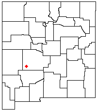
Socorro County, New Mexico
-2010:Whereas according to the 2010 U.S. Census Bureau:*75.1% White*1.1% Black*11.7% Native American*1.2% Asian*0.0% Native Hawaiian or Pacific Islander*2.8% Two or more races*8.1% Other races*48.5% Hispanic or Latino -2000:...
, in west-central New Mexico
New Mexico
New Mexico is a state located in the southwest and western regions of the United States. New Mexico is also usually considered one of the Mountain States. With a population density of 16 per square mile, New Mexico is the sixth-most sparsely inhabited U.S...
in the southwestern United States
United States
The United States of America is a federal constitutional republic comprising fifty states and a federal district...
. The highest point in the range is West Blue Mountain
West Blue Mountain (New Mexico)
West Blue Mountain is the highest peak in the San Mateo Mountains of southwestern New Mexico, in the United States. It is located within the Apache Kid Wilderness of the Cibola National Forest. It lies in the southern half of the range, far from any paved road, making access difficult and traffic...
, at 10,336 ft (3,151 m). The range runs roughly north-south and is about 40 miles (64 km) long. It lies about 25 miles (40 km) north-northwest of the town of Truth or Consequences
Truth or Consequences, New Mexico
Truth or Consequences is a spa city and the county seat of Sierra County, New Mexico, United States. As of the 2000 census, the population was 7,289. It is commonly known within New Mexico as T or C....
and about 30 miles (48 km) southwest of Socorro
Socorro, New Mexico
Socorro is a city in Socorro County in the U.S. state of New Mexico. It stands in the Rio Grande Valley at an elevation of . The population was 9,051 at the 2010 census...
. They should not be confused with the identically named range
San Mateo Mountains (Cibola County, New Mexico)
The San Mateo Mountains are a small mountain range in Cibola and McKinley counties of New Mexico, in the southwestern United States. The highest point in the range is Mount Taylor, at 11,301 ft . The range lies just northeast of the community of Grants, and about 60 miles west of Albuquerque...
in Cibola
Cibola County, New Mexico
-2010:Whereas according to the 2010 U.S. Census Bureau:*41.8% White*1.0% Black*41.0% Native American*0.5% Asian*0.1% Native Hawaiian or Pacific Islander*3.1% Two or more races*12.5% Other races*36.5% Hispanic or Latino -2000:...
and McKinley
McKinley County, New Mexico
-2010:Whereas according to the 2010 U.S. Census Bureau:*15.2% White*0.5% Black*75.5% Native American*0.8% Asian*0.0% Native Hawaiian or Pacific Islander*3.1% Two or more races*4.6% Other races*13.3% Hispanic or Latino -2000:...
counties, north of this range.
The San Mateo Mountains are a fault-block
Fault-block mountain
Fault-block landforms are formed when large areas of bedrock are widely broken up by faults creating large vertical displacements of continental crust....
range, made of volcanic rock from the Datil-Mogollon Volcanic Field, of age between twenty-eight and twenty-four million years. They form part of the western edge of the Rio Grande Rift
Rio Grande Rift
The Rio Grande Rift is a north-trending continental rift zone. It separates the Colorado Plateau in the west from the interior of the North American craton on the east. The rift extends from central Colorado in the north to the state of Chihuahua, Mexico in the south. The rift zone consists of four...
Valley. They also form the eastern border of the Plains of San Agustin
Plains of San Augustin
The Plains of San Agustin are found in the southwestern U.S. state of New Mexico in the San Agustin Basin, south of U.S. Highway 60. They are located in Catron and Socorro Counties, about 50 miles west of the town of Socorro and about 25 miles north of Reserve...
, site of the Very Large Array
Very Large Array
The Very Large Array is a radio astronomy observatory located on the Plains of San Agustin, between the towns of Magdalena and Datil, some fifty miles west of Socorro, New Mexico, USA...
.
Some mining activity, involving gold, silver, and copper, occurred in the southern part of the range near the end of the nineteenth century.
Most of the San Mateo Mountains are within the Magdalena Ranger District of the Cibola National Forest
Cibola National Forest
The Cibola National Forest is a United States National Forest in western and central New Mexico, USA. The forest also manages four National Grasslands that stretch from northeastern New Mexico eastward into the Texas Panhandle and western Oklahoma. It is administered by the United States Forest...
. There are two designated wilderness areas in the range, the Apache Kid Wilderness
Apache Kid Wilderness
Apache Kid Wilderness is a wilderness area located within the Cibola National Forest in the U.S. state of New Mexico. Straddling a southern portion of the San Mateo Mountains of southwestern Socorro County, the area is characterized by rugged, narrow, and steep canyons bisecting high mountain...
44650 acres (181 km²) and the Withington Wilderness 18869 acres (76 km²). Numerous trails and hiking
Hiking
Hiking is an outdoor activity which consists of walking in natural environments, often in mountainous or other scenic terrain. People often hike on hiking trails. It is such a popular activity that there are numerous hiking organizations worldwide. The health benefits of different types of hiking...
opportunities exist, but the mountains see little use due to their distance from large population centers such as Albuquerque
Albuquerque, New Mexico
Albuquerque is the largest city in the state of New Mexico, United States. It is the county seat of Bernalillo County and is situated in the central part of the state, straddling the Rio Grande. The city population was 545,852 as of the 2010 Census and ranks as the 32nd-largest city in the U.S. As...
.
Significant summits include:
| Mountain | Height (ft) | Height (m) | Coordinates | Prominence Topographic prominence In topography, prominence, also known as autonomous height, relative height, shoulder drop , or prime factor , categorizes the height of the mountain's or hill's summit by the elevation between it and the lowest contour line encircling it and no higher summit... (ft) |
|---|---|---|---|---|
| West Blue Mountain West Blue Mountain (New Mexico) West Blue Mountain is the highest peak in the San Mateo Mountains of southwestern New Mexico, in the United States. It is located within the Apache Kid Wilderness of the Cibola National Forest. It lies in the southern half of the range, far from any paved road, making access difficult and traffic... |
10,783 | 3,287 | 33.6651°N 107.4457°W | 3,146 |
| Vicks Peak | 10,252 | 3,125 | 33.5531°N 107.4350°W | 1,432 |
| San Mateo Mountain | 10,145 | 3,092 | 33.5604°N 107.4498°W | 652 |
| San Mateo Peak | 10,139 | 3,090 | 33.6112°N 107.4323°W | 1,199 |
| Mount Withington | 10,115 | 3,083 | 33.8807°N 107.4862°W | 2,335 |
| Apache Kid Peak | 10,048 | 3,063 | 33.6414°N 107.4152°W | 539 |