
Rowena, Oregon
Encyclopedia
Rowena is an unincorporated
community in Wasco County
, Oregon
, United States
. For statistical purposes, the United States Census Bureau
has defined Rowena as a census-designated place
(CDP). The census definition of the area may not precisely correspond to local understanding of the area with the same name. The population was 148 at the 2000 census.
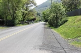
Rowena is located west of The Dalles on the Columbia River
, where the river passes through the natural feature Rowena Gap. Interstate 84 (Columbia River Highway) and U.S. Route 30 (Historic Columbia River Highway) pass through the community. Route 30 near Rowena is notable for the Rowena Loops.
According to Oregon Geographic Names
, the exact origin of the name "Rowena" is disputed. Two sources say Rowena was named for H.S. Rowe, a railroad company official, in the early 1880s. Another source says it was named for a girl, Rowena, who had been living in the area at the time the community was founded. It is also possible that the name comes indirectly from Rowena, Ivanhoe
s lady, in the novel
by Sir Walter Scott
.
There was once a ferry
operating between Rowena and Lyle, Washington
across the Columbia.
The Nature Conservancy
has a nature preserve
on the plateau
near Rowena, The Tom McCall
Preserve, that is known for its spring wildflowers. The preserve is owned and managed in cooperation with Mayer State Park
.
According to the United States Census Bureau
, the CDP has a total area of 1.9 square miles (4.9 km²), all land.
of 2000, there were 148 people, 63 households, and 40 families residing in the CDP. The population density
was 79.7 people per square mile (30.7/km²). There were 89 housing units at an average density of 47.9 per square mile (18.5/km²). The racial makeup of the CDP was 98.65% White, 0.68% Asian and 0.68% Pacific Islander.
There were 63 households out of which 31.7% had children under the age of 18 living with them, 49.2% were married couples
living together, 9.5% had a female householder with no husband present, and 36.5% were non-families. 31.7% of all households were made up of individuals and 11.1% had someone living alone who was 65 years of age or older. The average household size was 2.33 and the average family size was 2.93.
In the CDP the population was spread out with 30.4% under the age of 18, 5.4% from 18 to 24, 34.5% from 25 to 44, 18.9% from 45 to 64, and 10.8% who were 65 years of age or older. The median age was 35 years. For every 100 females there were 85.0 males. For every 100 females age 18 and over, there were 98.1 males.
The median income for a household in the CDP was $41,080, and the median income for a family was $42,417. Males had a median income of $40,938 versus $26,111 for females. The per capita income
for the CDP was $15,457. There were 16.3% of families and 13.6% of the population living below the poverty line, including 10.0% of under eighteens and none of those over 64.
Unincorporated area
In law, an unincorporated area is a region of land that is not a part of any municipality.To "incorporate" in this context means to form a municipal corporation, a city, town, or village with its own government. An unincorporated community is usually not subject to or taxed by a municipal government...
community in Wasco County
Wasco County, Oregon
Wasco County is a county located in the U.S. state of Oregon. The county is named for a local tribe of Native Americans, the Wasco, a Chinook tribe who lived on the south side of the Columbia River. In 2010, its population was 25,213...
, Oregon
Oregon
Oregon is a state in the Pacific Northwest region of the United States. It is located on the Pacific coast, with Washington to the north, California to the south, Nevada on the southeast and Idaho to the east. The Columbia and Snake rivers delineate much of Oregon's northern and eastern...
, United States
United States
The United States of America is a federal constitutional republic comprising fifty states and a federal district...
. For statistical purposes, the United States Census Bureau
United States Census Bureau
The United States Census Bureau is the government agency that is responsible for the United States Census. It also gathers other national demographic and economic data...
has defined Rowena as a census-designated place
Census-designated place
A census-designated place is a concentration of population identified by the United States Census Bureau for statistical purposes. CDPs are delineated for each decennial census as the statistical counterparts of incorporated places such as cities, towns and villages...
(CDP). The census definition of the area may not precisely correspond to local understanding of the area with the same name. The population was 148 at the 2000 census.
Rowena is located west of The Dalles on the Columbia River
Columbia River
The Columbia River is the largest river in the Pacific Northwest region of North America. The river rises in the Rocky Mountains of British Columbia, Canada, flows northwest and then south into the U.S. state of Washington, then turns west to form most of the border between Washington and the state...
, where the river passes through the natural feature Rowena Gap. Interstate 84 (Columbia River Highway) and U.S. Route 30 (Historic Columbia River Highway) pass through the community. Route 30 near Rowena is notable for the Rowena Loops.
According to Oregon Geographic Names
Oregon Geographic Names
Oregon Geographic Names is an authoritative compilation of the origin and meaning of place names in the U.S. state of Oregon. , the book is in its seventh edition and is compiled and edited by Lewis L. McArthur, who took over from his father, Lewis A. McArthur, as of the fourth edition...
, the exact origin of the name "Rowena" is disputed. Two sources say Rowena was named for H.S. Rowe, a railroad company official, in the early 1880s. Another source says it was named for a girl, Rowena, who had been living in the area at the time the community was founded. It is also possible that the name comes indirectly from Rowena, Ivanhoe
Ivanhoe
Ivanhoe is a historical fiction novel by Sir Walter Scott in 1819, and set in 12th-century England. Ivanhoe is sometimes credited for increasing interest in Romanticism and Medievalism; John Henry Newman claimed Scott "had first turned men's minds in the direction of the middle ages," while...
s lady, in the novel
Novel
A novel is a book of long narrative in literary prose. The genre has historical roots both in the fields of the medieval and early modern romance and in the tradition of the novella. The latter supplied the present generic term in the late 18th century....
by Sir Walter Scott
Walter Scott
Sir Walter Scott, 1st Baronet was a Scottish historical novelist, playwright, and poet, popular throughout much of the world during his time....
.
There was once a ferry
Ferry
A ferry is a form of transportation, usually a boat, but sometimes a ship, used to carry primarily passengers, and sometimes vehicles and cargo as well, across a body of water. Most ferries operate on regular, frequent, return services...
operating between Rowena and Lyle, Washington
Lyle, Washington
Lyle is a census-designated place in Klickitat County, Washington, United States. The population was 530 at the 2000 census.- History :...
across the Columbia.
The Nature Conservancy
The Nature Conservancy
The Nature Conservancy is a US charitable environmental organization that works to preserve the plants, animals, and natural communities that represent the diversity of life on Earth by protecting the lands and waters they need to survive....
has a nature preserve
Nature reserve
A nature reserve is a protected area of importance for wildlife, flora, fauna or features of geological or other special interest, which is reserved and managed for conservation and to provide special opportunities for study or research...
on the plateau
Plateau
In geology and earth science, a plateau , also called a high plain or tableland, is an area of highland, usually consisting of relatively flat terrain. A highly eroded plateau is called a dissected plateau...
near Rowena, The Tom McCall
Tom McCall
Thomas Lawson McCall was an American politician and journalist in the state of Oregon. A Republican, he was the 30th Governor of Oregon from 1967 to 1975. A native of Massachusetts, he grew up there and in Central Oregon before attending the University of Oregon...
Preserve, that is known for its spring wildflowers. The preserve is owned and managed in cooperation with Mayer State Park
Mayer State Park
Mayer State Park is a state park in the Columbia River Gorge, near Rowena, Oregon in Wasco County in the U.S. state of Oregon. It consists of several disjointed parcels of transected by Interstate 84 and the tracks of the Union Pacific Railroad....
.
Geography
Rowena is located at 45°40′6"N 121°16′34"W (45.668198, -121.276201).According to the United States Census Bureau
United States Census Bureau
The United States Census Bureau is the government agency that is responsible for the United States Census. It also gathers other national demographic and economic data...
, the CDP has a total area of 1.9 square miles (4.9 km²), all land.
Demographics
As of the censusCensus
A census is the procedure of systematically acquiring and recording information about the members of a given population. It is a regularly occurring and official count of a particular population. The term is used mostly in connection with national population and housing censuses; other common...
of 2000, there were 148 people, 63 households, and 40 families residing in the CDP. The population density
Population density
Population density is a measurement of population per unit area or unit volume. It is frequently applied to living organisms, and particularly to humans...
was 79.7 people per square mile (30.7/km²). There were 89 housing units at an average density of 47.9 per square mile (18.5/km²). The racial makeup of the CDP was 98.65% White, 0.68% Asian and 0.68% Pacific Islander.
There were 63 households out of which 31.7% had children under the age of 18 living with them, 49.2% were married couples
Marriage
Marriage is a social union or legal contract between people that creates kinship. It is an institution in which interpersonal relationships, usually intimate and sexual, are acknowledged in a variety of ways, depending on the culture or subculture in which it is found...
living together, 9.5% had a female householder with no husband present, and 36.5% were non-families. 31.7% of all households were made up of individuals and 11.1% had someone living alone who was 65 years of age or older. The average household size was 2.33 and the average family size was 2.93.
In the CDP the population was spread out with 30.4% under the age of 18, 5.4% from 18 to 24, 34.5% from 25 to 44, 18.9% from 45 to 64, and 10.8% who were 65 years of age or older. The median age was 35 years. For every 100 females there were 85.0 males. For every 100 females age 18 and over, there were 98.1 males.
The median income for a household in the CDP was $41,080, and the median income for a family was $42,417. Males had a median income of $40,938 versus $26,111 for females. The per capita income
Per capita income
Per capita income or income per person is a measure of mean income within an economic aggregate, such as a country or city. It is calculated by taking a measure of all sources of income in the aggregate and dividing it by the total population...
for the CDP was $15,457. There were 16.3% of families and 13.6% of the population living below the poverty line, including 10.0% of under eighteens and none of those over 64.