
.gif)
Route 77 (New Jersey)
Encyclopedia
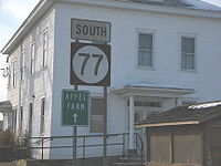
Route 77 is a state highway
in the southern part of the U.S. state
of New Jersey
. It runs 22.55 mi (36.29 km) from an intersection with Route 49 in Bridgeton
, Cumberland County
north to an intersection with Route 45 in Mullica Hill
, Gloucester County
. It is a mostly two-lane, undivided road traversing through farmland in Cumberland, Salem
, and Gloucester Counties. Along the way, Route 77 intersects Route 56 in Upper Deerfield Township
and U.S. Route 40
in Upper Pittsgrove Township
.
Prior to 1927, the route was a branch of pre-1927 Route 6 that ran from Bridgeton to Mullica Hill. In 1927, it was designated as Route 46, which replaced the Bridgeton-Mullica Hill branch of pre-1927 Route 6. In 1953, it was renumbered to Route 77 to avoid conflicting with U.S. Route 46
in the northern part of the state.
, Cumberland County
on Pearl Street. In a short distance, the route intersects County Route 670 (Commerce Street) and then crosses County Route 552
(Irving Avenue), which ends a block to the west at Laurel Street. It continues north through residential areas of Bridgeton, meeting County Route 665 (Penn Street) and County Route 659 (Bridgeton Avenue/Rosenhayn Avenue). Route 77 heads into a commercial area, crossing into Upper Deerfield Township
at the intersection with Laurel Plaza Drive. The route intersects the western terminus of Route 56 (Landis Avenue) and County Route 622 (Cornwell Drive) where the route is briefly a four-lane road. Past this intersection, Route 77 heads into farmland, where it intersects several county roads including County Route 704 (Silver Lake Road), County Route 617 (Finley Road), and County Route 658 (Big Oak Road). It heads north into Seabrook
, where it meets County Route 743 (Parsonage Road) and County Route 711 (Northville Road). Route 77 intersects County Route 612 (Polk Lane) and County Route 630 (Parsonage Road) before crossing County Route 540
(Deerfield Road) in Deerfield. Past County Route 540, the route intersects County Route 640 (Friesburg Road) and County Route 730 (Tices Lane). Route 77 then intersects County Route 614 (Bridgeton Road), the last county route intersection in Cumberland County.
 Route 77 crosses into Upper Pittsgrove Township
, Salem County
, where it becomes Pole Tavern-Bridgeton Road, and crosses County Route 611 (Elmer-Shirley Road) in Shirley. It continues north through farms to Pole Tavern, where Route 77 meets U.S. Route 40
(Harding Highway), County Route 604 (Monroeville Road), and County Route 635 (Daretown Road) at the Pole Tavern Circle
. Past the Pole Tavern Circle, the route becomes Bridgeton Pike and crosses County Route 660 (Alderman Road). Before leaving Salem County, Route 77 intersects two more county routes: County Route 619 (Glassboro Road/Whig Lane) and County Route 666 (Monroeville-Swedesboro Road).
Route 77 crosses Oldmans Creek
into Elk Township
, Gloucester County
, meeting County Route 641 (Ferrell Road) and County Route 616 (Harrisonville Way) before crossing County Route 538
(Elk Road). Past this intersection, the route crosses County Route 618 (Fislerville Road/Harrisonville Road) and enters Harrison Township
. Route 77 continues northwest and enters Mullica Hill
, where it intersects the northern terminus of County Route 581
(Commissioners Road) and heads north on South Main Street. Route 77 ends at Route 45 (Woodstown Road) where Route 45 continues to the north on South Main Street.
and split into two branches in Mullica Hill that ran to Salem
and Bridgeton. In the 1927 New Jersey state highway renumbering
, Route 46 was designated along the former branch of pre-1927 Route 6 that ran from Bridgeton to Mullica Hill. In the 1953 New Jersey state highway renumbering
, which stated that no state route and U.S. route could share the same number, Route 46 was changed to Route 77 to avoid a conflict with U.S. Route 46
in North Jersey
.
State highway
State highway, state road or state route can refer to one of three related concepts, two of them related to a state or provincial government in a country that is divided into states or provinces :#A...
in the southern part of the U.S. state
U.S. state
A U.S. state is any one of the 50 federated states of the United States of America that share sovereignty with the federal government. Because of this shared sovereignty, an American is a citizen both of the federal entity and of his or her state of domicile. Four states use the official title of...
of New Jersey
New Jersey
New Jersey is a state in the Northeastern and Middle Atlantic regions of the United States. , its population was 8,791,894. It is bordered on the north and east by the state of New York, on the southeast and south by the Atlantic Ocean, on the west by Pennsylvania and on the southwest by Delaware...
. It runs 22.55 mi (36.29 km) from an intersection with Route 49 in Bridgeton
Bridgeton, New Jersey
Bridgeton is a city in Cumberland County, New Jersey, United States, in the south part of the state, on the Cohansey River, near Delaware Bay. As of the 2010 United States Census, the city population was 25,349. It is the county seat of Cumberland County...
, Cumberland County
Cumberland County, New Jersey
Cumberland County is a county located in the U.S. state of New Jersey. As of the 2010 Census, the population is 156,898. Its county seat is Bridgeton. Cumberland County is named for Prince William, Duke of Cumberland....
north to an intersection with Route 45 in Mullica Hill
Mullica Hill, New Jersey
Mullica Hill is a census-designated place and unincorporated area located within Harrison Township, in Gloucester County, New Jersey. As of the United States 2000 Census, Mullica Hill population was 1,658.-History:...
, Gloucester County
Gloucester County, New Jersey
Gloucester County is a county located in the U.S. state of New Jersey. As of the 2010 Census, the population was 288,288. Its county seat is Woodbury....
. It is a mostly two-lane, undivided road traversing through farmland in Cumberland, Salem
Salem County, New Jersey
-Demographics:As of the census of 2000, there were 64,285 people, 24,295 households, and 17,370 families residing in the county. The population density was 190 people per square mile . There were 26,158 housing units at an average density of 77 per square mile...
, and Gloucester Counties. Along the way, Route 77 intersects Route 56 in Upper Deerfield Township
Upper Deerfield Township, New Jersey
Upper Deerfield Township is a township in Cumberland County, New Jersey, United States. It is part of the Vineland-Millville-Bridgeton Primary Metropolitan Statistical Area for statistical purposes...
and U.S. Route 40
U.S. Route 40 in New Jersey
U.S. Route 40 is a U.S. highway running from Park City, Utah east to Atlantic City, New Jersey. The easternmost segment of the route runs through the southern part of New Jersey between the Delaware Memorial Bridge over the Delaware River in Pennsville Township, Salem County, where it continues...
in Upper Pittsgrove Township
Upper Pittsgrove Township, New Jersey
Upper Pittsgrove Township is a Township in Salem County, New Jersey, United States. As of the 2000 United States Census, the township population was 3,468.Upper Pittsgrove Township was incorporated on March 10, 1846, from portions of Pittsgrove Township...
.
Prior to 1927, the route was a branch of pre-1927 Route 6 that ran from Bridgeton to Mullica Hill. In 1927, it was designated as Route 46, which replaced the Bridgeton-Mullica Hill branch of pre-1927 Route 6. In 1953, it was renumbered to Route 77 to avoid conflicting with U.S. Route 46
U.S. Route 46
U.S. Route 46 is an east–west U.S. Highway, running for , completely within the state of New Jersey. The west end is at an interchange with Interstate 80 and Route 94 in Columbia, Warren County on the Delaware River...
in the northern part of the state.
Cumberland County
Route 77 heads north from Route 49 and County Route 609 in BridgetonBridgeton, New Jersey
Bridgeton is a city in Cumberland County, New Jersey, United States, in the south part of the state, on the Cohansey River, near Delaware Bay. As of the 2010 United States Census, the city population was 25,349. It is the county seat of Cumberland County...
, Cumberland County
Cumberland County, New Jersey
Cumberland County is a county located in the U.S. state of New Jersey. As of the 2010 Census, the population is 156,898. Its county seat is Bridgeton. Cumberland County is named for Prince William, Duke of Cumberland....
on Pearl Street. In a short distance, the route intersects County Route 670 (Commerce Street) and then crosses County Route 552
County Route 552 (New Jersey)
County Route 552, abbreviated CR 552, is a county highway in the U.S. state of New Jersey. The highway extends from Laurel Street in Bridgeton to Harding Highway in Hamilton Township.-Cumberland County:...
(Irving Avenue), which ends a block to the west at Laurel Street. It continues north through residential areas of Bridgeton, meeting County Route 665 (Penn Street) and County Route 659 (Bridgeton Avenue/Rosenhayn Avenue). Route 77 heads into a commercial area, crossing into Upper Deerfield Township
Upper Deerfield Township, New Jersey
Upper Deerfield Township is a township in Cumberland County, New Jersey, United States. It is part of the Vineland-Millville-Bridgeton Primary Metropolitan Statistical Area for statistical purposes...
at the intersection with Laurel Plaza Drive. The route intersects the western terminus of Route 56 (Landis Avenue) and County Route 622 (Cornwell Drive) where the route is briefly a four-lane road. Past this intersection, Route 77 heads into farmland, where it intersects several county roads including County Route 704 (Silver Lake Road), County Route 617 (Finley Road), and County Route 658 (Big Oak Road). It heads north into Seabrook
Seabrook, New Jersey
Seabrook is an unincorporated area within Upper Deerfield Township in Cumberland County, New Jersey, United States. The area is served as United States Postal Service ZIP code 08302....
, where it meets County Route 743 (Parsonage Road) and County Route 711 (Northville Road). Route 77 intersects County Route 612 (Polk Lane) and County Route 630 (Parsonage Road) before crossing County Route 540
County Route 540 (New Jersey)
County Route 540, abbreviated CR 540, is a county highway in the U.S. state of New Jersey. The highway extends from the intersection of U.S. Route 130 and Route 140 in Carneys Point Township to Harding Highway County Route 540, abbreviated CR 540, is a county highway in the U.S. state of New...
(Deerfield Road) in Deerfield. Past County Route 540, the route intersects County Route 640 (Friesburg Road) and County Route 730 (Tices Lane). Route 77 then intersects County Route 614 (Bridgeton Road), the last county route intersection in Cumberland County.
Salem and Gloucester Counties
Upper Pittsgrove Township, New Jersey
Upper Pittsgrove Township is a Township in Salem County, New Jersey, United States. As of the 2000 United States Census, the township population was 3,468.Upper Pittsgrove Township was incorporated on March 10, 1846, from portions of Pittsgrove Township...
, Salem County
Salem County, New Jersey
-Demographics:As of the census of 2000, there were 64,285 people, 24,295 households, and 17,370 families residing in the county. The population density was 190 people per square mile . There were 26,158 housing units at an average density of 77 per square mile...
, where it becomes Pole Tavern-Bridgeton Road, and crosses County Route 611 (Elmer-Shirley Road) in Shirley. It continues north through farms to Pole Tavern, where Route 77 meets U.S. Route 40
U.S. Route 40 in New Jersey
U.S. Route 40 is a U.S. highway running from Park City, Utah east to Atlantic City, New Jersey. The easternmost segment of the route runs through the southern part of New Jersey between the Delaware Memorial Bridge over the Delaware River in Pennsville Township, Salem County, where it continues...
(Harding Highway), County Route 604 (Monroeville Road), and County Route 635 (Daretown Road) at the Pole Tavern Circle
Pole Tavern Circle
Pole Tavern Circle is a traffic circle in Upper Pittsgrove Township, New Jersey, located at the intersection of U.S. Route 40, State Route 77, Monroeville Road , and Daretown Road ....
. Past the Pole Tavern Circle, the route becomes Bridgeton Pike and crosses County Route 660 (Alderman Road). Before leaving Salem County, Route 77 intersects two more county routes: County Route 619 (Glassboro Road/Whig Lane) and County Route 666 (Monroeville-Swedesboro Road).
Route 77 crosses Oldmans Creek
Oldmans Creek
Oldmans Creek is a tributary of the Delaware River in southwestern New Jersey in the United States.Oldmans Creek defines part of the western boundary between Gloucester and Salem counties. It starts just southwest of Glassboro, approximately one mile from the head of Raccoon Creek...
into Elk Township
Elk Township, New Jersey
Elk Township is a township in Gloucester County, New Jersey, United States. As of the United States 2000 Census, the township population was 3,514....
, Gloucester County
Gloucester County, New Jersey
Gloucester County is a county located in the U.S. state of New Jersey. As of the 2010 Census, the population was 288,288. Its county seat is Woodbury....
, meeting County Route 641 (Ferrell Road) and County Route 616 (Harrisonville Way) before crossing County Route 538
County Route 538 (New Jersey)
County Route 538, abbreviated CR 538, is a county highway in the U.S. state of New Jersey. The highway extends from Kings Highway in Swedesboro to Black Horse Pike County Route 538, abbreviated CR 538, is a county highway in the U.S. state of New Jersey. The highway extends from Kings Highway...
(Elk Road). Past this intersection, the route crosses County Route 618 (Fislerville Road/Harrisonville Road) and enters Harrison Township
Harrison Township, New Jersey
Harrison Township is a township in Gloucester County, New Jersey, United States. As of the United States 2000 Census, the township population was 8,788....
. Route 77 continues northwest and enters Mullica Hill
Mullica Hill, New Jersey
Mullica Hill is a census-designated place and unincorporated area located within Harrison Township, in Gloucester County, New Jersey. As of the United States 2000 Census, Mullica Hill population was 1,658.-History:...
, where it intersects the northern terminus of County Route 581
County Route 581 (New Jersey)
County Route 581, abbreviated CR 581, is a county highway in the U.S. state of New Jersey. The highway extends from Main Street in Quinton Township to Bridgeton Pike in Harrison Township.-Route description:...
(Commissioners Road) and heads north on South Main Street. Route 77 ends at Route 45 (Woodstown Road) where Route 45 continues to the north on South Main Street.
History
Prior to 1927, the route was a branch of pre-1927 Route 6, which had run south from CamdenCamden, New Jersey
The city of Camden is the county seat of Camden County, New Jersey. It is located across the Delaware River from Philadelphia, Pennsylvania. As of the 2010 United States Census, the city had a total population of 77,344...
and split into two branches in Mullica Hill that ran to Salem
Salem, New Jersey
Salem is a city in Salem County, New Jersey, United States. As of the United States 2010 Census, the city population was 5,146. It is the county seat of Salem County, the most rural county in the state of New Jersey. The name Salem is related to the Hebrew word shalom, meaning "peace".The town and...
and Bridgeton. In the 1927 New Jersey state highway renumbering
1927 New Jersey state highway renumbering
In 1927, New Jersey's state highways were renumbered. The old system, which had been defined in sequence by the legislature, was growing badly, as several routes shared the same number, and many unnumbered state highways had been defined...
, Route 46 was designated along the former branch of pre-1927 Route 6 that ran from Bridgeton to Mullica Hill. In the 1953 New Jersey state highway renumbering
1953 New Jersey state highway renumbering
On January 1, 1953, the New Jersey Department of Transportation renumbered many of the State Routes. A few rules were followed in deciding what to renumber:...
, which stated that no state route and U.S. route could share the same number, Route 46 was changed to Route 77 to avoid a conflict with U.S. Route 46
U.S. Route 46
U.S. Route 46 is an east–west U.S. Highway, running for , completely within the state of New Jersey. The west end is at an interchange with Interstate 80 and Route 94 in Columbia, Warren County on the Delaware River...
in North Jersey
North Jersey
North Jersey is a colloquial term, with no precise consensus definition, for the northern portion of the U.S. state of New Jersey. A straightforward, noncolloquial term for the region is northern New Jersey.- Two-portion approaches :...
.