
.gif)
Route 64 (New Jersey)
Encyclopedia
Route 64 is a 0.32 mile (0.5149888 km) long state highway
in the U.S. state
of New Jersey
. It is a state-maintained bridge over Amtrak
and New Jersey Transit
's Northeast Corridor
line in West Windsor. Route 64 begins at an intersection with County Route 526
and County Route 571
in West Windsor. It heads along the bridge to an intersection with County Route 615, where Route 64 ends. County routes 526 and 571, which are unofficially concurrent with Route 64, continues to Hightstown
.
Route 64 was designated originally as an alignment of Route 31A, a spur off of State Highway Route 31 (currently U.S. Route 206
) from Princeton eastward to Hightstown, where it met State Highway Route 33. The state planned on turning the alignment into a full-fledged expressway for several decades, including constructing the alignment that Route 64 currently uses in 1939. The route was amended in 1941, and was renumbered from Route 31A to Route 64 in the 1953 renumbering. Route 64 was proposed to become part of the Princeton–Hightstown Bypass (later designated New Jersey Route 92), but completion never occurred. Currently, the route remains the bridge over the Northeast Corridor. However, it is not currently planned that Route 64 will receive an extension of sorts from the proposed Penns Neck Bypass to U.S. Route 1
, a proposed realignment of County routes 526 and 571.
, County Route 571
, and Mercer County Route 615 in the community of West Windsor. From this point, County Routes 526 and 571 continue along the right-of-way towards U.S. Route 130
. The route heads north crosses over the Amtrak
and New Jersey Transit
-used Northeast Corridor Line
and passes to the north of a local bus depot. Route 64 continues westward for a short distance, crossing through a local woodland and by several local homes. The route makes a gradual curve to the west off the railroad bridge and passes a couple of homes before heading to the south slightly at a jughandle. Route 64 reaches its northern terminus and County Route 526 and County Route 571 make a right turn to head northwest toward U.S. Route 1
.
In 1938, the New Jersey State Highway Department and New Jersey General Assembly
put forth a proposal detailing that a highway from State Highway Route 31
(co-signed with U.S. Route 206) in the city of Princeton
eastward through Mercer County onto current-day County Route 571. From there, it would follow an alignment of highway to the intersection with State Highway Route 33 in the community of Hightstown
. The original proposal for the highway was to turn the road into a limited-access freeway along its entirety. The route was designated as State Highway Route 31A, a suffixed spur of State Highway Route 31 that year. A portion of the highway was constructed in 1939, when a bridge over the Pennsylvania Railroad
was constructed from Washington Road's former alignment to the current intersection with Route 615. This new, 104 feet (31.7 m) long bridge replaced the at-grade crossing on Washington Road, which is now a dead-end. The state highway law was amended just three years later, with the freeway option removed and the extensions remaining.
The new bridge remained in place along Route 31A, however, no new portions of the freeway were constructed in terms of creating the Route 31A Freeway, as proposed in 1938. In 1950, then-governor of New Jersey, Alfred E. Driscoll
, cited the need for the expressway as an important truck and passenger car highway from Trenton to the Jersey Shore
. Route 31A itself was decommissioned in the 1953 New Jersey state highway renumbering
, and replaced by the designation of Route 64. The route was truncated from both ends toward Princeton and Hightstown, leaving just the bridge in West Windsor. Route 31A remained in the state highway statutes for several decades after decommissioning, with a bill in 1991 being proposed. The bill passed, and Route 31A was stripped from the statutes on January 18, 1992.
 Route 64, after designation in 1953, remained a short bridge along the highway. However, the need for an expressway from Trenton to the Jersey Shore remained, and in the late 1950s, the State Highway Department brought about plans for the Princeton–Hightstown Bypass, a four-lane freeway that would head for 14 miles (22.5 km) from U.S. Route 206 in Montgomery Township
to New Jersey Route 33 in Hightstown. In the length, the freeway was to interchange with U.S. Route 1
, U.S. Route 130
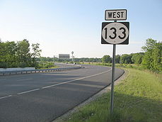
and New Jersey Route 27. The route was re-designated as Route 92, and remained a high priority project for several decades. Even after changes in alignment, Route 64 was still an alternative. However, Route 92 was shelved on December 1, 2006 in favor of widening the New Jersey Turnpike
mainline, and only New Jersey Route 133 was constructed for the proposal.
As part of the proposed Penns Neck Bypass on U.S. Route 1, the New Jersey Department of Transportation
plans on realigning County Route 571 and Route 526 from the western terminus of Route 64 to a northerly route to Route 1. Although Route 571 and Route 526 are proposed to be realigned onto the new alignment, there is no designated change proposed for Route 64. On the contrary to this, one state figure shows Route 64 running along Washington Road, where the two county routes currently run.
State highway
State highway, state road or state route can refer to one of three related concepts, two of them related to a state or provincial government in a country that is divided into states or provinces :#A...
in the U.S. state
U.S. state
A U.S. state is any one of the 50 federated states of the United States of America that share sovereignty with the federal government. Because of this shared sovereignty, an American is a citizen both of the federal entity and of his or her state of domicile. Four states use the official title of...
of New Jersey
New Jersey
New Jersey is a state in the Northeastern and Middle Atlantic regions of the United States. , its population was 8,791,894. It is bordered on the north and east by the state of New York, on the southeast and south by the Atlantic Ocean, on the west by Pennsylvania and on the southwest by Delaware...
. It is a state-maintained bridge over Amtrak
Amtrak
The National Railroad Passenger Corporation, doing business as Amtrak , is a government-owned corporation that was organized on May 1, 1971, to provide intercity passenger train service in the United States. "Amtrak" is a portmanteau of the words "America" and "track". It is headquartered at Union...
and New Jersey Transit
New Jersey Transit
The New Jersey Transit Corporation is a statewide public transportation system serving the United States state of New Jersey, and New York, Orange, and Rockland counties in New York State...
's Northeast Corridor
Northeast Corridor
The Northeast Corridor is a fully electrified railway line owned primarily by Amtrak serving the Northeast megalopolis of the United States from Boston in the north, via New York to Washington, D.C. in the south, with branches serving other cities...
line in West Windsor. Route 64 begins at an intersection with County Route 526
County Route 526 (New Jersey)
County Route 526 is a county highway in the U.S. state of New Jersey. The highway extends from Hightstown Road in West Windsor Township to Lanes Mill Road in Lakewood Township....
and County Route 571
County Route 571 (New Jersey)
County Route 571, abbreviated CR 571, is a county highway in the U.S. state of New Jersey. The highway extends from Route 37 in Toms River Township to Route 27 in the Borough of Princeton.-Ocean County:...
in West Windsor. It heads along the bridge to an intersection with County Route 615, where Route 64 ends. County routes 526 and 571, which are unofficially concurrent with Route 64, continues to Hightstown
Hightstown, New Jersey
Hightstown is a Borough in Mercer County, New Jersey, United States. As of the 2010 United States Census, the borough population was 5,494.Hightstown was incorporated as a borough by an Act of the New Jersey Legislature on March 5, 1853, within portions of East Windsor Township. The borough became...
.
Route 64 was designated originally as an alignment of Route 31A, a spur off of State Highway Route 31 (currently U.S. Route 206
U.S. Route 206
U.S. Route 206 is a long north–south United States highway in New Jersey and Pennsylvania, United States. Only about a half a mile of its length is in Pennsylvania; the Milford-Montague Toll Bridge carries it over the Delaware River into New Jersey, where it is the remainder of the route...
) from Princeton eastward to Hightstown, where it met State Highway Route 33. The state planned on turning the alignment into a full-fledged expressway for several decades, including constructing the alignment that Route 64 currently uses in 1939. The route was amended in 1941, and was renumbered from Route 31A to Route 64 in the 1953 renumbering. Route 64 was proposed to become part of the Princeton–Hightstown Bypass (later designated New Jersey Route 92), but completion never occurred. Currently, the route remains the bridge over the Northeast Corridor. However, it is not currently planned that Route 64 will receive an extension of sorts from the proposed Penns Neck Bypass to U.S. Route 1
U.S. Route 1 in New Jersey
U.S. Route 1 is a United States highway which parallels the East Coast of the United States, running from Key West, Florida in the south to Fort Kent, Maine at the Canadian border in the north. Of the entire length of the route, of it runs through New Jersey...
, a proposed realignment of County routes 526 and 571.
Route description
Route 64 begins at an intersection with County Route 526County Route 526 (New Jersey)
County Route 526 is a county highway in the U.S. state of New Jersey. The highway extends from Hightstown Road in West Windsor Township to Lanes Mill Road in Lakewood Township....
, County Route 571
County Route 571 (New Jersey)
County Route 571, abbreviated CR 571, is a county highway in the U.S. state of New Jersey. The highway extends from Route 37 in Toms River Township to Route 27 in the Borough of Princeton.-Ocean County:...
, and Mercer County Route 615 in the community of West Windsor. From this point, County Routes 526 and 571 continue along the right-of-way towards U.S. Route 130
U.S. Route 130
U.S. Route 130 is a north–south U.S. Highway completely within the state of New Jersey. It runs from Interstate 295 and US 40 at Deepwater in Pennsville Township, Salem County, where the road continues east as Route 49, north to US 1 in North Brunswick Township, Middlesex County, where...
. The route heads north crosses over the Amtrak
Amtrak
The National Railroad Passenger Corporation, doing business as Amtrak , is a government-owned corporation that was organized on May 1, 1971, to provide intercity passenger train service in the United States. "Amtrak" is a portmanteau of the words "America" and "track". It is headquartered at Union...
and New Jersey Transit
New Jersey Transit
The New Jersey Transit Corporation is a statewide public transportation system serving the United States state of New Jersey, and New York, Orange, and Rockland counties in New York State...
-used Northeast Corridor Line
Northeast Corridor Line
The Northeast Corridor Line is a commuter rail operation run by New Jersey Transit along Amtrak's Northeast Corridor. It is the successor to commuter services provided by the Pennsylvania Railroad along the section between Trenton, New Jersey and New York Penn Station...
and passes to the north of a local bus depot. Route 64 continues westward for a short distance, crossing through a local woodland and by several local homes. The route makes a gradual curve to the west off the railroad bridge and passes a couple of homes before heading to the south slightly at a jughandle. Route 64 reaches its northern terminus and County Route 526 and County Route 571 make a right turn to head northwest toward U.S. Route 1
U.S. Route 1 in New Jersey
U.S. Route 1 is a United States highway which parallels the East Coast of the United States, running from Key West, Florida in the south to Fort Kent, Maine at the Canadian border in the north. Of the entire length of the route, of it runs through New Jersey...
.
History
Route 31A and the original freeway
In the late-1920s, the state proposed a bypass along the alignment.In 1938, the New Jersey State Highway Department and New Jersey General Assembly
New Jersey General Assembly
The New Jersey General Assembly is the lower house of the New Jersey Legislature.Since the election of 1967 , the Assembly has consisted of 80 members. Two members are elected from each of New Jersey's 40 legislative districts for a term of two years, each representing districts with average...
put forth a proposal detailing that a highway from State Highway Route 31
U.S. Route 206
U.S. Route 206 is a long north–south United States highway in New Jersey and Pennsylvania, United States. Only about a half a mile of its length is in Pennsylvania; the Milford-Montague Toll Bridge carries it over the Delaware River into New Jersey, where it is the remainder of the route...
(co-signed with U.S. Route 206) in the city of Princeton
Princeton, New Jersey
Princeton is a community located in Mercer County, New Jersey, United States. It is best known as the location of Princeton University, which has been sited in the community since 1756...
eastward through Mercer County onto current-day County Route 571. From there, it would follow an alignment of highway to the intersection with State Highway Route 33 in the community of Hightstown
Hightstown, New Jersey
Hightstown is a Borough in Mercer County, New Jersey, United States. As of the 2010 United States Census, the borough population was 5,494.Hightstown was incorporated as a borough by an Act of the New Jersey Legislature on March 5, 1853, within portions of East Windsor Township. The borough became...
. The original proposal for the highway was to turn the road into a limited-access freeway along its entirety. The route was designated as State Highway Route 31A, a suffixed spur of State Highway Route 31 that year. A portion of the highway was constructed in 1939, when a bridge over the Pennsylvania Railroad
Pennsylvania Railroad
The Pennsylvania Railroad was an American Class I railroad, founded in 1846. Commonly referred to as the "Pennsy", the PRR was headquartered in Philadelphia, Pennsylvania....
was constructed from Washington Road's former alignment to the current intersection with Route 615. This new, 104 feet (31.7 m) long bridge replaced the at-grade crossing on Washington Road, which is now a dead-end. The state highway law was amended just three years later, with the freeway option removed and the extensions remaining.
The new bridge remained in place along Route 31A, however, no new portions of the freeway were constructed in terms of creating the Route 31A Freeway, as proposed in 1938. In 1950, then-governor of New Jersey, Alfred E. Driscoll
Alfred E. Driscoll
Alfred Eastlack Driscoll was an American Republican Party politician, who served in the New Jersey Senate representing Camden County, who served as the 43rd Governor of New Jersey, and as president of Warner-Lambert .-Biography:He was born on October 25, 1902 in Pittsburgh, Pennsylvania...
, cited the need for the expressway as an important truck and passenger car highway from Trenton to the Jersey Shore
Jersey Shore
The Jersey Shore is a term used to refer to both the Atlantic coast of the U.S. state of New Jersey and the adjacent resort and residential communities. . The New Jersey State Department of Tourism considers the Shore Region, Greater Atlantic City, and the Southern Shore to be distinct, each having...
. Route 31A itself was decommissioned in the 1953 New Jersey state highway renumbering
1953 New Jersey state highway renumbering
On January 1, 1953, the New Jersey Department of Transportation renumbered many of the State Routes. A few rules were followed in deciding what to renumber:...
, and replaced by the designation of Route 64. The route was truncated from both ends toward Princeton and Hightstown, leaving just the bridge in West Windsor. Route 31A remained in the state highway statutes for several decades after decommissioning, with a bill in 1991 being proposed. The bill passed, and Route 31A was stripped from the statutes on January 18, 1992.
Route 92 and future changes to CR 571
Montgomery Township, New Jersey
Montgomery Township is a Township in Somerset County, New Jersey, United States. As of the United States 2010 Census, the township population was 22,254, which represents growth of 27% since 2000 and more than 130% since the 1990 Census population figure of 9,612.Montgomery Township was...
to New Jersey Route 33 in Hightstown. In the length, the freeway was to interchange with U.S. Route 1
U.S. Route 1 in New Jersey
U.S. Route 1 is a United States highway which parallels the East Coast of the United States, running from Key West, Florida in the south to Fort Kent, Maine at the Canadian border in the north. Of the entire length of the route, of it runs through New Jersey...
, U.S. Route 130
U.S. Route 130
U.S. Route 130 is a north–south U.S. Highway completely within the state of New Jersey. It runs from Interstate 295 and US 40 at Deepwater in Pennsville Township, Salem County, where the road continues east as Route 49, north to US 1 in North Brunswick Township, Middlesex County, where...
and New Jersey Route 27. The route was re-designated as Route 92, and remained a high priority project for several decades. Even after changes in alignment, Route 64 was still an alternative. However, Route 92 was shelved on December 1, 2006 in favor of widening the New Jersey Turnpike
New Jersey Turnpike
The New Jersey Turnpike is a toll road in New Jersey, maintained by the New Jersey Turnpike Authority. According to the International Bridge, Tunnel and Turnpike Association, the Turnpike is the nation's sixth-busiest toll road and is among one of the most heavily traveled highways in the United...
mainline, and only New Jersey Route 133 was constructed for the proposal.
As part of the proposed Penns Neck Bypass on U.S. Route 1, the New Jersey Department of Transportation
New Jersey Department of Transportation
The New Jersey Department of Transportation is the agency responsible for transportation issues and policy in New Jersey. It is headed by the Commissioner of Transportation...
plans on realigning County Route 571 and Route 526 from the western terminus of Route 64 to a northerly route to Route 1. Although Route 571 and Route 526 are proposed to be realigned onto the new alignment, there is no designated change proposed for Route 64. On the contrary to this, one state figure shows Route 64 running along Washington Road, where the two county routes currently run.
Major intersections
See also
- List of state highways in the United States shorter than one mile
- New Jersey Route 13New Jersey Route 13Route 13 is a short state highway in the communities of Point Pleasant and Bay Head, New Jersey, both of which are in Ocean County. The route consists of the Lovelandtown Bridge, and a distinct part of Bridge Avenue, which is mostly maintained by the county as County Route 632...
- New Jersey Route 162New Jersey Route 162Route 162 is an unsigned long state highway in Lower Township, New Jersey, United States. The highway's designation consists entirely of a bridge on Seashore Road , which is known as Relocated Seashore Road. The southern terminus of the highway is an intersection with County Routes 641 and 626 in...