
.gif)
Route 55 (New Jersey)
Encyclopedia
Route 55 is a state highway
in the southern part of New Jersey
, United States
that is built to freeway standards. Also known as the Veterans Memorial Highway, it runs 40.54 mi (65.24 km) from an intersection with Route 47 in Port Elizabeth
north to an interchange
with Route 42 in Gloucester County
. The Route 55 freeway serves as a main road through Cumberland and Gloucester counties, serving Millville
, Vineland
, and Glassboro
. It is used as a commuter route north to Philadelphia and, along with Route 47, as a route from the Delaware Valley
to the Jersey Shore
resorts in Cape May County
.
What is now Route 55 was originally proposed in the 1950s as a toll road called the Cape May Expressway that was to run from the Walt Whitman Bridge
to Cape May
. In 1962, the New Jersey Expressway Authority was created to build the Cape May Expressway and the Atlantic City Expressway
. However, by 1965, the road to Cape May was turned over to the New Jersey Department of Transportation
(NJDOT) and designated as Route 55, which was to run from Westville
to Cape May Court House
. The first portion of the route opened around Millville in 1969 while the section bypassing Vineland was completed in the 1970s. Route 55 was completed north to Deptford in 1989. Meanwhile, the portion between Route 47 in Port Elizabeth and the Garden State Parkway
in Middle Township
was canceled in 1975 due to the impact the highway would have on the surrounding environment. However, traffic jams on Route 47 during the summer months and the lack of an adequate evacuation route for the Cape May Peninsula have led officials to reexamine the possibility of extending Route 55 southward to Cape May County.
 Route 55 begins at a signalized intersection with Route 47 in the Port Elizabeth
section of Maurice River Township
, Cumberland County
, heading to the north as a two-lane undivided road through wooded areas. At the southern terminus, the road continues south as part of Route 47. A short distance after beginning, the road widens into a four-lane divided freeway and comes to a southbound exit and northbound entrance with Schooner Landing Road. Past this interchange, Route 55 enters Millville
and crosses over the Manantico Creek
as it heads into built-up areas. The freeway continues north to an interchange with Route 49.
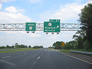
Past the Route 49 interchange, Route 55 continues through Millville, passing over County Route 552 Spur (CR 552 Spur). The route passes to the east of WheatonArts and the Creative Glass Center of America before turning northwest and crossing into Vineland
, where it interchanges with CR 555
.
The freeway turns to the west past the CR 555 interchange and crosses over a Conrail Shared Assets Operations
railroad line before entering Millville again. At this point, the route comes to a modified cloverleaf interchange
with Route 47 adjacent to the Cumberland Mall
. From Route 47, the freeway enters forested areas again and makes a turn to the north, crossing back into Vineland. In Vineland, it interchanges with CR 552
near the South Jersey Health Care Regional Medical Center. This exit also serves Cumberland County College
to the east.
Route 55 continues between rural areas near the Maurice River
to the west and development to the east, coming to a cloverleaf interchange with Route 56. Past this interchange, the route passes over a Winchester & Western Railroad line before crossing over CR 540
. Farther north, a modified cloverleaf interchange serves CR 674 (Garden Road), which provides access to the northern part of Vineland. Past the Garden Road interchange, Route 55 continues through farmland and woodland, passing to the east of Rudys Airport. The freeway crosses Scotland Run and briefly runs through Pittsgrove Township
in Salem County
.
, Gloucester County
, and reaches a cloverleaf interchange with U.S. Route 40
(US 40). Past this interchange, the freeway heads north, crossing over CR 538
. Route 55 comes to a diamond interchange
with Little Mill Road before entering Clayton
and turning to the west. A short distance later, Route 55 continues into Elk Township
and comes to an interchange with CR 553
.
The route continues north into Glassboro
, where it has an interchange with CR 641. Past this interchange, Route 55 crosses into Harrison Township
and meets US 322
and CR 536
at a cloverleaf interchange. US 322 heads east into Glassboro and serves Rowan University
.
 Past the US 322 interchange, the freeway continues through agricultural areas and enters Mantua Township
, where it turns northeast and crosses under CR 553 Alternate. Route 55 passes under a Conrail Shared Assets Operations railroad line before intersecting CR 553 again at a modified cloverleaf interchange. This interchange provides access to The Broadway Theatre of Pitman
.
Past CR 553, the route turns north again and passes near more suburban surroundings, briefly entering Washington Township
before crossing into Deptford Township
. In Deptford Township, Route 55 comes to a cloverleaf interchange with Route 47. Northbound Route 47 heads toward the main campus of Gloucester County College
in Sewell
. It crosses CR 534
before coming to a trumpet interchange with Deptford Center Road that provides access to CR 621 and the Deptford Mall
. Past this interchange, Route 55 passes under CR 544
and CR 621 before merging into the northbound direction of the Route 42 freeway.
in the 1950s, two toll freeways were proposed to connect the bridge to Atlantic City
and Cape May
. In 1962, the New Jersey Expressway Authority Act was signed into law. This act created the New Jersey Expressway Authority, which was to manage both the Atlantic City
and Cape May expressways.
While the Atlantic City Expressway was completed by the authority in 1965, the Cape May Expressway was turned over to the state about this time. The Cape May Expressway was designated Route 55 and legislated to run from US 130
in Westville
to US 9 near Cape May Court House
. This proposed freeway was projected to cost $90 million (equivalent to $ in ) and be completed in 1975.
In 1969, the first segment of Route 55 opened between Maurice River Township and the Vineland-Millville border, connecting to Route 47 at both ends. In the 1970s, the planned northern terminus of Route 55 was moved to Route 42 in Deptford. The portion of Route 55 between Route 47 in Millville and US 40 in Franklin Township was completed in the mid-1970s while the portion between US 40 and Route 42 was completed in October 1989. The Route 55 freeway has been instrumental in bringing economic development to southern New Jersey. The most common use of the highway is as a commuting route northward to Philadelphia. Following its completion, residential development in the southern part of Gloucester County has increased.
While the freeway was under construction in 1983, it was discovered that it ran through Native American burial grounds in Deptford. This revelation led to unsuccessful lawsuits to cease construction of the route. After the lawsuits, a couple of incidents happened to construction workers, including a construction worker being run over by an asphalt truck, another being blown off a bridge by strong winds, and a van carrying five construction workers randomly erupting into flames.
Meanwhile, the portion of freeway south of Route 47 in Maurice River Township was not yet built. In 1972, NJDOT wanted to provide adequate access to the Cape May Peninsula by extending the freeway southeast from the current terminus to the Garden State Parkway
in Middle Township
. NJDOT conducted an environmental study on this proposal in 1975. The route was projected to cost $155 million (equivalent to $ in ) and be finished by 1995. Plans resurfaced for a southern extension in 1993 when a feasibility study was conducted to see if the extension of Route 55 could be built. This study, which estimated the extension would cost between $423 million and $483 million (equivalent to $ and $ in ), concluded that the road should not be built because it crossed too many wetlands.
In 1975, the Delaware River Port Authority
proposed that a Port Authority Transit Corporation
(PATCO) rail line be added along the median of Route 55 between Deptford and Glassboro; however, plans were canceled. In the 2000s, another proposal resurfaced to add a PATCO line along the Route 55 corridor. The alternative called for park and ride
lots to be constructed along the Route 55 corridor, providing access to the line. Phase I would have run to Glassboro (Rowan University) and Phase II would have extended down to the Millville area and service the Cumberland Mall area.
The Route 55 freeway, like many other highways in New Jersey, once had solar-powered emergency call boxes every mile (about 1.6 km); the use of the call boxes became limited due to the increasing popularity of cell phones. To save on maintenance costs, NJDOT removed these call boxes in 2005.
 Despite the fact that the southern extension has been held up for decades, it is being revisited due to the disturbing images of Hurricane Katrina
and Hurricane Rita
in the Gulf states. The Cape May Peninsula and surrounding area does not have a proper evacuation route and Route 55 may be extended in order to provide one. In addition, traffic jams along Route 47 during the summer have also led to a possible revival of the proposal. There are efforts and studies being done to finish the remaining 20 miles (32.2 km) of the missing freeway. As a result, construction of this section is not expected to begin for years. Any proposal to extend Route 55 still faces environmental opposition.
In 2009, State Senator Jeff Van Drew introduced a plan for an extension of Route 55 into Cape May County. In the plan, the South Jersey Transportation Authority
would build the road and it would cost $1 billion. In order to reduce the impact on the environment, the freeway may be elevated. It is also anticipated that the extension of Route 55 would be tolled; however, no tolls are planned to be placed on the existing route. This proposal for an elevated Route 55 follows two years of failed attempts for a feasibility study to relieve traffic on Route 47. Portions of Route 47 and Route 347 may be upgraded from a surface road to a freeway that would become part of Route 55.
New Jersey Governor Jon S. Corzine and the Delaware River Port Authority announced a comprehensive transportation plan for South Jersey on May 12, 2009. This plan would introduce express bus service along the Route 55 freeway and the adjacent Route 42 freeway. It would also include a diesel light rail line between Camden and Glassboro via Woodbury over an existing railroad right-of-way (as opposed to the expanded PATCO line via Route 55), improvements to New Jersey Transit
’s Atlantic City Line
, and enhanced connections to the Atlantic City International Airport
.
!County
!Location
!Mile
!Exit
!Destinations
!Notes
|-
|rowspan=8|Cumberland
|rowspan=2|Maurice River Township
|20.00
|
|
|At-grade intersection
|-
|21.49
|21
|Schooner Landing Road
|Southbound exit, northbound entrance
|-
|Millville
|24.59
|24
|
|
|-
|Vineland
|26.88
|26
|
|
|-
|Millville
|27.79
|27
|
|
|-
|rowspan=3|Vineland
|29.75
|29
|
|
|-
|32.69
|32A-B
|
|
|-
|35.01
|35
|
|Southbound signed as exits 35A (east) and 35B (west)
|-
|rowspan=10|Gloucester
|rowspan=2|Franklin Township
|39.36
|39A-B
|
|
|-
|43.50
|43
|Little Mill Road – Franklinville
, Clayton
|
|-
|Elk Township
|45.36
|45
|
|
|-
|Glassboro
|48.84
|48
|
|
|-
|Harrison Township
|50.50
|50A-B
|
|
|-
|Mantua Township
|53.48
|53
|
|Southbound signed as exits 53A (south) and 53B (north)
|-
|rowspan=4|Deptford Township
|rowspan=2|56.37
|56A
|
|
|-
|56B
|
|
|-
|58.90
|58
|
|
|-
|60.54
|
|, Philadelphia
|
|-
State highway
State highway, state road or state route can refer to one of three related concepts, two of them related to a state or provincial government in a country that is divided into states or provinces :#A...
in the southern part of New Jersey
New Jersey
New Jersey is a state in the Northeastern and Middle Atlantic regions of the United States. , its population was 8,791,894. It is bordered on the north and east by the state of New York, on the southeast and south by the Atlantic Ocean, on the west by Pennsylvania and on the southwest by Delaware...
, United States
United States
The United States of America is a federal constitutional republic comprising fifty states and a federal district...
that is built to freeway standards. Also known as the Veterans Memorial Highway, it runs 40.54 mi (65.24 km) from an intersection with Route 47 in Port Elizabeth
Port Elizabeth, New Jersey
Port Elizabeth is an unincorporated area within Maurice River Township, Cumberland County, New Jersey. The area is served as United States Postal Service ZIP code 08348....
north to an interchange
Interchange (road)
In the field of road transport, an interchange is a road junction that typically uses grade separation, and one or more ramps, to permit traffic on at least one highway to pass through the junction without directly crossing any other traffic stream. It differs from a standard intersection, at which...
with Route 42 in Gloucester County
Gloucester County, New Jersey
Gloucester County is a county located in the U.S. state of New Jersey. As of the 2010 Census, the population was 288,288. Its county seat is Woodbury....
. The Route 55 freeway serves as a main road through Cumberland and Gloucester counties, serving Millville
Millville, New Jersey
Millville is a city in Cumberland County, New Jersey, United States. As of the 2000 United States Census, the city population was 26,847. Millville, Bridgeton and Vineland are the three principal New Jersey cities of the Vineland-Millville-Bridgeton Primary Metropolitan Statistical Area which...
, Vineland
Vineland, New Jersey
Vineland is a city in Cumberland County, New Jersey, United States. As of the 2010 United States Census, the city had a total population of 60,724...
, and Glassboro
Glassboro, New Jersey
Glassboro is a borough in Gloucester County, New Jersey, United States. As of the United States 2000 Census, the borough population was 19,068....
. It is used as a commuter route north to Philadelphia and, along with Route 47, as a route from the Delaware Valley
Delaware Valley
The Delaware Valley is a term used to refer to the valley where the Delaware River flows, along with the surrounding communities. This includes the metropolitan area centered on the city of Philadelphia. Such educational institutions as Delaware Valley Regional High School in Alexandria Township...
to the Jersey Shore
Jersey Shore
The Jersey Shore is a term used to refer to both the Atlantic coast of the U.S. state of New Jersey and the adjacent resort and residential communities. . The New Jersey State Department of Tourism considers the Shore Region, Greater Atlantic City, and the Southern Shore to be distinct, each having...
resorts in Cape May County
Cape May County, New Jersey
-Climate:Being the southernmost point in New Jersey, Cape May has fairly mild wintertime temperatures. Contrary to that, the summertime has lower temperatures than most places in the state, making the county a popular place to escape the heat. It is in zone 7a/7b, which is the same as parts of...
.
What is now Route 55 was originally proposed in the 1950s as a toll road called the Cape May Expressway that was to run from the Walt Whitman Bridge
Walt Whitman Bridge
The Walt Whitman Bridge is a green-colored single-level suspension bridge spanning the Delaware River from Philadelphia to Gloucester City, New Jersey. Named after the poet Walt Whitman, who resided in nearby Camden toward the end of his life, the Walt Whitman Bridge is one of the larger bridges...
to Cape May
Cape May, New Jersey
Cape May is a city at the southern tip of Cape May Peninsula in Cape May County, New Jersey, where the Delaware Bay meets the Atlantic Ocean and is one of the country's oldest vacation resort destinations. It is part of the Ocean City Metropolitan Statistical Area. As of the 2010 United States...
. In 1962, the New Jersey Expressway Authority was created to build the Cape May Expressway and the Atlantic City Expressway
Atlantic City Expressway
The Atlantic City Expressway is a , controlled-access toll road in New Jersey, managed and operated by the South Jersey Transportation Authority...
. However, by 1965, the road to Cape May was turned over to the New Jersey Department of Transportation
New Jersey Department of Transportation
The New Jersey Department of Transportation is the agency responsible for transportation issues and policy in New Jersey. It is headed by the Commissioner of Transportation...
(NJDOT) and designated as Route 55, which was to run from Westville
Westville, New Jersey
Westville is a Borough in Gloucester County, New Jersey, United States. As of the 2000 United States Census, the borough population was 4,501. The Borough of Westville is known as "The Gateway to South Jersey."...
to Cape May Court House
Cape May Court House, New Jersey
Cape May Court House is a census-designated place and unincorporated area located within Middle Township, in Cape May County, New Jersey. It is part of the Ocean City Metropolitan Statistical Area. As of the United States 2000 Census, the CDP population was 4,704...
. The first portion of the route opened around Millville in 1969 while the section bypassing Vineland was completed in the 1970s. Route 55 was completed north to Deptford in 1989. Meanwhile, the portion between Route 47 in Port Elizabeth and the Garden State Parkway
Garden State Parkway
The Garden State Parkway is a 172.4-mile limited-access toll parkway that stretches the length of New Jersey from the New York line at Montvale, New Jersey, to Cape May at New Jersey's southernmost tip. Its name refers to New Jersey's nickname, the "Garden State." Most New Jersey residents refer...
in Middle Township
Middle Township, New Jersey
Middle Township is a township in Cape May County, New Jersey, United States. It is part of the Ocean City Metropolitan Statistical Area. As of the United States 2000 Census, the township population was 16,405....
was canceled in 1975 due to the impact the highway would have on the surrounding environment. However, traffic jams on Route 47 during the summer months and the lack of an adequate evacuation route for the Cape May Peninsula have led officials to reexamine the possibility of extending Route 55 southward to Cape May County.
Cumberland and Salem counties
Port Elizabeth, New Jersey
Port Elizabeth is an unincorporated area within Maurice River Township, Cumberland County, New Jersey. The area is served as United States Postal Service ZIP code 08348....
section of Maurice River Township
Maurice River Township, New Jersey
Maurice River Township is a township in Cumberland County, New Jersey, United States. It is part of the Vineland-Millville- Bridgeton Primary Metropolitan Statistical Area for statistical purposes...
, Cumberland County
Cumberland County, New Jersey
Cumberland County is a county located in the U.S. state of New Jersey. As of the 2010 Census, the population is 156,898. Its county seat is Bridgeton. Cumberland County is named for Prince William, Duke of Cumberland....
, heading to the north as a two-lane undivided road through wooded areas. At the southern terminus, the road continues south as part of Route 47. A short distance after beginning, the road widens into a four-lane divided freeway and comes to a southbound exit and northbound entrance with Schooner Landing Road. Past this interchange, Route 55 enters Millville
Millville, New Jersey
Millville is a city in Cumberland County, New Jersey, United States. As of the 2000 United States Census, the city population was 26,847. Millville, Bridgeton and Vineland are the three principal New Jersey cities of the Vineland-Millville-Bridgeton Primary Metropolitan Statistical Area which...
and crosses over the Manantico Creek
Manantico Creek
Manantico Creek, spelled Menantico on federal maps, is an tributary of the Maurice River in southern New Jersey in the United States.Menantico Creek begins in Cumberland County at the confluence of Cedar and Panther Branches, north of Hances Bridge...
as it heads into built-up areas. The freeway continues north to an interchange with Route 49.
Past the Route 49 interchange, Route 55 continues through Millville, passing over County Route 552 Spur (CR 552 Spur). The route passes to the east of WheatonArts and the Creative Glass Center of America before turning northwest and crossing into Vineland
Vineland, New Jersey
Vineland is a city in Cumberland County, New Jersey, United States. As of the 2010 United States Census, the city had a total population of 60,724...
, where it interchanges with CR 555
County Route 555 (New Jersey)
County Route 555, abbreviated CR 555, is a county highway in the U.S. state of New Jersey. The highway extends from Port Norris Road in Downe Township to Black Horse Pike in Washington Township ....
.
The freeway turns to the west past the CR 555 interchange and crosses over a Conrail Shared Assets Operations
Conrail Shared Assets Operations
Conrail Shared Assets Operations is an American railroad company. It operates three networks—the North Jersey, South Jersey/Philadelphia, and Detroit Shared Assets Areas, where it serves as a local carrier and switching company for CSX Transportation and the Norfolk Southern Railway...
railroad line before entering Millville again. At this point, the route comes to a modified cloverleaf interchange
Cloverleaf interchange
A cloverleaf interchange is a two-level interchange in which left turns, reverse direction in left-driving regions, are handled by ramp roads...
with Route 47 adjacent to the Cumberland Mall
Cumberland Mall (New Jersey)
Cumberland Mall is a shopping mall located in Vineland, New Jersey, on Route 47 at Route 55 .Cumberland Mall is strategically positioned away from its nearest competitor, south of Philadelphia, Pennsylvania and on route to the Southern New Jersey Shore Points. The mall almost went under, but...
. From Route 47, the freeway enters forested areas again and makes a turn to the north, crossing back into Vineland. In Vineland, it interchanges with CR 552
County Route 552 (New Jersey)
County Route 552, abbreviated CR 552, is a county highway in the U.S. state of New Jersey. The highway extends from Laurel Street in Bridgeton to Harding Highway in Hamilton Township.-Cumberland County:...
near the South Jersey Health Care Regional Medical Center. This exit also serves Cumberland County College
Cumberland County College
Cumberland County College is an accredited, co-educational, two-year, public, community college located in Cumberland County, New Jersey. Cumberland County College is located on a campus, featuring nine buildings, in Vineland...
to the east.
Route 55 continues between rural areas near the Maurice River
Maurice River
The Maurice River is a river that empties into the Delaware Bay in southern New Jersey in the United States.The Maurice River, pronounced "Morris", is approximately long and is the second longest and largest tributary to Delaware Bay. Its watershed includes an extensive southern portion of the...
to the west and development to the east, coming to a cloverleaf interchange with Route 56. Past this interchange, the route passes over a Winchester & Western Railroad line before crossing over CR 540
County Route 540 (New Jersey)
County Route 540, abbreviated CR 540, is a county highway in the U.S. state of New Jersey. The highway extends from the intersection of U.S. Route 130 and Route 140 in Carneys Point Township to Harding Highway County Route 540, abbreviated CR 540, is a county highway in the U.S. state of New...
. Farther north, a modified cloverleaf interchange serves CR 674 (Garden Road), which provides access to the northern part of Vineland. Past the Garden Road interchange, Route 55 continues through farmland and woodland, passing to the east of Rudys Airport. The freeway crosses Scotland Run and briefly runs through Pittsgrove Township
Pittsgrove Township, New Jersey
Pittsgrove Township is a Township in Salem County, New Jersey, United States. As of the United States 2010 Census, the township population was 9,393....
in Salem County
Salem County, New Jersey
-Demographics:As of the census of 2000, there were 64,285 people, 24,295 households, and 17,370 families residing in the county. The population density was 190 people per square mile . There were 26,158 housing units at an average density of 77 per square mile...
.
Gloucester County
Route 55 continues northwest into Franklin TownshipFranklin Township, Gloucester County, New Jersey
Franklin Township is a township in Gloucester County, New Jersey, United States. As of the United States 2000 Census, the township population was 15,466....
, Gloucester County
Gloucester County, New Jersey
Gloucester County is a county located in the U.S. state of New Jersey. As of the 2010 Census, the population was 288,288. Its county seat is Woodbury....
, and reaches a cloverleaf interchange with U.S. Route 40
U.S. Route 40 in New Jersey
U.S. Route 40 is a U.S. highway running from Park City, Utah east to Atlantic City, New Jersey. The easternmost segment of the route runs through the southern part of New Jersey between the Delaware Memorial Bridge over the Delaware River in Pennsville Township, Salem County, where it continues...
(US 40). Past this interchange, the freeway heads north, crossing over CR 538
County Route 538 (New Jersey)
County Route 538, abbreviated CR 538, is a county highway in the U.S. state of New Jersey. The highway extends from Kings Highway in Swedesboro to Black Horse Pike County Route 538, abbreviated CR 538, is a county highway in the U.S. state of New Jersey. The highway extends from Kings Highway...
. Route 55 comes to a diamond interchange
Diamond interchange
A diamond interchange is a common type of road junction, used where a freeway crosses a minor road. The freeway itself is grade-separated from the minor road, one crossing the other over a bridge...
with Little Mill Road before entering Clayton
Clayton, New Jersey
Clayton is a Borough in Gloucester County, New Jersey, United States. As of the 2010 United States Census, the borough population was 8,179.Jacob Fisler, who purchased much of the area that is now Clayton, established a community called Fislertown in 1850 that grew substantially after he opened a...
and turning to the west. A short distance later, Route 55 continues into Elk Township
Elk Township, New Jersey
Elk Township is a township in Gloucester County, New Jersey, United States. As of the United States 2000 Census, the township population was 3,514....
and comes to an interchange with CR 553
County Route 553 (New Jersey)
County Route 553, abbreviated CR 553, is a county highway in the U.S. state of New Jersey. The highway extends from Hands Landing Road/Ogden Avenue in Commercial Township to Broadway in Deptford Township.-Cumberland County:...
.
The route continues north into Glassboro
Glassboro, New Jersey
Glassboro is a borough in Gloucester County, New Jersey, United States. As of the United States 2000 Census, the borough population was 19,068....
, where it has an interchange with CR 641. Past this interchange, Route 55 crosses into Harrison Township
Harrison Township, New Jersey
Harrison Township is a township in Gloucester County, New Jersey, United States. As of the United States 2000 Census, the township population was 8,788....
and meets US 322
U.S. Route 322 in New Jersey
U.S. Route 322 is a U.S. highway running from Cleveland, Ohio east to Atlantic City, New Jersey. The easternmost segment of the route in New Jersey runs from the Commodore Barry Bridge over the Delaware River in Logan Township, Glocuester County, where it continues into Chester, Pennsylvania,...
and CR 536
County Route 536 (New Jersey)
County Route 536, abbreviated CR 536, is a county highway in the U.S. state of New Jersey. The highway extends from the Commodore Barry Bridge crossing the Delaware River at Chester at the Pennsylvania state line and Logan Township, to U.S...
at a cloverleaf interchange. US 322 heads east into Glassboro and serves Rowan University
Rowan University
Rowan University is a public university in Glassboro, New Jersey, USA with a satellite campus in Camden, New Jersey. The school was founded in 1923 as Glassboro Normal School on a twenty-five acre tract of land donated by the town...
.
Mantua Township, New Jersey
Mantua Township is a township in Gloucester County, New Jersey, United States. As of the United States 2000 Census, the township population was 14,217....
, where it turns northeast and crosses under CR 553 Alternate. Route 55 passes under a Conrail Shared Assets Operations railroad line before intersecting CR 553 again at a modified cloverleaf interchange. This interchange provides access to The Broadway Theatre of Pitman
Pitman, New Jersey
Pitman is a Borough in Gloucester County, New Jersey, United States. As of the 2000 United States Census, the borough population was 9,331.-Geography:Pitman is located at ....
.
Past CR 553, the route turns north again and passes near more suburban surroundings, briefly entering Washington Township
Washington Township, Gloucester County, New Jersey
Washington Township is a township in Gloucester County, New Jersey, United States. In the 2010 United States Census, Washington Township's population was 48,559, having grown from 47,114 in the 2000 Census....
before crossing into Deptford Township
Deptford Township, New Jersey
Deptford Township is a township in Gloucester County, New Jersey, in the United States. As of the 2010 United States Census, the township's population was 30,561....
. In Deptford Township, Route 55 comes to a cloverleaf interchange with Route 47. Northbound Route 47 heads toward the main campus of Gloucester County College
Gloucester County College
Gloucester County College is an accredited, co-educational, two-year, public , community college located in Sewell, Gloucester County, New Jersey, USA. It was established in 1966 and has of grounds...
in Sewell
Sewell, New Jersey
Sewell is an unincorporated area within Mantua Township in Gloucester County, New Jersey, United States. Sewell also refers to part of Washington Township, Gloucester County, New Jersey, which is not part of Mantua Township. Locals refer to the Sewell part of Mantua as Old Sewell...
. It crosses CR 534
County Route 534 (New Jersey)
County Route 534, abbreviated CR 534, is a county highway in the U.S. state of New Jersey. The highway extends from Route 47 in Deptford Township to Medford-Indian Mills Road in Shamong Township.-Gloucester County:...
before coming to a trumpet interchange with Deptford Center Road that provides access to CR 621 and the Deptford Mall
Deptford Mall
The Deptford Mall is a major shopping destination in Deptford Township, Gloucester County, New Jersey, United States. It is the seventh largest mall in the state of New Jersey and the largest in the state's South Jersey region. Owned and managed by The Macerich Company, it is the county's only...
. Past this interchange, Route 55 passes under CR 544
County Route 544 (New Jersey)
County Route 544, abbreviated CR 544, is a county highway in the U.S. state of New Jersey. The highway extends from Cooper Street in Deptford Township to Taunton Boulevard in Medford Township.-Gloucester County:...
and CR 621 before merging into the northbound direction of the Route 42 freeway.
History
Following the completion of the Walt Whitman BridgeWalt Whitman Bridge
The Walt Whitman Bridge is a green-colored single-level suspension bridge spanning the Delaware River from Philadelphia to Gloucester City, New Jersey. Named after the poet Walt Whitman, who resided in nearby Camden toward the end of his life, the Walt Whitman Bridge is one of the larger bridges...
in the 1950s, two toll freeways were proposed to connect the bridge to Atlantic City
Atlantic City, New Jersey
Atlantic City is a city in Atlantic County, New Jersey, United States, and a nationally renowned resort city for gambling, shopping and fine dining. The city also served as the inspiration for the American version of the board game Monopoly. Atlantic City is located on Absecon Island on the coast...
and Cape May
Cape May, New Jersey
Cape May is a city at the southern tip of Cape May Peninsula in Cape May County, New Jersey, where the Delaware Bay meets the Atlantic Ocean and is one of the country's oldest vacation resort destinations. It is part of the Ocean City Metropolitan Statistical Area. As of the 2010 United States...
. In 1962, the New Jersey Expressway Authority Act was signed into law. This act created the New Jersey Expressway Authority, which was to manage both the Atlantic City
Atlantic City Expressway
The Atlantic City Expressway is a , controlled-access toll road in New Jersey, managed and operated by the South Jersey Transportation Authority...
and Cape May expressways.
While the Atlantic City Expressway was completed by the authority in 1965, the Cape May Expressway was turned over to the state about this time. The Cape May Expressway was designated Route 55 and legislated to run from US 130
U.S. Route 130
U.S. Route 130 is a north–south U.S. Highway completely within the state of New Jersey. It runs from Interstate 295 and US 40 at Deepwater in Pennsville Township, Salem County, where the road continues east as Route 49, north to US 1 in North Brunswick Township, Middlesex County, where...
in Westville
Westville, New Jersey
Westville is a Borough in Gloucester County, New Jersey, United States. As of the 2000 United States Census, the borough population was 4,501. The Borough of Westville is known as "The Gateway to South Jersey."...
to US 9 near Cape May Court House
Cape May Court House, New Jersey
Cape May Court House is a census-designated place and unincorporated area located within Middle Township, in Cape May County, New Jersey. It is part of the Ocean City Metropolitan Statistical Area. As of the United States 2000 Census, the CDP population was 4,704...
. This proposed freeway was projected to cost $90 million (equivalent to $ in ) and be completed in 1975.
In 1969, the first segment of Route 55 opened between Maurice River Township and the Vineland-Millville border, connecting to Route 47 at both ends. In the 1970s, the planned northern terminus of Route 55 was moved to Route 42 in Deptford. The portion of Route 55 between Route 47 in Millville and US 40 in Franklin Township was completed in the mid-1970s while the portion between US 40 and Route 42 was completed in October 1989. The Route 55 freeway has been instrumental in bringing economic development to southern New Jersey. The most common use of the highway is as a commuting route northward to Philadelphia. Following its completion, residential development in the southern part of Gloucester County has increased.
While the freeway was under construction in 1983, it was discovered that it ran through Native American burial grounds in Deptford. This revelation led to unsuccessful lawsuits to cease construction of the route. After the lawsuits, a couple of incidents happened to construction workers, including a construction worker being run over by an asphalt truck, another being blown off a bridge by strong winds, and a van carrying five construction workers randomly erupting into flames.
Meanwhile, the portion of freeway south of Route 47 in Maurice River Township was not yet built. In 1972, NJDOT wanted to provide adequate access to the Cape May Peninsula by extending the freeway southeast from the current terminus to the Garden State Parkway
Garden State Parkway
The Garden State Parkway is a 172.4-mile limited-access toll parkway that stretches the length of New Jersey from the New York line at Montvale, New Jersey, to Cape May at New Jersey's southernmost tip. Its name refers to New Jersey's nickname, the "Garden State." Most New Jersey residents refer...
in Middle Township
Middle Township, New Jersey
Middle Township is a township in Cape May County, New Jersey, United States. It is part of the Ocean City Metropolitan Statistical Area. As of the United States 2000 Census, the township population was 16,405....
. NJDOT conducted an environmental study on this proposal in 1975. The route was projected to cost $155 million (equivalent to $ in ) and be finished by 1995. Plans resurfaced for a southern extension in 1993 when a feasibility study was conducted to see if the extension of Route 55 could be built. This study, which estimated the extension would cost between $423 million and $483 million (equivalent to $ and $ in ), concluded that the road should not be built because it crossed too many wetlands.
In 1975, the Delaware River Port Authority
Delaware River Port Authority
The Delaware River Port Authority is a bi-state instrumentality created by a Congressionally approved interstate compact between the governments of the Commonwealth of Pennsylvania and the State of New Jersey...
proposed that a Port Authority Transit Corporation
Port Authority Transit Corporation
The PATCO Speedline, also known colloquially as the High Speed Line, is a rapid transit system operated by the Port Authority Transit Corporation, which runs between Philadelphia, Pennsylvania and Camden County, New Jersey...
(PATCO) rail line be added along the median of Route 55 between Deptford and Glassboro; however, plans were canceled. In the 2000s, another proposal resurfaced to add a PATCO line along the Route 55 corridor. The alternative called for park and ride
Park and ride
Park and ride facilities are car parks with connections to public transport that allow commuters and other people wishing to travel into city centres to leave their vehicles and transfer to a bus, rail system , or carpool for the rest of their trip...
lots to be constructed along the Route 55 corridor, providing access to the line. Phase I would have run to Glassboro (Rowan University) and Phase II would have extended down to the Millville area and service the Cumberland Mall area.
The Route 55 freeway, like many other highways in New Jersey, once had solar-powered emergency call boxes every mile (about 1.6 km); the use of the call boxes became limited due to the increasing popularity of cell phones. To save on maintenance costs, NJDOT removed these call boxes in 2005.
Future
Hurricane Katrina
Hurricane Katrina of the 2005 Atlantic hurricane season was a powerful Atlantic hurricane. It is the costliest natural disaster, as well as one of the five deadliest hurricanes, in the history of the United States. Among recorded Atlantic hurricanes, it was the sixth strongest overall...
and Hurricane Rita
Hurricane Rita
Hurricane Rita was the fourth-most intense Atlantic hurricane ever recorded and the most intense tropical cyclone ever observed in the Gulf of Mexico. Rita caused $11.3 billion in damage on the U.S. Gulf Coast in September 2005...
in the Gulf states. The Cape May Peninsula and surrounding area does not have a proper evacuation route and Route 55 may be extended in order to provide one. In addition, traffic jams along Route 47 during the summer have also led to a possible revival of the proposal. There are efforts and studies being done to finish the remaining 20 miles (32.2 km) of the missing freeway. As a result, construction of this section is not expected to begin for years. Any proposal to extend Route 55 still faces environmental opposition.
In 2009, State Senator Jeff Van Drew introduced a plan for an extension of Route 55 into Cape May County. In the plan, the South Jersey Transportation Authority
South Jersey Transportation Authority
The South Jersey Transportation Authority is a quasi-private agency created by the New Jersey Legislature in 1991 to manage transportation-related services in the six South Jersey counties: Atlantic, Camden, Cape May, Cumberland, Gloucester and Salem....
would build the road and it would cost $1 billion. In order to reduce the impact on the environment, the freeway may be elevated. It is also anticipated that the extension of Route 55 would be tolled; however, no tolls are planned to be placed on the existing route. This proposal for an elevated Route 55 follows two years of failed attempts for a feasibility study to relieve traffic on Route 47. Portions of Route 47 and Route 347 may be upgraded from a surface road to a freeway that would become part of Route 55.
New Jersey Governor Jon S. Corzine and the Delaware River Port Authority announced a comprehensive transportation plan for South Jersey on May 12, 2009. This plan would introduce express bus service along the Route 55 freeway and the adjacent Route 42 freeway. It would also include a diesel light rail line between Camden and Glassboro via Woodbury over an existing railroad right-of-way (as opposed to the expanded PATCO line via Route 55), improvements to New Jersey Transit
New Jersey Transit
The New Jersey Transit Corporation is a statewide public transportation system serving the United States state of New Jersey, and New York, Orange, and Rockland counties in New York State...
’s Atlantic City Line
Atlantic City Line
The Atlantic City Line is a rail line operated by New Jersey Transit between Philadelphia, Pennsylvania and Atlantic City, New Jersey, operating along the corridor of the White Horse Pike. It runs over trackage that was controlled by both the Pennsylvania Railroad and the Pennsylvania-Reading...
, and enhanced connections to the Atlantic City International Airport
Atlantic City International Airport
Atlantic City International Airport is a joint civil-military public airport located nine nautical miles northwest of the central business district of Atlantic City, in Atlantic County, New Jersey...
.
Exit list
{| class=wikitable!County
!Location
!Mile
!Exit
!Destinations
!Notes
|-
|rowspan=8|Cumberland
Cumberland County, New Jersey
Cumberland County is a county located in the U.S. state of New Jersey. As of the 2010 Census, the population is 156,898. Its county seat is Bridgeton. Cumberland County is named for Prince William, Duke of Cumberland....
|rowspan=2|Maurice River Township
Maurice River Township, New Jersey
Maurice River Township is a township in Cumberland County, New Jersey, United States. It is part of the Vineland-Millville- Bridgeton Primary Metropolitan Statistical Area for statistical purposes...
|20.00
|
|
|At-grade intersection
|-
|21.49
|21
|Schooner Landing Road
|Southbound exit, northbound entrance
|-
|Millville
Millville, New Jersey
Millville is a city in Cumberland County, New Jersey, United States. As of the 2000 United States Census, the city population was 26,847. Millville, Bridgeton and Vineland are the three principal New Jersey cities of the Vineland-Millville-Bridgeton Primary Metropolitan Statistical Area which...
|24.59
|24
|
|
|-
|Vineland
Vineland, New Jersey
Vineland is a city in Cumberland County, New Jersey, United States. As of the 2010 United States Census, the city had a total population of 60,724...
|26.88
|26
|
|
|-
|Millville
Millville, New Jersey
Millville is a city in Cumberland County, New Jersey, United States. As of the 2000 United States Census, the city population was 26,847. Millville, Bridgeton and Vineland are the three principal New Jersey cities of the Vineland-Millville-Bridgeton Primary Metropolitan Statistical Area which...
|27.79
|27
|
|
|-
|rowspan=3|Vineland
Vineland, New Jersey
Vineland is a city in Cumberland County, New Jersey, United States. As of the 2010 United States Census, the city had a total population of 60,724...
|29.75
|29
|
|
|-
|32.69
|32A-B
|
|
|-
|35.01
|35
|
|Southbound signed as exits 35A (east) and 35B (west)
|-
|rowspan=10|Gloucester
Gloucester County, New Jersey
Gloucester County is a county located in the U.S. state of New Jersey. As of the 2010 Census, the population was 288,288. Its county seat is Woodbury....
|rowspan=2|Franklin Township
Franklin Township, Gloucester County, New Jersey
Franklin Township is a township in Gloucester County, New Jersey, United States. As of the United States 2000 Census, the township population was 15,466....
|39.36
|39A-B
|
|
|-
|43.50
|43
|Little Mill Road – Franklinville
Franklinville, New Jersey
Franklinville is an unincorporated area within Franklin Township in Gloucester County, New Jersey, United States. The area is served as United States Postal Service ZIP Code 08322....
, Clayton
Clayton, New Jersey
Clayton is a Borough in Gloucester County, New Jersey, United States. As of the 2010 United States Census, the borough population was 8,179.Jacob Fisler, who purchased much of the area that is now Clayton, established a community called Fislertown in 1850 that grew substantially after he opened a...
|
|-
|Elk Township
Elk Township, New Jersey
Elk Township is a township in Gloucester County, New Jersey, United States. As of the United States 2000 Census, the township population was 3,514....
|45.36
|45
|
|
|-
|Glassboro
Glassboro, New Jersey
Glassboro is a borough in Gloucester County, New Jersey, United States. As of the United States 2000 Census, the borough population was 19,068....
|48.84
|48
|
|
|-
|Harrison Township
Harrison Township, New Jersey
Harrison Township is a township in Gloucester County, New Jersey, United States. As of the United States 2000 Census, the township population was 8,788....
|50.50
|50A-B
|
|
|-
|Mantua Township
Mantua Township, New Jersey
Mantua Township is a township in Gloucester County, New Jersey, United States. As of the United States 2000 Census, the township population was 14,217....
|53.48
|53
|
|Southbound signed as exits 53A (south) and 53B (north)
|-
|rowspan=4|Deptford Township
Deptford Township, New Jersey
Deptford Township is a township in Gloucester County, New Jersey, in the United States. As of the 2010 United States Census, the township's population was 30,561....
|rowspan=2|56.37
|56A
|
|
|-
|56B
|
|
|-
|58.90
|58
|
|
|-
|60.54
|
|, Philadelphia
Philadelphia, Pennsylvania
Philadelphia is the largest city in the Commonwealth of Pennsylvania and the county seat of Philadelphia County, with which it is coterminous. The city is located in the Northeastern United States along the Delaware and Schuylkill rivers. It is the fifth-most-populous city in the United States,...
|
|-