
.gif)
Route 439 (New Jersey)
Encyclopedia
Route 439 is a short state highway in the communities of Linden
and Elizabeth
in Union County, New Jersey
. The highway is known as the Bayway, North Avenue and Elmora Avenue from the Goethals Bridge
and Interstate 278
in Linden and does a loop around Elizabeth, with the designation terminating at an intersection with New Jersey Route 27 in Elizabeth. The highway originated as part of Route 28 south of the current intersection with New Jersey Route 28 and Route S24 (which made up several routes) north of that intersection to New Jersey Route 82. The current designation of NJ 439 was assigned in the 1953 renumbering.
near the Goethals Bridge
in Elizabeth
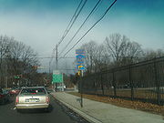
. The highway progresses westward, passing to the south of the Number 22 Elementary School. The surroundings of the highway are densely populated, with buildings surrounding the highway the entire time. Turning to the northeast, Route 439 intersects with the southern terminus of County Route 623 (South Broad Street) and enters the small community of Bayway, for which the highway is named. There, the route intersects with U.S. Route 1
and U.S. Route 9
at the Bayway Circle, where it changes monikers to South Elmora Avenue and continues deeper into Elizabeth.
 After the Bayway Circle, Route 439 continues to the northeast and into Elizabeth, where it intersects with County Route 656 (Lidgerwood Avenue) and crosses the New Jersey Transit
railroad line nearby. The highway then intersects with the northern terminus of County Route 514
, which heads southward. The development becomes more residential for a short time along Route 439, until the first intersection with New Jersey Route 27 (Rahway Avenue), where the commercial development experienced earlier returns. After NJ 27, the route's loop begins to turn even further northward, where it enters Elmora. The highway passes to the southwest of Carteret Park and soon leaves Elmora.
North of Elmora, Route 439 intersects with County Route 610 (West Grand Street) and New Jersey Route 28 (Westfield Avenue), both of which parallel each other for several miles. After the intersection with NJ 28, the highway begins the turn to the east once again. At an intersection with Chilton Street, the highway changes monikers to North Avenue, which it retains for the remaining length. During the curve, Route 439 enters Union and intersects with the southern terminus of New Jersey Route 82, where Kean University
and Phil Rizzuto Park both surround the highway. After NJ 82, the highway enters Hillside
and begins the eastward progression, passing to the south of Elizabeth River Park. After the curve completes, Route 439 enters Elizabeth again and intersects with County Route 623 once again and continues a short distance, where it terminates at the second intersection with NJ 27. North Avenue continues eastward to an interchange with New Jersey Route 81.
from NJ 28 to the intersection with U.S. Routes 1 and 9. The highway was set to serve a new Staten Island
crossing, which finally opened on June 29, 1928. The highway north of NJ 28 and progressed north to the current day intersection with NJ 82 was New Jersey State Highway Route S-24, which a spur of New Jersey Route 24 from Phillipsburg
to Elizabeth. The designations remained intact for over two decades, but across the Arthur Kill
in Staten Island, New York State Route 439
was assigned onto the Goethals Bridge, and when the 1953 New Jersey state highway renumbering
occurred on January 1, 1953, the highway was redesignated as NJ 439 to match up at the state line. The NJ alignment has remained intact since, but the New York alignment was decommissioned in 1972.
Linden, New Jersey
- Local government :, the Mayor of Linden is . The former longtime Mayor of Linden is 82-year-old John T. Gregorio, who served as mayor of Linden for 30, nonconsecutive years and was repeatedly tagged with scandal during his mayoral career, including one felony conviction, later pardoned, which...
and Elizabeth
Elizabeth, New Jersey
Elizabeth is a city in Union County, New Jersey, United States. As of the 2010 United States Census, the city had a total population of 124,969, retaining its ranking as New Jersey's fourth largest city with an increase of 4,401 residents from its 2000 Census population of 120,568...
in Union County, New Jersey
Union County, New Jersey
Union County is a county located in the U.S. state of New Jersey. As of the 2010 Census, the population was 536,499. It is part of the New York Metropolitan Area. Its county seat is Elizabeth. Union County ranks 93rd among the highest-income counties in the United States. It also ranks 74th in...
. The highway is known as the Bayway, North Avenue and Elmora Avenue from the Goethals Bridge
Goethals Bridge
The Goethals Bridge connects Elizabeth, New Jersey to Staten Island , near the Howland Hook Marine Terminal, Staten Island, New York over the Arthur Kill. Operated by the Port Authority of New York and New Jersey, the span was one of the first structures built by the authority...
and Interstate 278
Interstate 278
Interstate 278 is an auxiliary Interstate Highway in New Jersey and New York, United States. The road runs from U.S. Route 1/9 in Linden, New Jersey to the Bruckner Interchange in the New York City borough of the Bronx...
in Linden and does a loop around Elizabeth, with the designation terminating at an intersection with New Jersey Route 27 in Elizabeth. The highway originated as part of Route 28 south of the current intersection with New Jersey Route 28 and Route S24 (which made up several routes) north of that intersection to New Jersey Route 82. The current designation of NJ 439 was assigned in the 1953 renumbering.
Route description
New Jersey Route 439 begins at an intersection with Union County Route 616 and Interstate 278Interstate 278
Interstate 278 is an auxiliary Interstate Highway in New Jersey and New York, United States. The road runs from U.S. Route 1/9 in Linden, New Jersey to the Bruckner Interchange in the New York City borough of the Bronx...
near the Goethals Bridge
Goethals Bridge
The Goethals Bridge connects Elizabeth, New Jersey to Staten Island , near the Howland Hook Marine Terminal, Staten Island, New York over the Arthur Kill. Operated by the Port Authority of New York and New Jersey, the span was one of the first structures built by the authority...
in Elizabeth
Elizabeth, New Jersey
Elizabeth is a city in Union County, New Jersey, United States. As of the 2010 United States Census, the city had a total population of 124,969, retaining its ranking as New Jersey's fourth largest city with an increase of 4,401 residents from its 2000 Census population of 120,568...
. The highway progresses westward, passing to the south of the Number 22 Elementary School. The surroundings of the highway are densely populated, with buildings surrounding the highway the entire time. Turning to the northeast, Route 439 intersects with the southern terminus of County Route 623 (South Broad Street) and enters the small community of Bayway, for which the highway is named. There, the route intersects with U.S. Route 1
U.S. Route 1
U.S. Route 1 is a major north–south U.S. Highway that serves the East Coast of the United States. It runs 2,377 miles from Fort Kent, Maine at the Canadian border south to Key West, Florida. U.S. 1 generally parallels Interstate 95, though it is significantly farther west between...
and U.S. Route 9
U.S. Route 9
U.S. Route 9 is a north–south United States highway in the states of Delaware, New Jersey, and New York in the United States. It is one of only two U.S. highways with a ferry connection ; the other being US 10. US 9 is signed east–west in Delaware and north–south on the rest of...
at the Bayway Circle, where it changes monikers to South Elmora Avenue and continues deeper into Elizabeth.
New Jersey Transit
The New Jersey Transit Corporation is a statewide public transportation system serving the United States state of New Jersey, and New York, Orange, and Rockland counties in New York State...
railroad line nearby. The highway then intersects with the northern terminus of County Route 514
County Route 514 (New Jersey)
County Route 514 is a county highway in the U.S. state of New Jersey. The highway extends from US 202 in East Amwell Township to Bayway Avenue in Elizabeth...
, which heads southward. The development becomes more residential for a short time along Route 439, until the first intersection with New Jersey Route 27 (Rahway Avenue), where the commercial development experienced earlier returns. After NJ 27, the route's loop begins to turn even further northward, where it enters Elmora. The highway passes to the southwest of Carteret Park and soon leaves Elmora.
North of Elmora, Route 439 intersects with County Route 610 (West Grand Street) and New Jersey Route 28 (Westfield Avenue), both of which parallel each other for several miles. After the intersection with NJ 28, the highway begins the turn to the east once again. At an intersection with Chilton Street, the highway changes monikers to North Avenue, which it retains for the remaining length. During the curve, Route 439 enters Union and intersects with the southern terminus of New Jersey Route 82, where Kean University
Kean University
Kean University is a coeducational, public research university located in Union and Hillside, New Jersey, United States. Kean University serves its students in the liberal arts, the sciences, and the professions with a dedication to intellectual and cultural growth and is best known for its...
and Phil Rizzuto Park both surround the highway. After NJ 82, the highway enters Hillside
Hillside, New Jersey
Hillside is a township in Union County, New Jersey, United States. As of the 2010 United States Census, the township population was 21,404.Hillside was incorporated as a township on April 3, 1913, from portions of Union Township, based on the results of a referendum held on April 29, 1913.The town...
and begins the eastward progression, passing to the south of Elizabeth River Park. After the curve completes, Route 439 enters Elizabeth again and intersects with County Route 623 once again and continues a short distance, where it terminates at the second intersection with NJ 27. North Avenue continues eastward to an interchange with New Jersey Route 81.
History
NJ 439 originates as an alignment of 'New Jersey State Highway Route 28, assigned in the 1927 New Jersey state highway renumbering1927 New Jersey state highway renumbering
In 1927, New Jersey's state highways were renumbered. The old system, which had been defined in sequence by the legislature, was growing badly, as several routes shared the same number, and many unnumbered state highways had been defined...
from NJ 28 to the intersection with U.S. Routes 1 and 9. The highway was set to serve a new Staten Island
Staten Island
Staten Island is a borough of New York City, New York, United States, located in the southwest part of the city. Staten Island is separated from New Jersey by the Arthur Kill and the Kill Van Kull, and from the rest of New York by New York Bay...
crossing, which finally opened on June 29, 1928. The highway north of NJ 28 and progressed north to the current day intersection with NJ 82 was New Jersey State Highway Route S-24, which a spur of New Jersey Route 24 from Phillipsburg
Phillipsburg, New Jersey
Phillipsburg, known locally as P'burg, is a town in Warren County, New Jersey, in the United States. As of 2010 United States Census, the town's population was 14,950....
to Elizabeth. The designations remained intact for over two decades, but across the Arthur Kill
Arthur Kill
The Arthur Kill is a tidal strait separating Staten Island, New York from mainland New Jersey, USA, and a major navigational channel of the Port of New York and New Jersey. Kill is from the Middle Dutch word kille, meaning "riverbed" or "water channel"...
in Staten Island, New York State Route 439
New York State Route 439
New York State Route 439 was an east–west state highway on Staten Island in New York, United States. The western terminus of the route was at the Goethals Bridge, where it continued into New Jersey as its Route 439. Its eastern terminus was at the Staten Island Ferry terminal in the St....
was assigned onto the Goethals Bridge, and when the 1953 New Jersey state highway renumbering
1953 New Jersey state highway renumbering
On January 1, 1953, the New Jersey Department of Transportation renumbered many of the State Routes. A few rules were followed in deciding what to renumber:...
occurred on January 1, 1953, the highway was redesignated as NJ 439 to match up at the state line. The NJ alignment has remained intact since, but the New York alignment was decommissioned in 1972.