
.gif)
Route 41 (New Jersey)
Encyclopedia
Route 41 is a state highway
in the U.S. state
of New Jersey
. It runs 14.08 mi (22.66 km) from the five-way intersection of Route 47 (Delsea Drive), County Route 603 (Fairview-Sewell Road/Blackswood-Barnsboro Road), and County Route 630 (Egg Harbor Road), also known as Five Points, in Deptford Township
, Gloucester County
to the southern terminus of County Route 611 in Maple Shade, Burlington County
, just north of the Route 41's interchanges with Route 38 and Route 73. The route is a two- to four-lane suburban road that passes through several communities, including Runnemede
, Haddonfield
, and Cherry Hill Township. Between the intersection with Route 168 in Runnemede and Route 154 in Cherry Hill Township, Route 41 is maintained by Camden County
and is also signed as County Route 573.
Route 41 was legislated in 1927 to run from Route 47 in Fairview, Deptford Township to Route 38 in Moorestown. Originally, the route was intended to bypass Haddonfield
, however this bypass was never fully completed and Route 41 was signed along a temporary county-maintained alignment that also became County Route 573. The northern part of this bypass was completed and became Route 154 in 1953. The road has seen many changes including the replacement of the traffic circle
with Routes 38 and 73 with an interchange that involved realigning Route 41 around the original circle in 1960 and the replacement of the Ellisburg Circle
at Routes 70 and 154 with a signalized intersection in the early 1990s. The temporary alignment of Route 41 along County Route 573 was made permanent in the early 2000s.
, Gloucester County
on a two-lane, undivided road called Hurffville Road. The route intersects County Route 621 (County House Road) and then intersects County Route 534
(Good Intent Road). The route continues north and meets Deptford Center Road, which provides access to the Deptford Mall
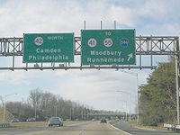
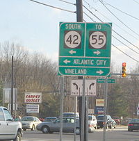
and Route 55, and a ramp to southbound Route 42. Route 41 comes to an interchange with Route 42, with access provided to and from northbound Route 42. Past Route 42, Route 41 intersects County Route 544
(Clements Bridge Road), with which it forms a concurrency
.
 The route crosses the Big Timber Creek
into Camden County
, running along the border of Runnemede
and Gloucester Township
. County Route 544 veers to the right onto Evesham Road, and Route 41 continues northeast on Clements Bridge Road into Runnemede. At the intersection with Route 168, Route 41 becomes county-maintained and runs concurrent with County Route 573. The two routes cross into Barrington
, where they pass over the New Jersey Turnpike
. Upon crossing a Conrail
railroad line, Route 41 and County Route 573 run along the border of Barrington and Haddon Heights
, with Barrington to the southeast and Haddon Heights to the northwest. The two routes pass under Interstate 295
before meeting U.S. Route 30
at a modified traffic circle
.
Route 41 and County Route 573 continue north on Highland Avenue and cross into Haddonfield
, where the road becomes Chews Landing Road. The two routes meet County Route 551 Spur (Kings Highway), and they bear to the right onto Kings Highway, heading northeast. They pass over New Jersey Transit
’s Atlantic City Line
and the PATCO Speedline and then intersect County Route 561
(Haddon Avenue) Past CR 561, the road crosses the Cooper River
into Cherry Hill Township. Route 41 and County Route 573 make a right turn onto a four-lane divided highway
and intersect Route 154 (Brace Road). At this point, County Route 573 ends and Route 41 makes a left turn onto a six-lane divided highway, becoming state-maintained again and forming a concurrency with Route 154.
At the point Route 41 crosses Route 70, Route 154 ends and Route 41 continues to the northeast on Kings Highway, a five-lane road with a center left-turn lane. Route 41 becomes a four-lane divided highway at the crossing of the Pennsauken Creek
and enters Maple Shade Township
, Burlington County
. The route interchanges with Route 38 and with Route 73 a short distance later. It continues to the northeast, where Route 41 ends at the end of state maintenance and Kings Highway continues northeast as County Route 611.
to Route 38 in Moorestown along its current alignment, except through Haddonfield
, which it was to bypass to the east. Also legislated in 1927 was a spur of Route 41, Route S41, which was to run from the Tacony-Palmyra Bridge
to Berlin
. Later spurs of Route 41 included Route S41A, which was a southern extension of Route S41 from Berlin to Route 42 (now U.S. Route 322
) in Folsom
proposed in 1938. In the 1953 New Jersey state highway renumbering
, Routes S41 and S41A became Route 73 and Route 41 was legislated along a county-maintained temporary route between Route 168 in Runnemede
and Route 70 in Cherry Hill Township, signed Route 41 Temporary, when it became the apparent the bypass around Haddonfield would not be fully completed. Only the northernmost section of the bypass between County Route 561
and Route 70 had been built and this eventually became Route 154. The county-maintained section of Route 41 also became known as County Route 573.
Since 1953, many changes have occurred along Route 41. Following reconstruction of the traffic circle between Routes 38, 41, and 73 into an interchange by the 1990s, Route 41 was relocated to a new alignment that bypassed the original traffic circle and extended north a short distance on Kings Highway to just south of the County Route 608 (Lenola Road) intersection in Maple Shade Township
. The Ellisburg Circle
at the intersection of Routes 41, 70, and 154 was reconstructed into an intersection with jughandles and traffic lights by the 1990s also. This reconstruction involved realigning Route 41 to form a brief concurrency with Route 154 just south of Route 70. In the early 2000s, the Route 41 interchange with Route 42 in Deptford Township was, along with the County Route 544
interchange with Route 42, reconstructed to ease traffic movements in the area. Signs for Route 41 Temporary and County Route 573 still remain along this stretch of Route 41, which today is officially considered to be a part of mainline Route 41.
State highway
State highway, state road or state route can refer to one of three related concepts, two of them related to a state or provincial government in a country that is divided into states or provinces :#A...
in the U.S. state
U.S. state
A U.S. state is any one of the 50 federated states of the United States of America that share sovereignty with the federal government. Because of this shared sovereignty, an American is a citizen both of the federal entity and of his or her state of domicile. Four states use the official title of...
of New Jersey
New Jersey
New Jersey is a state in the Northeastern and Middle Atlantic regions of the United States. , its population was 8,791,894. It is bordered on the north and east by the state of New York, on the southeast and south by the Atlantic Ocean, on the west by Pennsylvania and on the southwest by Delaware...
. It runs 14.08 mi (22.66 km) from the five-way intersection of Route 47 (Delsea Drive), County Route 603 (Fairview-Sewell Road/Blackswood-Barnsboro Road), and County Route 630 (Egg Harbor Road), also known as Five Points, in Deptford Township
Deptford Township, New Jersey
Deptford Township is a township in Gloucester County, New Jersey, in the United States. As of the 2010 United States Census, the township's population was 30,561....
, Gloucester County
Gloucester County, New Jersey
Gloucester County is a county located in the U.S. state of New Jersey. As of the 2010 Census, the population was 288,288. Its county seat is Woodbury....
to the southern terminus of County Route 611 in Maple Shade, Burlington County
Burlington County, New Jersey
There were 154,371 households out of which 34.30% had children under the age of 18 living with them, 57.70% were married couples living together, 10.90% had a female householder with no husband present, and 27.70% were non-families. 22.90% of all households were made up of individuals and 8.50% had...
, just north of the Route 41's interchanges with Route 38 and Route 73. The route is a two- to four-lane suburban road that passes through several communities, including Runnemede
Runnemede, New Jersey
Runnemede is a borough in Camden County, New Jersey, United States. As of the 2000 United States Census, the borough population is 8,533.Runnemede was incorporated as a borough by an Act of the New Jersey Legislature on March 23, 1926, from portions of the now-defunct Centre Township, based on the...
, Haddonfield
Haddonfield, New Jersey
Haddonfield is a borough located in Camden County, New Jersey. As of the 2010 United States Census, the borough had a total population of 11,593....
, and Cherry Hill Township. Between the intersection with Route 168 in Runnemede and Route 154 in Cherry Hill Township, Route 41 is maintained by Camden County
Camden County, New Jersey
-Demographics:As of the 2010 Census the population of Camden County was 60.28% Non-Hispanic white, 18.45% Non-Hispanic black, 1.12% Hispanic blacks, 0.17% Non-Hispanic Native American, 0.15% Hispanic Native Americans, 5.07% Non-Hispanic Asian, and 0.14% non-Hispanics reporting some other race...
and is also signed as County Route 573.
Route 41 was legislated in 1927 to run from Route 47 in Fairview, Deptford Township to Route 38 in Moorestown. Originally, the route was intended to bypass Haddonfield
Haddonfield, New Jersey
Haddonfield is a borough located in Camden County, New Jersey. As of the 2010 United States Census, the borough had a total population of 11,593....
, however this bypass was never fully completed and Route 41 was signed along a temporary county-maintained alignment that also became County Route 573. The northern part of this bypass was completed and became Route 154 in 1953. The road has seen many changes including the replacement of the traffic circle
Traffic circle
A traffic circle or rotary is a type of circular intersection in which traffic must travel in one direction around a central island. In some countries, traffic entering the circle has the right-of-way and drivers in the circle must yield. In many other countries, traffic entering the circle must...
with Routes 38 and 73 with an interchange that involved realigning Route 41 around the original circle in 1960 and the replacement of the Ellisburg Circle
Ellisburg Circle
The Ellisburg Circle was a traffic circle that stood in Cherry Hill Township, New Jersey from 1938 to 1992, at the intersection between Route 41, Route 70 and Route 154. The name is used as a shopping center at the location of the former circle....
at Routes 70 and 154 with a signalized intersection in the early 1990s. The temporary alignment of Route 41 along County Route 573 was made permanent in the early 2000s.
Route description
Gloucester County
Route 41 heads north from the Five Points intersection with Route 47, County Route 603, and County Route 630 in Deptford TownshipDeptford Township, New Jersey
Deptford Township is a township in Gloucester County, New Jersey, in the United States. As of the 2010 United States Census, the township's population was 30,561....
, Gloucester County
Gloucester County, New Jersey
Gloucester County is a county located in the U.S. state of New Jersey. As of the 2010 Census, the population was 288,288. Its county seat is Woodbury....
on a two-lane, undivided road called Hurffville Road. The route intersects County Route 621 (County House Road) and then intersects County Route 534
County Route 534 (New Jersey)
County Route 534, abbreviated CR 534, is a county highway in the U.S. state of New Jersey. The highway extends from Route 47 in Deptford Township to Medford-Indian Mills Road in Shamong Township.-Gloucester County:...
(Good Intent Road). The route continues north and meets Deptford Center Road, which provides access to the Deptford Mall
Deptford Mall
The Deptford Mall is a major shopping destination in Deptford Township, Gloucester County, New Jersey, United States. It is the seventh largest mall in the state of New Jersey and the largest in the state's South Jersey region. Owned and managed by The Macerich Company, it is the county's only...
and Route 55, and a ramp to southbound Route 42. Route 41 comes to an interchange with Route 42, with access provided to and from northbound Route 42. Past Route 42, Route 41 intersects County Route 544
County Route 544 (New Jersey)
County Route 544, abbreviated CR 544, is a county highway in the U.S. state of New Jersey. The highway extends from Cooper Street in Deptford Township to Taunton Boulevard in Medford Township.-Gloucester County:...
(Clements Bridge Road), with which it forms a concurrency
Concurrency (road)
A concurrency, overlap, or coincidence in a road network is an instance of one physical road bearing two or more different highway, motorway, or other route numbers...
.
Camden and Burlington Counties
Big Timber Creek
Big Timber Creek is a stream in southwestern New Jersey, United States, and is also known by the name 'Tetamekanchz Kyl' by the Lenape tribes. It drains a watershed of . A tributary of the Delaware River, it enters the Delaware between the boroughs of Brooklawn and Westville, just south Gloucester...
into Camden County
Camden County, New Jersey
-Demographics:As of the 2010 Census the population of Camden County was 60.28% Non-Hispanic white, 18.45% Non-Hispanic black, 1.12% Hispanic blacks, 0.17% Non-Hispanic Native American, 0.15% Hispanic Native Americans, 5.07% Non-Hispanic Asian, and 0.14% non-Hispanics reporting some other race...
, running along the border of Runnemede
Runnemede, New Jersey
Runnemede is a borough in Camden County, New Jersey, United States. As of the 2000 United States Census, the borough population is 8,533.Runnemede was incorporated as a borough by an Act of the New Jersey Legislature on March 23, 1926, from portions of the now-defunct Centre Township, based on the...
and Gloucester Township
Gloucester Township, New Jersey
Gloucester Township is a Township in Camden County, New Jersey, United States. As of the 2010 United States Census, the township had a total population of 64,634...
. County Route 544 veers to the right onto Evesham Road, and Route 41 continues northeast on Clements Bridge Road into Runnemede. At the intersection with Route 168, Route 41 becomes county-maintained and runs concurrent with County Route 573. The two routes cross into Barrington
Barrington, New Jersey
Barrington is a Borough in Camden County, New Jersey, United States. As of the 2010 United States Census, the borough population was 6,983.Barrington was incorporated as a borough on March 27, 1917, from portions of the now-defunct Centre Township, based on the results of a referendum held on April...
, where they pass over the New Jersey Turnpike
New Jersey Turnpike
The New Jersey Turnpike is a toll road in New Jersey, maintained by the New Jersey Turnpike Authority. According to the International Bridge, Tunnel and Turnpike Association, the Turnpike is the nation's sixth-busiest toll road and is among one of the most heavily traveled highways in the United...
. Upon crossing a Conrail
Conrail Shared Assets Operations
Conrail Shared Assets Operations is an American railroad company. It operates three networks—the North Jersey, South Jersey/Philadelphia, and Detroit Shared Assets Areas, where it serves as a local carrier and switching company for CSX Transportation and the Norfolk Southern Railway...
railroad line, Route 41 and County Route 573 run along the border of Barrington and Haddon Heights
Haddon Heights, New Jersey
Haddon Heights is a borough in Camden County, New Jersey, United States. As of the United States 2000 Census, the borough population is 7,473....
, with Barrington to the southeast and Haddon Heights to the northwest. The two routes pass under Interstate 295
Interstate 295 (Delaware-New Jersey)
Interstate 295 in New Jersey and Delaware is an auxiliary Interstate Highway, designated as a bypass around Philadelphia, Pennsylvania. The route begins at a junction with Interstate 95 south of Wilmington, Delaware, and runs to another junction with I-95 north of Trenton, New Jersey...
before meeting U.S. Route 30
U.S. Route 30 in New Jersey
U.S. Route 30 is a U.S. highway running from Astoria, Oregon east to Atlantic City, New Jersey. In the U.S. state of New Jersey, US 30 runs from the Benjamin Franklin Bridge at the Delaware River in Camden, Camden County while concurrent with Interstate 676 southeast to Virginia...
at a modified traffic circle
Traffic circle
A traffic circle or rotary is a type of circular intersection in which traffic must travel in one direction around a central island. In some countries, traffic entering the circle has the right-of-way and drivers in the circle must yield. In many other countries, traffic entering the circle must...
.
Route 41 and County Route 573 continue north on Highland Avenue and cross into Haddonfield
Haddonfield, New Jersey
Haddonfield is a borough located in Camden County, New Jersey. As of the 2010 United States Census, the borough had a total population of 11,593....
, where the road becomes Chews Landing Road. The two routes meet County Route 551 Spur (Kings Highway), and they bear to the right onto Kings Highway, heading northeast. They pass over New Jersey Transit
New Jersey Transit
The New Jersey Transit Corporation is a statewide public transportation system serving the United States state of New Jersey, and New York, Orange, and Rockland counties in New York State...
’s Atlantic City Line
Atlantic City Line
The Atlantic City Line is a rail line operated by New Jersey Transit between Philadelphia, Pennsylvania and Atlantic City, New Jersey, operating along the corridor of the White Horse Pike. It runs over trackage that was controlled by both the Pennsylvania Railroad and the Pennsylvania-Reading...
and the PATCO Speedline and then intersect County Route 561
County Route 561 (New Jersey)
County Route 561, abbreviated CR 561, is a county highway in the U.S. state of New Jersey. The highway extends from New York Road in Galloway Township to Federal Street , Camden.-Atlantic County:...
(Haddon Avenue) Past CR 561, the road crosses the Cooper River
Cooper River (New Jersey)
The Cooper River is a tributary of the Delaware River in southwestern New Jersey in the United States.The confluence of the Cooper River with the Delaware River is in Camden...
into Cherry Hill Township. Route 41 and County Route 573 make a right turn onto a four-lane divided highway
Divided Highway
Divided Highway is a compilation album by American rock band The Doobie Brothers, released in 2003. . All tracks are taken from the albums Cycles and Brotherhood .-Track listing:...
and intersect Route 154 (Brace Road). At this point, County Route 573 ends and Route 41 makes a left turn onto a six-lane divided highway, becoming state-maintained again and forming a concurrency with Route 154.
At the point Route 41 crosses Route 70, Route 154 ends and Route 41 continues to the northeast on Kings Highway, a five-lane road with a center left-turn lane. Route 41 becomes a four-lane divided highway at the crossing of the Pennsauken Creek
Pennsauken Creek
Pennsauken Creek is a tributary of the Delaware River in Burlington and Camden counties, New Jersey in the United States.Pennsauken Creek drains of southwestern Burlington County and northern Camden County and joins the Delaware River near Palmyra....
and enters Maple Shade Township
Maple Shade Township, New Jersey
Maple Shade Township is a township in Burlington County, New Jersey, United States. As of the United States 2000 Census, the township population was 19,079....
, Burlington County
Burlington County, New Jersey
There were 154,371 households out of which 34.30% had children under the age of 18 living with them, 57.70% were married couples living together, 10.90% had a female householder with no husband present, and 27.70% were non-families. 22.90% of all households were made up of individuals and 8.50% had...
. The route interchanges with Route 38 and with Route 73 a short distance later. It continues to the northeast, where Route 41 ends at the end of state maintenance and Kings Highway continues northeast as County Route 611.
History
Route 41 was legislated in 1927 to run from Route 47 in Fairview in Deptford TownshipDeptford Township, New Jersey
Deptford Township is a township in Gloucester County, New Jersey, in the United States. As of the 2010 United States Census, the township's population was 30,561....
to Route 38 in Moorestown along its current alignment, except through Haddonfield
Haddonfield, New Jersey
Haddonfield is a borough located in Camden County, New Jersey. As of the 2010 United States Census, the borough had a total population of 11,593....
, which it was to bypass to the east. Also legislated in 1927 was a spur of Route 41, Route S41, which was to run from the Tacony-Palmyra Bridge
Tacony-Palmyra Bridge
The Tacony–Palmyra Bridge is a combination steel arch, double-leaf bascule bridge across the Delaware River, connecting New Jersey Route 73 in Palmyra, New Jersey and Pennsylvania Route 73 in the Tacony section of Philadelphia. The bridge has a total length of 3,659 feet and spans 2,324 feet . It...
to Berlin
Berlin, New Jersey
Berlin is a Borough in Camden County, New Jersey, United States. As of the 2010 United States Census, the borough population was 7,588.Berlin was incorporated as a borough on March 29, 1927, from portions of Berlin Township, based on the results of a referendum held on April 26,...
. Later spurs of Route 41 included Route S41A, which was a southern extension of Route S41 from Berlin to Route 42 (now U.S. Route 322
U.S. Route 322 in New Jersey
U.S. Route 322 is a U.S. highway running from Cleveland, Ohio east to Atlantic City, New Jersey. The easternmost segment of the route in New Jersey runs from the Commodore Barry Bridge over the Delaware River in Logan Township, Glocuester County, where it continues into Chester, Pennsylvania,...
) in Folsom
Folsom, New Jersey
Folsom is a borough in Atlantic County, New Jersey, United States. As of the United States 2010 Census, the borough population was 1,885.Folsom was incorporated as a borough by an Act of the New Jersey Legislature on May 23, 1906, from portions of Buena Vista Township.New Jersey Monthly magazine...
proposed in 1938. In the 1953 New Jersey state highway renumbering
1953 New Jersey state highway renumbering
On January 1, 1953, the New Jersey Department of Transportation renumbered many of the State Routes. A few rules were followed in deciding what to renumber:...
, Routes S41 and S41A became Route 73 and Route 41 was legislated along a county-maintained temporary route between Route 168 in Runnemede
Runnemede, New Jersey
Runnemede is a borough in Camden County, New Jersey, United States. As of the 2000 United States Census, the borough population is 8,533.Runnemede was incorporated as a borough by an Act of the New Jersey Legislature on March 23, 1926, from portions of the now-defunct Centre Township, based on the...
and Route 70 in Cherry Hill Township, signed Route 41 Temporary, when it became the apparent the bypass around Haddonfield would not be fully completed. Only the northernmost section of the bypass between County Route 561
County Route 561 (New Jersey)
County Route 561, abbreviated CR 561, is a county highway in the U.S. state of New Jersey. The highway extends from New York Road in Galloway Township to Federal Street , Camden.-Atlantic County:...
and Route 70 had been built and this eventually became Route 154. The county-maintained section of Route 41 also became known as County Route 573.
Since 1953, many changes have occurred along Route 41. Following reconstruction of the traffic circle between Routes 38, 41, and 73 into an interchange by the 1990s, Route 41 was relocated to a new alignment that bypassed the original traffic circle and extended north a short distance on Kings Highway to just south of the County Route 608 (Lenola Road) intersection in Maple Shade Township
Maple Shade Township, New Jersey
Maple Shade Township is a township in Burlington County, New Jersey, United States. As of the United States 2000 Census, the township population was 19,079....
. The Ellisburg Circle
Ellisburg Circle
The Ellisburg Circle was a traffic circle that stood in Cherry Hill Township, New Jersey from 1938 to 1992, at the intersection between Route 41, Route 70 and Route 154. The name is used as a shopping center at the location of the former circle....
at the intersection of Routes 41, 70, and 154 was reconstructed into an intersection with jughandles and traffic lights by the 1990s also. This reconstruction involved realigning Route 41 to form a brief concurrency with Route 154 just south of Route 70. In the early 2000s, the Route 41 interchange with Route 42 in Deptford Township was, along with the County Route 544
County Route 544 (New Jersey)
County Route 544, abbreviated CR 544, is a county highway in the U.S. state of New Jersey. The highway extends from Cooper Street in Deptford Township to Taunton Boulevard in Medford Township.-Gloucester County:...
interchange with Route 42, reconstructed to ease traffic movements in the area. Signs for Route 41 Temporary and County Route 573 still remain along this stretch of Route 41, which today is officially considered to be a part of mainline Route 41.