
.gif)
Rot (Danube)
Encyclopedia
Tributary
A tributary or affluent is a stream or river that flows into a main stem river or a lake. A tributary does not flow directly into a sea or ocean...
of the river Danube
Danube
The Danube is a river in the Central Europe and the Europe's second longest river after the Volga. It is classified as an international waterway....
in the region of Upper Swabia
Upper Swabia
Upper Swabia is a region in Germany in the federal states of Baden-Württemberg and Bavaria. The name refers to the area between the Swabian Alb, Lake Constance and the Lech...
in Baden-Württemberg
Baden-Württemberg
Baden-Württemberg is one of the 16 states of Germany. Baden-Württemberg is in the southwestern part of the country to the east of the Upper Rhine, and is the third largest in both area and population of Germany's sixteen states, with an area of and 10.7 million inhabitants...
in Germany
Germany
Germany , officially the Federal Republic of Germany , is a federal parliamentary republic in Europe. The country consists of 16 states while the capital and largest city is Berlin. Germany covers an area of 357,021 km2 and has a largely temperate seasonal climate...
. It has a length of 54 km.
The Rot runs in a northerly direction parallel to the river Iller
Iller
The Iller is a river in Bavaria, Germany. It is a right tributary of the Danube, 147 km in length.The source is located near Oberstdorf in the Allgäu region of the Alps, close to the Austrian border. From there it runs northwards, passing the towns of Sonthofen, Immenstadt, and Kempten...
to the east, and Westernach to the west. Both these rivers are also tributaries to the Danube.
Geography
The Rot originates in the district of BiberachBiberach (district)
Biberach is a district in Baden-Württemberg, Germany. It is bounded by the districts of Ravensburg, Sigmaringen, Reutlingen and Alb-Donau, and the Bavarian districts Neu-Ulm, Unterallgäu and the district-free city Memmingen...
in the vicinity of the village of Rot an der Rot
Rot an der Rot
Rot an der Rot is a town in the district of Biberach in Baden-Württemberg in Germany. The town developed out of Rot an der Rot Abbey....
, when two streams merge, the Paffenrieder Bach from the south and the Sendener Bach from the south-west.
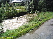
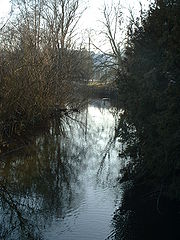
The Rot meanders north through its increasingly widening valley, the heights of which are covered by woods, whereas the river itself is embedded first by moor
Moorland
Moorland or moor is a type of habitat, in the temperate grasslands, savannas, and shrublands biome, found in upland areas, characterised by low-growing vegetation on acidic soils and heavy fog...
land and wet meadow
Wet meadow
A wet meadow is a semi-wetland meadow which is saturated with water throughout much of the year. Wet meadows may occur because of poor drainage or the receipt of large amounts of water from rain or melted snow. They may also occur in riparian zones....
s, later by fields
Field (agriculture)
In agriculture, the word field refers generally to an area of land enclosed or otherwise and used for agricultural purposes such as:* Cultivating crops* Usage as a paddock or, generally, an enclosure of livestock...
.
Passing Rot an der Rot, where it is joined by the small river Haslach
Haslach (Rot)
The Haslach is a small river in the region of Upper Swabia in Baden Württemberg in Germany.It is an eastern tributary to the river Rot and has a length of 5,5 km.- Geography :...
, the Rot flows through Eichenberg
Berkheim
Berkheim is a municipality in the district of Biberach in Baden-Württemberg in Germany.-References:...
, Gutenzell-Hürbel
Gutenzell-Hürbel
Gutenzell-Hürbel is a town in the district of Biberach in Baden-Württemberg in Germany.Gutenzell developed out of Gutenzell Abbey, a Cistercian nunnery founded in 1237....
, Schwendi
Schwendi
Schwendi is a municipality in the district Biberach, Baden-Württemberg, Germany, located near Laupheim. The mayor is Mr. Karremann....
, Burgrieden
Burgrieden
Burgrieden is a municipality in the district of Biberach in Baden-Württemberg in Germany....
towards Achstetten
Achstetten
Achstetten is a the northernmost municipality in the district of Biberach, in the region of Upper Swabia in Baden-Württemberg, Germany. As of 30 September 2008, it has a population of 4.141....
. From Schwendi onwards the river has been channelised, with a weir
Weir
A weir is a small overflow dam used to alter the flow characteristics of a river or stream. In most cases weirs take the form of a barrier across the river that causes water to pool behind the structure , but allows water to flow over the top...
at Achstetten to slow down the flow of the water. Here the river forks, parts of the river are allowed to follow the original meandering bed whereas the main body of water follows the channelised route. After about 1,5 km the two merge again.
The Rot then flows through Dellmensingen
Erbach an der Donau
Erbach an der Donau is a town on the Danube River in Baden-Württemberg, Germany. Located in the Alb-Donau District, Erbach lies between Ulm and Ehingen an der Donau on the southern edge of the Swabian Alb.-History:...
, situated in the Alb-Donau District
Alb-Donau (district)
Alb-Donau-Kreis is a district in Baden-Württemberg, Germany. It is bounded by the districts of Biberach, Reutlingen, Göppingen and Heidenheim, the two Bavarian districts Günzburg and Neu-Ulm, and the city of Ulm.- History :...
. North of Dellmensingen most of the waters of the Rot flow through an artificially created channel into the reservoir
Reservoir
A reservoir , artificial lake or dam is used to store water.Reservoirs may be created in river valleys by the construction of a dam or may be built by excavation in the ground or by conventional construction techniques such as brickwork or cast concrete.The term reservoir may also be used to...
of a hydroelectric plant
Hydroelectricity
Hydroelectricity is the term referring to electricity generated by hydropower; the production of electrical power through the use of the gravitational force of falling or flowing water. It is the most widely used form of renewable energy...
near Donaustetten. The remaining waters of the Rot keep flowing in its original stream bed
Stream bed
A stream bed is the channel bottom of a stream, river or creek; the physical confine of the normal water flow. The lateral confines or channel margins, during all but flood stage, are known as the stream banks or river banks. In fact, a flood occurs when a stream overflows its banks and flows onto...
to empty into the Danube north of Donaustetten.
Tourism
Parts of the Upper Swabian Baroque RouteUpper Swabian Baroque Route
The Upper Swabian Baroque Route is a touristic theme route through Upper Swabia, following the themes of "nature, culture, baroque". The route has a length of about 500 km . It was established in 1966, being one of the first theme routes in Germany...
and the Upper Swabian Mill Route run along the river Rot.
See also
- Upper SwabiaUpper SwabiaUpper Swabia is a region in Germany in the federal states of Baden-Württemberg and Bavaria. The name refers to the area between the Swabian Alb, Lake Constance and the Lech...
- DanubeDanubeThe Danube is a river in the Central Europe and the Europe's second longest river after the Volga. It is classified as an international waterway....
- List of rivers of Baden-Württemberg