

Roseville Bridge
Encyclopedia
Middle Harbour
Middle Harbour is the northern arm of Port Jackson in Sydney, Australia.Middle Harbour extends about to the northwest, from where it joins the main harbour near the Heads. Its shore is nearly everywhere rugged, barren and forested and for this reason Middle Harbour was almost entirely neglected...
in Sydney
Sydney
Sydney is the most populous city in Australia and the state capital of New South Wales. Sydney is located on Australia's south-east coast of the Tasman Sea. As of June 2010, the greater metropolitan area had an approximate population of 4.6 million people...
, Australia
Australia
Australia , officially the Commonwealth of Australia, is a country in the Southern Hemisphere comprising the mainland of the Australian continent, the island of Tasmania, and numerous smaller islands in the Indian and Pacific Oceans. It is the world's sixth-largest country by total area...
. It is the only crossing besides Spit Bridge
Spit Bridge
The Spit Bridge is a bascule bridge that carries Spit Road over Middle Harbour in Sydney, New South Wales, Australia, at a point called "The Spit", 10 km north-east of the CBD. It connects the suburbs of Mosman, on the south bank and Seaforth, on the north bank...
.
The bridge is 17.4 metres overhead. However, the adjacent Pipe Bridge has only 11 metres. This limitation, combined with only 1.5 metres depth of water, make it out of reach for most cruising vessels.
History
The original bridge was opened in 1924 and was a low-level two-lane bridge. It was located downstream of the current bridge, and connected Babbage Road to what is today called Healey Way, which is the entrance to Davidson Park within Garigal National ParkGarigal National Park
Garigal National Park is a national park in New South Wales , 20 km north of central Sydney. The park is somewhat disjointed but covers the following areas:...
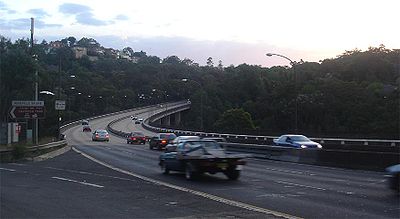
. The suburbs east of Middle Harbour grew rapidly in the years following the opening of Roseville Bridge and in 1966 the NSW Liberal government under Premier Robin Askin (the member for Collaroy at the time, later the member for Pittwater) opened the current six-lane, high-level bridge. Along with the bridge, a significant upgrade of the approach roads was completed, which became the six-lane Warringah Road. This upgraded section of road is approximately 2km in length.
The 1924 bridge survived the opening of the new bridge, and provided pedestrian access only, until it was demolished in 1974, along with Roseville Baths. Almost nothing remains from these structures.
Today
In 21st century Sydney, Roseville Bridge is part of a major thoroughfare from the Pacific HighwayPacific Highway (Australia)
The Pacific Highway is a major transport route along part of the east coast of Australia and is part of Australia's national route 1.It is 960 km long and links Sydney, the capital of New South Wales, to Brisbane, the capital of Queensland, along the coast, via Gosford, Newcastle, Taree, Port...
at Roseville
Roseville, New South Wales
Roseville is a suburb on the Upper North Shore of Sydney in the state of New South Wales, Australia. Roseville is located north-west of the Sydney central business district and sits across the local government areas of Ku-ring-gai and Willoughby...
to the Northern Beaches and suburbs east of Middle Harbour. Due to the halt of the construction of the Warringah Expressway across Middle Harbour to Wakehurst Parkway and the Burnt Bridge Creek Deviation (which is the only part of the Warringah Expressway built on the Northern Beaches) by the Labor Wran government, there are today only two other major roads to these areas: Mona Vale Road, and Spit Road which crosses Middle Harbour downstream from Roseville Bridge using the Spit Bridge.