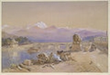
Roorkee is a city and seat of a
municipal councilA municipal council is the local government of a municipality. Specifically the term can refer to the institutions of various countries that can be translated by this term...
in
UttarakhandUttarakhand , formerly Uttaranchal, is a state in the northern part of India. It is often referred to as the Land of Gods due to the many holy Hindu temples and cities found throughout the state, some of which are among Hinduism's most spiritual and auspicious places of pilgrimage and worship...
, in far northern
IndiaIndia , officially the Republic of India , is a country in South Asia. It is the seventh-largest country by geographical area, the second-most populous country with over 1.2 billion people, and the most populous democracy in the world...
. It is located on the banks of the Ganges canal on the
national highwayThe National Highways Network of India, is a network of highways that is managed and maintained by agencies of the Government of India. These highways measured over as of 2010, including over of limited-access Expressways....
between Delhi and Dehradun. Roorkee is known for
Roorkee CantonmentRoorkee Cantonment is a cantonment town, in Roorkee, Haridwar district in the Indian state of Uttarakhand, and is one of country's oldest cantonments established in 1853, and the headquarters of Bengal Engineer Group since 1853.-History:...
, one of the country's oldest cantonments, and the headquarters of
Bengal Engineer GroupThe Bengal Engineer Group or the Bengal Sappers or Bengal Engineers as they are informally known, are remnants of British Indian Army's Bengal Army of the Bengal Presidency in British India; now a regiment of the Corps of Engineers in the Indian Army. The Bengal Sappers have their regimental...
(Bengal Sappers) since 1853. The renowned engineering college IIT Roorkee is located in this town.
Etymology
According to one story, Roorkee derives its name from
Rurimadi imran, the wife of some local Rajput chieftain. On the othr hand, vernacular belief amongst villagers around Roorkee is that it got its name from "
RorThe Ror is a Kshatriya community and numbers between 750,000 and 1,000,000. They hold nearly 270 villages in Haryana and 52 more in Western Uttar Pradesh and the Haridwar district of Uttarakhand....
ki", i.e., dwelling of a
RorThe Ror is a Kshatriya community and numbers between 750,000 and 1,000,000. They hold nearly 270 villages in Haryana and 52 more in Western Uttar Pradesh and the Haridwar district of Uttarakhand....
Roorkee is situated in
HaridwarHaridwar is an important pilgrimage city and municipality in the Haridwar district of Uttarakhand, India...
district of
UttarakhandUttarakhand , formerly Uttaranchal, is a state in the northern part of India. It is often referred to as the Land of Gods due to the many holy Hindu temples and cities found throughout the state, some of which are among Hinduism's most spiritual and auspicious places of pilgrimage and worship...
state.
History
Roorkee was the capital of a Moghul Mahal (similar to a present-day
ParganaA pargana is a former administrative unit of the Indian subcontinent, used primarily, but not exclusively, by the Muslim kingdoms.Parganas were introduced by the Delhi Sultanate, and the word is of Persian origin. As a revenue unit, a pargana consists of several mouzas, which are the smallest...
) during the time of Akbar, as is referred in
Ain-e-Akbari, authored by Abul Fazal.
During the 18th century, it came under the rule of Landhaura state, until the death of its
Bargujar king, Raja Ramdaval Dev in 1813 and later, became a part of the territories of the
British East India CompanyThe East India Company was an early English joint-stock company that was formed initially for pursuing trade with the East Indies, but that ended up trading mainly with the Indian subcontinent and China...
.
Before 1840, the city was a small village of mud houses on the banks of the Solani rivulet. Digging work on the Upper Ganges Canal formally began in April 1842, under the aegis of
Proby CautleySir Proby Thomas Cautley KCB , English engineer and palaeontologist, born in Suffolk, is best known for conceiving and supervising the construction of the Ganges canal in India...
, a British officer. Soon, Roorkee developed into a town. The canal, which was formally opened on 8 April 1854, irrigated over 767,000 acres (3,100 km²) in 5,000 villages.
Another factor that contributed to the city's growth was the inception of the 'Roorkee College', which has its origin in the training classes started in 1845 to train local youth to assist in the civil-engineering works in the making of the Upper Ganges Canal. This was to become the first engineering college established in India. On November 25, 1847, the college was formally constituted, through a proposal by the Sir James Thomason, Lt. Governor of North Western Province (1843–53), and after his death in 1853, the college was rechristened as 'Thomason College of Civil Engineering'. The college later upgraded to University of Roorkee in 1949, and on September 21, 2001, through an Act of Indian parliament, it was made one of the
Indian Institutes of TechnologyThe Indian Institutes of Technology are a group of autonomous engineering and technology-oriented institutes of higher education. The IITs are governed by the Institutes of Technology Act, 1961 which has declared them as “institutions of national importance”, and lays down their powers, duties,...
, IIT Roorkee.
India's first aqueduct was constructed over the Solani river, near Roorkee, part of the Ganges canal project, which itself was India's first irrigation work in North India, started by the British. The Ganges Canal led to another first for Roorkee - India's first steam engine, Mary Lind, especially shipped from England moved on rails in India, ran in Roorkee on December 22, 1851, between Roorkee and Piran Kaliyar, two years before the first passenger train ran from Bombay to Thane in 1853. Operated by the Bengal Sappers, the railway line was built to carry soil used for the construction of the Upper Ganges Canal aqueduct from Piran Kaliyar, 10 km (6.2 miles) away from the city. The locomotive rail paths are still intact. The steam engine is presently exhibited at Roorkee Railway Station.
The municipality of Roorkee was created in 1868, when it was already home to the Bengal Sappers and Miners since 1853, and two artillery units were stationed there. Today, the
Roorkee CantonmentRoorkee Cantonment is a cantonment town, in Roorkee, Haridwar district in the Indian state of Uttarakhand, and is one of country's oldest cantonments established in 1853, and the headquarters of Bengal Engineer Group since 1853.-History:...
has a large army base. The
Bengal Engineering Group and CentreThe Bengal Engineer Group or the Bengal Sappers or Bengal Engineers as they are informally known, are remnants of British Indian Army's Bengal Army of the Bengal Presidency in British India; now a regiment of the Corps of Engineers in the Indian Army. The Bengal Sappers have their regimental...
(BEG&C), are still there today.
Later in 1901, when the city had a population of 17,197, it was made headquarters of the Roorkee
TehsilA Tehsil or Tahsil/Tahasil , also known as Taluk and Mandal, is an administrative division of some country/countries of South Asia....
, in
SaharanpurSaharanpur is a city and a Municipal Corporation in the state of Uttar Pradesh in northern India. It is the administrative headquarters of Saharanpur District as well as Saharanpur Division...
district of the
United ProvinceThe United Provinces of Agra and Oudh was a province of India under the British Raj, which existed from 1902 to 1947; the official name was shortened by the Government of India Act 1935 to United Provinces, by which the province had been commonly known, and by which name it was also a province of...
of the
British RajBritish Raj was the British rule in the Indian subcontinent between 1858 and 1947; The term can also refer to the period of dominion...
; the tehsil included in it 426 villages (of the
parganas of Jwalapur,
ManglaurManglaur is a city and a municipal board in Haridwar district in the Indian state of Uttarakhand.-Demographics: India census, Manglaur had a population of 42,782. Males constitute 53% of the population and females 47%. Manglaur has an average literacy rate of 37%, lower than the national average...
and Bhagwanpur) and six towns, most important among them being
HaridwarHaridwar is an important pilgrimage city and municipality in the Haridwar district of Uttarakhand, India...
and
ManglaurManglaur is a city and a municipal board in Haridwar district in the Indian state of Uttarakhand.-Demographics: India census, Manglaur had a population of 42,782. Males constitute 53% of the population and females 47%. Manglaur has an average literacy rate of 37%, lower than the national average...
. The
Old Cemetery in the city is today a protected monument, by the
Archaeological Survey of IndiaThe Archaeological Survey of India is a department of the Government of India, attached to the Ministry of Culture . The ASI is responsible for archaeological studies and the preservation of archaeological heritage of the country in accordance with the various acts of the Indian Parliament...
.
Roorkee is also famous for the shrine of 13th century, Sufi saint
Alauddin Sabir KaliyariAlauddin Ali Ahmed Kaliyari also known as Sabir Kaliyari was a prominent South Asian Sufi Saint of Chishti Order in 13th century, a successor to Baba Fareed , and the first in the Sabiriya branch of Chishti Order....
- the
dargahA Dargah is a Sufi shrine built over the grave of a revered religious figure, often a Sufi saint. Local Muslims visit the shrine known as . Dargahs are often associated with Sufi meeting rooms and hostels, known as khanqah...
is also known as Sarkar Sabir Pak - situated in Piran Kaliyar village, where an annual 15-day spiritual fair (
UrsUrs is the death anniversary of a Sufi saint in South Asia, usually held at the saint's dargah . South Asian Sufis being mainly Chishtiyya, refer to their saints as lovers and God as beloved...
) is held in his.
roorkee is the future for the engineers.there are lots of best engineering colleges which have the power to compete with the foreign universities.
Industry
Roorkee is also famous for the manufacture of survey and nautical instruments.
It started in early 1900, with the repairing of instruments of "The Thomason College of Civil Engineering" (later University of Roorkee, and then IIT Roorkee) and moving on to manufacturing of compasses, levels and other surveying instruments.
After getting the state status to Uttarakhand, Roorkee has grown to having 100+ industries and corporate houses under SIDCUL.
Geography
Roorkee is located at 29.87°N 77.88°E. It has an average elevation of 268 metres (879 feet).
Roorkee is 172 kilometres (106.9 mi) north of the Indian capital,
New DelhiNew Delhi is the capital city of India. It serves as the centre of the Government of India and the Government of the National Capital Territory of Delhi. New Delhi is situated within the metropolis of Delhi. It is one of the nine districts of Delhi Union Territory. The total area of the city is...
and located between the rivers
GangesThe Ganges or Ganga, , is a trans-boundary river of India and Bangladesh. The river rises in the western Himalayas in the Indian state of Uttarakhand, and flows south and east through the Gangetic Plain of North India into Bangladesh, where it empties into the Bay of Bengal. By discharge it...
and
YamunaThe Yamuna is the largest tributary river of the Ganges in northern India...
, close to the foothills of the
HimalayasThe Himalaya Range or Himalaya Mountains Sanskrit: Devanagari: हिमालय, literally "abode of snow"), usually called the Himalayas or Himalaya for short, is a mountain range in Asia, separating the Indian subcontinent from the Tibetan Plateau...
. Before the creation of
UttarakhandUttarakhand , formerly Uttaranchal, is a state in the northern part of India. It is often referred to as the Land of Gods due to the many holy Hindu temples and cities found throughout the state, some of which are among Hinduism's most spiritual and auspicious places of pilgrimage and worship...
on November 9, 2000, Roorkee was a part of the state of
Uttar PradeshUttar Pradesh abbreviation U.P. , is a state located in the northern part of India. With a population of over 200 million people, it is India's most populous state, as well as the world's most populous sub-national entity...
.
Climate
Due to its location away from any major water body and its close proximity to the Himalayas, Roorkee has an extreme and erratic continental climate. Summers start in late March and go on until early July, with average temperatures around 28 °C (82.4 °F). The monsoon season starts in July and goes on uptil October, with torrential rainfall, due to the blocking of the monsoon clouds by the Himalayas. The post monsoon season starts in October and goes on uptil late November, with average temperatures sliding from 21 °C (69.8 °F) to 15 °C (59 °F). Winters start in December, with lows close to freezing and frequent cold waves due to the cold katabatic winds blowing from the Himalayas. The total annual rainfall is about 2600 mm (102 in).
Transport
Roorkee comes under Northern Railway region of
Indian RailwaysIndian Railways , abbreviated as IR , is a departmental undertaking of Government of India, which owns and operates most of India's rail transport. It is overseen by the Ministry of Railways of the Government of India....
and is connected to major Indian cities.
The nearest airport is
Jolly Grant AirportJolly Grant Airport , also known as Dehradun Airport, is an airport serving Dehradun, Uttarakhand, India.-Overview:The airport is located about southeast of the city of Dehradun. Nestled in the foothills of the Himalayas, the airport, after a runway extension to accommodate larger aircraft,...
in
Dehradun- Geography :The Dehradun district has various types of physical geography from Himalayan mountains to Plains. Raiwala is the lowest point at 315 meters above sea level, and the highest points are within the Tiuni hills, rising to 3700 m above sea level...
, though the preferred one is
Indira Gandhi International AirportIndira Gandhi International Airport is the primary international airport of the National Capital Region of Delhi, India, situated in West Delhi, 16 km southwest of New Delhi city centre. Named after Indira Gandhi, the former Prime Minister of India, it is the busiest airport in India in...
in
New DelhiNew Delhi is the capital city of India. It serves as the centre of the Government of India and the Government of the National Capital Territory of Delhi. New Delhi is situated within the metropolis of Delhi. It is one of the nine districts of Delhi Union Territory. The total area of the city is...
.
Roorkee's major neighbour-cities are
Dehradun- Geography :The Dehradun district has various types of physical geography from Himalayan mountains to Plains. Raiwala is the lowest point at 315 meters above sea level, and the highest points are within the Tiuni hills, rising to 3700 m above sea level...
,
HaridwarHaridwar is an important pilgrimage city and municipality in the Haridwar district of Uttarakhand, India...
, Rishikesh,
SaharanpurSaharanpur is a city and a Municipal Corporation in the state of Uttar Pradesh in northern India. It is the administrative headquarters of Saharanpur District as well as Saharanpur Division...
,
MuzaffarnagarMuzaffarnagar is a major city and a municipal board in the Indian state of Uttar Pradesh. The city was established in Mughal period by a Sayyid Jagirdar, Munawar Lashkar Ali, and so named in honour of his father, Muzaffar Ali Khan. It is the headquarters of the Muzaffarnagar district. It is a...
,
Meerut,
AmbalaAmbala is a city and a municipal corporation in Ambala district in the state of Haryana, India, located on the border of the states of Haryana and Punjab in India. Politically; Ambala has two sub-areas: Ambala Cantt and Ambala City, approximately 3 kilometers apart from each other...
and
ChandigarhChandigarh is a union territory of India that serves as the capital of two states, Haryana and Punjab. The name Chandigarh translates as "The Fort of Chandi". The name is from an ancient temple called Chandi Mandir, devoted to the Hindu goddess Chandi, in the city...
. The
National Highway 58National Highway 58 is a National Highway in Northern India. It links Ghaziabad in Uttar Pradesh with Badrinath in Uttarakhand. This Highway passes through Badrinath, Joshimath, Chamoli, Nandaprayag, Rudraprayag, Srinagar, Devprayag, Rishikesh, Haridwar, Muzaffarnagar, Purquazi, Meerut,...
(
NH58National Highway 58 is a National Highway in Northern India. It links Ghaziabad in Uttar Pradesh with Badrinath in Uttarakhand. This Highway passes through Badrinath, Joshimath, Chamoli, Nandaprayag, Rudraprayag, Srinagar, Devprayag, Rishikesh, Haridwar, Muzaffarnagar, Purquazi, Meerut,...
) (Delhi-Haridwar-Mana Pass) and NH73 (Panchkula/Chandigarh - Yamuna Nagar - Roorkee) pass through the heart of the city.
Demographics
As of 2001 India
censusA census is the procedure of systematically acquiring and recording information about the members of a given population. It is a regularly occurring and official count of a particular population. The term is used mostly in connection with national population and housing censuses; other common...
, Roorkee had a population of 2,52,784. Males constituted 53% of the population and females 47%. Roorkee has an average literacy rate of 82%, higher than the national average of 64%: male literacy is 87%, and female literacy is 81%. 11% of the population is under 6 years of age. The city has 61% Hindus (29.9% Bhramans, 13.8% Vaish, 17.3% others Hindus Cast), 28% Muslims, 9% Punjabis/Sikhs, 0.3% Christians and 1.7% Jains.
With a population of about 2,52,784 inhabitants, it is the third largest Municipal Council in the state of Uttarakhand, after
HaridwarHaridwar is an important pilgrimage city and municipality in the Haridwar district of Uttarakhand, India...
&
HaldwaniHaldwani is a city, which along with its twin township of Kathgodam forms the Haldwani-Kathgodam municipal board in Nainital District in the Indian state of Uttarakhand....
.
Languages spoken are
HindiStandard Hindi, or more precisely Modern Standard Hindi, also known as Manak Hindi , High Hindi, Nagari Hindi, and Literary Hindi, is a standardized and sanskritized register of the Hindustani language derived from the Khariboli dialect of Delhi...
, Urdu and
PunjabiPunjabi is an Indo-Aryan language spoken by inhabitants of the historical Punjab region . For Sikhs, the Punjabi language stands as the official language in which all ceremonies take place. In Pakistan, Punjabi is the most widely spoken language...
.
Education
Roorkee is a centre of education and research. It is best known for
Indian Institute of Technology RoorkeeThe Indian Institute of Technology Roorkee , formerly the University of Roorkee, is a public university located in Roorkee, Uttarakhand, India...
(IIT), which was formerly called the University of Roorkee and originally known as the Thomason College of Civil Engineering.
The
Punjab Engineering CollegePEC University of Technology, formerly known as Punjab Engineering College , is an engineering institute located in the city of Chandigarh, India...
,
ChandigarhChandigarh is a union territory of India that serves as the capital of two states, Haryana and Punjab. The name Chandigarh translates as "The Fort of Chandi". The name is from an ancient temple called Chandi Mandir, devoted to the Hindu goddess Chandi, in the city...
started its operations in India, from a single room in the main building of erstwhile 'Thomason College of Civil Engineering', when it shifted to India from
LahoreLahore is the capital of the Pakistani province of Punjab and the second largest city in the country. With a rich and fabulous history dating back to over a thousand years ago, Lahore is no doubt Pakistan's cultural capital. One of the most densely populated cities in the world, Lahore remains a...
in
PakistanPakistan , officially the Islamic Republic of Pakistan is a sovereign state in South Asia. It has a coastline along the Arabian Sea and the Gulf of Oman in the south and is bordered by Afghanistan and Iran in the west, India in the east and China in the far northeast. In the north, Tajikistan...
after the
Partition of IndiaThe Partition of India was the partition of British India on the basis of religious demographics that led to the creation of the sovereign states of the Dominion of Pakistan and the Union of India on 14 and 15...
in 1947; it continued to operate from the premises in Roorkee until 1954, when it shifted to its present premises in
ChandigarhChandigarh is a union territory of India that serves as the capital of two states, Haryana and Punjab. The name Chandigarh translates as "The Fort of Chandi". The name is from an ancient temple called Chandi Mandir, devoted to the Hindu goddess Chandi, in the city...
.
Roorkee is also home to several government research institutes:
Central Building Research InstituteThe Central Building Research Institute at Roorkee, Uttarakhand, India, is a constituent establishment of Council of Scientific and Industrial Research, India and has been vested with the responsibility of generating, cultivating and promoting building science and technology in the service of the...
(C.B.R.I.), Irrigation Research Institute(I.R.I.), Institution of Engineers Regional Center (I.E.I.), Alternate Hydro Energy Centre (A.H.E.C.), Irrigation Design Organization (I.D.O.) and
National Institute of HydrologyNational Institute of Hydrology is a Government of India Society under Ministry of Water Resources and has been functioning as a premier research Institute in the area of hydrology and water resources in the country since December 1978...
(N.I.H.).
With the availability of numerous schools, colleges and institutions for higher education and professional degrees, students come for enrollment from all over India and abroad. To read a detailed history of this landmark institution, one can refer to two volumes by Prof. KV Mital named
"History of Thomason College of Engineering" and
"History of Roorkee University" published in 1996, available at Roorkee University alumni office in the main building of the institute campus.
In addition to the university, the notable colleges and schools in Roorkee are:
Private enngineering colleges
- Phonics School of Engineering, Roorkee
- College of Engineering Roorkee (COER)
- Quantum Global Campus, Mandawar, Roorkee
- Roorkee Institute of Technology, Roorkee
- Institute of Technology Roorkee, Rooekee
- Tech Words, Roorkee
- B.S.M. College of Engineering, Roorkee
- C.A.T, Polytecnic college, Roorkee
- Bishamber Sahai Group of institute, Roorkee.
Management colleges
- Quantum School of Business
- Quantum School of Management
- Hermes College of Management Studies
- Phonics School of Business Administration, Roorkee
- Institute of Management Studies, Roorkee - (I.M.S Roorkee)
- Phonics School of Business Administration, Roorkee
- Roorkee Institute of Management Sciences (R.I.M.S.)
Schools
- St. Gabriel's Academy, Roorkee Cantt, Roorkee
- Montfort School Roorkee
- Delhi Public School
Delhi Public School may refer to the following:* Delhi Public School Society, an umbrella organization for 95 private schools in India and other countries including:** Delhi Public School, Bangalore** Delhi Public School, Bathinda...
(DPS - Roorkee), Dehra Road, Roorkee
- St. Ann's Senior Secondary, Civil Lines, Roorkee
- Adarsh Bal Niketan, IIT-R, Rooorkee
- Army School, Cantt Area, Roorkee City
- St. John's, CBSE, Dehradun Road, Roorkee
- St. John's, ICSE, Civil Lines, Roorkee
- Greenway Public School, Haridwar Road, Roorkee
- Seventh Day Adventist School, Delhi Road, Roorkee
- Childrens Senior Academy, Delhi Road, Roorkee
- Sargya Public School, Roorkee
- Doon Public School
Doon Public School in West Delhi, India, is an English medium, co-educational, Senior Secondary School, affiliated with the Central Board of Secondary Education of New Delhi. It was founded by Mr. A. S. Anand...
, Near Mandi, Roorkee
- Roorkee Public School, Haridwar Road, Roorkee
- St. Marks, Delhi Road, opp. Hotel Godawari, Roorkee
- Shemford
Shemford schools are a chain of formal schools in India. They are run and managed by the operators of India's first preschool chain, Shemrock. Shemford has around ten branches across India, including Hajipur, Kashipur, Kaithal, Najafgarh, Rohini, Hosur, Kagsar, Mirzapur, Pathankot, Patna, Rewa,...
, Roorkee (CBSE) 10+2 School
- Kendriya Vidhyalaya Roorkee (Central School) (CBSE)
Neighbourhoods
Roorkee has expanded considerably in recent times. At present, the city's posh residential and commercial areas include:
Posh residential areas: Chaw Mandi, Saraswati Kunj, Civil-lines Residential area, Jadugar Road, Rajputana West, Bhagirathi Kunj, Solani Puram, Ashok Nagar, Adarsh Nagar, Niti Nagar, Ram Nagar Outer, New Avas Vikas township, Salman Colony, Zohra Bagh, New Nehru Nagar, Ganeshpur, Railway Road, Defence Colony, Akashdeep Enclave, Pradeep Vihar, Colonel's Enclave, Ganges Enclave, RajVihar Colony, Preet Vihar, Purwa deen dayal, Purvali, Saket colony, Sanjay Gandhi Colony, South Civil Lines, Ashoka Puram, Green Park Colony, Rajendra Nagar, Subhash Nagar.
Main commercial areas: Civil-lines Market, Vishal Mega Mart, Main Bazar,Tyagi Market, Sultan Tower, Nehar Kinara (Canal View Road), B.T. Ganj, Chaw Mandi, Old Railway Road, Amber Talab, MaktoolPuri, Roorkee Cantt. (Sapper Market I and II, Lalkurti), Ramnagar camp, Delhi Road, Easy Day.
A full-fledged developed village, Mazri lies 14 kilometres (8.7 mi) outside Roorkee, 3 kilometres (1.9 mi) away from Piran Kaliyar. Since the British rule, Mazri is a leading village in the education sector, has a remarkable literacy rate of 98%, and many engineers of the Roorkee region originate from here. The village Sunehrah had a major presence in the struggle for freedom against the British. The
ashramTraditionally, an ashram is a spiritual hermitage. Additionally, today the term ashram often denotes a locus of Indian cultural activity such as yoga, music study or religious instruction, the moral equivalent of a studio or dojo....
of Asha Ram Bapu Ji is located at Sunehra.
External links