
Richland, Oregon
Encyclopedia
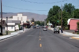
Richland is a city in Baker County
, Oregon
, United States
. The population was 147 at the 2000 census.
ted in 1897 due to needs from nearby mining and railroad interests. It replaced New Bridge
as the primary rural service center in the area.
between Baker City
and Oxbow
on the Oregon–Idaho border.
According to the United States Census Bureau
, the city has a total area of 0.1 square mile (0.258998811 km²), all land.
of 2000, there were 147 people, 86 households, and 41 families residing in the city. The population density
was 1,849.1 people per square mile (709.5/km²). There were 121 housing units at an average density of 1,522.0 per square mile (584.0/km²). The racial makeup of the city was 97.28% White, 0.68% Native American, 0.68% Asian, and 1.36% from two or more races. Hispanic or Latino of any race were 0.68% of the population.
There were 86 households out of which 7.0% had children under the age of 18 living with them, 41.9% were married couples
living together, 5.8% had a female householder with no husband present, and 51.2% were non-families. 45.3% of all households were made up of individuals and 29.1% had someone living alone who was 65 years of age or older. The average household size was 1.71 and the average family size was 2.31.
In the city the population was spread out with 8.2% under the age of 18, 1.4% from 18 to 24, 8.8% from 25 to 44, 35.4% from 45 to 64, and 46.3% who were 65 years of age or older. The median age was 63 years. For every 100 females there were 93.4 males. For every 100 females age 18 and over, there were 98.5 males.
The median income for a household in the city was $17,344, and the median income for a family was $27,500. Males had a median income of $25,000 versus $19,688 for females. The per capita income
for the city was $13,462. There were 11.4% of families and 18.4% of the population living below the poverty line, including 37.5% of under eighteens and 13.0% of those over 64.
Baker County, Oregon
Baker County is a county located in the U.S. state of Oregon. It is included in the 8 county definition of Eastern Oregon. It is named for Edward Dickinson Baker, a senator from Oregon who was killed at Ball's Bluff, a battle of the Civil War in Virginia in 1861. It was split from the eastern part...
, Oregon
Oregon
Oregon is a state in the Pacific Northwest region of the United States. It is located on the Pacific coast, with Washington to the north, California to the south, Nevada on the southeast and Idaho to the east. The Columbia and Snake rivers delineate much of Oregon's northern and eastern...
, United States
United States
The United States of America is a federal constitutional republic comprising fifty states and a federal district...
. The population was 147 at the 2000 census.
History
Richland was platPlat
A plat in the U.S. is a map, drawn to scale, showing the divisions of a piece of land. Other English-speaking countries generally call such documents a cadastral map or plan....
ted in 1897 due to needs from nearby mining and railroad interests. It replaced New Bridge
New Bridge, Oregon
New Bridge is an unincorporated community in Baker County, Oregon, United States, about three miles north of Richland and Oregon Route 86. Its elevation is 2369 feet ....
as the primary rural service center in the area.
Geography
Richland is located along Oregon Route 86Oregon Route 86
Oregon Route 86 is an Oregon state highway running from Interstate 84 at Baker City to the Idaho state line at Oxbow . OR 86 comprises most of the Baker-Copperfield Highway No. 12 . It is long and runs east–west. OR 86 has an unsigned spur near Halfway, which runs for...
between Baker City
Baker City, Oregon
Baker City is a city in and the county seat of Baker County, Oregon, United States. It was named after Edward D. Baker. The population was 9,828 at the 2010 census.-History:...
and Oxbow
Oxbow, Oregon
Oxbow is an unincorporated community in Baker County, Oregon, United States. Oxbow is located on Oregon Route 86 next to the Snake River near the Oxbow Dam on the Oregon-Idaho border, about 17 miles northeast of Halfway. Oxbow is just south of the site of the former mining town of Copperfield...
on the Oregon–Idaho border.
According to the United States Census Bureau
United States Census Bureau
The United States Census Bureau is the government agency that is responsible for the United States Census. It also gathers other national demographic and economic data...
, the city has a total area of 0.1 square mile (0.258998811 km²), all land.
Demographics
As of the censusCensus
A census is the procedure of systematically acquiring and recording information about the members of a given population. It is a regularly occurring and official count of a particular population. The term is used mostly in connection with national population and housing censuses; other common...
of 2000, there were 147 people, 86 households, and 41 families residing in the city. The population density
Population density
Population density is a measurement of population per unit area or unit volume. It is frequently applied to living organisms, and particularly to humans...
was 1,849.1 people per square mile (709.5/km²). There were 121 housing units at an average density of 1,522.0 per square mile (584.0/km²). The racial makeup of the city was 97.28% White, 0.68% Native American, 0.68% Asian, and 1.36% from two or more races. Hispanic or Latino of any race were 0.68% of the population.
There were 86 households out of which 7.0% had children under the age of 18 living with them, 41.9% were married couples
Marriage
Marriage is a social union or legal contract between people that creates kinship. It is an institution in which interpersonal relationships, usually intimate and sexual, are acknowledged in a variety of ways, depending on the culture or subculture in which it is found...
living together, 5.8% had a female householder with no husband present, and 51.2% were non-families. 45.3% of all households were made up of individuals and 29.1% had someone living alone who was 65 years of age or older. The average household size was 1.71 and the average family size was 2.31.
In the city the population was spread out with 8.2% under the age of 18, 1.4% from 18 to 24, 8.8% from 25 to 44, 35.4% from 45 to 64, and 46.3% who were 65 years of age or older. The median age was 63 years. For every 100 females there were 93.4 males. For every 100 females age 18 and over, there were 98.5 males.
The median income for a household in the city was $17,344, and the median income for a family was $27,500. Males had a median income of $25,000 versus $19,688 for females. The per capita income
Per capita income
Per capita income or income per person is a measure of mean income within an economic aggregate, such as a country or city. It is calculated by taking a measure of all sources of income in the aggregate and dividing it by the total population...
for the city was $13,462. There were 11.4% of families and 18.4% of the population living below the poverty line, including 37.5% of under eighteens and 13.0% of those over 64.