
Regional District of East Kootenay, British Columbia
Encyclopedia
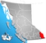
The Regional District of East Kootenay (RDEK) is a regional district in the Canadian province of British Columbia
, Canada
. As of the 2006 census
, the population
was 55,485. The area
is 27,560.48 square kilometres (10,641.16 sq mi). The regional district offices are in Cranbrook
, the largest community in the region. Other important population centers include the cities of Kimberley
and Fernie
, and the district municipality
of Invermere
and Sparwood
Despite its name, the regional district does not include all of the region known as the East Kootenay, which includes the Creston Valley
and the east shore of Kootenay Lake
.
, which is flanked by the Purcell Mountains
and Rocky Mountains
on the east and west, and includes the Columbia Valley
region, the southern half of which is in the regional district (its northern half is in the Columbia-Shuswap Regional District. Another distinct area within the regional district is the Elk Valley in the southern Rockies, which is the entrance to the Crowsnest Pass
and an important coal-mining region. Other than the Columbia
and Kootenay River
s, whose valleys form the bottomlands of the Rocky Mountain Trench, also included in the regional district are the northernmost parts of the basins of the Flathead
, Moyie
and Yahk Rivers (the Moyie and Yahk are tributaries of the Kootenay, entering it in the United States, and the Flathead is a tributary of the Clark Fork
in Montana
).
British Columbia
British Columbia is the westernmost of Canada's provinces and is known for its natural beauty, as reflected in its Latin motto, Splendor sine occasu . Its name was chosen by Queen Victoria in 1858...
, Canada
Canada
Canada is a North American country consisting of ten provinces and three territories. Located in the northern part of the continent, it extends from the Atlantic Ocean in the east to the Pacific Ocean in the west, and northward into the Arctic Ocean...
. As of the 2006 census
Census
A census is the procedure of systematically acquiring and recording information about the members of a given population. It is a regularly occurring and official count of a particular population. The term is used mostly in connection with national population and housing censuses; other common...
, the population
Population
A population is all the organisms that both belong to the same group or species and live in the same geographical area. The area that is used to define a sexual population is such that inter-breeding is possible between any pair within the area and more probable than cross-breeding with individuals...
was 55,485. The area
Area
Area is a quantity that expresses the extent of a two-dimensional surface or shape in the plane. Area can be understood as the amount of material with a given thickness that would be necessary to fashion a model of the shape, or the amount of paint necessary to cover the surface with a single coat...
is 27,560.48 square kilometres (10,641.16 sq mi). The regional district offices are in Cranbrook
Cranbrook, British Columbia
Cranbrook, British Columbia is a city in southeast British Columbia, located on the west side of the Kootenay River at its confluence with the St. Mary's River, It is the largest urban centre in the region known as the East Kootenay. As of 2006, Cranbrook's population is 18,267, and the...
, the largest community in the region. Other important population centers include the cities of Kimberley
Kimberley, British Columbia
Kimberley is a small city in southeast British Columbia, Canada along Highway 95A between the Purcell and Rocky Mountains. Kimberley was named in 1896 after the Kimberley mine in South Africa. From 1917 to 2001, it was the home to the world's largest lead-zinc mine, the Sullivan Mine...
and Fernie
Fernie, British Columbia
Fernie is a city in the Elk Valley area of the East Kootenay region of southeastern British Columbia, Canada, located on BC Highway 3 on the eastern approaches to the Crowsnest Pass through the Rocky Mountains...
, and the district municipality
District municipality
A district municipality is a designation for a class of municipalities found in several locations, including Canada, Lithuania, and South Africa.-Usage in British Columbia:...
of Invermere
Invermere, British Columbia
Invermere is a community in eastern British Columbia, Canada, near the border of Alberta. With its growing permanent population of almost 4,000 , swelling to near 40,000 on summer weekends, it is the hub of the Columbia Valley between Golden, and Cranbrook...
and Sparwood
Sparwood, British Columbia
-Newspapers:* Fernie Free Press - Weekly Paper* Elk Valley Herald - Weekly Paper* Kootenay News Advertiser - Weekly Paper* The Valley - Weekly Paper* Fernie Fix - Monthly Glossy Magazine* Black Rock News - Semimonthly-Radio stations:...
Despite its name, the regional district does not include all of the region known as the East Kootenay, which includes the Creston Valley
Creston Valley
The Creston Valley is a Canadian river delta wetland and Wildlife Management Area near Creston in south-central British Columbia, on the floodplain of the Kootenay River at the south end of Kootenay Lake. Predominantly marshland, it was classified as a wetland of international importance on...
and the east shore of Kootenay Lake
Kootenay Lake
Kootenay Lake is a lake located in British Columbia, Canada and is part of theKootenay River. The lake has been raised by the Corra Linn Dam and has a dike system at the southern end, which, along with industry in the 1950s-70s, has changed the ecosystem in and around the water...
.
Geography
The regional district's dominant landform is the Rocky Mountain TrenchRocky Mountain Trench
The Rocky Mountain Trench, or the Trench or The Valley of a Thousand Peaks, is a large valley in the northern part of the Rocky Mountains. It is both visually and cartographically a striking physiographic feature extending approximately from Flathead Lake, Montana, to the Liard River, just south...
, which is flanked by the Purcell Mountains
Purcell Mountains
The Purcell Mountains are a mountain range in southeastern British Columbia, Canada. They are a subrange of the Columbia Mountains, which includes the Selkirk, Monashee, and Cariboo Mountains. They are located on the west side of the Rocky Mountain Trench in the area of the Columbia Valley, and on...
and Rocky Mountains
Canadian Rockies
The Canadian Rockies comprise the Canadian segment of the North American Rocky Mountains range. They are the eastern part of the Canadian Cordillera, extending from the Interior Plains of Alberta to the Rocky Mountain Trench of British Columbia. The southern end borders Idaho and Montana of the USA...
on the east and west, and includes the Columbia Valley
Columbia Valley
The Columbia Valley is the name used for a region in the Rocky Mountain Trench near the headwaters of the Columbia River between the town of Golden and the Canal Flats. The main hub of the valley is the town of Invermere. Other towns include Radium Hot Springs, Windermere and Fairmont Hot Springs...
region, the southern half of which is in the regional district (its northern half is in the Columbia-Shuswap Regional District. Another distinct area within the regional district is the Elk Valley in the southern Rockies, which is the entrance to the Crowsnest Pass
Crowsnest Pass
Crowsnest Pass is a high mountain pass across the Continental Divide of the Canadian Rockies on the Alberta/British Columbia border.-Geography:...
and an important coal-mining region. Other than the Columbia
Columbia River
The Columbia River is the largest river in the Pacific Northwest region of North America. The river rises in the Rocky Mountains of British Columbia, Canada, flows northwest and then south into the U.S. state of Washington, then turns west to form most of the border between Washington and the state...
and Kootenay River
Kootenay River
The Kootenay is a major river in southeastern British Columbia, Canada and the northern part of the U.S. states of Montana and Idaho. It is one of the uppermost major tributaries of the Columbia River, which is the largest North American river that empties into the Pacific Ocean...
s, whose valleys form the bottomlands of the Rocky Mountain Trench, also included in the regional district are the northernmost parts of the basins of the Flathead
Flathead River
The Flathead River, in the northwestern part of the U.S. state of Montana, originates in the Rocky Mountains near Glacier National Park and flows southwest into Flathead Lake, then after a journey of , empties into the Clark Fork. The river is part of the Columbia River drainage basin, as the Clark...
, Moyie
Moyie River
The Moyie River is a tributary of the Kootenai River in the U.S. state of Idaho and the Canadian province of British Columbia. The Moyie River is part of the Columbia River basin, being a tributary of the Kootenay River, which is tributary to the Columbia River.-Course:The Moyie River originates...
and Yahk Rivers (the Moyie and Yahk are tributaries of the Kootenay, entering it in the United States, and the Flathead is a tributary of the Clark Fork
Clark Fork (river)
The Clark Fork is a river in the U.S. states of Montana and Idaho, approximately long. The largest river by volume in Montana, it drains an extensive region of the Rocky Mountains in western Montana and northern Idaho in the watershed of the Columbia River, flowing northwest through a long...
in Montana
Montana
Montana is a state in the Western United States. The western third of Montana contains numerous mountain ranges. Smaller, "island ranges" are found in the central third of the state, for a total of 77 named ranges of the Rocky Mountains. This geographical fact is reflected in the state's name,...
).