
Rancho Penasquitos, San Diego, California
Encyclopedia
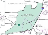
Rancho Peñasquitos is a community in the northeastern part of the city of San Diego, California
. It is named after the first Spanish Land Grant in the County - Rancho de Los Penasquitos. Peñasquitos means little cliffs in Spanish
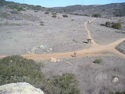
. It abuts Los Penasquitos canyon preserve - an open space preserve - that offers hiking, biking, and equestrian trails. The community is commonly abbreviated "PQ."
The population of PQ is approximately 55,000; it is located in ZIP code
92129. The telephone area code is 858.
The highest point in the community is Black Mountain
, which rises to an elevation of 1500 feet (457.2 m).
history within the area dates back as far as 7,000 years ago. Remains of the prehistoric culture can still be found. Rancho de los Peñasquitos was present day San Diego County's first Mexican land grant
, the Rancho Santa Maria de Los Peñasquitos
. In 1823, one league
(4,243 acre
s; 17 km²) was awarded to Captain Francisco María Ruiz
, a Commandant of the Presidio of San Diego
. This one league was at the eastern part of the Los Penasquitos Canyon and extended into Sabre Springs
and up to Rancho Bernardo
.
and emergency medical services
are provided by the San Diego Fire-Rescue Department fire station #40 at 13393 Salmon River Rd in the area of Rancho Peñasquitos. This station is in the 7th Battalion.
operates from a station on 13396 Salmon River Rd, serving the neighborhood.
California
California is a state located on the West Coast of the United States. It is by far the most populous U.S. state, and the third-largest by land area...
. It is named after the first Spanish Land Grant in the County - Rancho de Los Penasquitos. Peñasquitos means little cliffs in Spanish
Spanish language
Spanish , also known as Castilian , is a Romance language in the Ibero-Romance group that evolved from several languages and dialects in central-northern Iberia around the 9th century and gradually spread with the expansion of the Kingdom of Castile into central and southern Iberia during the...
. It abuts Los Penasquitos canyon preserve - an open space preserve - that offers hiking, biking, and equestrian trails. The community is commonly abbreviated "PQ."
The population of PQ is approximately 55,000; it is located in ZIP code
ZIP Code
ZIP codes are a system of postal codes used by the United States Postal Service since 1963. The term ZIP, an acronym for Zone Improvement Plan, is properly written in capital letters and was chosen to suggest that the mail travels more efficiently, and therefore more quickly, when senders use the...
92129. The telephone area code is 858.
Geography
Rancho Peñasquitos is roughly bounded:- On the north by Black Mountain RanchBlack Mountain Ranch, San Diego, CaliforniaBlack Mountain Ranch is a community in the northeastern part of the city of San Diego, California. Black Mountain Ranch encompasses and is located north of Rancho Penasquitos and Torrey Highlands, south of the Santa Fe Valley, east of Fairbanks Ranch and Rancho Santa Fe, and west of 4S Ranch.The...
and Rancho BernardoRancho Bernardo, San Diego, CaliforniaRancho Bernardo is an upscale master-planned community in the northern hills of the city of San Diego, California.-Geography:The topography of Rancho Bernardo consists of canyons and rolling hills... - On the south by Los Peñasquitos Canyon PreserveLos Peñasquitos Canyon PreserveLos Peñasquitos Canyon Preserve is an urban park in San Diego, California. Stretching approximately , the park encompasses some of both Peñasquitos and Lopez canyons, and is one of the largest urban parks in the United States. The preserve is jointly owned and administered by the City of San Diego...
and Mira MesaMira Mesa, San Diego, CaliforniaMira Mesa is a large suburb that is part of the city of San Diego, California.Mira Mesa is bordered by Interstate 15 to the east, Interstate 805 to the west, the Los Peñasquitos Canyon to the north and Marine Corps Air Station Miramar, to the south. The west end of Mira Mesa is a business and... - On the east by Carmel Mountain RanchCarmel Mountain Ranch, San Diego, CaliforniaCarmel Mountain Ranch, sometimes shortened to simply Carmel Mountain, such as on maps, or abbreviated to CMR by local residents and organizations, is a community of San Diego, California in the northeastern part of that city.-Geography:...
, PowayPoway, CaliforniaPoway is a city in San Diego County, California. Originally an unincorporated community in San Diego County, Poway officially became a city in December 1980. Even though Poway lies geographically in the middle of San Diego County, most consider its relative location as north county inland...
, and Sabre SpringsSabre Springs, San Diego, CaliforniaSabre Springs is a community of San Diego, California in the northeastern part of that city. It is roughly bounded by the city limits of Poway on the east, Ted Williams Parkway on the north, the 15 on the west, and Poway Road and on the south.... - On the west by Torrey HighlandsTorrey Highlands, San Diego, CaliforniaTorrey Highlands is a primarily residential community in northern San Diego, California. Most of the community has been developed from 2000 to present.-Geography:...
and Del Mar MesaDel Mar Mesa, San Diego, CaliforniaDel Mar Mesa is a primarily residential community of located in northern San Diego, California. The majority of the community has been developed in the 2000s....
.
The highest point in the community is Black Mountain
Black Mountain Open Space Park
Black Mountain Open Space Park is a city park located in San Diego, California. The park covers in the Black Mountain Ranch and Rancho Peñasquitos area of northern San Diego. The park includes the 1,558 foot Black Mountain and preserves coastal sage scrub and chaparral plant communities...
, which rises to an elevation of 1500 feet (457.2 m).
History
Native American KumeyaayKumeyaay
The Kumeyaay, also known as Tipai-Ipai, Kamia, or formerly Diegueño, are Native American people of the extreme southwestern United States and northwest Mexico. They live in the states of California in the US and Baja California in Mexico. In Spanish, the name is commonly spelled...
history within the area dates back as far as 7,000 years ago. Remains of the prehistoric culture can still be found. Rancho de los Peñasquitos was present day San Diego County's first Mexican land grant
Ranchos of California
The Spanish, and later the Méxican government encouraged settlement of territory now known as California by the establishment of large land grants called ranchos, from which the English ranch is derived. Devoted to raising cattle and sheep, the owners of the ranchos attempted to pattern themselves...
, the Rancho Santa Maria de Los Peñasquitos
Rancho Santa Maria de Los Peñasquitos
Rancho Santa Maria de Los Peñasquitos was a Mexican land grant in present day southwestern San Diego County, California given in 1823 to Francisco María Ruiz. The name means "Saint Mary of the Little Cliffs"...
. In 1823, one league
League (unit)
A league is a unit of length . It was long common in Europe and Latin America, but it is no longer an official unit in any nation. The league originally referred to the distance a person or a horse could walk in an hour...
(4,243 acre
Acre
The acre is a unit of area in a number of different systems, including the imperial and U.S. customary systems. The most commonly used acres today are the international acre and, in the United States, the survey acre. The most common use of the acre is to measure tracts of land.The acre is related...
s; 17 km²) was awarded to Captain Francisco María Ruiz
Francisco María Ruiz
Francisco María Ruiz was an early settler of San Diego, CaliforniaRuiz was born 1754 in Loreto, Baja California. He enlisted in the army when he was 26 and sent to Upper California...
, a Commandant of the Presidio of San Diego
Presidio of San Diego
El Presidio Reál de San Diego is an historical fort established on May 14, 1769, by Commandant Pedro Fages for Spain. It was the first permanent European settlement on the Pacific Coast of the United States. As the first of the presidios and Spanish missions in California, it was the base of...
. This one league was at the eastern part of the Los Penasquitos Canyon and extended into Sabre Springs
Sabre Springs, San Diego, California
Sabre Springs is a community of San Diego, California in the northeastern part of that city. It is roughly bounded by the city limits of Poway on the east, Ted Williams Parkway on the north, the 15 on the west, and Poway Road and on the south....
and up to Rancho Bernardo
Rancho Bernardo, San Diego, California
Rancho Bernardo is an upscale master-planned community in the northern hills of the city of San Diego, California.-Geography:The topography of Rancho Bernardo consists of canyons and rolling hills...
.
Demographics
According to the 2000 Census, 47,217 people resided in ZIP code 92129, a majority of which were between 18 and 65 years old. American FactFinder Additional details can be seen here.Infrastructure
State Route 56 traverses east-west through the central portion of the community. Interstate 15 passes on the east side of Rancho Peñasquitos. Black Mountain Road is the main North-South artery, and Carmel Mountain Road/Rancho Peñasquitos Boulevard is the main East-West artery.Community events
- Fiesta de los Peñasquitos is a community oriented street faire held on the First Sunday in May
- In Honor of the Fourth of July, Westview High School features a fireworks show (which until recently was hosted by Mt. Carmel High School) (This show usually is held on July 3rd).
- Christmas Card LaneChristmas Card LaneChristmas Card Lane is a holiday light display in San Diego, California in the community of Rancho Penasquitos. It is one of the most famous holiday displays in San Diego....
(starting at Oviedo Street - off Black Mtn. Rd) from Dec 10 until Dec 31.
Media
- Rancho Penasquitos Community Web Portal
- 92129 Magazine
- Paranormal Activity was shot in one of the tract houses in the community.
Fire service
Fire protectionFire protection
Fire protection is the study and practice of mitigating the unwanted effects of fires. It involves the study of the behaviour, compartmentalisation, suppression and investigation of fire and its related emergencies, as well as the research and development, production, testing and application of...
and emergency medical services
Emergency medical services
Emergency medical services are a type of emergency service dedicated to providing out-of-hospital acute medical care and/or transport to definitive care, to patients with illnesses and injuries which the patient, or the medical practitioner, believes constitutes a medical emergency...
are provided by the San Diego Fire-Rescue Department fire station #40 at 13393 Salmon River Rd in the area of Rancho Peñasquitos. This station is in the 7th Battalion.
Police Service
The San Diego Police DepartmentSan Diego Police Department
The San Diego Police Department is the primary law enforcement agency for the city of San Diego, California. Established on May 9, 1889, the first chief of police was Joseph Coyne. The current police chief is William Lansdowne.-History:...
operates from a station on 13396 Salmon River Rd, serving the neighborhood.
Parks
- PQ Skate Park
- Canyonside Recreation Center
- Hilltop Recreation Center
- Peñasquitos Creek Park
- rolling hills park
- Black Mountain Open Space ParkBlack Mountain Open Space ParkBlack Mountain Open Space Park is a city park located in San Diego, California. The park covers in the Black Mountain Ranch and Rancho Peñasquitos area of northern San Diego. The park includes the 1,558 foot Black Mountain and preserves coastal sage scrub and chaparral plant communities...
- Los Peñasquitos Canyon PreserveLos Peñasquitos Canyon PreserveLos Peñasquitos Canyon Preserve is an urban park in San Diego, California. Stretching approximately , the park encompasses some of both Peñasquitos and Lopez canyons, and is one of the largest urban parks in the United States. The preserve is jointly owned and administered by the City of San Diego...
- Twin Trails Neighborhood Park
High schools
- Abraxas High School
- Del Norte High SchoolDel Norte High School (San Diego, California)Del Norte High School is a secondary school located in 4S Ranch, a community of San Diego, California in the United States. It is part of the Poway Unified School District. The campus has finished construction, and it covers of land....
- Mt. Carmel High School
- Poway High SchoolPoway High SchoolPoway High School is a public, comprehensive high school located in the city of Poway, California. Established in 1961, it serves ninth through twelfth grade students from the communities of Poway and Rancho Bernardo. The school mascot is the Titan...
- Rancho Bernardo High SchoolRancho Bernardo High SchoolRancho Bernardo High School, or RBHS, is a public high school in the Poway Unified School District of San Diego County, California. Rancho Bernardo High School opened in September 1990 as the district's third high school. There are approximately 2,300 students in grades 9 through 12, and...
- Westview High SchoolWestview High School (San Diego)Westview High School is a public secondary school located in Torrey Highlands, a community of San Diego, California in the United States. It is part of the Poway Unified School District....
Middle schools
- Bernardo Heights Middle School
- Black Mountain Middle SchoolBlack Mountain Middle SchoolBlack Mountain Middle School , a National Blue Ribbon School in 1991 and 2000, and a California Distinguished School in 1999, 1994, and 1992, is a school in the Poway Unified School District and is located in Rancho Peñasquitos...
- Meadowbrook Middle School
- Mesa Verde Middle SchoolMesa Verde Middle School (Rancho Peñasquitos)-Feeders and Location:Mesa Verde Middle School is located in the northern part of San Diego, just west of Interstate 15 and about east of Interstate 5. To the south is California State Route 56. There are four elementary "feeder schools" of Mesa Verde: Canyon View Elementary School, Deer Canyon...
- Twin Peaks Middle School
- Oak Valley Middle School
Elementary schools
- Adobe Bluffs Elementary School
- Canyon View Elementary School
- Chaparral Elementary School
- Creekside Elementary School
- Deer Canyon Elementary School
- Garden Road Elementary School
- Highland Ranch Elementary School
- Los Peñasquitos Elementary School
- Midland Elementary School
- Monterey Ridge Elementary School
- Morning Creek Elementary School
- Painted Rock Elementary School
- Park Village Elementary SchoolPark Village Elementary SchoolPark Village Elementary School, often abbreviated PVES, is located at 7930 Park Village Road in Rancho Penasquitos, California. It is part of the Poway Unified School District. Its principal is Ricardo Cecena.-Demographics:...
- Pomerade Elementary School
- Rolling Hills Elementary School
- Shoal Creek Elementary School
- Stone Ranch Elementary School
- Sundance Elementary School)
- Sunset Hills Elementary School
- Tierra Bonita Elementary School
- Turtleback Elementary School
- Valley Elementary School
- Westwood Elementary School