
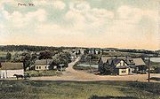
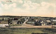
Perry, Maine
Encyclopedia
Perry is a town in Washington County
, Maine
, United States
, on the Canadian
border. As of the 2000 census, the town had a total population of 847.
Once part of Plantation T1 TS, the area was settled in 1758 by John Frost, who built a trading post
beside the St. Croix River
. Situated on Passamaquoddy Bay
, the town was incorporated on February 12, 1818, even as the British
held Eastport
six miles away. It was named after Commodore Oliver Hazard Perry
, hero of the War of 1812
. Part of the community lies within the Pleasant Point Passamaquoddy Indian Reservation.
, the town has a total area of 42.6 square miles (110.3 km²), of which, 29.5 square miles (76.4 km²) of it is land and 13.1 square miles (33.9 km²) of it (30.85%) is water. Located beside Passamaquoddy Bay, Perry is drained by the St. Croix River.
of 2000, there were 847 people, 331 households, and 238 families residing in the town. The population density
was 28.8 people per square mile (11.1/km²). There were 529 housing units at an average density of 18.0 per square mile (6.9/km²). The racial makeup of the town was 86.19% White, 0.24% African American, 11.92% Native American, 0.12% Pacific Islander, and 1.53% from two or more races.
There were 331 households out of which 34.1% had children under the age of 18 living with them, 55.3% were married couples
living together, 10.0% had a female householder with no husband present, and 27.8% were non-families. 21.5% of all households were made up of individuals and 8.8% had someone living alone who was 65 years of age or older. The average household size was 2.54 and the average family size was 2.92.
In the town the population was spread out with 27.5% under the age of 18, 7.4% from 18 to 24, 27.2% from 25 to 44, 26.7% from 45 to 64, and 11.2% who were 65 years of age or older. The median age was 37 years. For every 100 females there were 92.9 males. For every 100 females age 18 and over, there were 99.4 males.
The median income for a household in the town was $27,788, and the median income for a family was $35,104. Males had a median income of $31,442 versus $22,292 for females. The per capita income
for the town was $14,285. About 15.9% of families and 17.5% of the population were below the poverty line, including 17.2% of those under age 18 and 32.5% of those age 65 or over.
Washington County, Maine
Washington County is a county located in the U.S. state of Maine. In 2010, its population was 32,856. Its county seat is Machias.Sometimes referred to as "Sunrise County" because it is the easternmost county in the United States, and it is often where the rising sun first shines on the 48...
, Maine
Maine
Maine is a state in the New England region of the northeastern United States, bordered by the Atlantic Ocean to the east and south, New Hampshire to the west, and the Canadian provinces of Quebec to the northwest and New Brunswick to the northeast. Maine is both the northernmost and easternmost...
, United States
United States
The United States of America is a federal constitutional republic comprising fifty states and a federal district...
, on the Canadian
Canada
Canada is a North American country consisting of ten provinces and three territories. Located in the northern part of the continent, it extends from the Atlantic Ocean in the east to the Pacific Ocean in the west, and northward into the Arctic Ocean...
border. As of the 2000 census, the town had a total population of 847.
History
Once part of Plantation T1 TS, the area was settled in 1758 by John Frost, who built a trading post
Trading post
A trading post was a place or establishment in historic Northern America where the trading of goods took place. The preferred travel route to a trading post or between trading posts, was known as a trade route....
beside the St. Croix River
St. Croix River (Maine-New Brunswick)
The St. Croix River is a river in northeastern North America, in length, that forms part of the Canada – United States border between Maine and New Brunswick . The river rises in the Chiputneticook Lakes and flows south and southeast, between Calais and St. Stephen...
. Situated on Passamaquoddy Bay
Passamaquoddy Bay
Passamaquoddy Bay is an inlet of the Bay of Fundy, between the U.S. state of Maine and the Canadian province of New Brunswick, at the mouth of the St. Croix River. Most of the bay lies within Canada, with its western shore bounded by Washington County, Maine. The southernmost point is formed by...
, the town was incorporated on February 12, 1818, even as the British
Great Britain
Great Britain or Britain is an island situated to the northwest of Continental Europe. It is the ninth largest island in the world, and the largest European island, as well as the largest of the British Isles...
held Eastport
Eastport, Maine
Eastport is a small city in Washington County, Maine, United States. The population was 1,640 at the 2000 census. The principal island is Moose Island, which is connected to the mainland by causeway...
six miles away. It was named after Commodore Oliver Hazard Perry
Oliver Hazard Perry
United States Navy Commodore Oliver Hazard Perry was born in South Kingstown, Rhode Island , the son of USN Captain Christopher Raymond Perry and Sarah Wallace Alexander, a direct descendant of William Wallace...
, hero of the War of 1812
War of 1812
The War of 1812 was a military conflict fought between the forces of the United States of America and those of the British Empire. The Americans declared war in 1812 for several reasons, including trade restrictions because of Britain's ongoing war with France, impressment of American merchant...
. Part of the community lies within the Pleasant Point Passamaquoddy Indian Reservation.
Geography
According to the United States Census BureauUnited States Census Bureau
The United States Census Bureau is the government agency that is responsible for the United States Census. It also gathers other national demographic and economic data...
, the town has a total area of 42.6 square miles (110.3 km²), of which, 29.5 square miles (76.4 km²) of it is land and 13.1 square miles (33.9 km²) of it (30.85%) is water. Located beside Passamaquoddy Bay, Perry is drained by the St. Croix River.
Demographics
As of the censusCensus
A census is the procedure of systematically acquiring and recording information about the members of a given population. It is a regularly occurring and official count of a particular population. The term is used mostly in connection with national population and housing censuses; other common...
of 2000, there were 847 people, 331 households, and 238 families residing in the town. The population density
Population density
Population density is a measurement of population per unit area or unit volume. It is frequently applied to living organisms, and particularly to humans...
was 28.8 people per square mile (11.1/km²). There were 529 housing units at an average density of 18.0 per square mile (6.9/km²). The racial makeup of the town was 86.19% White, 0.24% African American, 11.92% Native American, 0.12% Pacific Islander, and 1.53% from two or more races.
There were 331 households out of which 34.1% had children under the age of 18 living with them, 55.3% were married couples
Marriage
Marriage is a social union or legal contract between people that creates kinship. It is an institution in which interpersonal relationships, usually intimate and sexual, are acknowledged in a variety of ways, depending on the culture or subculture in which it is found...
living together, 10.0% had a female householder with no husband present, and 27.8% were non-families. 21.5% of all households were made up of individuals and 8.8% had someone living alone who was 65 years of age or older. The average household size was 2.54 and the average family size was 2.92.
In the town the population was spread out with 27.5% under the age of 18, 7.4% from 18 to 24, 27.2% from 25 to 44, 26.7% from 45 to 64, and 11.2% who were 65 years of age or older. The median age was 37 years. For every 100 females there were 92.9 males. For every 100 females age 18 and over, there were 99.4 males.
The median income for a household in the town was $27,788, and the median income for a family was $35,104. Males had a median income of $31,442 versus $22,292 for females. The per capita income
Per capita income
Per capita income or income per person is a measure of mean income within an economic aggregate, such as a country or city. It is calculated by taking a measure of all sources of income in the aggregate and dividing it by the total population...
for the town was $14,285. About 15.9% of families and 17.5% of the population were below the poverty line, including 17.2% of those under age 18 and 32.5% of those age 65 or over.