

Pequop Mountains
Encyclopedia
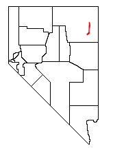
Elko County, Nevada
-Demographics:As of the census of 2000, there were 45,291 people, 15,638 households, and 11,493 families residing in the county. The population density was 3/sq mi . There were 18,456 housing units at an average density of 1/sq mi...
, in northeastern Nevada
Nevada
Nevada is a state in the western, mountain west, and southwestern regions of the United States. With an area of and a population of about 2.7 million, it is the 7th-largest and 35th-most populous state. Over two-thirds of Nevada's people live in the Las Vegas metropolitan area, which contains its...
in the western United States
United States
The United States of America is a federal constitutional republic comprising fifty states and a federal district...
. The range runs generally north-south for approximately 51 miles (82 km). The high point of the range is an unnamed peak (9249 feet, 2819 m) located at 40°55.46'N and 114°35.38'W.
The range comprises two distinct groups of mountains, separated by a low line of hills at Flower Pass. To the west is Independence Valley and the East Humboldt Range
East Humboldt Range
The East Humboldt Range is a line of mountains in northeastern Nevada in the Great Basin region of the western United States. It located in central Elko County in the upper watershed of the Humboldt River, which flows to the southwest from its source just north of the range.The East Humboldts run...
, while to the east is Goshute Valley
Goshute Valley
The Goshute Valley is an endorheic landform of the Great Basin. The towns of Oasis and Cobre are in the valley's north, and the central and north of the valley contains broken flatlands, with short washes draining from the surrounding mountain ranges....
and the Toano Range
Toano Range
The Toano Range is a group of mountains located in the eastern part of Elko County, in the northeastern section of the state of Nevada in the Great Basin region of the western United States. The highest point in the range reaches ....
. The southern section of the range, bending slightly to the southwest, essentially merges with Spruce Mountain
Spruce Mountain
Spuce Mountain is a mountain in Elko County, in the northeastern section of the state of Nevada in the Great Basin region of the western United States. The summit is at ....
, and is the location of the South Pequop Wilderness Study Area.
These mountains are a serious obstacle to travel between the more level terrain of the Great Salt Lake Desert
Great Salt Lake Desert
The Great Salt Lake Desert is a large dry lake in northern Utah between the Great Salt Lake and the Nevada border which is noted for white sand from evaporite Lake Bonneville salt deposits...
and the Humboldt River Valley
Humboldt River
The Humboldt River runs through northern Nevada in the western United States. At approximately long it is the second longest river in the Great Basin, after the Bear River. It has no outlet to the ocean, but instead empties into the Humboldt Sink...
. The First Transcontinental Railroad
First Transcontinental Railroad
The First Transcontinental Railroad was a railroad line built in the United States of America between 1863 and 1869 by the Central Pacific Railroad of California and the Union Pacific Railroad that connected its statutory Eastern terminus at Council Bluffs, Iowa/Omaha, Nebraska The First...
was routed around the north end of the range, on its way to Promontory Summit in Utah
Utah
Utah is a state in the Western United States. It was the 45th state to join the Union, on January 4, 1896. Approximately 80% of Utah's 2,763,885 people live along the Wasatch Front, centering on Salt Lake City. This leaves vast expanses of the state nearly uninhabited, making the population the...
. The later Western Pacific Railroad
Western Pacific Railroad
The Western Pacific Railroad was a Class I railroad in the United States. It was formed in 1903 as an attempt to break the near-monopoly the Southern Pacific Railroad had on rail service into northern California...
line, which crosses the Great Salt Lake Desert, tunnelled through the range at Flower Pass (which was itself part of the historic Hastings Cutoff
Hastings Cutoff
The Hastings Cutoff was an alternate route for emigrants to travel to California, as proposed by Lansford Hastings.In 1845, Hastings published a guide entitled The Emigrant's Guide to Oregon and California...
route). Interstate 80
Interstate 80
Interstate 80 is the second-longest Interstate Highway in the United States, following Interstate 90. It is a transcontinental artery running from downtown San Francisco, California to Teaneck, New Jersey in the New York City Metropolitan Area...
crosses the northern section of the range at 6967 ft (2,123.5 m) Pequop Summit, its highest point between Parley's Summit
Parley's Summit
Parleys Summit is a mountain pass in the Wasatch Mountains in Utah traversed by Interstate 80. It is the summit of Parleys Canyon, and the town of Summit Park is nearby....
in the Wasatch Mountains of Utah
Utah
Utah is a state in the Western United States. It was the 45th state to join the Union, on January 4, 1896. Approximately 80% of Utah's 2,763,885 people live along the Wasatch Front, centering on Salt Lake City. This leaves vast expanses of the state nearly uninhabited, making the population the...
and Donner Summit in the Sierra Nevada Range of California
California
California is a state located on the West Coast of the United States. It is by far the most populous U.S. state, and the third-largest by land area...
.
External links
- Pequop Mountains - PeakBagger.com
- South Pequop Wilderness Study Area - Friends of Nevada Wilderness