

Pennsylvania Route 910
Encyclopedia
Pennsylvania Route 910 is an east–west state highway in Allegheny County, Pennsylvania
, in the Pittsburgh Metropolitan Area. It travels nineteen miles (30 km) between I-79
in Wexford
and Freeport Road, former Pennsylvania Route 28
in Harmarville
.
Two portions of the Allegheny County Belt System routes run along PA 910:
 PA 910 begins at an interchange with I-79
on the border of Franklin Park
and Marshall Township
, heading east-northeast on three-lane undivided Wexford Bayne Road into Marshall Township, carrying two westbound lanes and one eastbound lane. At this point, the route is concurrent with the Orange Belt of the Allegheny County Belt System
. The road passes a few businesses before narrowing to two lanes and running past residential subdivisions. PA 910 continues into Pine Township
and comes to an interchange with US 19
in Wexford
. At this point, the route becomes Wexford Road and heads east through forested areas. Farther east, the road passes through a mix of woods and residential development, entering Richland Township
. In this area, PA 910 becomes Gibsonia Road and passes over I-76
(Pennsylvania Turnpike
) before heading through wooded areas of homes. The route passes through Gibsonia
and crosses a Buffalo and Pittsburgh Railroad
line, passing through more wooded residential areas as it comes to an intersection with PA 8
in a commercial area.
Past this, the road turns southeast and runs near more housing subdivisions, crossing into West Deer Township
and passing near businesses. At the intersection with Oak Road, the Orange Belt splits from PA 910 by heading east on that road, and PA 910 curves south. The route turns southeast and then south again, passing a mix of fields, woods, and homes. At the Cedar Ridge Road intersection, the Yellow Belt joins PA 910 for the remainder of the route and the road heads into Indiana Township
, coming to another bridge over the Pennsylvania Turnpike). The road curves southeast through woods before passing through the residential community of Dorseyville
. The route heads east and crosses over the Pennsylvania Turnpike again, making another turn to the southeast through wooded areas of development. PA 910 heads south and passes over the Pennsylvania Turnpike a fourth time, reaching the community of Indianola. The route continues southeast through wooded areas of residential and commercial development a short distance to the west of the Pennsylvania Turnpike, entering Harmar Township
. The road becomes Indianola Road and passes through forests, becoming a three-lane road with two eastbound lanes and one westbound lane. PA 910 makes a sharp turn to the southwest and becomes a two-lane divided highway
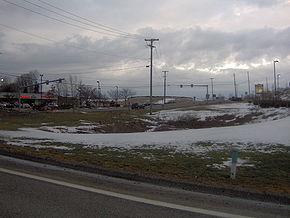
, coming to an interchange with the PA 28
freeway. At this point, the route widens into a four-lane divided highway and passes businesses, reaching its terminus at Freeport Road.
Allegheny County, Pennsylvania
Allegheny County is a county in the southwestern part of the U.S. state of Pennsylvania. As of the 2010 census, the population was 1,223,348; making it the second most populous county in Pennsylvania, following Philadelphia County. The county seat is Pittsburgh...
, in the Pittsburgh Metropolitan Area. It travels nineteen miles (30 km) between I-79
Interstate 79
Interstate 79 is an Interstate Highway in the eastern United States, designated from Interstate 77 in Charleston, West Virginia to Pennsylvania Route 5 and Pennsylvania Route 290 in Erie, Pennsylvania...
in Wexford
Wexford, Pennsylvania
Wexford is an unincorporated community in Allegheny County, Pennsylvania, United States. The area known as Wexford is split among multiple municipalities, including Franklin Park, McCandless, Pine Township, and Marshall Township...
and Freeport Road, former Pennsylvania Route 28
Pennsylvania Route 28
Pennsylvania Route 28 is a major state highway which runs for 97 miles from Interstate 279 and Interstate 579 at the Interstate 279 Interchange in Pittsburgh to U.S. Route 219 in Brockway in the U.S. state of Pennsylvania. The expressway from Kittanning to Pittsburgh is called the Alexander H...
in Harmarville
Harmarville, Pennsylvania
Harmarville, Pennsylvania is an unincorporated community located in Harmar Township, Allegheny County, Pennsylvania. Although it is not tracked by the U.S. Census, the population is estimated to be 1,200 residents....
.
Two portions of the Allegheny County Belt System routes run along PA 910:
- Orange Belt (11 miles) from PA 910's western terminus in Franklin Park to Oak Rd. in Gibsonia
- Yellow Belt (6.3 miles) from Cedar Ridge Rd. in Allison Park to PA 910's eastern terminus in Harmarville
Route description
Interstate 79
Interstate 79 is an Interstate Highway in the eastern United States, designated from Interstate 77 in Charleston, West Virginia to Pennsylvania Route 5 and Pennsylvania Route 290 in Erie, Pennsylvania...
on the border of Franklin Park
Franklin Park, Pennsylvania
Franklin Park is a borough in Allegheny County, Pennsylvania, United States. The population was 13,470 at the 2010 census.-Geography:Franklin Park is located at ....
and Marshall Township
Marshall Township, Pennsylvania
Marshall Township is a township in Allegheny County, Pennsylvania, United States. The population was 6,915 at the 2010 census.-Geography:According to the United States Census Bureau, the township has a total area of 15.6 square miles , all of it land...
, heading east-northeast on three-lane undivided Wexford Bayne Road into Marshall Township, carrying two westbound lanes and one eastbound lane. At this point, the route is concurrent with the Orange Belt of the Allegheny County Belt System
Allegheny County belt system
The Allegheny County Belt System color codes miscellaneous county roads to form a unique system of routes in Allegheny County, Pennsylvania and around the city of Pittsburgh....
. The road passes a few businesses before narrowing to two lanes and running past residential subdivisions. PA 910 continues into Pine Township
Pine Township, Allegheny County, Pennsylvania
Pine Township is a township in Allegheny County, Pennsylvania, United States. The population was 11,497 at the 2010 census.-Geography:According to the United States Census Bureau, the township has a total area of , of which 0.06% is water.-Demographics:...
and comes to an interchange with US 19
U.S. Route 19 in Pennsylvania
U.S. Route 19 in Pennsylvania closely parallels Interstate 79 for its entire length. US 19 enters Pennsylvania in Greene County near Mount Morris. Its northern terminus is in the city of Erie. Part is named for Commodore Oliver Hazard Perry, hero of the Battle of Lake Erie.-Route description:In...
in Wexford
Wexford, Pennsylvania
Wexford is an unincorporated community in Allegheny County, Pennsylvania, United States. The area known as Wexford is split among multiple municipalities, including Franklin Park, McCandless, Pine Township, and Marshall Township...
. At this point, the route becomes Wexford Road and heads east through forested areas. Farther east, the road passes through a mix of woods and residential development, entering Richland Township
Richland Township, Allegheny County, Pennsylvania
Richland Township is a township in Allegheny County, Pennsylvania, United States. The population was 11,100 at the 2010 census.-Geography:According to the United States Census Bureau, the township has a total area of 14.6 square miles , all of it land.-Demographics:As of the census of 2000,...
. In this area, PA 910 becomes Gibsonia Road and passes over I-76
Interstate 76 (east)
Interstate 76 is an Interstate Highway in the United States, running 435 miles from an interchange with Interstate 71 west of Akron, Ohio, east to Interstate 295 near Camden, New Jersey....
(Pennsylvania Turnpike
Pennsylvania Turnpike
The Pennsylvania Turnpike is a toll highway system operated by the Pennsylvania Turnpike Commission in the Commonwealth of Pennsylvania, United States. The three sections of the turnpike system total . The main section extends from Ohio to New Jersey and is long...
) before heading through wooded areas of homes. The route passes through Gibsonia
Gibsonia, Pennsylvania
Gibsonia is an unincorporated community and census-designated place in Allegheny County in the U.S. state of Pennsylvania, north of the city of Pittsburgh. It had a population of 2,733 at the 2010 census. Its ZIP Code is 15044.-Geography:...
and crosses a Buffalo and Pittsburgh Railroad
Buffalo and Pittsburgh Railroad
The Buffalo and Pittsburgh Railroad is a Class II railroad operating in New York and Pennsylvania.The BPRR is owned by Genesee and Wyoming Industries. Its main line runs between Buffalo, New York and Eidenau, Pennsylvania, north of Pittsburgh. Here, connections are made to the city center via the...
line, passing through more wooded residential areas as it comes to an intersection with PA 8
Pennsylvania Route 8
Pennsylvania Route 8 is a major long route in western Pennsylvania. Officially, PA 8 is named the William Flinn Highway. Its southern terminus is at Interstate 376, U.S. Route 22, and U.S. Route 30 in Pittsburgh...
in a commercial area.
Past this, the road turns southeast and runs near more housing subdivisions, crossing into West Deer Township
West Deer Township, Pennsylvania
West Deer Township is a township in Allegheny County, Pennsylvania in the United States. The population was 11,771 at the 2010 census.-History:...
and passing near businesses. At the intersection with Oak Road, the Orange Belt splits from PA 910 by heading east on that road, and PA 910 curves south. The route turns southeast and then south again, passing a mix of fields, woods, and homes. At the Cedar Ridge Road intersection, the Yellow Belt joins PA 910 for the remainder of the route and the road heads into Indiana Township
Indiana Township, Pennsylvania
Indiana Township is a township in Allegheny County, Pennsylvania in the United States. The population was 7,253 at the 2010 census.-Geography:According to the United States Census Bureau, the township has a total area of , all of it land.-Demographics:...
, coming to another bridge over the Pennsylvania Turnpike). The road curves southeast through woods before passing through the residential community of Dorseyville
Dorseyville, Pennsylvania
Dorseyville is an unincorporated village in Indiana Township, Allegheny County, Pennsylvania in the United States.-History:...
. The route heads east and crosses over the Pennsylvania Turnpike again, making another turn to the southeast through wooded areas of development. PA 910 heads south and passes over the Pennsylvania Turnpike a fourth time, reaching the community of Indianola. The route continues southeast through wooded areas of residential and commercial development a short distance to the west of the Pennsylvania Turnpike, entering Harmar Township
Harmar Township, Pennsylvania
Harmar Township is a township in Allegheny County, Pennsylvania, United States. The population was 2,921 at the 2010 census.-Geography:According to the United States Census Bureau, the township has a total area of , of which is land and , or 7.45%, is water.-Streams:Harmar Township is entirely in...
. The road becomes Indianola Road and passes through forests, becoming a three-lane road with two eastbound lanes and one westbound lane. PA 910 makes a sharp turn to the southwest and becomes a two-lane divided highway
Divided Highway
Divided Highway is a compilation album by American rock band The Doobie Brothers, released in 2003. . All tracks are taken from the albums Cycles and Brotherhood .-Track listing:...
, coming to an interchange with the PA 28
Pennsylvania Route 28
Pennsylvania Route 28 is a major state highway which runs for 97 miles from Interstate 279 and Interstate 579 at the Interstate 279 Interchange in Pittsburgh to U.S. Route 219 in Brockway in the U.S. state of Pennsylvania. The expressway from Kittanning to Pittsburgh is called the Alexander H...
freeway. At this point, the route widens into a four-lane divided highway and passes businesses, reaching its terminus at Freeport Road.