
Orsett
Encyclopedia
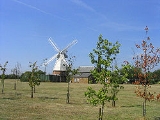
Orsett is a village and ecclesiastical parish located within Thurrock
unitary district in Essex
, England
, situated around 5 km north-east of Grays
. All residences within the postal district of Orsett have RM16 3__ postcodes.
.
Orsett contains a ring and bailey earthwork
known locally as Bishop Bonner's palace. On the gravel terrace, there is a neolithic Causewayed enclosure
discovered by as a result of crop mark
s which showed on aerial photographs
taken by Dr St Joseph
of Cambridge University. It has three concentric ditches with a number of breaks or causeways. The enclosure was used as a burial ground by the Saxons and contained at least three barrows
visible on the aerial photo.
Orsett Heath
in the south of the parish was formerly part of an extensive area of heathland that included Terrel's Heath
.
Two public houses have survived in the centre of the village, one being the prize-winning Whitmore Arms, the other the Foxhound, and outside the village centre, Orsett has one additional pub - The Kings Arms. The Orsett Cock, for many years a landmark, closed its doors as a public house in 2010, and is currently (March 2011) undergoing conversion into an Indian restaurant called Voujon.
Orsett also has 2 BP Garages off the A13, which both have M&S convenience stores, whilst the south services also possess a McDonalds fast food establishment.
Orsett is also home to South Essex Wildlife Hospital . Dedicated to putting ‘life’ back into the ‘wild‘, it is a wildlife rescue, rehabilitation and public advice charity. They care for sick and injured wildlife and aim to release animals back into the wild. No injured or sick animal is turned away, staffed only by dedicated volunteers. For more information, visit http://southessexwildlife.org/.
), and contains Whitmore Hall, the 'Home of Orsett Scouts'. During 2009, planning permission for a further 11 new homes was granted for the westernmost part of this estate.
Most of the former hospital site has been re-developed as housing in the last five years. The redevelopment provided 200 houses, despite being within the green belt
and avoided the need to provide affordable housing on the site.
The historic Orsett Hall
on Prince Charles's Avenue, the home of the Whitmore family until their estate was sold in the late-1960s, was destroyed by fire in May 2007 but was rebuilt during 2008/09. The exterior design is in keeping with the original Georgian building. It was used for a Help for Heroes
charity event on 11th April, 2010. Orsett House is an early-eighteenth-century house off the High Street and on the western edge of the village.
It has a well-equipped village hall at its western end and a centre for the churches in the High Street.
and Horndon-on-the-Hill
. Politically, it has traditionally been Conservative. Mrs Teresa Gorman
, the former Conservative Member of Parliament for the Billericay constituency, is probably Orsett's best known resident.
Thurrock
Thurrock is a unitary authority with borough status in the English ceremonial county of Essex. It is part of the London commuter belt and an area of regeneration within the Thames Gateway redevelopment zone. The local authority is Thurrock Council....
unitary district in Essex
Essex
Essex is a ceremonial and non-metropolitan county in the East region of England, and one of the home counties. It is located to the northeast of Greater London. It borders with Cambridgeshire and Suffolk to the north, Hertfordshire to the west, Kent to the South and London to the south west...
, England
England
England is a country that is part of the United Kingdom. It shares land borders with Scotland to the north and Wales to the west; the Irish Sea is to the north west, the Celtic Sea to the south west, with the North Sea to the east and the English Channel to the south separating it from continental...
, situated around 5 km north-east of Grays
Grays
Grays is the largest town in the borough and unitary authority of Thurrock in Essex and one of the Thurrock's traditional parishes...
. All residences within the postal district of Orsett have RM16 3__ postcodes.
History
It has historically been a primarily agricultural community situated at the southern edge of the old ice age flood plain traversed by the river MardykeMardyke (river)
The Mardyke is a small river, mainly in Thurrock, that flows into the River Thames at Purfleet, close to the Queen Elizabeth II Bridge. In part, it forms the boundary between the Essex hundreds of Barstable and Chafford...
.
Orsett contains a ring and bailey earthwork
Earthworks (archaeology)
In archaeology, earthwork is a general term to describe artificial changes in land level. Earthworks are often known colloquially as 'lumps and bumps'. Earthworks can themselves be archaeological features or they can show features beneath the surface...
known locally as Bishop Bonner's palace. On the gravel terrace, there is a neolithic Causewayed enclosure
Causewayed enclosure
A causewayed enclosure is a type of large prehistoric earthwork common to the early Neolithic in Europe. More than 100 examples are recorded in France and 70 in England, while further sites are known in Scandinavia, Belgium, Germany, Italy, Ireland and Slovakia.The term "causewayed enclosure" is...
discovered by as a result of crop mark
Crop mark
Crop mark may refer to*in printing, marks placed at the corners of a form to indicate where the page is to be trimmed*Cropmarks, in archaeology: differential growth indicating buried sites*Crop circles...
s which showed on aerial photographs
Aerial photography
Aerial photography is the taking of photographs of the ground from an elevated position. The term usually refers to images in which the camera is not supported by a ground-based structure. Cameras may be hand held or mounted, and photographs may be taken by a photographer, triggered remotely or...
taken by Dr St Joseph
Kenneth St Joseph
John Kenneth Sinclair St Joseph, CBE was a British archaeologist, geologist and Royal Air Force veteran who pioneered the use of aerial photography as a method of archaeological research in Britain and Ireland.-Early life:...
of Cambridge University. It has three concentric ditches with a number of breaks or causeways. The enclosure was used as a burial ground by the Saxons and contained at least three barrows
Tumulus
A tumulus is a mound of earth and stones raised over a grave or graves. Tumuli are also known as barrows, burial mounds, Hügelgrab or kurgans, and can be found throughout much of the world. A tumulus composed largely or entirely of stones is usually referred to as a cairn...
visible on the aerial photo.
Orsett Heath
Orsett Heath
Orsett Heath is a location and recently built hamlet in the unitary authority of Thurrock, in the ceremonial county of Essex. It is located about twenty miles away from London. Nearby settlements include the towns of Tilbury and Grays Thurrock and the villages of Orsett and Chadwell St Mary. For...
in the south of the parish was formerly part of an extensive area of heathland that included Terrel's Heath
Terrel's Heath
Terrel's Heath is, in spite of its name, an area of woodland in Chadwell St Mary named on the 1938 six-inch Ordnance Survey map.-Location and description: Terrel's Heath is adjacent to Woodside Primary School in Little Thurrock...
.
Layout and Facilities
The centre of Orsett is aligned on an east-west axis along the High Road upon which the parish church of St Giles and All Saints is located along with the animal pound and lock-up opposite Rowley Road. Its former workhouse on Rowley Road was developed into a large modern hospital in the 1960s but has, since the 1980s, been reduced in size once again despite intense local opposition. Most of the former shops in the High Road - e.g. the hairdressers, the Post Office opposite the Church, the butcher's shop, Pigg's store and the store selling honey - along with the blacksmith's in Rowley Road have closed to be replaced by just one convenience store, which itself contains a small post office, succeeding the previous Post Office, which closed due to retirement in mid-2009.Two public houses have survived in the centre of the village, one being the prize-winning Whitmore Arms, the other the Foxhound, and outside the village centre, Orsett has one additional pub - The Kings Arms. The Orsett Cock, for many years a landmark, closed its doors as a public house in 2010, and is currently (March 2011) undergoing conversion into an Indian restaurant called Voujon.
Orsett also has 2 BP Garages off the A13, which both have M&S convenience stores, whilst the south services also possess a McDonalds fast food establishment.
Orsett is also home to South Essex Wildlife Hospital . Dedicated to putting ‘life’ back into the ‘wild‘, it is a wildlife rescue, rehabilitation and public advice charity. They care for sick and injured wildlife and aim to release animals back into the wild. No injured or sick animal is turned away, staffed only by dedicated volunteers. For more information, visit http://southessexwildlife.org/.
Education
The village's primary school has been located since the mid-19th century in School Lane educating children up to the age of 14 until 1944 and to 11 thereafter.Buildings
Apart from some small-scale Council housing in Ridgewell Avenue to the North of the High Street, there was no significant growth in residential development until 1954-55 when new properties were erected in School Lane. These were followed by further developments on the former site of the Anglican Rectory (known as Herga Hyll following its sale), off Rectory and Conways Roads and off Rowley Road. During the late 1980s and throughout the 1990s, a new housing estate was built on land that belonged to the old container site, and some of the ex-military Orsett Camp site, between Stanford Road and Orsett Golf Course. This estate is commonly known as Bonners (after Bishop BonnerEdmund Bonner
Edmund Bonner , Bishop of London, was an English bishop. Initially an instrumental figure in the schism of Henry VIII from Rome, he was antagonized by the Protestant reforms introduced by Somerset and reconciled himself to Roman Catholicism...
), and contains Whitmore Hall, the 'Home of Orsett Scouts'. During 2009, planning permission for a further 11 new homes was granted for the westernmost part of this estate.
Most of the former hospital site has been re-developed as housing in the last five years. The redevelopment provided 200 houses, despite being within the green belt
Green belt
A green belt or greenbelt is a policy and land use designation used in land use planning to retain areas of largely undeveloped, wild, or agricultural land surrounding or neighbouring urban areas. Similar concepts are greenways or green wedges which have a linear character and may run through an...
and avoided the need to provide affordable housing on the site.
The historic Orsett Hall
Orsett Hall
Orsett Hall was a 17th century grade 2 listed building in Orsett, Essex . It was set in of parkland and was the centre of the Orsett Hall agricultural estate. The house was destroyed by fire on 11 May 2007 and rebuilt in the same style and on the same footprint as the original building in 2009...
on Prince Charles's Avenue, the home of the Whitmore family until their estate was sold in the late-1960s, was destroyed by fire in May 2007 but was rebuilt during 2008/09. The exterior design is in keeping with the original Georgian building. It was used for a Help for Heroes
Help for Heroes
Help for Heroes is a British charity launched on 1 October 2007 to help provide better facilities for British servicemen and women wounded since September 11, 2001. It was founded by Bryn Parry OBE and his wife Emma Parry OBE after they visited soldiers at Selly Oak Hospital in Birmingham...
charity event on 11th April, 2010. Orsett House is an early-eighteenth-century house off the High Street and on the western edge of the village.
It has a well-equipped village hall at its western end and a centre for the churches in the High Street.
Sport
Orsett is home to a very well known cricket club and to a football club HSSC Orsett. It has one tennis court and a bowling green.Politics
Orsett is part of a ward that also contains BulphanBulphan
Bulphan is a village in the borough of Thurrock in the East of England and one of the traditional parishes in Thurrock. It is pronounced 'Bull-ven' though newcomers often mispronounce it as 'Bul-fan'....
and Horndon-on-the-Hill
Horndon-on-the-Hill
Horndon-on-the-Hill is a village and Church of England parish in the unitary authority of Thurrock. It is about a mile northwest of Stanford le Hope and about two miles northeast of Orsett - from 1894, it was part of the Orsett Rural District....
. Politically, it has traditionally been Conservative. Mrs Teresa Gorman
Teresa Gorman
Teresa Ellen Gorman is a British politician, and was Conservative Member of Parliament for Billericay, in the county of Essex in England until 2001 when she stood down...
, the former Conservative Member of Parliament for the Billericay constituency, is probably Orsett's best known resident.