
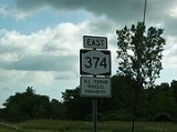
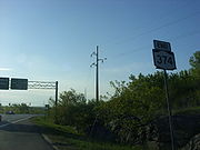
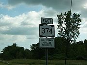
New York State Route 374
Encyclopedia
New York State Route 374 (NY 374) is a state highway
in the North Country
of New York
in the United States. The route follows a generally northwest to southeast progression; however, the portion of the route within Franklin County
runs north–south and is signed in the same manner. The western terminus of NY 374 is at the Canada – United States border north of the village of Chateaugay
, where the road continues north as Quebec Route 202. Its eastern terminus is at an intersection with NY 22
north of the city of Plattsburgh
.
Most of the alignment of Route 374 is located in the Adirondack Park, heading along the shorelines of several large lakes in the northern part of the park, including the two Chateaugay Lakes and Chazy Lake. The route serves as the major road in the area of the Adirondacks for most of its length, and as a major arterial in the city of Plattsburgh itself. NY 374 was assigned in the 1930 state route renumbering from NY 3
in Cadyville to the state line. It was extended eastward to NY 22 in Plattsburgh in the 1970s following the completion of an arterial bypassing northern Plattsburgh.
as County Route 52 (CR 52) and named River Street. Route 374 intersects with McCormick Road, which heads eastward to Earlville
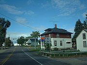
. The route begins to parallel Chasm Road (CR 35), which meets its eastern termini at Route 374. Although the last few miles have been basically undeveloped rural forests. Paralleling CR 35, the highway enters the developed community of Chateaugay
.
 In Chauteaugay, Route 374 heads past the local baseball fields and passes several of the local developments. The route remains known as River Street until an intersection with U.S. Route 11
(US 11, named Main Street), where it changes names to Depot Street and becomes maintained by the New York State Department of Transportation
(NYSDOT). The route continues southward out of Chateaugay and back into the local forests and fields, where it passes to the east of High Falls Park. At the intersection with Pulpmill Road, Route 374 continues to the southeast, losing any sight of development around the highway. The route parallels Healey Road and intersects with Number Five Road, where the highway moves around in different directions. The route continues along the Chateaugay River and into Brainardsville, where it intersects with NY 190
(Military Turnpike) and CR 24 (Brainardsville Road), which heads westward to SUNY Potsdam. The route leaves Brainardsville shortly after the intersection with Reynolds Road.
Route 374, after leaving the community of Brainardsville, heads southwestward through some local residential developments before an intersection with Davis Road, where it turns to the southeastward. The route continues in this direction, intersecting with the western terminus of Forge Road (CR 54), a former alignment of Route 190 that heads eastward to the Clinton County
line. Route 374 becomes very undeveloped again before following the shores of Lower Chateaugay Lake's eastern side. The route follows the short length of the shoreline. At the point where the lake turns into the Chateaugay Narrows, Route 374 enters the Adirondack Park and Clinton County.
In Clinton County, Route 374 continues along the Narrows, intersecting with Harris Road, which is a dead-end locla road. The route continues southward, intersecting with Narrows Road, which crosses over the Narrows and enters a partially-developed community. The route continues to the southeast running along the eastern shoreline of Upper Chateaugay Lake. A short distance later, Route 374 heads to the east, along the shoreline into Merrill, a small community in the area. The road is moderately developed, until curving to the southeast and away from the shoreline of Upper Chateaugay Lake.
, where it intersects with Bradley Pond Road (CR 2). The route continues into the moderately developed community, where it intersects with Standish Road (CR 1). The route here turns eastward, intersecting with local roads before leaving the community of Lyon Mountain and back into the undeveloped rural areas.
 Route 374 continues through the undeveloped regions of the Adirondack Park and heads along a northeastern pace to an intersection with Chazy Lake Road (CR 29) on the shores of Chazy Lake. Route 374, which runs along the northern shoreline of the lake, serves as the northern terminus of Chazy Lake Road. The route continues along the northeastern shoreline and direction along Chazy Lake before turning to the southeast at a bend in the highway. Route 374 continues now on an eastward progression away from the lake becoming developed residentially once again. The route than intersects with Plank Road (CR 8) and begins a southeastern progression. The route turns to the south, heading along the deep forests in the Adirondack Park. Route 374 continues southward for a couple miles along the forests, making a bend in the curve into the community of Dannemora
. In Dannemora, Route 374 heads eastward, intersecting with Emmonds Street, where it becomes highly developed commercially and residentially. The route progresses eastward, passing a large commercial strip, intersecting with General LeRoy Manor Road (CR 26), where it leaves Dannemora.
 After leaving the community of Dannemora, the route heads to the southeast and back into the forests of the Adirondack Park. Route 374 continues eastward, progressing the to the north of downtown Cadyville. The highway turns to the northeast once again, entering Cadyville, where the route approaches an interchange with NY 3
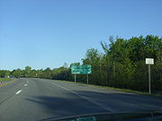
. At this interchange, Route 374 becomes a bypass, remaining a two-lane route with at-grade intersections with local roads, like Rand Hill Road, as it bypasses Cadyville and West Plattsburgh, paralleling Route 3. After West Plattsburgh, Route 3 curves to the southeast to intersect NY 22B, and Route 374 remains on an eastern track, intersecting Route 190, which intersected back in Brainardsville. Remaining a 55 miles per hour (24.6 m/s) two-lane arterial, the road parallels other main east–west roads like Tom Miller Road (CR 26), Route 3 (Cornelia Street) and Rugar Street. Just before its final junction with NY 22
, the road widens to a divided four-lane highway in preparation for the nearby junction of Interstate 87 and curving into one-way streets in the city of Plattsburgh
.
 NY 374 was assigned as part of the 1930 renumbering of state highways in New York. It initially began at the Canada – United States border north of the village of Chateaugay
and ended at an intersection with NY 3
in Cadyville, a small hamlet within the town of Plattsburgh
. At the time, NY 3 was the primary east–west highway into the city of Plattsburgh
. In the early 1970s, a new highway was constructed north of NY 3 between NY 374 and NY 22
just outside the Plattsburgh city limits. The roadway effectively supplanted NY 3 as the main east–west road into the city; in fact, a 2.5 miles (4 km) section of the highway was built within 200 yards (182.9 m) of NY 3. The highway was completed by 1973 as an eastward extension of NY 374.
On April 1, 1980, ownership and maintenance of NY 374 from its junction with US 11
in the village of Chateaugay to the Canadian border was transferred from the state of New York
to Franklin County
as part of a highway maintenance swap between the two levels of government. This section of NY 374 is now co-designated
as the unsigned CR 52.
State highway
State highway, state road or state route can refer to one of three related concepts, two of them related to a state or provincial government in a country that is divided into states or provinces :#A...
in the North Country
North Country, New York
The North Country is a region of the U.S. state of New York that encompasses the state's extreme northern frontier, bordering Lake Ontario on the west, the Saint Lawrence River and the Canadian provinces of Ontario and Quebec on the north and northwest, and Lake Champlain and Vermont on the east...
of New York
New York
New York is a state in the Northeastern region of the United States. It is the nation's third most populous state. New York is bordered by New Jersey and Pennsylvania to the south, and by Connecticut, Massachusetts and Vermont to the east...
in the United States. The route follows a generally northwest to southeast progression; however, the portion of the route within Franklin County
Franklin County, New York
Franklin County is a county located in the U.S. state of New York. As of the 2010 census, the population was 51,599. It is named in honor of American Founding Father Benjamin Franklin...
runs north–south and is signed in the same manner. The western terminus of NY 374 is at the Canada – United States border north of the village of Chateaugay
Chateaugay (village), New York
Chateaugay is a village located in the in Franklin County New York, USA. The population was 798 at the 2000 census. The village and town are named after a village near Lyon in France, which became the name of a land grant in Canada....
, where the road continues north as Quebec Route 202. Its eastern terminus is at an intersection with NY 22
New York State Route 22
New York State Route 22 is a north–south state highway in eastern New York in the United States. It runs parallel to the state's eastern edge from the outskirts of New York City to a short distance south of the Canadian border. At , it is the state's longest north–south route and...
north of the city of Plattsburgh
Plattsburgh (city), New York
Plattsburgh is a city in and county seat of Clinton County, New York, United States. The population was 19,989 at the 2010 census. The population of the unincorporated areas within the Town of Plattsburgh was 11,870 as of the 2010 census; making the population for the immediate, urban Plattsburgh,...
.
Most of the alignment of Route 374 is located in the Adirondack Park, heading along the shorelines of several large lakes in the northern part of the park, including the two Chateaugay Lakes and Chazy Lake. The route serves as the major road in the area of the Adirondacks for most of its length, and as a major arterial in the city of Plattsburgh itself. NY 374 was assigned in the 1930 state route renumbering from NY 3
New York State Route 3
New York State Route 3 is a major east–west state highway in New York, United States, that connects central New York to the North Country region near the Canadian border via Adirondack Park. The route extends for between its western terminus at an intersection with NY 104A in the Cayuga...
in Cadyville to the state line. It was extended eastward to NY 22 in Plattsburgh in the 1970s following the completion of an arterial bypassing northern Plattsburgh.
Canadian border and the Chateaugay Lakes region
Route 374 begins at the Canada – United States border near the community of Hinchinbroke, Quebec, as the continuation of Quebec Route 202 (Herdman Customs Road). The route heads southward, maintained by Franklin CountyFranklin County, New York
Franklin County is a county located in the U.S. state of New York. As of the 2010 census, the population was 51,599. It is named in honor of American Founding Father Benjamin Franklin...
as County Route 52 (CR 52) and named River Street. Route 374 intersects with McCormick Road, which heads eastward to Earlville
Earlville, New York
Earlville is a village in New York, United States. The population was 791 at the 2000 census. The village is named after Jonas Earl, a canal commissioner....
. The route begins to parallel Chasm Road (CR 35), which meets its eastern termini at Route 374. Although the last few miles have been basically undeveloped rural forests. Paralleling CR 35, the highway enters the developed community of Chateaugay
Chateaugay (village), New York
Chateaugay is a village located in the in Franklin County New York, USA. The population was 798 at the 2000 census. The village and town are named after a village near Lyon in France, which became the name of a land grant in Canada....
.
U.S. Route 11 in New York
U.S. Route 11 is a part of the U.S. Highway System that runs from New Orleans, Louisiana, to the Canadian border at Rouses Point, New York...
(US 11, named Main Street), where it changes names to Depot Street and becomes maintained by the New York State Department of Transportation
New York State Department of Transportation
The New York State Department of Transportation is responsible for the development and operation of highways, railroads, mass transit systems, ports, waterways and aviation facilities in the U.S...
(NYSDOT). The route continues southward out of Chateaugay and back into the local forests and fields, where it passes to the east of High Falls Park. At the intersection with Pulpmill Road, Route 374 continues to the southeast, losing any sight of development around the highway. The route parallels Healey Road and intersects with Number Five Road, where the highway moves around in different directions. The route continues along the Chateaugay River and into Brainardsville, where it intersects with NY 190
New York State Route 190
New York State Route 190 is an east–west state highway in the North Country of New York in the United States. The western terminus of the route is at an intersection with NY 374 in the community of Brainardsville within the town of Bellmont. Its eastern terminus is at a junction with...
(Military Turnpike) and CR 24 (Brainardsville Road), which heads westward to SUNY Potsdam. The route leaves Brainardsville shortly after the intersection with Reynolds Road.
Route 374, after leaving the community of Brainardsville, heads southwestward through some local residential developments before an intersection with Davis Road, where it turns to the southeastward. The route continues in this direction, intersecting with the western terminus of Forge Road (CR 54), a former alignment of Route 190 that heads eastward to the Clinton County
Clinton County, New York
Clinton County is a county located in the U.S. state of New York. As of the 2010 census, the population was 82,128. Its name is in honor of the first Governor of New York as a state, George Clinton. Its county seat is Plattsburgh.-History:...
line. Route 374 becomes very undeveloped again before following the shores of Lower Chateaugay Lake's eastern side. The route follows the short length of the shoreline. At the point where the lake turns into the Chateaugay Narrows, Route 374 enters the Adirondack Park and Clinton County.
In Clinton County, Route 374 continues along the Narrows, intersecting with Harris Road, which is a dead-end locla road. The route continues southward, intersecting with Narrows Road, which crosses over the Narrows and enters a partially-developed community. The route continues to the southeast running along the eastern shoreline of Upper Chateaugay Lake. A short distance later, Route 374 heads to the east, along the shoreline into Merrill, a small community in the area. The road is moderately developed, until curving to the southeast and away from the shoreline of Upper Chateaugay Lake.
Lyon Mountain to the Plattsburgh arterial
After leaving the shorelines of the lakes, Route 374 intersects with Sunset Road, which is a local road heading to the southwest back to the lake. The route continues to the southeast, entering the community of Lyon MountainLyon Mountain, New York
Lyon Mountain is a hamlet located in the Town of Dannemora in Clinton County, New York, United States. The population was 423 at the 2010 census.Lyon Mountain is in the western part of the town....
, where it intersects with Bradley Pond Road (CR 2). The route continues into the moderately developed community, where it intersects with Standish Road (CR 1). The route here turns eastward, intersecting with local roads before leaving the community of Lyon Mountain and back into the undeveloped rural areas.
Dannemora (village), New York
Dannemora is a village located primarily in the Town of Dannemora in Clinton County, New York. The population was 3,936 at the 2010 census. The name is derived from Dannemora, Sweden, an iron-making town where early settlers came from ....
. In Dannemora, Route 374 heads eastward, intersecting with Emmonds Street, where it becomes highly developed commercially and residentially. The route progresses eastward, passing a large commercial strip, intersecting with General LeRoy Manor Road (CR 26), where it leaves Dannemora.
New York State Route 3
New York State Route 3 is a major east–west state highway in New York, United States, that connects central New York to the North Country region near the Canadian border via Adirondack Park. The route extends for between its western terminus at an intersection with NY 104A in the Cayuga...
. At this interchange, Route 374 becomes a bypass, remaining a two-lane route with at-grade intersections with local roads, like Rand Hill Road, as it bypasses Cadyville and West Plattsburgh, paralleling Route 3. After West Plattsburgh, Route 3 curves to the southeast to intersect NY 22B, and Route 374 remains on an eastern track, intersecting Route 190, which intersected back in Brainardsville. Remaining a 55 miles per hour (24.6 m/s) two-lane arterial, the road parallels other main east–west roads like Tom Miller Road (CR 26), Route 3 (Cornelia Street) and Rugar Street. Just before its final junction with NY 22
New York State Route 22
New York State Route 22 is a north–south state highway in eastern New York in the United States. It runs parallel to the state's eastern edge from the outskirts of New York City to a short distance south of the Canadian border. At , it is the state's longest north–south route and...
, the road widens to a divided four-lane highway in preparation for the nearby junction of Interstate 87 and curving into one-way streets in the city of Plattsburgh
Plattsburgh (city), New York
Plattsburgh is a city in and county seat of Clinton County, New York, United States. The population was 19,989 at the 2010 census. The population of the unincorporated areas within the Town of Plattsburgh was 11,870 as of the 2010 census; making the population for the immediate, urban Plattsburgh,...
.
History
Chateaugay (village), New York
Chateaugay is a village located in the in Franklin County New York, USA. The population was 798 at the 2000 census. The village and town are named after a village near Lyon in France, which became the name of a land grant in Canada....
and ended at an intersection with NY 3
New York State Route 3
New York State Route 3 is a major east–west state highway in New York, United States, that connects central New York to the North Country region near the Canadian border via Adirondack Park. The route extends for between its western terminus at an intersection with NY 104A in the Cayuga...
in Cadyville, a small hamlet within the town of Plattsburgh
Plattsburgh (town), New York
Plattsburgh is a town in Clinton County, New York, United States. The population was 11,870 at the 2010 census. The town is named after Zephaniah Platt, an early land owner.The Town of Plattsburgh borders the City of Plattsburgh...
. At the time, NY 3 was the primary east–west highway into the city of Plattsburgh
Plattsburgh (city), New York
Plattsburgh is a city in and county seat of Clinton County, New York, United States. The population was 19,989 at the 2010 census. The population of the unincorporated areas within the Town of Plattsburgh was 11,870 as of the 2010 census; making the population for the immediate, urban Plattsburgh,...
. In the early 1970s, a new highway was constructed north of NY 3 between NY 374 and NY 22
New York State Route 22
New York State Route 22 is a north–south state highway in eastern New York in the United States. It runs parallel to the state's eastern edge from the outskirts of New York City to a short distance south of the Canadian border. At , it is the state's longest north–south route and...
just outside the Plattsburgh city limits. The roadway effectively supplanted NY 3 as the main east–west road into the city; in fact, a 2.5 miles (4 km) section of the highway was built within 200 yards (182.9 m) of NY 3. The highway was completed by 1973 as an eastward extension of NY 374.
On April 1, 1980, ownership and maintenance of NY 374 from its junction with US 11
U.S. Route 11 in New York
U.S. Route 11 is a part of the U.S. Highway System that runs from New Orleans, Louisiana, to the Canadian border at Rouses Point, New York...
in the village of Chateaugay to the Canadian border was transferred from the state of New York
New York
New York is a state in the Northeastern region of the United States. It is the nation's third most populous state. New York is bordered by New Jersey and Pennsylvania to the south, and by Connecticut, Massachusetts and Vermont to the east...
to Franklin County
Franklin County, New York
Franklin County is a county located in the U.S. state of New York. As of the 2010 census, the population was 51,599. It is named in honor of American Founding Father Benjamin Franklin...
as part of a highway maintenance swap between the two levels of government. This section of NY 374 is now co-designated
Concurrency (road)
A concurrency, overlap, or coincidence in a road network is an instance of one physical road bearing two or more different highway, motorway, or other route numbers...
as the unsigned CR 52.