

New Hampshire Route 114
Encyclopedia
New Hampshire Route 114 (abbreviated NH 114) is a 60.39 miles (97.2 km) long secondary north–south highway in central New Hampshire
. The highway runs between Bedford
, in Hillsborough County
and Grantham
, in Sullivan County
.
 The southern terminus of NH 114 is at New Hampshire Route 101
in Bedford. The northern terminus is at New Hampshire Route 10
in Grantham. The highway maintains a northwest-southeast alignment from Bedford northward.
in southeast New Hampshire
. The highway connects Goffstown
with downtown Manchester
.
The eastern terminus of NH 114A is at U.S. Route 3 and New Hampshire Route 3A
in Manchester on the west side of the Merrimack River
. The western terminus is at the junction with New Hampshire Route 114 in Goffstown. The route maintains a northwest-southeast routing for its entire length.
New Hampshire
New Hampshire is a state in the New England region of the northeastern United States of America. The state was named after the southern English county of Hampshire. It is bordered by Massachusetts to the south, Vermont to the west, Maine and the Atlantic Ocean to the east, and the Canadian...
. The highway runs between Bedford
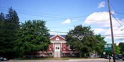
Bedford, New Hampshire
-Demographics:As of the Census of 2000, there were 18,274 people, 6,251 households, and 5,125 families residing in the town. The population density was 556.6 people per square mile . There were 6,401 housing units at an average density of 195.0 per square mile...
, in Hillsborough County
Hillsborough County, New Hampshire
-Demographics:As of the census of 2000, there were 380,841 people, 144,455 households, and 98,807 families residing in the county. The population density was 435 people per square mile . There were 149,961 housing units at an average density of 171 per square mile...
and Grantham
Grantham, New Hampshire
Grantham is a town in Sullivan County, New Hampshire, United States. The population was 2,985 at the 2010 census. This made Grantham the fastest growing town numerically in Sullivan County between the 2000 and 2010 censuses...
, in Sullivan County
Sullivan County, New Hampshire
-Demographics:As of the census of 2000, there were 40,458 people, 16,530 households, and 11,174 families residing in the county. The population density was 29/; . There were 20,158 housing units at an average density of 38 per square mile...
.
New Hampshire Route 101
New Hampshire Route 101 is a state-maintained highway in southern New Hampshire extending from Keene to Hampton Beach. It is the major east–west highway in the southern portion of the state....
in Bedford. The northern terminus is at New Hampshire Route 10
New Hampshire Route 10
New Hampshire Route 10 is a north–south state highway in the U.S. state of New Hampshire. Its southern terminus is at the Massachusetts state line in the town of Winchester. In Massachusetts the highway becomes Massachusetts Route 10. Total length of the highway is .-Route description:NH 10...
in Grantham. The highway maintains a northwest-southeast alignment from Bedford northward.
Suffixed routes
New Hampshire Route 114A (abbreviated NH 114A) is a 3.69 miles (5.9 km) long east–west highway in Hillsborough CountyHillsborough County, New Hampshire
-Demographics:As of the census of 2000, there were 380,841 people, 144,455 households, and 98,807 families residing in the county. The population density was 435 people per square mile . There were 149,961 housing units at an average density of 171 per square mile...
in southeast New Hampshire
New Hampshire
New Hampshire is a state in the New England region of the northeastern United States of America. The state was named after the southern English county of Hampshire. It is bordered by Massachusetts to the south, Vermont to the west, Maine and the Atlantic Ocean to the east, and the Canadian...
. The highway connects Goffstown
Goffstown, New Hampshire
Goffstown is a town in Hillsborough County, New Hampshire, United States. The population was 17,651 at the 2010 census. The compact center of town, where 3,196 people resided at the 2010 census, is defined by the U.S. Census Bureau as the Goffstown census-designated place and is located at the...
with downtown Manchester
Manchester, New Hampshire
Manchester is the largest city in the U.S. state of New Hampshire, the tenth largest city in New England, and the largest city in northern New England, an area comprising the states of Maine, New Hampshire, and Vermont. It is in Hillsborough County along the banks of the Merrimack River, which...
.
The eastern terminus of NH 114A is at U.S. Route 3 and New Hampshire Route 3A
New Hampshire Route 3A
New Hampshire Route 3A is a designation held by two separate state highways in New Hampshire. The two segments, although not directly connected, are linked by U.S. Route 3, from which they derive their route number.-Southern segment:...
in Manchester on the west side of the Merrimack River
Merrimack River
The Merrimack River is a river in the northeastern United States. It rises at the confluence of the Pemigewasset and Winnipesaukee rivers in Franklin, New Hampshire, flows southward into Massachusetts, and then flows northeast until it empties into the Atlantic Ocean at Newburyport...
. The western terminus is at the junction with New Hampshire Route 114 in Goffstown. The route maintains a northwest-southeast routing for its entire length.