

New Dorp Lane
Encyclopedia
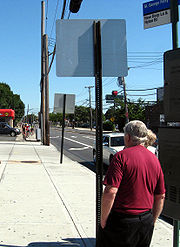
New Dorp Lane is a northwest - southeast street in New York City
in the neighborhood of New Dorp
in Staten Island
, New York
. While it is not an especially long or wide avenue (running one lane in each direction, only 1.5 miles (2.4 km) long), the segment west of Hylan Boulevard
is one of the densest, busiest commercial districts on the island, comparable to parts of Brooklyn
.
 It begins at Richmond Road
, runs for 0.2 mile (0.321868 km) until it reaches New Dorp Plaza, a pair of north-south side streets which are also commercial in character. The pair of streets flank the Staten Island Railway
's New Dorp
Station on either side. It continues along, passing numerous shops, restaurants, banks and offices, and a library. At 0.6 mile (0.965604 km), it reaches Hylan Boulevard
, the East Shore
's main north-south thoroughfare, here running northeast-southwest, at one of the most notoriously dangerous intersections on the island, one known for congestion and collisions. Continuing southwest, the avenue widens and is much less busy. It passes New Dorp High School
, and then runs along the southwestern border of Miller Field
, terminating at 1.5 miles (2.4 km), on the beach along Raritan Bay
.
Our Lady Queen of Peace, the area's major Catholic
parish, is located on New Dorp Lane near its western end.
New Dorp Lane is served by the S76/S86 local buses.
New York City
New York is the most populous city in the United States and the center of the New York Metropolitan Area, one of the most populous metropolitan areas in the world. New York exerts a significant impact upon global commerce, finance, media, art, fashion, research, technology, education, and...
in the neighborhood of New Dorp
New Dorp, Staten Island
New Dorp – an anglicization of Nieuwe Dorp, Dutch for New Village – is a neighborhood in Staten Island, one of the five boroughs of New York City, United States. The community lies near the foot of Todt Hill, with Grant City immediately to its north, Oakwood bordering to the south, and...
in Staten Island
Staten Island
Staten Island is a borough of New York City, New York, United States, located in the southwest part of the city. Staten Island is separated from New Jersey by the Arthur Kill and the Kill Van Kull, and from the rest of New York by New York Bay...
, New York
New York
New York is a state in the Northeastern region of the United States. It is the nation's third most populous state. New York is bordered by New Jersey and Pennsylvania to the south, and by Connecticut, Massachusetts and Vermont to the east...
. While it is not an especially long or wide avenue (running one lane in each direction, only 1.5 miles (2.4 km) long), the segment west of Hylan Boulevard
Hylan Boulevard
Hylan Boulevard is a major northeast-southwest boulevard in the New York City borough of Staten Island. It is approximately long , and runs from the North Shore neighborhood of Rosebank to the South Shore neighborhood of Tottenville....
is one of the densest, busiest commercial districts on the island, comparable to parts of Brooklyn
Brooklyn
Brooklyn is the most populous of New York City's five boroughs, with nearly 2.6 million residents, and the second-largest in area. Since 1896, Brooklyn has had the same boundaries as Kings County, which is now the most populous county in New York State and the second-most densely populated...
.
Richmond Road (Staten Island)
Richmond Road is a major north-south artery along the East Shore of the New York City borough of Staten Island. It is approximately long, and runs through the neighborhoods of Concord, Grymes Hill, Emerson Hill, Grasmere, Old Town, Dongan Hills, Grant City, Todt Hill, New Dorp, Egbertville,...
, runs for 0.2 mile (0.321868 km) until it reaches New Dorp Plaza, a pair of north-south side streets which are also commercial in character. The pair of streets flank the Staten Island Railway
Staten Island Railway
The Staten Island Rapid Transit Operating Authority, publicly known as MTA Staten Island Railway or SIR, is the operator of the lone rapid transit line in the borough of Staten Island, New York City, USA...
's New Dorp
New Dorp (Staten Island Railway station)
New Dorp is a Staten Island Railway station in the neighborhood of New Dorp, Staten Island, New York. It is located on an open cut at New Dorp Lane and Railroad Avenue on the main line. It has two side platforms and orange colored walls and railings. The northbound platform has a high concrete...
Station on either side. It continues along, passing numerous shops, restaurants, banks and offices, and a library. At 0.6 mile (0.965604 km), it reaches Hylan Boulevard
Hylan Boulevard
Hylan Boulevard is a major northeast-southwest boulevard in the New York City borough of Staten Island. It is approximately long , and runs from the North Shore neighborhood of Rosebank to the South Shore neighborhood of Tottenville....
, the East Shore
East Shore, Staten Island
The term East Shore is frequently applied to a series of neighborhoods along the Lower New York Bay and the Raritan Bay and within New York City's borough of Staten Island....
's main north-south thoroughfare, here running northeast-southwest, at one of the most notoriously dangerous intersections on the island, one known for congestion and collisions. Continuing southwest, the avenue widens and is much less busy. It passes New Dorp High School
New Dorp High School
New Dorp High School, administered by the New York City Department of Education, is a public school located on the East Shore of the New York City borough of Staten Island in the New Dorp neighborhood. The school is located at 465 New Dorp Lane next to Miller Field, an army airport turned park,...
, and then runs along the southwestern border of Miller Field
Miller Field (Staten Island)
Miller Field was a United States Air Force facility on Staten Island, New York, in New Dorp. It was founded in November 1919 and completed in 1921...
, terminating at 1.5 miles (2.4 km), on the beach along Raritan Bay
Raritan Bay
Raritan Bay is a bay located at the southern portion of Lower New York Bay between the U.S. states of New York and New Jersey and is part of the New York Bight. The bay is bounded on the northwest by New York's Staten Island, on the west by Perth Amboy, New Jersey, on the south by the Raritan...
.
Our Lady Queen of Peace, the area's major Catholic
Catholicism
Catholicism is a broad term for the body of the Catholic faith, its theologies and doctrines, its liturgical, ethical, spiritual, and behavioral characteristics, as well as a religious people as a whole....
parish, is located on New Dorp Lane near its western end.
New Dorp Lane is served by the S76/S86 local buses.