
Nebraska National Forest
Encyclopedia
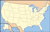
The Nebraska National Forest is a United States National Forest
located in the U.S. state
of Nebraska
. The total area of the national forest is 142000 acres (575 km²).
The national forest comprises two ranger districts. The 90000 acres (364 km²) Bessey Ranger District is located in the Sandhills
of central Nebraska. Encompassing about 63.9% of the forest's total area, it lies in parts of Thomas
and Blaine
counties. It was established in 1902 by Charles E. Bessey as an experiment to see if forests could be created in treeless areas of the Great Plains
for use as a national timber reserve. This effort resulted in a 20000 acres (80.9 km²) forest, the largest human-planted forest in the United States. Today, the forest's nursery supplies 2.5 to 3 million seedlings per year.
The 52000 acres (210 km²) Pine Ridge Ranger District is located in the Pine Ridge
region of northwest Nebraska. It contains about 36.1% of the forest's total area, and it lies in part of Dawes
and Sioux
counties. The native ponderosa
forests were added to the National Forest system in the 1950s. The Soldier Creek Wilderness
, a federally designated wilderness area, is located in the forest.
The nursery is listed on the National Register of Historic Places
.
In descending order of land, the forest lies in parts of Thomas, Dawes, Blaine, and Sioux counties. It is managed by the Forest Service together with Samuel R. McKelvie National Forest
and the Buffalo Gap
, Fort Pierre
, and Oglala
National Grasslands from common offices in Chadron, Nebraska
. There is a local ranger
district office located in Halsey
.
, Niobrara
and North Platte
National Forests
.
United States National Forest
National Forest is a classification of federal lands in the United States.National Forests are largely forest and woodland areas owned by the federal government and managed by the United States Forest Service, part of the United States Department of Agriculture. Land management of these areas...
located in the U.S. state
U.S. state
A U.S. state is any one of the 50 federated states of the United States of America that share sovereignty with the federal government. Because of this shared sovereignty, an American is a citizen both of the federal entity and of his or her state of domicile. Four states use the official title of...
of Nebraska
Nebraska
Nebraska is a state on the Great Plains of the Midwestern United States. The state's capital is Lincoln and its largest city is Omaha, on the Missouri River....
. The total area of the national forest is 142000 acres (575 km²).
The national forest comprises two ranger districts. The 90000 acres (364 km²) Bessey Ranger District is located in the Sandhills
Sand Hills (Nebraska)
The Sand Hills, often written Sandhills, is a region of mixed-grass prairie on grass-stabilized sand dunes in north-central Nebraska, covering just over one quarter of the state...
of central Nebraska. Encompassing about 63.9% of the forest's total area, it lies in parts of Thomas
Thomas County, Nebraska
-History:Thomas County was formed in 1887. It was named after General George H. Thomas.-Demographics:As of the census of 2000, there were 729 people, 325 households, and 216 families residing in the county. The population density was 1 person per square mile . There were 446 housing units at an...
and Blaine
Blaine County, Nebraska
-History:Blaine County was formed in 1885. It was named after presidential candidate James G. Blaine.-Demographics:As of the census of 2000, there were 583 people, 238 households, and 168 families residing in the county. The population density was 1 people per square mile . There were 333 housing...
counties. It was established in 1902 by Charles E. Bessey as an experiment to see if forests could be created in treeless areas of the Great Plains
Great Plains
The Great Plains are a broad expanse of flat land, much of it covered in prairie, steppe and grassland, which lies west of the Mississippi River and east of the Rocky Mountains in the United States and Canada. This area covers parts of the U.S...
for use as a national timber reserve. This effort resulted in a 20000 acres (80.9 km²) forest, the largest human-planted forest in the United States. Today, the forest's nursery supplies 2.5 to 3 million seedlings per year.
The 52000 acres (210 km²) Pine Ridge Ranger District is located in the Pine Ridge
Pine Ridge (region)
The Pine Ridge is an escarpment between the Niobrara River and the White River in far northwestern Nebraska...
region of northwest Nebraska. It contains about 36.1% of the forest's total area, and it lies in part of Dawes
Dawes County, Nebraska
-National protected areas:*Nebraska National Forest *Oglala National Grassland *Pine Ridge National Recreation Area-Demographics:As of the census of 2000, there were 9,060 people, 3,512 households, and 2,086 families residing in the county. The population density was 6 people per square mile...
and Sioux
Sioux County, Nebraska
-National protected areas:* Agate Fossil Beds National Monument* Nebraska National Forest * Oglala National Grassland -Demographics:...
counties. The native ponderosa
Ponderosa Pine
Pinus ponderosa, commonly known as the Ponderosa Pine, Bull Pine, Blackjack Pine, or Western Yellow Pine, is a widespread and variable pine native to western North America. It was first described by David Douglas in 1826, from eastern Washington near present-day Spokane...
forests were added to the National Forest system in the 1950s. The Soldier Creek Wilderness
Soldier Creek Wilderness
Soldier Creek Wilderness is located in the U.S. state of Nebraska. Created by an act of Congress in 1986, the wilderness is managed by the U.S. Forest Service and covers an area of 7,794 acres within the Pine Ridge section of the Nebraska National Forest...
, a federally designated wilderness area, is located in the forest.
The nursery is listed on the National Register of Historic Places
National Register of Historic Places
The National Register of Historic Places is the United States government's official list of districts, sites, buildings, structures, and objects deemed worthy of preservation...
.
In descending order of land, the forest lies in parts of Thomas, Dawes, Blaine, and Sioux counties. It is managed by the Forest Service together with Samuel R. McKelvie National Forest
Samuel R. McKelvie National Forest
The Samuel R. McKelvie National Forest is located in the north-central Sandhills region of the U.S. state of Nebraska. Created on October 15, 1971 , the forest is named after former Governor Samuel R. McKelvie...
and the Buffalo Gap
Buffalo Gap National Grassland
Buffalo Gap National Grassland is a National Grassland located primarily in southwestern South Dakota, United States. It is also the second largest National Grassland. Characteristics of the grasslands include mixed prairie and chalky badlands. The grassland is managed by the U.S. Forest Service...
, Fort Pierre
Fort Pierre National Grassland
Fort Pierre National Grassland is a United States National Grassland in central South Dakota, south of the capital, Pierre. It is primarily a short grass prairie. It has a land area of 115,890 acres . In descending order of acreage it lies in parts of Lyman, Stanley, and Jones counties. Part of the...
, and Oglala
Oglala National Grassland
The Oglala National Grassland is a United States National Grassland in the northwest corner of Nebraska. It is in northern Sioux and northwestern Dawes counties, on the borders with South Dakota and Wyoming...
National Grasslands from common offices in Chadron, Nebraska
Chadron, Nebraska
Chadron is a city in Dawes County, Nebraska, United States. The population was 5,851 at the 2010 census. It is the county seat of Dawes County. Chadron is the home of Chadron State College....
. There is a local ranger
National Park Ranger
National Park Service Rangers are among the uniformed employees charged with protecting and preserving areas set aside in the National Park System by the United States Congress and/or the President of the United States...
district office located in Halsey
Halsey, Nebraska
Halsey is a village in Blaine and Thomas Counties in the U.S. state of Nebraska. The population was 59 at the 2000 census.-Geography:Halsey is located at , mostly in Thomas County....
.
History
Nebraska National Forest was established on November 15, 1907 by the consolidation of three smaller forests: Dismal RiverDismal River National Forest
Dismal River National Forest was established as the Dismal River Forest Reserve by the General Land Office in Nebraska on April 16, 1902 with . After the transfer of federal forests to the U.S. Forest Service in 1905, it became a National Forest on March 4, 1907. On July 1, 1908 the lands were...
, Niobrara
Niobrara National Forest
Niobrara National Forest was established as the Niobrara Forest Reserve by the General Land Office in Nebraska on April 16, 1902 with . After the transfer of federal forests to the U.S. Forest Service in 1905, it became a National Forest on March 4, 1907...
and North Platte
North Platte National Forest
North Platte National Forest was established as the North Platte Forest Reserve by the General Land Office in Nebraska on March 10, 1902 with . After the transfer of federal forests to the U.S. Forest Service in 1905, it became a National Forest on March 4, 1907. On July 1, 1908 the entire forest...
National Forests
United States National Forest
National Forest is a classification of federal lands in the United States.National Forests are largely forest and woodland areas owned by the federal government and managed by the United States Forest Service, part of the United States Department of Agriculture. Land management of these areas...
.