

National Register of Historic Places listings in Southern Chester County, Pennsylvania
Encyclopedia
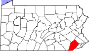
File:Map of Chester County Pennsylvania NRHP sites.PNG|thumb|right|Map of Chester County (clickable)
poly 77 194 71 185 77 176 100 130 101 113 100 100 97 89 128 71 187 24 216 5 222 7 229 4 237 3 253 11 258 15 262 13 262 9 264 8 277 32 278 34 282 33 281 30 282 26 286 26 289 35 291 43 300 50 300 55 298 58 299 63 257 117 257 124 230 135 237 150 232 154 225 157 219 158 210 158 201 160 190 162 191 164 176 164 Northern
National Register of Historic Places listings in Northern Chester County, Pennsylvania
File:Map of Chester County Pennsylvania NRHP sites.PNG|thumb|right|Map of Chester County poly 230 136 258 125 257 120 300 64 302 62 309 57 313 57 310 63 308 65 308 69 309 70 312 73 318 77 320 75 323 75 328 75 330 79 330 83 328 85 328 89 331 91 331 95 334 100 341 98 352 96 364 117 378 111 381 113...
poly 230 136 258 125 257 120 300 64 302 62 309 57 313 57 310 63 308 65 308 69 309 70 312 73 318 77 320 75 323 75 328 75 330 79 330 83 328 85 328 89 331 91 331 95 334 100 341 98 352 96 364 117 378 111 381 113 355 129 359 138 338 159 342 160 342 164 303 190 302 195 300 196 302 204 296 199 294 202 293 202 293 205 289 207 289 211 282 216 278 212 271 214 261 201 264 196 Eastern
desc none
This is a list of the National Register of Historic Places listings in southern Chester County, Pennsylvania.
This is intended to be a complete list of the properties and districts on the National Register of Historic Places
National Register of Historic Places
The National Register of Historic Places is the United States government's official list of districts, sites, buildings, structures, and objects deemed worthy of preservation...
in southern Chester County
Chester County, Pennsylvania
-State parks:*French Creek State Park*Marsh Creek State Park*White Clay Creek Preserve-Demographics:As of the 2010 census, the county was 85.5% White, 6.1% Black or African American, 0.2% Native American or Alaskan Native, 3.9% Asian, 0.0% Native Hawaiian, 1.8% were two or more races, and 2.4% were...
, Pennsylvania
Pennsylvania
The Commonwealth of Pennsylvania is a U.S. state that is located in the Northeastern and Mid-Atlantic regions of the United States. The state borders Delaware and Maryland to the south, West Virginia to the southwest, Ohio to the west, New York and Ontario, Canada, to the north, and New Jersey to...
, United States
United States
The United States of America is a federal constitutional republic comprising fifty states and a federal district...
. Southern Chester County is defined as being the municipalities south of the Pennsylvania Main Line
Pennsylvania Main Line
The Main Line is an unofficial historical and socio-cultural region of suburban Philadelphia, Pennsylvania, comprising a collection of affluent towns built along the old Main Line of the Pennsylvania Railroad which ran northwest from downtown Philadelphia parallel to Lancaster Avenue , a road...
and west of West Chester
West Chester, Pennsylvania
The Borough of West Chester is the county seat of Chester County, Pennsylvania, United States. The population was 18,461 at the 2010 census.Valley Forge, the Brandywine Battlefield, Longwood Gardens, Marsh Creek State Park, and other historical attractions are near West Chester...
. The locations of National Register properties and districts for which the latitude and longitude coordinates are included below, may be seen in a Google map.
There are 310 properties and districts listed on the Register in Chester County, including 7 National Historic Landmark
National Historic Landmark
A National Historic Landmark is a building, site, structure, object, or district, that is officially recognized by the United States government for its historical significance...
s. Southern Chester County includes 117 properties and districts, including 2 National Historic Landmarks; the county's remaining properties and districts are listed elsewhere
National Register of Historic Places listings in Chester County, Pennsylvania
File:Map of Chester County Pennsylvania NRHP sites.PNG|thumb|right|Map of Chester County poly 77 194 71 185 77 176 100 130 101 113 100 100 97 89 128 71 187 24 216 5 222 7 229 4 237 3 253 11 258 15 262 13 262 9 264 8 277 32 278 34 282 33 281 30 282 26 286 26 289 35 291 43 300 50 300 55 298 58 299 63...
.
Current listings
|}
Former listings
|--! | 1
| Bridge in New Garden Township
Landenberg Bridge
The Landenberg Bridge is a truss bridge carrying Landenberg Road across the White Clay Creek in Landenberg, Pennsylvania.The bridge was originally built by the Schuylkill Bridge Company of Phoenixville, Pennsylvania in 1899, using the stone abutments from an earlier bridge...
|
|
| Landenberg Road over White Clay Creek, near Landenberg
39°46′39"N 75°46′19"W
| New Garden Township
New Garden Township, Chester County, Pennsylvania
New Garden Township is a township in Chester County, Pennsylvania, United States. The population was 11,984 at the 2010 census. New Garden is the center of the mushroom agribusiness in southeastern Pennsylvania with a higher concentration of composting, mushroom growing, packaging, and shipping...
| Listed on June 22, 1988.
|--
! | 2
| Mortonville Bridge
|
|
| Strasburg Road near Coatesville
39°56′47"N 75°46′47"W
| East Fallowfield
East Fallowfield Township, Chester County, Pennsylvania
East Fallowfield Township is a township in Chester County, Pennsylvania, United States. The population was 7,449 at the 2010 census.-Geography:According to the United States Census Bureau, the township has a total area of , all of it land....
and Newlin Townships
| Listed on September 18, 1985
|}
See also
- List of National Historic Landmarks in Pennsylvania
- National Register of Historic Places listings in Pennsylvania