
.gif)
National Highway 209 (India)
Encyclopedia
Karnataka
Karnataka , the land of the Kannadigas, is a state in South West India. It was created on 1 November 1956, with the passing of the States Reorganisation Act and this day is annually celebrated as Karnataka Rajyotsava...
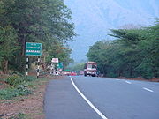
and ends at NH 7 at Vedasandur
Vedasandur
Nagayakottai panchayat is vedasandur unionVedasandur is a panchayat town in Dindigul district in the Indian state of Tamil Nadu.-Etymology:The name derived from the Vedan Sandhaiur that is Vedan means hunter, Sandhai means the place for sales something, the Hunters were come and sold their goods...
north of Dindigul District
Dindigul District
Dindigul District is an administrative region in the south of Tamil Nadu, India. The district was carved out of Madurai District in the year 1985...
in Tamil Nadu
Tamil Nadu
Tamil Nadu is one of the 28 states of India. Its capital and largest city is Chennai. Tamil Nadu lies in the southernmost part of the Indian Peninsula and is bordered by the union territory of Pondicherry, and the states of Kerala, Karnataka, and Andhra Pradesh...
. The road crosses Kaveri river between Malavalli
Malavalli
Malavalli is a taluk in Mandya district in the Indian state of Karnataka. The headquarter of Malavalli taluk is the town of the same name.-Geography:Malavalli town is located at . It has an average elevation of 610 metres ....
and Sattegal and it crosses from Punjanoor in Karnataka into Hasanur in Tamil Nadu. The road is called Sathy road between Coimbatore
Coimbatore
Coimbatore , also known as Kovai , is the second largest city in the Indian state of Tamil Nadu. It is a major commercial centre in Tamil Nadu and is known as the "Manchester of South India"....
and Sathyamangalam
Sathyamangalam
Sathyamangalam or Sathy is a small city and taluk in Erode district in the Indian state of Tamil Nadu. It lies on both banks of the Bhavani River, a tributary of the Kaveri in the foothills of the Western Ghats...
of Erode District
Erode District
Erode District is a western district of the state of Tamil Nadu, India, with Erode as its headquarters. Until the year 1996, Erode district was called as Periyar District....
. This is the most important road passing through the Coimbatore city
Coimbatore
Coimbatore , also known as Kovai , is the second largest city in the Indian state of Tamil Nadu. It is a major commercial centre in Tamil Nadu and is known as the "Manchester of South India"....
and its suburbs. The length of the road is about 44 km within its city limits including suburbs. It is the best way to reach Bangalore from Coimbatore about 350 km,instead of going via Salem due to heavy traffic between Salem-Coimbatore NH47.
There is a proposal to convert the Dindigal - Annur(Coimbatore) as an expressway in this route due to the volume of vehicular and truck traffic. This route passing through ghat session from Sathyamangalam to Hasanur in Tamilnadu.
Tamil Nadu Route
Hasanur, BannariBannari
Bannari is a small village located at a distance of 12 km from Sathyamangalam and 35 km from Gobichettipalayam in Erode District on NH 209 and it is close to Tamil Nadu and Karnataka border .- Bannari Amman Temple :...
, Sathyamangalam
Sathyamangalam
Sathyamangalam or Sathy is a small city and taluk in Erode district in the Indian state of Tamil Nadu. It lies on both banks of the Bhavani River, a tributary of the Kaveri in the foothills of the Western Ghats...
, Puliyampatti, Annur
Annur
Annur is a suburb of Coimbatore situated 29 km north of the city in Tamil Nadu, India. It is 29 km north of Gandhipuram.It lies on the Coimbatore – Mysore National Highway-209. Annur is a part of Coimbatore Rural district, which is included by the Corporation of Coimbatore...
(suburb of Coimbatore) , Coimbatore
Coimbatore
Coimbatore , also known as Kovai , is the second largest city in the Indian state of Tamil Nadu. It is a major commercial centre in Tamil Nadu and is known as the "Manchester of South India"....
, Pollachi
Pollachi
Pollachi is a taluk of Coimbatore Rural district of the Tamil Nadu state of India. It lies in the southern part of the Coimbatore city around 40 kilometres from downtown Coimbatore. This is the second largest town in the District after Corporation of Coimbatore. Owing to the proximity to the...
, Udumalaipettai
Udumalaipettai
Udumalai also known as Udumalpet is a town and a municipality in Tirupur district, Indian state of Tamil Nadu. Poor Man's Ooty, as it is called, the Udumalpet town is one of the famous summer resorts of Tamil Nadu, surrounded by Mountains on three sides.Its name in the ancient days was "UDUMALAI"...
, Madathukulam, Palani
Palani
Palani is a city and a municipality in the Dindigul district of the South Indian state of Tamil Nadu, located about 100 km South of Coimbatore City and 60 km west of Dindigul...
and Dindigul
Dindigul
Dindigul is a town and municipality in the Tamil Nadu state of southern India. The name Dindigul comes from the Portmanteau of “Thindu” meaning pillow and “kal” meaning Rock and refers to the bare hill dominating the city’s both land and skyscape...
.
There is a proposal for extending this highway as NH 209-A, which splits from Sathy towards Erode
Erode
Erode is a city, a municipal corporation and the headquarters of Erode district in the South Indian state of Tamil Nadu.It is situated at the center of the South Indian Peninsula, about southwest from the state capital Chennai and on the banks of the rivers Cauvery and Bhavani, between 11° 19.5"...
via Gobi
Gobichettipalayam
Gobi or Gobichettipalayam is a Municipality in Erode District of Tamil Nadu state, India. A major part of present Gobichettipalayam was previously known as Veerapandi Gramam, and documents and records still use that name. Gobichettipalayam is an important city in the North- Western part of Erode...
and reaches Dindigul
Dindigul
Dindigul is a town and municipality in the Tamil Nadu state of southern India. The name Dindigul comes from the Portmanteau of “Thindu” meaning pillow and “kal” meaning Rock and refers to the bare hill dominating the city’s both land and skyscape...
via Sivagiri
Sivagiri
Jawaharlal Nehru"I am happy and privileged to come here and pay my tribute to a great man whose message is as vital and essential today as it was when he gave it"...
, Aravakkurichi.
Karnataka Side Route
Bengaluru, Kaglipur, Harohalli, KanakapuraKanakapura
Kanakapura is a town and the headquarters of Kanakapura Taluk in the Ramanagara district in the state of Karnataka, India. Situated near the city of Bengaluru, this town is famous for the production of silk and granite.- Etymology :...
, Halgur, Malavalli
Malavalli
Malavalli is a taluk in Mandya district in the Indian state of Karnataka. The headquarter of Malavalli taluk is the town of the same name.-Geography:Malavalli town is located at . It has an average elevation of 610 metres ....
, Sattegal, Kollegal
Kollegal
Kollegal is one of the major taluks in the Chamrajnagar District of Karnataka State in the south of India. Kollegal is well known for its silk industry which attracts traders from all over the state.-History:...
, Yelandur, Chamrajanagar and Punjanoor.
HISTORICAL IMPORTANCE
Tippu Sultan, the associated King of Mysore Kingdom used to travel along this route only.When he was in kingdom extending plan to Coimbatore he took Mysore-Nanjangud-Chamarajanagar-Sathy- Coimbatore route to reach his New areas in TN.But now we can say Chamarajanagar-Coimbatore section of NH -209 is important in historical perspective.The mode of Transportation was with help of Bulls or Horse.