

Monte Azul
Encyclopedia
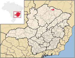
Minas Gerais
Minas Gerais is one of the 26 states of Brazil, of which it is the second most populous, the third richest, and the fourth largest in area. Minas Gerais is the Brazilian state with the largest number of Presidents of Brazil, the current one, Dilma Rousseff, being one of them. The capital is the...
in Brazil
Brazil
Brazil , officially the Federative Republic of Brazil , is the largest country in South America. It is the world's fifth largest country, both by geographical area and by population with over 192 million people...
. The population in 2007 was 23,477 in an area of 992 km². The elevation is 582 meters. It became a municipality in 1878. The postal code (CEP) is 39500-000.
Monte Azul is part of the statistical microregion of Janaúba
Janaúba
Janaúba is a municipality in the north of the Brazilian state of Minas Gerais. In 2007 the population was 65,387 in a total area of 2,189 km2. The elevation is 692 meters above sea level.-Location:...
. It is 627 km. from the state capital, Belo Horizonte
Belo Horizonte
Belo Horizonte is the capital of and largest city in the state of Minas Gerais, located in the southeastern region of Brazil. It is the third largest metropolitan area in the country...
and about 30 km. south of the state boundary with Bahia
Bahia
Bahia is one of the 26 states of Brazil, and is located in the northeastern part of the country on the Atlantic coast. It is the fourth most populous Brazilian state after São Paulo, Minas Gerais and Rio de Janeiro, and the fifth-largest in size...
.
It is connected by paved roads to the regional center of Janaúba to the south. It is on the Minas Gerais-Bahia railroad line, which last had passenger service in 1996.
The main economic activities are cattle raising (30,000 head in 2006) and farming with modest production of rice, beans, corn, and sorghum. In 2006 there were 2,531 rural producers with a total area of 66,342 hectares. Cropland made up 8,500 hectares and natural pasture 67,000 hectares. There were only 67 tractors a ratio of one for every 70 farms. In the urban area there were 2 financial institutions as of 2006. There were 1,212 automobiles, giving a ratio of about one automobile for every 19 inhabitants. The Gross Domestic Product was R$ 63,578,000 (2005), which was mainly generated by services. Health care was provided by 17 public health clinics. There was one private hospital with 17 beds (2005).
Settlement of this region goes back to colonial times. The first name was Tremedal and it belonged to the capitania of Bahia
Bahia
Bahia is one of the 26 states of Brazil, and is located in the northeastern part of the country on the Atlantic coast. It is the fourth most populous Brazilian state after São Paulo, Minas Gerais and Rio de Janeiro, and the fifth-largest in size...
. The first chapel was built in 1818. In 1840 the district of Tremedal was transferred from Formiga (present day Montes Claros) to Grão Mogol
Grão Mogol
Grão Mogol is a Brazilian municipality located in the north of the state of Minas Gerais. In 2007 the population was 14,954 in a total area of 3,890 km². The elevation is 829 meters. It became a municipality in 1840.-Location and Distances:...
. In 1850 it was a district of Rio Pardo de Minas
Rio Pardo de Minas
Rio Pardo de Minas is a municipality in the northeast of the Brazilian state of Minas Gerais. Its population in 2007 was 28,633 inhabitants in a total area of 3,119 km².-Important facts and Distances:...
. In 1878 it separated from Rio Pardo and became the municipality of Boa Vista do Tremedal. In 1887 it became a city. In 1938 the name was changed to Monte Azul because of the color of the nearby mountains.
Municipal Human Development Index
Human Development Index
The Human Development Index is a composite statistic used to rank countries by level of "human development" and separate "very high human development", "high human development", "medium human development", and "low human development" countries...
- MHDI: .657 (2000)
- State ranking: 723 out of 853 municipalities as of 2000
- National ranking: 3,664 out of 5,138 municipalities as of 2000
- Life expectancy: 67.8
- Literacy rate: 72.0
- Combined primary, secondary and tertiary gross enrollment ratio: .760
- Per capita income (monthly): R$88.75 (For the complete list see Frigoletto)