

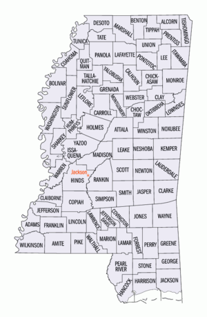
Mississippi census statistical areas
Encyclopedia
United States Census Bureau
The United States Census Bureau is the government agency that is responsible for the United States Census. It also gathers other national demographic and economic data...
has defined 3 Combined Statistical Area
Combined Statistical Area
The United States Office of Management and Budget defines micropolitan and metropolitan statistical areas. Metropolitan and micropolitan statistical areas consist of one or more counties...
s (CSAs), 5 Metropolitan Statistical Areas (MSAs), and 20 Micropolitan Statistical Areas (μSAs) in the State of Mississippi. The following table describes these areas with the following information:
- The name of the Combined Statistical Area (CSA), if any.
- The population of the CSA as of 2006-07-01, as estimated by the United States Census Bureau.
- The name of the Core Based Statistical AreaCore based statistical areaA Core Based Statistical Area is a U.S. geographic area defined by the Office of Management and Budget based around an urban center of at least 10,000 people and adjacent areas that are socioeconomically tied to the urban center by commuting. Areas defined on the basis of these standards applied...
(CBSA). - The population of the CBSA as of 2006-07-01, as estimated by the United States Census Bureau.
- The name of the countyCounty (United States)In the United States, a county is a geographic subdivision of a state , usually assigned some governmental authority. The term "county" is used in 48 of the 50 states; Louisiana is divided into parishes and Alaska into boroughs. Parishes and boroughs are called "county-equivalents" by the U.S...
or parishCounty (United States)In the United States, a county is a geographic subdivision of a state , usually assigned some governmental authority. The term "county" is used in 48 of the 50 states; Louisiana is divided into parishes and Alaska into boroughs. Parishes and boroughs are called "county-equivalents" by the U.S...
. - The population of the county or parish as of 2006-07-01, as estimated by the United States Census Bureau.
| Combined Statistical Area | 2006 Pop | Core Based Statistical Area | 2006 Pop | County | 2006 Pop |
|---|---|---|---|---|---|
| Jackson-Yazoo City, MS CSA | 557,385 | Jackson, MS MSA | 529,456 | Hinds County, Mississippi Hinds County, Mississippi As of the census of 2000, there were 250,800 people, 91,030 households, and 62,355 families residing in the county. The population density was 288 people per square mile . There were 100,287 housing units at an average density of 115 per square mile... |
249,012 |
| Rankin County, Mississippi Rankin County, Mississippi -Demographics:As of the census of 2000, there were 115,327 people, 42,089 households, and 31,145 families residing in the county. The population density was 149 people per square mile . There were 45,070 housing units at an average density of 58 per square mile... |
135,830 | ||||
| Madison County, Mississippi Madison County, Mississippi -Demographics:As of the census of 2000, there were 74,674 people, 27,219 households, and 19,325 families residing in the county. The population density was 104 people per square mile . There were 28,781 housing units at an average density of 40 per square mile... |
87,419 | ||||
| Copiah County, Mississippi Copiah County, Mississippi As of the census of 2000, there were 28,757 people, 10,142 households, and 7,494 families residing in the county. The population density was 37 people per square mile . There were 11,101 housing units at an average density of 14 per square mile... |
29,223 | ||||
| Simpson County, Mississippi Simpson County, Mississippi -Demographics:As of the census of 2000, there were 27,639 people, 10,076 households, and 7,385 families residing in the county. The population density was 47 people per square mile . There were 11,307 housing units at an average density of 19 per square mile... |
27,972 | ||||
| Yazoo City, MS μSA | 27,929 | Yazoo County, Mississippi Yazoo County, Mississippi -National protected area:*Hillside National Wildlife Refuge *Panther Swamp National Wildlife Refuge-History:The area which is now Yazoo County was acquired by the State of Mississippi from the Choctaw Indians in 1820. Yazoo County was established on January 21, 1823. It was the 19th county... |
27,929 | ||
| Gulfport-Biloxi-Pascagoula, MS CSA | 380,309 | Gulfport-Biloxi, MS MSA | 227,904 | Harrison County, Mississippi Harrison County, Mississippi -National protected areas:* De Soto National Forest * Gulf Islands National Seashore - Demographics :As of the census of 2000, there were 189,601 people, 71,538 households, and 48,574 families residing in the county. The population density was 326 people per square mile . There were 79,636 housing... |
171,875 |
| Hancock County, Mississippi Hancock County, Mississippi -Demographics:As of the census of 2000, there were 42,967 people, 16,897 households, and 11,827 families residing in the county. The population density was 90 people per square mile . There were 21,072 housing units at an average density of 44 per square mile... |
40,421 | ||||
| Stone County, Mississippi Stone County, Mississippi As of the census of 2000, there were 13,622 people, 4,747 households, and 3,626 families residing in the county. The population density was 31 people per square mile . There were 5,343 housing units at an average density of 12 per square mile... |
15,608 | ||||
| Pascagoula, MS MSA | 152,405 | Jackson County, Mississippi Jackson County, Mississippi There were 47,676 households out of which 37.00% had children under the age of 18 living with them, 55.70% were married couples living together, 14.50% had a female householder with no husband present, and 25.10% were non-families. 20.80% of all households were made up of individuals and 7.10% had... |
130,577 | ||
| George County, Mississippi George County, Mississippi -Demographics:As of the census of 2000, there were 19,144 people, 6,742 households, and 5,305 families residing in the county. The population density was 40 people per square mile . There were 7,513 housing units at an average density of 16 per square mile... |
21,828 | ||||
| primary census statistical area | 1,274,704 217,701 |
Memphis, TN-MS-AR MSA | 1,274,704 217,701 |
Shelby County, Tennessee Shelby County, Tennessee Shelby County is a county located in the U.S. state of Tennessee. It is the state's largest both in terms of population and geographic area, with a population of 927,644 at the 2010 census... |
911,438 |
| DeSoto County, Mississippi DeSoto County, Mississippi -Demographics:As of the census of 2005 estimate, there were 137,004 people, 38,792 households, and 30,102 families residing in the county. The population density was 224 people per square mile . There were 40,795 housing units at an average density of 85 per square mile... |
144,706 | ||||
| Tipton County, Tennessee Tipton County, Tennessee Tipton County is a county located on the western end of the U.S. state of Tennessee. As of 2000, the population was 51,271. Its county seat is Covington. Tipton County is part of the Memphis, TN–MS–AR Metropolitan Statistical Area, centered on Shelby County, which borders Tipton on... |
57,380 | ||||
| Crittenden County, Arkansas | 52,083 | ||||
| Fayette County, Tennessee | 36,102 | ||||
| Marshall County, Mississippi Marshall County, Mississippi -Demographics:At the 2000 census, there were 34,993 people, 12,163 households and 9,110 families residing in the county. The population density was 50 per square mile . There were 13,252 housing units at an average density of 19 per square mile... |
35,853 | ||||
| Tate County, Mississippi Tate County, Mississippi -Demographics:As of the census of 2000, there were 25,370 people, 8,850 households, and 6,717 families residing in the county. The population density was 63 people per square mile . There were 9,354 housing units at an average density of 23 per square mile... |
26,723 | ||||
| Tunica County, Mississippi Tunica County, Mississippi As of the census of 2000, there were 9,227 people, 3,258 households, and 2,192 families residing in the county. The population density was 20 people per square mile . There were 3,705 housing units at an average density of 8 per square mile... |
10,419 | ||||
| primary census statistical area | 134,744 | Hattiesburg, MS MSA | 134,744 | Forrest County, Mississippi Forrest County, Mississippi The median income for a household in the county was $27,420, and the median income for a family was $35,791. Males had a median income of $28,742 versus $20,500 for females. The per capita income for the county was $15,160... |
76,372 |
| Lamar County, Mississippi Lamar County, Mississippi -Demographics:As of the census of 2000, there were 39,070 people, 14,396 households, and 10,725 families residing in the county. The population density was 79 people per square mile . There were 15,433 housing units at an average density of 31 per square mile... |
46,240 | ||||
| Perry County, Mississippi Perry County, Mississippi -Demographics:As of the census of 2000, there were 12,138 people, 4,420 households, and 3,332 families residing in the county. The population density was 19 people per square mile . There were 5,107 housing units at an average density of 8 per square mile... |
12,132 | ||||
| primary census statistical area | 131,953 | Tupelo, MS μSA | 131,953 | Lee County, Mississippi Lee County, Mississippi -National protected areas:* Brices Cross Roads National Battlefield Site* Natchez Trace Parkway * Tupelo National Battlefield-History:On September 20, 1816, General Andrew Jackson, David Meriwether, and the Chickasaw Nation signed the Treaty of Chickasaw Council House in Lee County.Lee County was... |
79,714 |
| Pontotoc County, Mississippi Pontotoc County, Mississippi -National protected area:* Natchez Trace Parkway * Tombigbee National Forest -Demographics:As of the census of 2000, there were 26,726 people, 10,097 households, and 7,562 families residing in the county. The population density was 54 people per square mile . There were 10,816 housing units at an... |
28,887 | ||||
| Itawamba County, Mississippi Itawamba County, Mississippi In 2000, there were 8,773 households out of which 33.20% had children under the age of 18 living with them, 60.30% were married couples living together, 9.90% had a female householder with no husband present, and 25.90% were non-families. 23.40% of all households were made up of individuals and... |
23,352 | ||||
| primary census statistical area | 104,463 | Meridian, MS μSA | 104,463 | Lauderdale County, Mississippi Lauderdale County, Mississippi -Demographics:As of the census of 2000, there were 78,161 people, 29,990 households, and 20,573 families residing in the county. The population density was 111 people per square mile . There were 33,418 housing units at an average density of 48 per square mile... |
76,724 |
| Clarke County, Mississippi Clarke County, Mississippi -Demographics:As of the census of 2000, there were 17,955 people, 6,978 households, and 5,024 families residing in the county. The population density was 26 people per square mile . There were 8,100 housing units at an average density of 12 per square mile... |
17,631 | ||||
| Kemper County, Mississippi Kemper County, Mississippi -Demographics:As of the census of 2000, there were 10,453 people, 3,909 households, and 2,787 families residing in the county. The population density was 14 people per square mile . There were 4,533 housing units at an average density of 6 per square mile... |
10,108 | ||||
| primary census statistical area | 84,912 | Laurel, MS μSA | 84,912 | Jones County, Mississippi Jones County, Mississippi -History:Jones County, formed out parts of Covington and Wayne counties, was established on January 24, 1826 and was named for John Paul Jones. There are other counties named Jones, but it appears that this is the only one named for John Paul Jones... |
66,715 |
| Jasper County, Mississippi Jasper County, Mississippi -History:Jasper County was formed in 1833 from the middle section of what been Jones County. It was named for Sgt. William Jasper who first distinguished himself in the defense of Fort Moultrie in 1776. When a shell from a British warship shot away the flagstaff, he recovered the flag, raised it on... |
18,197 | ||||
| Columbus-West Point, MS CSA | 80,983 | Columbus, MS μSA | 59,773 | Lowndes County, Mississippi Lowndes County, Mississippi As of the census of 2000, there were 61,586 people, 22,849 households, and 16,405 families residing in the county. The population density was 123 people per square mile . There were 25,104 housing units at an average density of 50 per square mile... |
59,773 |
| West Point, MS μSA | 21,210 | Clay County, Mississippi Clay County, Mississippi As of the census of 2000, there were 21,979 people, 8,152 households, and 5,885 families residing in the county. The population density was 54 people per square mile . There were 8,810 housing units at an average density of 22 per square mile... |
21,210 | ||
| primary census statistical area | 58,007 | Greenville, MS μSA | 58,007 | Washington County, Mississippi Washington County, Mississippi -National protected areas:*Holt Collier National Wildlife Refuge*Theodore Roosevelt National Wildlife Refuge *Yazoo National Wildlife Refuge-Demographics:... |
58,007 |
| primary census statistical area | 57,099 | Picayune, MS μSA | 57,099 | Pearl River County, Mississippi Pearl River County, Mississippi -National protected areas:*Bogue Chitto National Wildlife Refuge *De Soto National Forest -Demographics:The census estimates of 2006 place the county population over 57,000 and place it among the 10 fastest growing counties in the U.S. As of the census of 2000, there were 48,621 people, 18,078... |
57,099 |
| primary census statistical area | 53,706 | McComb, MS μSA | 53,706 | Pike County, Mississippi Pike County, Mississippi -Demographics:As of the census of 2000, there were 38,940 people, 14,792 households, and 10,502 families residing in the county. The population density was 95 people per square mile . There were 16,720 housing units at an average density of 41 per square mile... |
40,240 |
| Amite County, Mississippi Amite County, Mississippi -Demographics:As of the census of 2000, there were 13,599 people, 5,271 households, and 3,879 families residing in the county. The population density was 19 people per square mile . There were 6,446 housing units at an average density of 9 per square mile... |
13,466 | ||||
| primary census statistical area | 49,308 | Vicksburg, MS μSA | 49,308 | Warren County, Mississippi Warren County, Mississippi -National protected areas:* Theodore Roosevelt National Wildlife Refuge * Vicksburg National Military Park -Demographics:As of the census of 2000, there were 49,644 people, 18,756 households, and 13,222 families residing in the county. The population density was 85 people per square mile... |
49,308 |
| primary census statistical area | 46,078 | Greenwood, MS μSA | 46,078 | Leflore County, Mississippi Leflore County, Mississippi -National protected area:*Mathews Brake National Wildlife Refuge*Theodore Roosevelt National Wildlife Refuge -Demographics:As of the census of 2000, there were 37,947 people, 12,956 households, and 8,887 families residing in the county. The population density was 64 people per square mile... |
35,752 |
| Carroll County, Mississippi Carroll County, Mississippi -Demographics:As of the census of 2000, there were 10,769 people, 4,071 households, and 3,069 families residing in the county. The population density was 17 people per square mile . There were 4,888 housing units at an average density of 8 per square mile... |
10,326 | ||||
| primary census statistical area | 41,633 | Starkville, MS μSA | 41,633 | Oktibbeha County, Mississippi Oktibbeha County, Mississippi -National protected areas:*Noxubee National Wildlife Refuge *Tombigbee National Forest -Demographics:As of the census of 2000, there were 42,902 people, 15,945 households, and 9,264 families residing in the county. The population density was 94 people per square mile . There were 17,344 housing... |
41,633 |
| primary census statistical area | 40,865 | Oxford, MS μSA | 40,865 | Lafayette County, Mississippi Lafayette County, Mississippi -Demographics:As of the census of 2000, there were 38,744 people, 14,373 households, and 8,321 families residing in the county. The population density was 61 people per square mile . There were 16,587 housing units at an average density of 26 per square mile... |
40,865 |
| primary census statistical area | 38,352 | Cleveland, MS μSA | 38,352 | Bolivar County, Mississippi Bolivar County, Mississippi -Demographics:As of the census of 2000, there were 40,633 people, 13,776 households, and 9,725 families residing in the county. The population density was 46 people per square mile . There were 14,939 housing units at an average density of 17 per square mile... |
38,352 |
| primary census statistical area | 35,589 | Corinth, MS μSA | 35,589 | Alcorn County, Mississippi Alcorn County, Mississippi There were 14,224 households out of which 30.90% had children under the age of 18 living with them, 54.50% were married couples living together, 11.50% had a female householder with no husband present, and 30.30% were non-families. 27.60% of all households were made up of individuals and 11.90% had... |
35,589 |
| primary census statistical area | 34,404 | Brookhaven, MS μSA | 34,404 | Lincoln County, Mississippi Lincoln County, Mississippi -Demographics:As of the census of 2000, there were 33,166 people, 12,538 households, and 9,190 families residing in the county. The population density was 57 people per square mile . There were 14,052 housing units at an average density of 24 per square mile... |
34,404 |
| primary census statistical area | 52,086 32,626 |
Natchez, MS-LA μSA | 52,086 32,626 |
Adams County, Mississippi Adams County, Mississippi As of the census of 2000, there were 34,340 people, 13,677 households, and 9,409 families residing in the county. The population density was 75 people per square mile . There were 15,175 housing units at an average density of 33 per square mile... |
32,626 |
| Concordia Parish, Louisiana Concordia Parish, Louisiana Concordia Parish borders the Mississippi River in eastern Louisiana. The parish seat is Vidalia. As of 2000, the population was 20,247. It is part of the Natchez, MS–LA Micropolitan Statistical Area.-Prehistory:... |
19,460 | ||||
| primary census statistical area | 31,833 | Indianola, MS μSA | 31,833 | Sunflower County, Mississippi Sunflower County, Mississippi -Demographics:As of the census of 2000, there were 34,369 people, 9,637 households, and 7,314 families residing in the county. The population density was 50 people per square mile . There were 10,338 housing units at an average density of 15 per square mile... |
31,833 |
| primary census statistical area | 28,420 | Clarksdale, MS μSA | 28,420 | Coahoma County, Mississippi Coahoma County, Mississippi -Demographics:As of the census of 2000, there were 30,622 people, 10,553 households, and 7,482 families residing in the county. The population density was 55 people per square mile . There were 11,490 housing units at an average density of 21 per square mile... |
28,420 |
| primary census statistical area | 22,861 | Grenada, MS μSA | 22,861 | Grenada County, Mississippi Grenada County, Mississippi -Demographics:As of the census of 2000, there were 23,263 people, 8,820 households, and 6,297 families residing in the county. The population density was 55 people per square mile . There were 9,973 housing units at an average density of 24 per square mile... |
22,861 |
| none | Monroe County, Mississippi Monroe County, Mississippi -Demographics:As of the census of 2000, there were 38,014 people, 14,603 households, and 10,660 families residing in the county. The population density was 50 people per square mile . There were 16,236 housing units at an average density of 21 per square mile... |
37,572 | |||
| Panola County, Mississippi Panola County, Mississippi -Demographics:As of the census of 2000, there were 34,274 people, 12,232 households, and 9,014 families residing in the county. The population density was 50 people per square mile . There were 13,736 housing units at an average density of 20 per square mile... |
35,427 | ||||
| Neshoba County, Mississippi Neshoba County, Mississippi -Demographics:As of the census of 2000, there were 28,684 people, 10,694 households, and 7,742 families residing in the county. The population density was 50 people per square mile . There were 11,980 housing units at an average density of 21 per square mile... |
30,125 | ||||
| Scott County, Mississippi Scott County, Mississippi -Demographics:As of the census of 2000, there were 28,423 people, 10,183 households, and 7,535 families residing in the county. The population density was 47 people per square mile . There were 11,116 housing units at an average density of 18 per square mile... |
28,790 | ||||
| Union County, Mississippi Union County, Mississippi -Demographics:As of the census of 2000, there were 25,362 people, 9,786 households, and 7,241 families residing in the county. The population density was 61 people per square mile . There were 10,693 housing units at an average density of 26 per square mile... |
27,008 | ||||
| Marion County, Mississippi Marion County, Mississippi -Demographics:As of the census of 2000, there were 25,595 people, 9,336 households, and 6,880 families residing in the county. The population density was 47 people per square mile . There were 10,395 housing units at an average density of 19 per square mile... |
25,730 | ||||
| Prentiss County, Mississippi Prentiss County, Mississippi -Demographics:As of the census of 2000, there were 25,556 people, 9,821 households, and 7,169 families residing in the county. The population density was 62 people per square mile . There were 10,681 housing units at an average density of 26 per square mile... |
25,615 | ||||
| Leake County, Mississippi Leake County, Mississippi -Demographics:As of the census of 2000, there were 20,940 people, 7,611 households, and 5,563 families residing in the county. The population density was 36 people per square mile . There were 8,585 housing units at an average density of 15 per square mile... |
22,769 | ||||
| Newton County, Mississippi Newton County, Mississippi -History:Newton County was formed in 1836. All sources say it was named in honor of Sir Isaac Newton, including the 1896 history of Newton County.Newton County is adjacent to Jasper County, which was named for Sgt. William Jasper, a Revolutionary War hero of the Siege of Savannah in 1779. Sgt. John... |
22,413 | ||||
| Tippah County, Mississippi Tippah County, Mississippi -Demographics:At the 2000 census, there are 20,826 people, 8,108 households and 5,910 families residing in the county. The population density was 46 per square mile . There were 8,868 housing units at an average density of 19 per square mile... |
21,248 | ||||
| Wayne County, Mississippi Wayne County, Mississippi -Demographics:As of the census of 2000, there were 21,216 people, 7,857 households, and 5,853 families residing in the county. The population density was 26 people per square mile . There were 9,049 housing units at an average density of 11 per square mile... |
21,087 | ||||
| Holmes County, Mississippi Holmes County, Mississippi -National protected areas:*Hillside National Wildlife Refuge *Mathews Brake National Wildlife Refuge *Morgan Brake National Wildlife Refuge*Theodore Roosevelt National Wildlife Refuge -Demographics:... |
20,866 | ||||
| Covington County, Mississippi Covington County, Mississippi -2010 Census:As of the most recent census, 2010, the population of Covington County is 19,568, only a slight increase from 2000. Racially, the population was distributed with 62.7% being White, 34.7% Black/African American, 1.9% Hispanic/Latino, 0.2% Asian, 0.1% American Indian/Alaskan Native, and... |
20,447 | ||||
| Winston County, Mississippi Winston County, Mississippi -Demographics:At the 2000 census, there were 20,160 people, 7,578 households and 5,471 families residing in the county. The population density was 33 per square mile . There were 8,472 housing units at an average density of 14 per square mile... |
19,708 | ||||
| Attala County, Mississippi Attala County, Mississippi -Demographics:As of the census of 2000, there were 19,661 people, 7,567 households, and 5,380 families residing in the county. The population density was 27 people per square mile . There were 8,639 housing units at an average density of 12 per square mile... |
19,644 | ||||
| Tishomingo County, Mississippi Tishomingo County, Mississippi As of the census of 2000 there were 19,163 people, 7,917 households, and 5,573 families residing in the county. The population density was 45 people per square mile . There were 9,553 housing units at an average density of 22 per square mile... |
19,112 | ||||
| Chickasaw County, Mississippi Chickasaw County, Mississippi -National protected areas:* Natchez Trace Parkway * Tombigbee National Forest -Demographics:As of the census of 2000, there were 19,440 people, 7,253 households, and 5,287 families residing in the county. The population density was 39 people per square mile . There were 7,981 housing units at an... |
18,998 | ||||
| Smith County, Mississippi Smith County, Mississippi -Demographics:As of the census of 2000, there were 16,182 people, 6,046 households, and 4,558 families residing in the county. The population density was 25 people per square mile . There were 7,005 housing units at an average density of 11 per square mile... |
15,970 | ||||
| Walthall County, Mississippi Walthall County, Mississippi -Demographics:As of the census of 2000, there were 15,156 people, 5,571 households, and 4,111 families residing in the county. The population density was 38 people per square mile . There were 6,418 housing units at an average density of 16 per square mile... |
15,543 | ||||
| Calhoun County, Mississippi Calhoun County, Mississippi Calhoun County is a county located in the U.S. state of Mississippi. As of 2010, the population was 14,962. Its county seat is Pittsboro. Calhoun County is named after John C. Calhoun, the U.S. Vice President and U.S... |
14,647 | ||||
| Tallahatchie County, Mississippi Tallahatchie County, Mississippi -National protected areas:*Coldwater River National Wildlife Refuge *Tallahatchie National Wildlife Refuge -Demographics:As of the census of 2000, there were 14,903 people, 5,263 households, and 3,826 families residing in the county. The population density was 23 people per square mile... |
13,798 | ||||
| Lawrence County, Mississippi Lawrence County, Mississippi Lawrence County is a county located in the U.S. state of Mississippi. As of 2010, the population was 12,929. Its county seat is Monticello. Lawrence County is named for the naval hero James Lawrence.-Geography:... |
13,457 | ||||
| Yalobusha County, Mississippi Yalobusha County, Mississippi Yalobusha County is a county located in the U.S. state of Mississippi. As of 2010, the population was 12,678. Its county seats are Water Valley and Coffeeville.-History:... |
13,401 | ||||
| Jefferson Davis County, Mississippi Jefferson Davis County, Mississippi -Demographics:As of the census of 2000, there were 13,962 people, 5,177 households, and 3,768 families residing in the county. The population density was 34 people per square mile . There were 5,891 housing units at an average density of 14 per square mile... |
13,184 | ||||
| Greene County, Mississippi Greene County, Mississippi -Demographics:As of the census of 2000, there were 13,299 people, 4,148 households, and 3,152 families residing in the county. The population density was 19 people per square mile . There were 4,947 housing units at an average density of 7 per square mile... |
13,103 | ||||
| Noxubee County, Mississippi Noxubee County, Mississippi -Demographics:As of the census of 2000, there were 12,548 people, 4,470 households, and 3,222 families residing in the county. The population density was 18 people per square mile . There were 5,228 housing units at an average density of 8 per square mile... |
12,051 | ||||
| Montgomery County, Mississippi Montgomery County, Mississippi -Demographics:As of the census of 2000, there were 12,189 people, 4,690 households, and 3,367 families residing in the county. The population density was 30 people per square mile . There were 5,402 housing units at an average density of 13 per square mile... |
11,754 | ||||
| Claiborne County, Mississippi Claiborne County, Mississippi -Demographics:As of the census of 2000, there were 11,831 people, 3,685 households, and 2,531 families residing in the county. The population density was 24 people per square mile . There were 4,252 housing units at an average density of 9 per square mile... |
11,487 | ||||
| Humphreys County, Mississippi Humphreys County, Mississippi -Demographics:At the 2000 census, there were 11,206 people, 3,765 households and 2,695 families residing in the county. The population density was 27 per square mile . There were 4,138 housing units at an average density of 10 per square mile... |
10,393 | ||||
| Wilkinson County, Mississippi Wilkinson County, Mississippi -Demographics:As of the census of 2000, there were 10,312 people, 3,578 households, and 2,511 families residing in the county. The population density was 15 people per square mile . There were 5,106 housing units at an average density of 8 per square mile... |
10,239 | ||||
| Webster County, Mississippi Webster County, Mississippi -Demographics:As of the census of 2000, there were 10,294 people, 3,905 households, and 2,877 families residing in the county. The population density was 24 people per square mile . There were 4,344 housing units at an average density of 10 per square mile... |
10,041 | ||||
| Choctaw County, Mississippi Choctaw County, Mississippi -National protected areas:* Natchez Trace Parkway * Tombigbee National Forest -Demographics:As of the census of 2000, there were 9,758 people, 3,686 households, and 2,668 families residing in the county. The population density was 23 people per square mile . There were 4,249 housing units at an... |
9,401 | ||||
| Quitman County, Mississippi Quitman County, Mississippi -Demographics:As of the census of 2000, there were 10,117 people, 3,565 households, and 2,506 families residing in the county. The population density was 25 people per square mile . There were 3,923 housing units at an average density of 10 per square mile... |
9,289 | ||||
| Jefferson County, Mississippi Jefferson County, Mississippi -National protected areas:* Homochitto National Forest * Natchez Trace Parkway -Demographics:As of the census of 2000, there were 9,740 people, 3,308 households, and 2,338 families residing in the county. The population density was 19 people per square mile . There were 3,819 housing units at an... |
9,194 | ||||
| Franklin County, Mississippi Franklin County, Mississippi -Demographics:As of the census of 2000, there were 8,448 people, 3,211 households, and 2,337 families residing in the county. The population density was 15 people per square mile . There were 4,119 housing units at an average density of 7 per square mile... |
8,269 | ||||
| Benton County, Mississippi Benton County, Mississippi -Demographics:At the 2000 census, there were 8,026 people, 2,999 households and 2,216 families residing in the county. The population density was 20 per square mile . There were 3,456 housing units at an average density of 8 per square mile... |
7,873 | ||||
| Sharkey County, Mississippi Sharkey County, Mississippi -National protected area:*Delta National Forest*Theodore Roosevelt National Wildlife Refuge -Demographics:As of the census of 2000, there were 6,580 people, 2,163 households, and 1,589 families residing in the county. The population density was 15 people per square mile . There were 2,416 housing... |
5,851 | ||||
| Issaquena County, Mississippi Issaquena County, Mississippi -Demographics:As of the census of 2000, there were 2,274 people, 726 households, and 509 families residing in the county. The population density was 5.15 people per square mile . There were 877 housing units at an average density of 2 per square mile... |
1,805 | ||||
See also
- State of Mississippi
- Demographics of Mississippi
- Geography of Mississippi
- List of metropolitan areas in Mississippi
- List of micropolitan areas in Mississippi
- United States of America
- United States Census BureauUnited States Census BureauThe United States Census Bureau is the government agency that is responsible for the United States Census. It also gathers other national demographic and economic data...
- Table of United States Combined Statistical AreasTable of United States Combined Statistical Areasthumb|An enlargeable map of the 125 [[Combined Statistical Area]]s of the [[United States]]The United States Office of Management and Budget has defined 125 Combined Statistical Areas for the United States of America...
(CSA) - Table of United States Core Based Statistical Areas (CBSA)
- Table of United States Metropolitan Statistical AreasTable of United States Metropolitan Statistical Areasthumb|An enlargeable map of the 942 [[Core Based Statistical Area]]s of the [[United States]]. The 367 [[Metropolitan Statistical Area]]s are shown in red....
(MSA) - Table of United States Micropolitan Statistical AreasTable of United States Micropolitan Statistical Areasthumb|An enlargeable map of the 942 [[Core Based Statistical Area]]s of the [[United States]]. The 576 [[Micropolitan Statistical Area]]s are shown in blue....
(μSA) - Table of United States primary census statistical areas (PCSA)
- Table of United States Combined Statistical Areas
- United States Census Bureau