
Minnesota State Highway 244
Encyclopedia
Minnesota State Highway 244 is a highway
in Minnesota
, which runs from its intersection
with State Highway 120
and Ramsey County Road 15 (County E) at the White Bear Lake
/ Mahtomedi
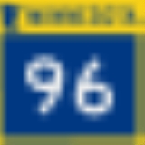
city boundary line and continues briefly east and then north to its northern terminus at its intersection with State Highway 96
in Dellwood
. The route is 7 miles (11.3 km) in length.
Highway 244 is also known as Wildwood Road, Mahtomedi Avenue, and Dellwood Avenue at various points throughout its route. The route is located in Washington County
.
, Willernie
, and Dellwood
. The route forms an arc around the east side of White Bear Lake.
The road runs primarily through a heavily wooded, residential area. That, combined with hilly terrain and numerous curves, results in a 30-35 MPH speed limit for most of its length. It becomes 45 MPH after the junction with Washington County Road 12, and lowers to 40 MPH when it reaches the commercial area at its southern terminus with Highway 120
and Ramsey County Road 15.
The route is legally defined as Route 244 in the Minnesota Statutes.
At one time, Highway 244 had continued farther west from its present day junction
with Highway 120
at the White Bear Lake
/ Mahtomedi
boundary line. Before 2002, the route had continued west of Highway 120 on present day Ramsey County Road 15 (the south edge of the city of White Bear Lake) until reaching Highway 61
at the Vadnais Heights
/ Gem Lake
boundary line. Highway 244 had previously formed an arc around both the south and east sides of White Bear Lake.
The state began turning the route over to Washington
and Ramsey
counties in 2001, which was expected to be finalized in 2009.
The 2001 Minnesota Legislature approved removal of Route 244 from the state trunk highway system. The portion within Ramsey County
was, and still is, also known as County Road E. In 2002, the Ramsey County portion was officially transferred to the county and the State Highway 244 signs were removed and it was re-signed as Ramsey County Road 15 (County E).
As of 2010, the section of 244 within Washington County
is still labeled as State Highway 244, but is still expected to be re-signed to county highway numbers. As of 2010, Highway 244 still appears on the official state highway map as a state highway within Washington County.
Highway
A highway is any public road. In American English, the term is common and almost always designates major roads. In British English, the term designates any road open to the public. Any interconnected set of highways can be variously referred to as a "highway system", a "highway network", or a...
in Minnesota
Minnesota
Minnesota is a U.S. state located in the Midwestern United States. The twelfth largest state of the U.S., it is the twenty-first most populous, with 5.3 million residents. Minnesota was carved out of the eastern half of the Minnesota Territory and admitted to the Union as the thirty-second state...
, which runs from its intersection
Intersection (road)
An intersection is a road junction where two or more roads either meet or cross at grade . An intersection may be 3-way - a T junction or fork, 4-way - a crossroads, or 5-way or more...
with State Highway 120
Minnesota State Highway 120
Minnesota State Highway 120 is a highway in Minnesota, which runs from its interchange with Interstate Highway 94 in Maplewood and continues north to its northern terminus at its intersection with State Highway 244 and Ramsey County Road 15 at the White Bear Lake / Mahtomedi boundary line...
and Ramsey County Road 15 (County E) at the White Bear Lake
White Bear Lake, Minnesota
White Bear Lake is a city in Ramsey and Washington counties in the U.S. state of Minnesota. The population was 23,797 at the 2010 census. The city is located on White Bear Lake, one of the largest lakes in the Minneapolis-St...
/ Mahtomedi
Mahtomedi, Minnesota
As of the census of 2000, there were 7,563 people, 2,503 households, and 2,027 families residing in the city. The population density was 2,095.4 people per square mile . There were 2,581 housing units at an average density of 715.1 per square mile...
city boundary line and continues briefly east and then north to its northern terminus at its intersection with State Highway 96
Minnesota State Highway 96
Minnesota State Highway 96 is a highway in Minnesota, which runs from its intersection with U.S. Highway 61 in White Bear Lake and continues east to its eastern terminus at its intersection with State Highway 95 on the northern edge of Stillwater....
in Dellwood
Dellwood, Minnesota
Dellwood is a city in Washington County, Minnesota, United States and a suburb of St. Paul. The population was 1,063 at the 2010 census.-Geography:...
. The route is 7 miles (11.3 km) in length.
Highway 244 is also known as Wildwood Road, Mahtomedi Avenue, and Dellwood Avenue at various points throughout its route. The route is located in Washington County
Washington County, Minnesota
Washington County is a county established in 1849 in the U.S. state of Minnesota. As of 2010, the population was 238,136. Its county seat is Stillwater.-History:...
.
Route description
Highway 244 serves as a north–south route between the communities of MahtomediMahtomedi, Minnesota
As of the census of 2000, there were 7,563 people, 2,503 households, and 2,027 families residing in the city. The population density was 2,095.4 people per square mile . There were 2,581 housing units at an average density of 715.1 per square mile...
, Willernie
Willernie, Minnesota
Willernie is a city in Washington County, Minnesota, United States. It is bordered on all sides by the city of Mahtomedi. The population was 507 at the 2010 census.-Geography:...
, and Dellwood
Dellwood, Minnesota
Dellwood is a city in Washington County, Minnesota, United States and a suburb of St. Paul. The population was 1,063 at the 2010 census.-Geography:...
. The route forms an arc around the east side of White Bear Lake.
The road runs primarily through a heavily wooded, residential area. That, combined with hilly terrain and numerous curves, results in a 30-35 MPH speed limit for most of its length. It becomes 45 MPH after the junction with Washington County Road 12, and lowers to 40 MPH when it reaches the commercial area at its southern terminus with Highway 120
Minnesota State Highway 120
Minnesota State Highway 120 is a highway in Minnesota, which runs from its interchange with Interstate Highway 94 in Maplewood and continues north to its northern terminus at its intersection with State Highway 244 and Ramsey County Road 15 at the White Bear Lake / Mahtomedi boundary line...
and Ramsey County Road 15.
The route is legally defined as Route 244 in the Minnesota Statutes.
History
Highway 244 was authorized on July 1, 1949. The route had been paved prior to it becoming a state highway.At one time, Highway 244 had continued farther west from its present day junction
Junction (traffic)
A junction, when discussed in the context of transport, is a location where traffic can change between different routes, directions, or sometimes modes, of travel.-Historical significance:...
with Highway 120
Minnesota State Highway 120
Minnesota State Highway 120 is a highway in Minnesota, which runs from its interchange with Interstate Highway 94 in Maplewood and continues north to its northern terminus at its intersection with State Highway 244 and Ramsey County Road 15 at the White Bear Lake / Mahtomedi boundary line...
at the White Bear Lake
White Bear Lake, Minnesota
White Bear Lake is a city in Ramsey and Washington counties in the U.S. state of Minnesota. The population was 23,797 at the 2010 census. The city is located on White Bear Lake, one of the largest lakes in the Minneapolis-St...
/ Mahtomedi
Mahtomedi, Minnesota
As of the census of 2000, there were 7,563 people, 2,503 households, and 2,027 families residing in the city. The population density was 2,095.4 people per square mile . There were 2,581 housing units at an average density of 715.1 per square mile...
boundary line. Before 2002, the route had continued west of Highway 120 on present day Ramsey County Road 15 (the south edge of the city of White Bear Lake) until reaching Highway 61
U.S. Route 61 in Minnesota
U.S. Highway 61 is a highway in southeast and east-central Minnesota, which runs from the River Bridge over the Mississippi River at La Crescent and continues north to its northern terminus at its junction with Interstate 35 at the city of Wyoming....
at the Vadnais Heights
Vadnais Heights, Minnesota
Vadnais Heights is a city in Ramsey County, Minnesota, United States. The population was 12,302 at the 2010 census.-Geography:According to the United States Census Bureau, the city has a total area of , of which, is land and is water. It borders the cities of Shoreview, Little Canada, White Bear...
/ Gem Lake
Gem Lake, Minnesota
Gem Lake is a city in Ramsey County, Minnesota, United States. The population was 393 at the 2010 census.-Geography:According to the United States Census Bureau, the city has a total area of , of which, of it is land and of it is water...
boundary line. Highway 244 had previously formed an arc around both the south and east sides of White Bear Lake.
The state began turning the route over to Washington
Washington County, Minnesota
Washington County is a county established in 1849 in the U.S. state of Minnesota. As of 2010, the population was 238,136. Its county seat is Stillwater.-History:...
and Ramsey
Ramsey County, Minnesota
Ramsey County is a county located in the U.S. state of Minnesota, founded in 1849. As of 2010, the population was 508,640. Its county seat is St. Paul, which is also Minnesota's state capital. The county is named for Alexander Ramsey , the first governor of the Minnesota Territory...
counties in 2001, which was expected to be finalized in 2009.
The 2001 Minnesota Legislature approved removal of Route 244 from the state trunk highway system. The portion within Ramsey County
Ramsey County, Minnesota
Ramsey County is a county located in the U.S. state of Minnesota, founded in 1849. As of 2010, the population was 508,640. Its county seat is St. Paul, which is also Minnesota's state capital. The county is named for Alexander Ramsey , the first governor of the Minnesota Territory...
was, and still is, also known as County Road E. In 2002, the Ramsey County portion was officially transferred to the county and the State Highway 244 signs were removed and it was re-signed as Ramsey County Road 15 (County E).
As of 2010, the section of 244 within Washington County
Washington County, Minnesota
Washington County is a county established in 1849 in the U.S. state of Minnesota. As of 2010, the population was 238,136. Its county seat is Stillwater.-History:...
is still labeled as State Highway 244, but is still expected to be re-signed to county highway numbers. As of 2010, Highway 244 still appears on the official state highway map as a state highway within Washington County.
Major intersections
| County | Location | Mile | Roads intersected | Notes |
|---|---|---|---|---|
| Washington Washington County, Minnesota Washington County is a county established in 1849 in the U.S. state of Minnesota. As of 2010, the population was 238,136. Its county seat is Stillwater.-History:... |
Mahtomedi Mahtomedi, Minnesota As of the census of 2000, there were 7,563 people, 2,503 households, and 2,027 families residing in the city. The population density was 2,095.4 people per square mile . There were 2,581 housing units at an average density of 715.1 per square mile... |
2.537 | , / CR 27 north | |
| 3.863 |  CR 12 (Stillwater Road) CR 12 (Stillwater Road) |
|||
| Dellwood Dellwood, Minnesota Dellwood is a city in Washington County, Minnesota, United States and a suburb of St. Paul. The population was 1,063 at the 2010 census.-Geography:... |
7.279 |