
Minnesota State Highway 96
Encyclopedia
Minnesota State Highway 96 is a highway
in Minnesota
, which runs from its
intersection
with U.S. Highway 61
in White Bear Lake
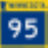
and continues east to its eastern terminus at its intersection with State Highway 95
on the northern edge of Stillwater
.
Highway 96 is also known as Dellwood Road in the communities of Dellwood
, Grant
, and Stillwater Township. The route is also known briefly as Lake Avenue North within the city of White Bear Lake.
, Dellwood
, Grant
, Stillwater Township, and Stillwater
.
The route is legally defined as Legislative Route 96 in the Minnesota Statutes.
From 1934 to 1994, State Highway 96 once extended farther west several miles through the communities of Vadnais Heights
, Shoreview
, and Arden Hills
. The former western terminus for State Highway 96 during this time period was at its intersection
with old U.S. Highway 8 (near I-35W
) on the Arden Hills / New Brighton
border. This section of Highway 96 was once part of the Highway 100 Beltway
circling the entire Twin Cities during the 1940s and 1950s.
Highway 96 between Highway 61
at White Bear Lake
and Old Highway 8 at Arden Hills is now known in the present day as Ramsey County
Highway 96.
Highway
A highway is any public road. In American English, the term is common and almost always designates major roads. In British English, the term designates any road open to the public. Any interconnected set of highways can be variously referred to as a "highway system", a "highway network", or a...
in Minnesota
Minnesota
Minnesota is a U.S. state located in the Midwestern United States. The twelfth largest state of the U.S., it is the twenty-first most populous, with 5.3 million residents. Minnesota was carved out of the eastern half of the Minnesota Territory and admitted to the Union as the thirty-second state...
, which runs from its
intersection
Intersection (road)
An intersection is a road junction where two or more roads either meet or cross at grade . An intersection may be 3-way - a T junction or fork, 4-way - a crossroads, or 5-way or more...
with U.S. Highway 61
U.S. Route 61 in Minnesota
U.S. Highway 61 is a highway in southeast and east-central Minnesota, which runs from the River Bridge over the Mississippi River at La Crescent and continues north to its northern terminus at its junction with Interstate 35 at the city of Wyoming....
in White Bear Lake
White Bear Lake, Minnesota
White Bear Lake is a city in Ramsey and Washington counties in the U.S. state of Minnesota. The population was 23,797 at the 2010 census. The city is located on White Bear Lake, one of the largest lakes in the Minneapolis-St...
and continues east to its eastern terminus at its intersection with State Highway 95
Minnesota State Highway 95
Minnesota State Highway 95 is a highway in east-central Minnesota, which runs from its intersection with State Highway 23 near St. Cloud and continues east and south to its southern terminus at its intersection with U.S...
on the northern edge of Stillwater
Stillwater, Minnesota
As of the census of 2000, there were 15,143 people, 5,797 households, and 4,115 families residing in the city. The population density was 2,340.0 people per square mile . There were 5,926 housing units at an average density of 915.7 per square mile...
.
Highway 96 is also known as Dellwood Road in the communities of Dellwood
Dellwood, Minnesota
Dellwood is a city in Washington County, Minnesota, United States and a suburb of St. Paul. The population was 1,063 at the 2010 census.-Geography:...
, Grant
Grant, Minnesota
Grant is a city in Washington County, Minnesota, United States and a suburb of St. Paul. The population was 4,096 at the 2010 census.-Geography:...
, and Stillwater Township. The route is also known briefly as Lake Avenue North within the city of White Bear Lake.
Route description
State Highway 96 serves as an east–west arterial route between the communities of White Bear LakeWhite Bear Lake, Minnesota
White Bear Lake is a city in Ramsey and Washington counties in the U.S. state of Minnesota. The population was 23,797 at the 2010 census. The city is located on White Bear Lake, one of the largest lakes in the Minneapolis-St...
, Dellwood
Dellwood, Minnesota
Dellwood is a city in Washington County, Minnesota, United States and a suburb of St. Paul. The population was 1,063 at the 2010 census.-Geography:...
, Grant
Grant, Minnesota
Grant is a city in Washington County, Minnesota, United States and a suburb of St. Paul. The population was 4,096 at the 2010 census.-Geography:...
, Stillwater Township, and Stillwater
Stillwater, Minnesota
As of the census of 2000, there were 15,143 people, 5,797 households, and 4,115 families residing in the city. The population density was 2,340.0 people per square mile . There were 5,926 housing units at an average density of 915.7 per square mile...
.
The route is legally defined as Legislative Route 96 in the Minnesota Statutes.
History
Highway 96 was authorized in 1933. It was paved east of U.S. 61 at the time the highway was marked. The part of the highway between U.S. 8 and U.S. 61 was completely paved by 1935.From 1934 to 1994, State Highway 96 once extended farther west several miles through the communities of Vadnais Heights
Vadnais Heights, Minnesota
Vadnais Heights is a city in Ramsey County, Minnesota, United States. The population was 12,302 at the 2010 census.-Geography:According to the United States Census Bureau, the city has a total area of , of which, is land and is water. It borders the cities of Shoreview, Little Canada, White Bear...
, Shoreview
Shoreview, Minnesota
As of the census of 2000, there are 25,377 people, Males: 12,303 , Females: 13,074 , 9,965 households, and 7,021 families residing in the city. The population density is 2,315.9 people per square mile . There are 10,127 housing units at an average density of 919.2 per square mile...
, and Arden Hills
Arden Hills, Minnesota
As of the census of 2000, there were 9,652 people, 2,959 households, and 2,228 families residing in the city. The population density was 1,087.3 people per square mile . There were 3,017 housing units at an average density of 339.9 per square mile...
. The former western terminus for State Highway 96 during this time period was at its intersection
Intersection (road)
An intersection is a road junction where two or more roads either meet or cross at grade . An intersection may be 3-way - a T junction or fork, 4-way - a crossroads, or 5-way or more...
with old U.S. Highway 8 (near I-35W
Interstate 35W (Minnesota)
Interstate 35W , is an Interstate Highway in the U.S. state of Minnesota, passing through downtown Minneapolis. It is one of two through routes for Interstate 35 through the Twin Cities of Minneapolis and Saint Paul, the other being Interstate 35E through downtown Saint Paul...
) on the Arden Hills / New Brighton
New Brighton, Minnesota
As of the census of 2000, there were 22,206 people, 9,013 households, and 5,903 families residing in the city. The population density was 3,343.9 people per square mile . There were 9,121 housing units at an average density of 1,373.5 per square mile...
border. This section of Highway 96 was once part of the Highway 100 Beltway
Minnesota State Highway 100
Minnesota State Highway 100 is a state highway in the Twin Cities region of Minnesota, which runs from its interchange with Interstate 494 in Bloomington and continues north to its northern terminus at its interchange with I-694 in Brooklyn Center...
circling the entire Twin Cities during the 1940s and 1950s.
Highway 96 between Highway 61
U.S. Route 61 in Minnesota
U.S. Highway 61 is a highway in southeast and east-central Minnesota, which runs from the River Bridge over the Mississippi River at La Crescent and continues north to its northern terminus at its junction with Interstate 35 at the city of Wyoming....
at White Bear Lake
White Bear Lake, Minnesota
White Bear Lake is a city in Ramsey and Washington counties in the U.S. state of Minnesota. The population was 23,797 at the 2010 census. The city is located on White Bear Lake, one of the largest lakes in the Minneapolis-St...
and Old Highway 8 at Arden Hills is now known in the present day as Ramsey County
Ramsey County, Minnesota
Ramsey County is a county located in the U.S. state of Minnesota, founded in 1849. As of 2010, the population was 508,640. Its county seat is St. Paul, which is also Minnesota's state capital. The county is named for Alexander Ramsey , the first governor of the Minnesota Territory...
Highway 96.