
McPhersonville, South Carolina
Encyclopedia
McPhersonville is an unincorporated community
in eastern Hampton County, South Carolina
, United States
, near the county's borders with Beaufort County
and Jasper County. Once an important center of affluence and culture in colonial Prince William Parish (roughly analogous to modern-day Hampton County), McPhersonville is now little more than a marked location on a secondary road between Yemassee
and Early Branch.
and Creek
Indians had established trading posts, trails, burial grounds and ceremonial grounds throughout the pine woods and swampland surrounding McPhersonville. The first lasting English settlements in the McPhersonville area date to the 1670s, before the Carolinas were divided in 1729. In 1682, the Proprietary County of Colleton was established, within which were later created Parishes of St. Bartholomew's (1706), Prince William (1745), St. Peter's (1747) and St. Luke's (1767). In 1769, Beaufort District was created from the merger of three earlier parishes: St. Peter's, St. Luke's, and Prince William, the latter roughly corresponding to modern-day Hampton County.
McPhersonville proper was established by rice planters from along the Combahee
and nearby rivers, who valued the inland area's cool winds, relatively low humidity and dense pine shade canopy. General James McPherson and his family were among the earliest residents; they were followed by the Drayton, McLeod, Pope, Mackey, Verdier, Brailsford, Martin, Palmer, McDougal, DeSaussure, Screven, Colcock, Hutson and Gregorie families. The Yamasee War of 1715 was largely fought in the areas around McPhersonville. It involved the Yamasee, Creeks, and many other tribes who rebelled against the unfair business practices of the region's white traders. Hundreds of colonists were killed and the loss of property was dramatic.
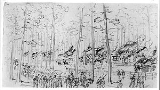
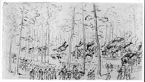 During the Civil War, McPhersonville was over-run early in the Carolinas Campaign
by Sherman's forces. Only two pre-Civil War homes and one church escaped the Union Army's passage through the village. Stoney Creek Independent Presbyterian Chapel of Prince William Parish
is the daughter chapel of old Stoney Creek Presbyterian Church, built in 1743 on the other side of the Pocotaligo River. The chapel was used as a hospital during the Civil War. It is on the National Register of Historic Places
. Historic Prince William’s Episcopal Church, on the other hand, did not survive the Civil War; it was first built in 1832, as a summer place of worship by the congregation of Sheldon Church of Prince William’s Parish (now famous as "Old Sheldon" ruins). Sherman’s army destroyed it in 1865 following its use by the Confederates as a smallpox clinic. Prince William's strongest timbers were used to build bridges across the Combahee, and the Federals set fire to the rest. It was rebuilt in its present modest form in 1898.
is now administered by Stoney Creek Presbyterian Foundation, associated with First Presbyterian Church in Beaufort. It was used as the Four Square Baptist Church where Gump prays with the choir for shrimp in the film Forrest Gump
.
Unincorporated area
In law, an unincorporated area is a region of land that is not a part of any municipality.To "incorporate" in this context means to form a municipal corporation, a city, town, or village with its own government. An unincorporated community is usually not subject to or taxed by a municipal government...
in eastern Hampton County, South Carolina
South Carolina
South Carolina is a state in the Deep South of the United States that borders Georgia to the south, North Carolina to the north, and the Atlantic Ocean to the east. Originally part of the Province of Carolina, the Province of South Carolina was one of the 13 colonies that declared independence...
, United States
United States
The United States of America is a federal constitutional republic comprising fifty states and a federal district...
, near the county's borders with Beaufort County
Beaufort County, South Carolina
-National protected areas:*Ernest F. Hollings ACE Basin National Wildlife Refuge *Pinckney Island National Wildlife Refuge-Demographics:As of the census of 2000, there were 155,215 people, 45,532 households, and 33,056 families residing in the county. The population density was 206 people per...
and Jasper County. Once an important center of affluence and culture in colonial Prince William Parish (roughly analogous to modern-day Hampton County), McPhersonville is now little more than a marked location on a secondary road between Yemassee
Yemassee, South Carolina
Yemassee is a town in Beaufort and Hampton counties in the U.S. state of South Carolina. The population was 1,027 at the 2010 census. Yemassee is also very near the borders of Colleton and Jasper counties and is often considered to be the geographical center or heart of the Lowcountry region...
and Early Branch.
Geography
McPhersonville is located at 32° 41' 31" North, 80° 55' 09" West (32.6918437, -80.9192743) . It is approximately 85 feet above sea level. The McPhersonville area is largely shady pine forests in sandy soil, which made it an attractive summer retreat for colonial plantation owners from the lower areas closer to the Atlantic coast, along with their extended families.Early history
By the time of European colonization, YemasseeYamasee
The Yamasee were a multiethnic confederation of Native Americans that lived in the coastal region of present-day northern coastal Georgia near the Savannah River and later in northeastern Florida.-History:...
and Creek
Creek people
The Muscogee , also known as the Creek or Creeks, are a Native American people traditionally from the southeastern United States. Mvskoke is their name in traditional spelling. The modern Muscogee live primarily in Oklahoma, Alabama, Georgia, and Florida...
Indians had established trading posts, trails, burial grounds and ceremonial grounds throughout the pine woods and swampland surrounding McPhersonville. The first lasting English settlements in the McPhersonville area date to the 1670s, before the Carolinas were divided in 1729. In 1682, the Proprietary County of Colleton was established, within which were later created Parishes of St. Bartholomew's (1706), Prince William (1745), St. Peter's (1747) and St. Luke's (1767). In 1769, Beaufort District was created from the merger of three earlier parishes: St. Peter's, St. Luke's, and Prince William, the latter roughly corresponding to modern-day Hampton County.
McPhersonville proper was established by rice planters from along the Combahee
Combahee River
The Combahee River is a short blackwater river in the southern Lowcountry region of South Carolina formed at the confluence of the Salkehatchie and Little Salkehatchie rivers near the Islandton community of Colleton County, South Carolina...
and nearby rivers, who valued the inland area's cool winds, relatively low humidity and dense pine shade canopy. General James McPherson and his family were among the earliest residents; they were followed by the Drayton, McLeod, Pope, Mackey, Verdier, Brailsford, Martin, Palmer, McDougal, DeSaussure, Screven, Colcock, Hutson and Gregorie families. The Yamasee War of 1715 was largely fought in the areas around McPhersonville. It involved the Yamasee, Creeks, and many other tribes who rebelled against the unfair business practices of the region's white traders. Hundreds of colonists were killed and the loss of property was dramatic.
Revolutionary War
During the Revolutionary War, British troops occupied the plantation of Isaac McPherson (described as “a great Rebel, a man of property” in contemporary reports) in March, 1780, after unsuccessfully trying to chase down 50 American troops on horseback. During their stay the British engaged in what they thought was a skirmish with the enemy, but mistakenly attacked their own troops. The British left McPherson’s Plantation and marched to the crossing of the Saltketcher (now the Salkehatchie) River, where a bridge had stood before the beginning of the war. They were met by 80 American militiamen who tried to prevent their crossing. The British Light Infantry crossed the river below this spot and came up behind the Americans. A captain and 16 privates were bayoneted to death by the British.Civil War
Carolinas Campaign
The Carolinas Campaign was the final campaign in the Western Theater of the American Civil War. In January 1865, Union Maj. Gen. William Tecumseh Sherman advanced north from Savannah, Georgia, through the Carolinas, with the intention of linking up with Union forces in Virginia. The defeat of ...
by Sherman's forces. Only two pre-Civil War homes and one church escaped the Union Army's passage through the village. Stoney Creek Independent Presbyterian Chapel of Prince William Parish
Stoney Creek Independent Presbyterian Chapel of Prince William Parish
Stoney Creek Independent Presbyterian Chapel of Prince William Parish or Stoney Creek Presbyterian Chapel is a chapel in southeastern Hampton County, South Carolina, United States in the unincorporated community of McPhersonville, South Carolina about west of Yemassee. In the USGS Geographic Names...
is the daughter chapel of old Stoney Creek Presbyterian Church, built in 1743 on the other side of the Pocotaligo River. The chapel was used as a hospital during the Civil War. It is on the National Register of Historic Places
National Register of Historic Places
The National Register of Historic Places is the United States government's official list of districts, sites, buildings, structures, and objects deemed worthy of preservation...
. Historic Prince William’s Episcopal Church, on the other hand, did not survive the Civil War; it was first built in 1832, as a summer place of worship by the congregation of Sheldon Church of Prince William’s Parish (now famous as "Old Sheldon" ruins). Sherman’s army destroyed it in 1865 following its use by the Confederates as a smallpox clinic. Prince William's strongest timbers were used to build bridges across the Combahee, and the Federals set fire to the rest. It was rebuilt in its present modest form in 1898.
Modern history
The economic tumult of the post-Civil Area, compounded by the destruction of the local infrastructure by Sherman's troops began a long era of decline for McPhersonville, in terms of its commerce, summer occupancy and year-round population. The McPhersonville post office closed in the 1950s and the community is now served by Yemassee's branch office. There are no significant businesses in modern McPhersonville, though the area has experienced a small renaissance in the past 20 years as modern property owners and investors are drawn to the same favorable environmental conditions that lured the early settlers. Stoney Creek Independent Presbyterian ChapelStoney Creek Independent Presbyterian Chapel of Prince William Parish
Stoney Creek Independent Presbyterian Chapel of Prince William Parish or Stoney Creek Presbyterian Chapel is a chapel in southeastern Hampton County, South Carolina, United States in the unincorporated community of McPhersonville, South Carolina about west of Yemassee. In the USGS Geographic Names...
is now administered by Stoney Creek Presbyterian Foundation, associated with First Presbyterian Church in Beaufort. It was used as the Four Square Baptist Church where Gump prays with the choir for shrimp in the film Forrest Gump
Forrest Gump
Forrest Gump is a 1994 American epic comedy-drama romance film based on the 1986 novel of the same name by Winston Groom. The film was directed by Robert Zemeckis, starring Tom Hanks, Robin Wright and Gary Sinise...
.