
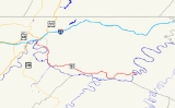
Maryland Route 51
Encyclopedia
Maryland Route 51 is a state highway
in the U.S. state
of Maryland
. Known for most of its length as Oldtown Road, the state highway runs 25.53 miles (41.1 km) from an interchange with Interstate 68
(I-68) in Cumberland
east to the West Virginia
state line at the Potomac River
, where the highway continues east as West Virginia Route 9 (WV 9) toward Paw Paw
. Around Cumberland, MD 51 is a major highway that provides a bypass of the South End neighborhood of that city and access to industrial areas along the Potomac River. East of North Branch
, MD 51 is a rural highway connecting small communities along the river in southeastern Allegany County
, including Oldtown
.
The city streets of Cumberland on which MD 51 was later designated were paved by 1910. The highway was constructed from the city limits of Cumberland to North Branch in the mid 1920s and to Paw Paw in the early 1930s and dedicated as Uhl Highway. Industrial Boulevard, a divided highway in the city of Cumberland, was constructed in the mid 1960s. MD 51 between Evitts Creek
and North Branch was relocated in the mid 1980s to better serve nearby industrial properties.
, providing access to the western end of the Chesapeake and Ohio Canal National Historical Park
(C&O Canal) at Canal Place
. A ramp to eastbound I-68 forms the east leg of the intersection, while Howard Street, which receives a ramp from westbound I-68, is the west leg. MD 51 heads south as Industrial Boulevard, a two-lane divided highway. Just south of its terminus, the state highway intersects Winston Street and Queen City Drive and receives a ramp from eastbound I-68. Queen City Drive is used by MD 51 west to access Centre Street, which has a ramp to westbound I-68. South of I-68 and Queen City Drive, MD 51 becomes a six-lane divided highway for a very short distance before Canal Parkway, which is unsigned MD 61
, exits eastbound and enters westbound just ahead of a bridge over CSX
's Cumberland Terminal Subdivision
.
MD 51 continues south on the west side of the South End neighborhood of Cumberland as a four-lane divided highway. The state highway turns east and gains a wide median with houses and businesses just before intersecting Virginia Avenue. Southbound Virginia Avenue completes the missing movements from the partial interchange with Canal Parkway, while northbound Virginia Avenue heads through the Chapel Hill Historic District
. After the median narrows, MD 51 parallels CSX's Cumberland rail yard
. MD 51's name changes to Oldtown Road after intersecting the old alignment with the same name that passes through the South End of Cumberland. Shortly after leaving the city limits of Cumberland, MD 51 crosses Evitts Creek and intersects Messick Road, which is unsigned MD 639
, then turns south through the unincorporated community of Evitts Creek, continuing to parallel the rail yard. The state highway reduces to a two-lane road after passing Uhl Highway, an old alignment of MD 51 that is unsigned MD 51E. The rail yard ends at Mexico Farms Road, which provides access to Mexico Farms Airport
and the Warrior Run Generating Station
. Within the hamlet of North Branch, MD 51 intersects as other end of Uhl Highway as well as Pittsburgh Plate Glass Road, which serves the North Branch Industrial Complex
, including Federal Correctional Institution, Cumberland
.
MD 51 enters a rural area and parallels the C&O Canal southeast through Spring Gap
. The state highway turns away from the Potomac River and passes through a hilly area south of Warrior Mountain
before entering the valley of Mill Run. MD 51 again parallels the C&O Canal as the highway approaches the unincorporated community of Oldtown. Within Oldtown, the state highway intersects Opessa Street, which leads to a private, low-water toll bridge across the Potomac River to Green Spring Road in Hampshire County, West Virginia
. MD 51 separates from the C&O Canal again as it leaves Oldtown and enters the valley of Sawpit Run, which the road follows to its confluence with Town Creek
. The state highway follows the creek to the community of Town Creek
, where it makes contact with the C&O Canal again. MD 51 then climbs a bluff and turns north again, passing through a swath of Green Ridge State Forest
before turning east and settling into the valley of Pursiane Run. The state highway turns north out of the stream valley as it loops east over the C&O Canal and south over the Potomac River into West Virginia, where the highway continues as WV 9 toward Paw Paw.
at North Branch. Construction was underway between Spring Gap and Oldtown by 1930. MD 51 was completed and marked between Spring Gap and Paw Paw, including the new bridge over the Potomac River near Paw Paw, in 1932. In 1934, the highway was named for G. Clinton Uhl, a native of Mount Savage
who was chairman of the Maryland State Roads Commission
from 1929 until his death in 1934.
MD 51 was widened between the city limits of Cumberland and North Branch in 1949 and 1950. A new bridge was constructed over Evitts Creek and the surrounding length of highway widened to three lanes in 1957. Industrial Boulevard was constructed from the Cumberland city limit west to the intersection of Mechanic Street and Centre Street in 1964. At the time, the new bypass of the South End of Cumberland was constructed as a divided highway from Oldtown Road to just east of Messick Road. The divided highway was extended to downtown Cumberland after a new bridge over the Baltimore and Ohio Railroad
was completed in 1965. The divided highway was extended east to its present extent just south of the northern intersection with Uhl Highway in Evitts Creek, part of the relocation of MD 51 through North Branch, in 1987. The present bridge over the Potomac River at Paw Paw was also constructed in 1987.
.
{| class=wikitable
!Location
!Mile
!Destinations
!Notes
|-
|rowspan=5|Cumberland
|0.00
|Mechanic Street north /
|Western terminus; I-68 Exit 43B
|-
|0.08
|Queen City Drive north / Centre Street north to
|Westbound exit, eastbound entrance; unsigned MD 51A
|-
|0.21
| – Wiley Ford, WV
, Cumberland Regional Airport
|Eastbound exit, westbound entrance; MD 61 is unsigned
|-
|1.24
|Virginia Avenue – Wiley Ford, WV
, Cumberland Regional Airport
|
|-
|2.54
|Oldtown Road west
|Old alignment of MD 51
|-
|rowspan=3|Evitts Creek
|2.86
| – Allegany College of Maryland
|MD 639 is unsigned
|-
|3.46
|Uhl Highway south
|Unsigned MD 51E
|-
|4.31
|Blue Valley Road east
|Unsigned MD 51F
|-
|North Branch
|5.63
|Uhl Highway north / Pittsburgh Plate Glass Road west – Mexico
|Uhl Highway is unsigned MD 51E
|-
|Oldtown
|14.72
|Bear Hill Road north / Opessa Street west to CR 1 south (Green Spring Road) – Green Spring, WV
|
|-
|
|25.53
| – Paw Paw, WV
|Eastern terminus; West Virginia
state line at Potomac River
MD 51 also had at least two former auxiliary routes.
State highway
State highway, state road or state route can refer to one of three related concepts, two of them related to a state or provincial government in a country that is divided into states or provinces :#A...
in the U.S. state
U.S. state
A U.S. state is any one of the 50 federated states of the United States of America that share sovereignty with the federal government. Because of this shared sovereignty, an American is a citizen both of the federal entity and of his or her state of domicile. Four states use the official title of...
of Maryland
Maryland
Maryland is a U.S. state located in the Mid Atlantic region of the United States, bordering Virginia, West Virginia, and the District of Columbia to its south and west; Pennsylvania to its north; and Delaware to its east...
. Known for most of its length as Oldtown Road, the state highway runs 25.53 miles (41.1 km) from an interchange with Interstate 68
Interstate 68
Interstate 68 is a Interstate highway in the U.S. states of West Virginia and Maryland, connecting in Morgantown to in Hancock. is also Corridor E of the Appalachian Development Highway System. From 1965 until the freeway's construction was completed in 1991, it was designated as...
(I-68) in Cumberland
Cumberland, Maryland
Cumberland is a city in the far western, Appalachian portion of Maryland, United States. It is the county seat of Allegany County, and the primary city of the Cumberland, MD-WV Metropolitan Statistical Area. At the 2010 census, the city had a population of 20,859, and the metropolitan area had a...
east to the West Virginia
West Virginia
West Virginia is a state in the Appalachian and Southeastern regions of the United States, bordered by Virginia to the southeast, Kentucky to the southwest, Ohio to the northwest, Pennsylvania to the northeast and Maryland to the east...
state line at the Potomac River
Potomac River
The Potomac River flows into the Chesapeake Bay, located along the mid-Atlantic coast of the United States. The river is approximately long, with a drainage area of about 14,700 square miles...
, where the highway continues east as West Virginia Route 9 (WV 9) toward Paw Paw
Paw Paw, West Virginia
Paw Paw is a town in Morgan County, West Virginia, United States. The population was 524 at the 2000 census. The town is known for the nearby Paw Paw Tunnel. Paw Paw was incorporated by the Circuit Court of Morgan County on April 8, 1891 and named for the pawpaw, a wild fruit which formerly grew in...
. Around Cumberland, MD 51 is a major highway that provides a bypass of the South End neighborhood of that city and access to industrial areas along the Potomac River. East of North Branch
North Branch, Maryland
North Branch is an unincorporated community in Allegany County, Maryland, United States. The Western Maryland Railroad Right-of-Way, Milepost 126 to Milepost 160 was listed on the National Register of Historic Places in 1981....
, MD 51 is a rural highway connecting small communities along the river in southeastern Allegany County
Allegany County, Maryland
Allegany County is a county located in the northwestern part of the US state of Maryland. It is part of the Cumberland, MD-WV Metropolitan Statistical Area. As of 2010, the population was 75,087. Its county seat is Cumberland...
, including Oldtown
Oldtown, Maryland
Oldtown is an unincorporated community in Allegany County, Maryland along the North Branch Potomac River founded in 18th century colonial times. The settlement was initially called "Shawanese Old Town" because it was the site of a Shawnee Amerindian village abandoned about a decade earlier...
.
The city streets of Cumberland on which MD 51 was later designated were paved by 1910. The highway was constructed from the city limits of Cumberland to North Branch in the mid 1920s and to Paw Paw in the early 1930s and dedicated as Uhl Highway. Industrial Boulevard, a divided highway in the city of Cumberland, was constructed in the mid 1960s. MD 51 between Evitts Creek
Evitts Creek, Maryland
Evitts Creek is an unincorporated community located on the eastern outskirts of Cumberland, Maryland, USA along Maryland Route 51 and immediately east of the confluence of Evitts Creek and the North Branch Potomac River....
and North Branch was relocated in the mid 1980s to better serve nearby industrial properties.
Route description
MD 51 begins at an intersection with ramps of I-68 Exit 43B. Mechanic Street heads north from the intersection toward the Downtown Cumberland Historic DistrictDowntown Cumberland Historic District
The Downtown Cumberland Historic District, also referred to as the Downtown Cumberland Mall, is the main shopping and dining district for the city of Cumberland, Maryland.-Location:...
, providing access to the western end of the Chesapeake and Ohio Canal National Historical Park
Chesapeake and Ohio Canal National Historical Park
The Chesapeake and Ohio Canal National Historical Park is a United States National Historical Park located in the District of Columbia and the states of Maryland and West Virginia. The park was established as a National Monument in 1961 by President Dwight D...
(C&O Canal) at Canal Place
Canal Place
Canal Place is a park owned by the State of Maryland and located in Cumberland, MD. The park includes the Western Maryland Railway Station, station plaza, a picnic area, a canal boat replica, a pedestrian bridge to George Washington’s Headquarters , picnic area, Shops at Canal Place, and the...
. A ramp to eastbound I-68 forms the east leg of the intersection, while Howard Street, which receives a ramp from westbound I-68, is the west leg. MD 51 heads south as Industrial Boulevard, a two-lane divided highway. Just south of its terminus, the state highway intersects Winston Street and Queen City Drive and receives a ramp from eastbound I-68. Queen City Drive is used by MD 51 west to access Centre Street, which has a ramp to westbound I-68. South of I-68 and Queen City Drive, MD 51 becomes a six-lane divided highway for a very short distance before Canal Parkway, which is unsigned MD 61
Maryland Route 61
Maryland Route 61 is an unsigned state highway in the U.S. state of Maryland. Known as Canal Parkway, the state highway begins at the West Virginia state line at the Potomac River opposite Wiley Ford, where the highway continues south as West Virginia Route 28 . The state highway runs north as...
, exits eastbound and enters westbound just ahead of a bridge over CSX
CSX Transportation
CSX Transportation operates a Class I railroad in the United States known as the CSX Railroad. It is the main subsidiary of the CSX Corporation. The company is headquartered in Jacksonville, Florida, and owns approximately 21,000 route miles...
's Cumberland Terminal Subdivision
Cumberland Terminal Subdivision
The Cumberland Terminal Subdivision is a railroad line owned and operated by CSX Transportation in the Cumberland, Maryland area. The line centers around the Cumberland rail yard and is a junction with three other subdivisions....
.
MD 51 continues south on the west side of the South End neighborhood of Cumberland as a four-lane divided highway. The state highway turns east and gains a wide median with houses and businesses just before intersecting Virginia Avenue. Southbound Virginia Avenue completes the missing movements from the partial interchange with Canal Parkway, while northbound Virginia Avenue heads through the Chapel Hill Historic District
Chapel Hill Historic District (Cumberland, Maryland)
The Chapel Hill Historic District is a national historic district in Cumberland, Allegany County, Maryland. It is a mixed-use historic district of 810 contributing resources on located on the southeast side of Cumberland. It contains a mix of residential, commercial, and institutional buildings,...
. After the median narrows, MD 51 parallels CSX's Cumberland rail yard
Rail yard
A rail yard, or railroad yard, is a complex series of railroad tracks for storing, sorting, or loading/unloading, railroad cars and/or locomotives. Railroad yards have many tracks in parallel for keeping rolling stock stored off the mainline, so that they do not obstruct the flow of traffic....
. MD 51's name changes to Oldtown Road after intersecting the old alignment with the same name that passes through the South End of Cumberland. Shortly after leaving the city limits of Cumberland, MD 51 crosses Evitts Creek and intersects Messick Road, which is unsigned MD 639
Maryland Route 639
Maryland Route 639 is an unsigned state highway in the U.S. state of Maryland. The state highway runs from MD 51 in Evitts Creek north to Interstate 68 , U.S. Route 40, US 220, and US 40 Alternate in Cumberland. MD 639 provides access to Allegany College of Maryland and Western Maryland...
, then turns south through the unincorporated community of Evitts Creek, continuing to parallel the rail yard. The state highway reduces to a two-lane road after passing Uhl Highway, an old alignment of MD 51 that is unsigned MD 51E. The rail yard ends at Mexico Farms Road, which provides access to Mexico Farms Airport
Mexico Farms Airport
Mexico Farms Airport is a public airport located south of downtown Cumberland, Maryland, United States. The airport is located immediately south of the larger Greater Cumberland Regional Airport....
and the Warrior Run Generating Station
Warrior Run Generating Station
Warrior Run Generating Station, owned by the AES Corporation, is a 205 megawatt cogeneration plant located south of Cumberland, Maryland, at 11600 Mexico Farms Road...
. Within the hamlet of North Branch, MD 51 intersects as other end of Uhl Highway as well as Pittsburgh Plate Glass Road, which serves the North Branch Industrial Complex
North Branch Industrial Complex
North Branch Industrial Complex is a business park located to the east of Cumberland, Maryland.Businesses locating in the Allegany County North Branch Industrial Complex qualify for real property tax credits at 50% to 70% of the increased value of the property for up to 10 years...
, including Federal Correctional Institution, Cumberland
Federal Correctional Institution, Cumberland
Federal Correctional Institution, Cumberland in Cumberland, Maryland is a federal prison that houses medium security male offenders. The FCI has an adjacent minimum security satellite camp that houses male offenders....
.
MD 51 enters a rural area and parallels the C&O Canal southeast through Spring Gap
Spring Gap, Maryland
Spring Gap is an unincorporated community in Allegany County, Maryland, United States.Spring Gap is located in the Potomac Valley along the Chesapeake and Ohio Canal at mile marker 173 where it meets with the Spring Gap Recreational Area. This park offers camping sites and a place to relax for...
. The state highway turns away from the Potomac River and passes through a hilly area south of Warrior Mountain
Warrior Mountain
Warrior Mountain is a ridge located in Allegany County, Maryland. Warrior Mountain begins northwest of Oldtown, Maryland and runs northeasterly to the water gap formed by the Murley Branch of Town Creek, south of Flintstone, Maryland...
before entering the valley of Mill Run. MD 51 again parallels the C&O Canal as the highway approaches the unincorporated community of Oldtown. Within Oldtown, the state highway intersects Opessa Street, which leads to a private, low-water toll bridge across the Potomac River to Green Spring Road in Hampshire County, West Virginia
Hampshire County, West Virginia
Hampshire County is a county located in the U.S. state of West Virginia. As of 2010, the population was 23,964. Its county seat is Romney, West Virginia's oldest town . Hampshire County was created by the Virginia General Assembly on December 13, 1753, from parts of Frederick and Augusta counties ...
. MD 51 separates from the C&O Canal again as it leaves Oldtown and enters the valley of Sawpit Run, which the road follows to its confluence with Town Creek
Town Creek (Potomac River)
Town Creek is a tributary stream of the Potomac River in the U.S. states of Maryland and Pennsylvania. The creek is formed from the confluence of Sweet Root Creek and Elk Lick Creek, about south of Buchanan State Forest in Bedford County, Pennsylvania. Town Creek flows south along the base of...
. The state highway follows the creek to the community of Town Creek
Town Creek, Maryland
Town Creek is an unincorporated community in Allegany County, Maryland. Town Creek lies on the Potomac River within the Chesapeake and Ohio Canal National Historical Park across the river from Okonoko, West Virginia. Town Creek takes its name from a nearby stream....
, where it makes contact with the C&O Canal again. MD 51 then climbs a bluff and turns north again, passing through a swath of Green Ridge State Forest
Green Ridge State Forest
Green Ridge State Forest is a state forest in Western Maryland. Approximately in size, it is situated along Green Ridge and Town Hill in eastern Allegany County.Camping, Hiking, Biking, ORV, Fishing, and Boating are all permitted in Green Ridge State Forest...
before turning east and settling into the valley of Pursiane Run. The state highway turns north out of the stream valley as it loops east over the C&O Canal and south over the Potomac River into West Virginia, where the highway continues as WV 9 toward Paw Paw.
History
Portions of what was to become MD 51 were paved within the city of Cumberland by 1910. The state highway originally began at the intersection of Baltimore Avenue and Front Street. MD 51 followed Park Street, Williams Street, and Louisiana Avenue to Oldtown Road southeast out of the city. The modern state highway was constructed from the Cumberland city line to North Branch by 1923. MD 51 was extended to Spring Gap between 1924 and 1926, including an underpass of the Western Maryland RailwayWestern Maryland Railway
The Western Maryland Railway was an American Class I railroad which operated in Maryland, West Virginia, and Pennsylvania. It was primarily a coal hauling and freight railroad, with a small passenger train operation. The WM became part of the Chessie System in 1973 and ceased operating its lines...
at North Branch. Construction was underway between Spring Gap and Oldtown by 1930. MD 51 was completed and marked between Spring Gap and Paw Paw, including the new bridge over the Potomac River near Paw Paw, in 1932. In 1934, the highway was named for G. Clinton Uhl, a native of Mount Savage
Mount Savage, Maryland
Mount Savage is an unincorporated community in Allegany County, Maryland, United States. A small blue-collar community, Mount Savage lies at the base of Big Savage Mountain in the Allegheny Mountains, between the cities of Frostburg and Cumberland...
who was chairman of the Maryland State Roads Commission
Maryland State Highway Administration
The Maryland State Highway Administration is the state agency responsible for maintaining Maryland numbered highways outside of Baltimore City...
from 1929 until his death in 1934.
MD 51 was widened between the city limits of Cumberland and North Branch in 1949 and 1950. A new bridge was constructed over Evitts Creek and the surrounding length of highway widened to three lanes in 1957. Industrial Boulevard was constructed from the Cumberland city limit west to the intersection of Mechanic Street and Centre Street in 1964. At the time, the new bypass of the South End of Cumberland was constructed as a divided highway from Oldtown Road to just east of Messick Road. The divided highway was extended to downtown Cumberland after a new bridge over the Baltimore and Ohio Railroad
Baltimore and Ohio Railroad
The Baltimore and Ohio Railroad was one of the oldest railroads in the United States and the first common carrier railroad. It came into being mostly because the city of Baltimore wanted to compete with the newly constructed Erie Canal and another canal being proposed by Pennsylvania, which...
was completed in 1965. The divided highway was extended east to its present extent just south of the northern intersection with Uhl Highway in Evitts Creek, part of the relocation of MD 51 through North Branch, in 1987. The present bridge over the Potomac River at Paw Paw was also constructed in 1987.
Junction list
The entire route is in Allegany CountyAllegany County, Maryland
Allegany County is a county located in the northwestern part of the US state of Maryland. It is part of the Cumberland, MD-WV Metropolitan Statistical Area. As of 2010, the population was 75,087. Its county seat is Cumberland...
.
{| class=wikitable
!Location
!Mile
!Destinations
!Notes
|-
|rowspan=5|Cumberland
Cumberland, Maryland
Cumberland is a city in the far western, Appalachian portion of Maryland, United States. It is the county seat of Allegany County, and the primary city of the Cumberland, MD-WV Metropolitan Statistical Area. At the 2010 census, the city had a population of 20,859, and the metropolitan area had a...
|0.00
|Mechanic Street north /
|Western terminus; I-68 Exit 43B
|-
|0.08
|Queen City Drive north / Centre Street north to
|Westbound exit, eastbound entrance; unsigned MD 51A
|-
|0.21
| – Wiley Ford, WV
Wiley Ford, West Virginia
Wiley Ford is a census-designated place in Mineral County, West Virginia, United States and part of the 'Cumberland, MD-WV Metropolitan Statistical Area'...
, Cumberland Regional Airport
|Eastbound exit, westbound entrance; MD 61 is unsigned
|-
|1.24
|Virginia Avenue – Wiley Ford, WV
Wiley Ford, West Virginia
Wiley Ford is a census-designated place in Mineral County, West Virginia, United States and part of the 'Cumberland, MD-WV Metropolitan Statistical Area'...
, Cumberland Regional Airport
|
|-
|2.54
|Oldtown Road west
|Old alignment of MD 51
|-
|rowspan=3|Evitts Creek
Evitts Creek, Maryland
Evitts Creek is an unincorporated community located on the eastern outskirts of Cumberland, Maryland, USA along Maryland Route 51 and immediately east of the confluence of Evitts Creek and the North Branch Potomac River....
|2.86
| – Allegany College of Maryland
Allegany College of Maryland
Allegany College of Maryland is a two-year public community college located in Cumberland, Maryland. It was previously known as Allegany Community College .- History :...
|MD 639 is unsigned
|-
|3.46
|Uhl Highway south
|Unsigned MD 51E
|-
|4.31
|Blue Valley Road east
|Unsigned MD 51F
|-
|North Branch
North Branch, Maryland
North Branch is an unincorporated community in Allegany County, Maryland, United States. The Western Maryland Railroad Right-of-Way, Milepost 126 to Milepost 160 was listed on the National Register of Historic Places in 1981....
|5.63
|Uhl Highway north / Pittsburgh Plate Glass Road west – Mexico
Mexico, Allegany County, Maryland
Mexico is an unincorporated community, in Allegany County, Maryland. It lies at an elevation of 604 feet ....
|Uhl Highway is unsigned MD 51E
|-
|Oldtown
Oldtown, Maryland
Oldtown is an unincorporated community in Allegany County, Maryland along the North Branch Potomac River founded in 18th century colonial times. The settlement was initially called "Shawanese Old Town" because it was the site of a Shawnee Amerindian village abandoned about a decade earlier...
|14.72
|Bear Hill Road north / Opessa Street west to
CR 1 south (Green Spring Road) – Green Spring, WVGreen Spring, West Virginia
Green Spring is an unincorporated census-designated place and railroad town in Hampshire County, West Virginia, USA. As of the 2010 census, its population was 218. Green Spring is located north of Springfield on Green Spring Road near the confluence of the North and South Branches of the Potomac...
|
|-
|
|25.53
| – Paw Paw, WV
Paw Paw, West Virginia
Paw Paw is a town in Morgan County, West Virginia, United States. The population was 524 at the 2000 census. The town is known for the nearby Paw Paw Tunnel. Paw Paw was incorporated by the Circuit Court of Morgan County on April 8, 1891 and named for the pawpaw, a wild fruit which formerly grew in...
|Eastern terminus; West Virginia
West Virginia
West Virginia is a state in the Appalachian and Southeastern regions of the United States, bordered by Virginia to the southeast, Kentucky to the southwest, Ohio to the northwest, Pennsylvania to the northeast and Maryland to the east...
state line at Potomac River
Potomac River
The Potomac River flows into the Chesapeake Bay, located along the mid-Atlantic coast of the United States. The river is approximately long, with a drainage area of about 14,700 square miles...
Auxiliary routes
MD 51 currently has four unsigned auxiliary routes.- MD 51A is the designation for a 0.04 mile (0.0643736 km) section of Centre Street that serves as a ramp from westbound MD 51 to northbound Queen City Drive and Winston Street.
- MD 51D is the designation for Evitts Creek Drive, a 0.18 mile (0.2896812 km) service road that closely parallels the eastbound side of MD 51 from its terminus at the MD 51–MD 639 intersection south to a cul-de-sac in the hamlet of Evitts Creek.
- MD 51E is the designation for Uhl Highway, a 2.24 miles (3.6 km) section of old alignment that runs from MD 51 a short distance south of MD 639 south to MD 51's intersection with Pittsburgh Plate Glass Road in North Branch.
- MD 51F is the designation for a 0.1 mile (0.160934 km) section of Blue Valley Road east from MD 51 in North Branch.
MD 51 also had at least two former auxiliary routes.
- MD 51B was the designation for 0.03 mile (0.0482802 km) section of Messick Road north from Messick Road's intersection with MD 51. MD 51B became part of MD 639 in 2008.
- MD 51C was the designation for Starlite Drive, a 0.27 mile (0.4345218 km) section of old alignment of MD 51 from Messick Road east to a private road. MD 51C was transferred to county maintenance in 2008.