
Maryland Route 456
Encyclopedia
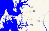
Maryland Route 456 is a state highway
in the U.S. state
of Maryland
. Known as Del Rhodes Avenue, the state highway runs 1.2 miles (1.9 km) from U.S. Route 50
(US 50) north to MD 18
within Queenstown
. MD 456, which serves as a cut-off between US 50 and US 301
just east of the split of the two highways, is officially separated into two sections, MD 456 and MD 456A, by a superstreet
intersection with US 301. The state highway was constructed in the early 1930s as a cut-off between Queenstown and MD 404
, then the main east–west highway in western Queen Anne's County
. MD 456 was extended south in the late 1940s when US 50 was moved to its present course.
designated US 50QB. MD 456 heads northwest along a row of residences. The state highway enters the town of Queenstown after crossing the Wye River
. MD 656 (Friels Road) splits to the west before MD 456 officially ends at US 301 (Blue Star Memorial Highway), where the two highways meet at a superstreet intersection. Traffic on MD 456 is required to turn right onto US 301, make a U-turn, and turn right again to continue on MD 456. The roadway, now officially MD 456A, continues 0.32 mile (0.5149888 km) to the highway's northern terminus at MD 18 (Main Street), officially MD 18C, in the center of Queenstown.
in Queen Anne's County
.
{|class=wikitable
!Mile
!Destinations
!Notes
|-
|0.00
|
|Southern terminus of MD 456
|-
|0.56
|
|
|-
|0.88
|, Wilmington
|Superstreet intersection; northern terminus of MD 456; southern terminus of MD 456A
|-
|1.20
|
|Northern terminus of MD 456A; officially MD 18C
State highway
State highway, state road or state route can refer to one of three related concepts, two of them related to a state or provincial government in a country that is divided into states or provinces :#A...
in the U.S. state
U.S. state
A U.S. state is any one of the 50 federated states of the United States of America that share sovereignty with the federal government. Because of this shared sovereignty, an American is a citizen both of the federal entity and of his or her state of domicile. Four states use the official title of...
of Maryland
Maryland
Maryland is a U.S. state located in the Mid Atlantic region of the United States, bordering Virginia, West Virginia, and the District of Columbia to its south and west; Pennsylvania to its north; and Delaware to its east...
. Known as Del Rhodes Avenue, the state highway runs 1.2 miles (1.9 km) from U.S. Route 50
U.S. Route 50 in Maryland
U.S. Route 50 is a major east–west route of the U.S. Highway system, stretching just over from Ocean City, Maryland on the Atlantic Ocean to West Sacramento, California. In the U.S. state of Maryland, US 50 exists in two sections. The longer of these serves as a major route connecting...
(US 50) north to MD 18
Maryland Route 18
Maryland Route 18 is a state highway in the U.S. state of Maryland. The state highway runs from the beginning of state maintenance at Love Point east to MD 213 in Centreville...
within Queenstown
Queenstown, Maryland
Queenstown is a town in Queen Anne's County, Maryland, United States. The population was 617 at the 2000 census.-Geography:Queenstown is located at ....
. MD 456, which serves as a cut-off between US 50 and US 301
U.S. Route 301 in Maryland
U.S. Route 301 in Maryland is a major highway that runs from Delaware to the Governor Harry W. Nice Memorial Bridge into Virginia. It passes through three of Maryland's four main regions: the Eastern Shore, the Baltimore-Washington Metropolitan Area, and Southern Maryland...
just east of the split of the two highways, is officially separated into two sections, MD 456 and MD 456A, by a superstreet
Superstreet
A superstreet is a type of road intersection that is a variation of the Michigan left. In this configuration, traffic on the minor road is not permitted to proceed straight across the major road or highway; traffic wishing to turn left or go straight must turn right onto the major road, make a...
intersection with US 301. The state highway was constructed in the early 1930s as a cut-off between Queenstown and MD 404
Maryland Route 404
Maryland Route 404 is a major highway on Maryland's Eastern Shore in the United States. It runs from Maryland Route 662 in Wye Mills on the border of Queen Anne's and Talbot Counties, southeast to the Delaware state line in Caroline County, where the road continues as Delaware Route 404 to Nassau...
, then the main east–west highway in western Queen Anne's County
Queen Anne's County, Maryland
Queen Anne's County is a county located on the Eastern Shore of the U.S. state of Maryland.As of 2010, the population was 47,798. Its county seat and most populous municipality is Centreville. The census-designated place of Stevensville is the county's most populous place...
. MD 456 was extended south in the late 1940s when US 50 was moved to its present course.
Route description
MD 456 begins at an intersection with US 50 (Ocean Gateway) just east of Queenstown. The ramp from westbound US 50 to northbound MD 456 is the original alignment and has the unsignedUnsigned highway
An unsigned highway is a highway that has been assigned a route number, but does not bear conventional road markings that would normally be used to identify the route with that number...
designated US 50QB. MD 456 heads northwest along a row of residences. The state highway enters the town of Queenstown after crossing the Wye River
Wye River (Maryland)
The Wye River is a tributary of the Chesapeake Bay, on the Eastern Shore of Maryland. It was named by the Lloyd family, Edward Lloyd , and Edward Lloyd , after the River Wye in Wales. It falls within Queen Anne's County and Talbot County, and joins the Miles River near its mouth to the Eastern Bay...
. MD 656 (Friels Road) splits to the west before MD 456 officially ends at US 301 (Blue Star Memorial Highway), where the two highways meet at a superstreet intersection. Traffic on MD 456 is required to turn right onto US 301, make a U-turn, and turn right again to continue on MD 456. The roadway, now officially MD 456A, continues 0.32 mile (0.5149888 km) to the highway's northern terminus at MD 18 (Main Street), officially MD 18C, in the center of Queenstown.
History
The Eastern Shore Boulevard, designated MD 404 by 1933, was completed around Queenstown by 1930. MD 456 was constructed from the MD 656 intersection north to the center of Queenstown shortly after 1930. When US 50 was moved to its present alignment south of Queenstown in 1949, MD 456 was extended south along the old section of MD 404 and MD 656 was designated on the section of old MD 404 between MD 456 and MD 18. The MD 456–US 301 junction was transformed into a superstreet intersection in 2003, resulting in the designation of MD 456A north of the junction.Junction list
The entire route is in QueenstownQueenstown, Maryland
Queenstown is a town in Queen Anne's County, Maryland, United States. The population was 617 at the 2000 census.-Geography:Queenstown is located at ....
in Queen Anne's County
Queen Anne's County, Maryland
Queen Anne's County is a county located on the Eastern Shore of the U.S. state of Maryland.As of 2010, the population was 47,798. Its county seat and most populous municipality is Centreville. The census-designated place of Stevensville is the county's most populous place...
.
{|class=wikitable
!Mile
!Destinations
!Notes
|-
|0.00
|
|Southern terminus of MD 456
|-
|0.56
|
|
|-
|0.88
|, Wilmington
Wilmington, Delaware
Wilmington is the largest city in the state of Delaware, United States, and is located at the confluence of the Christina River and Brandywine Creek, near where the Christina flows into the Delaware River. It is the county seat of New Castle County and one of the major cities in the Delaware Valley...
|Superstreet intersection; northern terminus of MD 456; southern terminus of MD 456A
|-
|1.20
|
|Northern terminus of MD 456A; officially MD 18C