

Manzano Mountains
Encyclopedia
Mountain range
A mountain range is a single, large mass consisting of a succession of mountains or narrowly spaced mountain ridges, with or without peaks, closely related in position, direction, formation, and age; a component part of a mountain system or of a mountain chain...
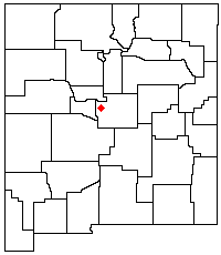
in the central part of the US State of New Mexico
New Mexico
New Mexico is a state located in the southwest and western regions of the United States. New Mexico is also usually considered one of the Mountain States. With a population density of 16 per square mile, New Mexico is the sixth-most sparsely inhabited U.S...
. They are oriented north-south and are about 40 miles (65 km) long. The center of the range lies about 25 miles (40 km) southeast of Albuquerque, and the northern foothills (termed the Manzanitas) are just a few miles east of the edge of the city. The name "Manzano" is Spanish
Spanish language
Spanish , also known as Castilian , is a Romance language in the Ibero-Romance group that evolved from several languages and dialects in central-northern Iberia around the 9th century and gradually spread with the expansion of the Kingdom of Castile into central and southern Iberia during the...
for "apple tree"; the mountains were named for apple orchards planted at the nearby town of Manzano
Manzano, New Mexico
Manzano is a census-designated place in Torrance County, New Mexico, United States. The population was 54 at the 2000 census. The Quarai Ruins of Salinas Pueblo Missions National Monument are located near the town. The center of population of New Mexico is located in Manzano .Manzano is part of...
.
The high point of the Manzano Mountains is Manzano Peak
Manzano Peak
Manzano Peak is the highest peak in the Manzano Mountains, a mountain range in the central part of the US State of New Mexico. It lies southwest of the town of Manzano and east-southeast of the town of Belen, in the Manzano Mountain Wilderness Area, part of the Mountainair Ranger District of the...
(10,098 ft, 3,078 m), at the southern end of the range. Other notable peaks include flat-topped Bosque Peak (9,610 ft, 2,929 m), near the center of the range, and the twin pyramids of Mosca Peak (9,509 ft, 2,898 m) and Guadalupe Peak (9,450 ft, 2,880 m). The last two are the most easily recognized peaks in the range as viewed from Albuquerque. Manzano Peak and Guadalupe Peak are the most dramatic in the range in terms of local relief and steepness; however, there are few cliffs in the range, as compared to the more dramatic Sandia Mountains
Sandia Mountains
The Sandia Mountains name posu gai hoo-oo, "where water slides down arroyo") are a mountain range located in Bernalillo and Sandoval counties, immediately to the east of the city of Albuquerque in New Mexico in the southwestern United States. The range is largely within the Cibola National...
.
The Manzano Mountains are the southern part of a larger geologic unit known as the Sandia-Manzano Mountains
Sandia-Manzano Mountains
The Sandia-Manzano Mountains are a substantial mountain area that defines the eastern edge of the middle Rio Grande valley of central New Mexico...
, which are a fault-block
Fault-block mountain
Fault-block landforms are formed when large areas of bedrock are widely broken up by faults creating large vertical displacements of continental crust....
range forming part of the eastern edge of the Rio Grande Rift
Rio Grande Rift
The Rio Grande Rift is a north-trending continental rift zone. It separates the Colorado Plateau in the west from the interior of the North American craton on the east. The rift extends from central Colorado in the north to the state of Chihuahua, Mexico in the south. The rift zone consists of four...
. They are separated from the Sandia Mountains to the north by Tijeras Canyon
Tijeras Canyon
Tijeras Canyon is a prominent canyon in the central part of the US state of New Mexico. Tijeras Canyon is often referred to by locals as the I-40 Canyon after the major highway that traverses it, linking Albuquerque and points east. It separates the Sandia Mountains to the north from the Manzano...
, through which Interstate 40
Interstate 40
Interstate 40 is the third-longest major east–west Interstate Highway in the United States, after I-90 and I-80. Its western end is at Interstate 15 in Barstow, California; its eastern end is at a concurrency of U.S. Route 117 and North Carolina Highway 132 in Wilmington, North Carolina...
follows the path of historic U.S. Route 66
U.S. Route 66
U.S. Route 66 was a highway within the U.S. Highway System. One of the original U.S. highways, Route 66 was established on November 11, 1926 -- with road signs erected the following year...
. US Highway 60
U.S. Route 60
U.S. Route 60 is an east–west United States highway, running from the Atlantic Ocean on the east coast in Virginia to western Arizona. Despite the final "0" in its number, indicating a transcontinental designation, the 1926 route formerly ended in Springfield, Missouri, at its intersection...
runs around the southern edge of the range.
The southern part of the Manzano Mountains is in the Mountainair Ranger District while much of the northern part is in the Sandia Ranger District of the Cibola National Forest
Cibola National Forest
The Cibola National Forest is a United States National Forest in western and central New Mexico, USA. The forest also manages four National Grasslands that stretch from northeastern New Mexico eastward into the Texas Panhandle and western Oklahoma. It is administered by the United States Forest...
. Extensive parts of the northern part of the range (and of the Manzanitas) lie within Kirtland Air Force Base
Kirtland Air Force Base
Kirtland Air Force Base is a United States Air Force base located in the southeast quadrant of the Albuquerque, New Mexico urban area, adjacent to the Albuquerque International Sunport. The base was named for the early Army aviator Col. Roy C. Kirtland...
and Isleta Pueblo
Isleta Pueblo
Isleta Pueblo is an unincorporated Tanoan pueblo in Bernalillo County, New Mexico, United States, originally established around the 14th century.-Overview:...
, and are closed to public access.
On September 14, 1977, a USAF Boeing EC-135 crashed into the Manzano Mountains just after takeoff from the Albuquerque International Sunport
Albuquerque International Sunport
Albuquerque International Sunport is a public airport located 3 miles southeast of the central business district of Albuquerque, a city in Bernalillo County, New Mexico, United States. It is the largest commercial airport in the state, handling 5,888,811 passengers in 2009...
airport, killing all 20 people on board.
While the Manzanos are almost as close to Albuquerque as are the Sandias, they are much less visited, lacking the paved road and tramway
Sandia Peak Tramway
The Sandia Peak Tramway is located adjacent to Albuquerque, New Mexico, USA. It stretches from the northeast edge of the city to the crestline of the Sandia Mountains and has the world's third longest single span.-History:...
access of their northern neighbors. However, many recreational sites exist, with opportunities for picnicing, camping, and hiking.
External links
- Cibola National Forest Official Site
- Manzano Mountains on TopoQuest