

Maine State Route 115
Encyclopedia
State Route 115 is a state highway
in southern Maine
, United States. It runs west to east for just over 18 miles (29 km) miles, from U.S. Route 302
/State Route 35
in North Windham
to State Route 88
in Yarmouth
.
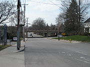 Route 115 serves as the primary entrance to North Windham village from the east. Within North Windham, it crosses a bridge over Ditch Brook marking the location of a terminal moraine
formerly containing Little Sebago Lake until destroyed by a flood on 4 June 1814. Route 115 becomes concurrent with U.S. Route 202
at the Gray
town line and parallels the west bank of the Pleasant River
through West Gray until reaching Gray village after a bridge over the Maine Turnpike. Route 115 separates from Route 202 as the easterly road of the 5-way intersection at Gray village and proceeds southeasterly paralleling the west bank of the Royal River
through Walnut Hill in North Yarmouth
, where it is known as the Gray Road. Route 115 is known as West Main Street as enters the town of Yarmouth crossing the Maine Central Railroad
Back Road and Lower Road a short distance northeast of their separation at Royal Junction.
State highway
State highway, state road or state route can refer to one of three related concepts, two of them related to a state or provincial government in a country that is divided into states or provinces :#A...
in southern Maine
Maine
Maine is a state in the New England region of the northeastern United States, bordered by the Atlantic Ocean to the east and south, New Hampshire to the west, and the Canadian provinces of Quebec to the northwest and New Brunswick to the northeast. Maine is both the northernmost and easternmost...
, United States. It runs west to east for just over 18 miles (29 km) miles, from U.S. Route 302
U.S. Route 302
U.S. Route 302 is a spur of U.S. Route 2. It currently runs 171 miles north from Portland, Maine, at U.S. Route 1, to Montpelier, Vermont, at US 2...
/State Route 35
Maine State Route 35
Maine State Route 35 runs the course of western Maine, from Bethel to Kennebunk. It passes through Oxford, Cumberland and York Counties. It is known in its lower sections for both its unusually windy course as well as its notoriously poor paving, as a result of winter frost heaves. Its northern...
in North Windham
North Windham, Maine
North Windham is a census-designated place within the town of Windham in Cumberland County, Maine, United States. The population was 4,568 at the 2000 census...
to State Route 88
Maine State Route 88
State Route 88 is a state highway in southern Maine, United States. It runs south to north for just over miles, from U.S. Route 1 in Falmouth to U.S. Route 1 in Yarmouth. It runs to the east of Route 1, and its speed limit is 35 mph, whereas that of Route 1 is 45-50 mph north of Bucknam...
in Yarmouth
Yarmouth, Maine
Yarmouth is a town in Cumberland County, Maine, United States, located approximately ten to fifteen miles north of Portland. Its population was 8,349 at the 2010 census....
.
Route
Terminal moraine
A terminal moraine, also called end moraine, is a moraine that forms at the end of the glacier called the snout.Terminal moraines mark the maximum advance of the glacier. An end moraine is at the present boundary of the glacier....
formerly containing Little Sebago Lake until destroyed by a flood on 4 June 1814. Route 115 becomes concurrent with U.S. Route 202
U.S. Route 202
U.S. Route 202 is a highway stretching from Delaware to Maine, also passing through the states of Pennsylvania, New Jersey, New York, Connecticut, Massachusetts, and New Hampshire....
at the Gray
Gray, Maine
Gray is a town in Cumberland County, Maine, United States. The population was 6,820 at the 2000 census. It is part of the Portland–South Portland–Biddeford, Maine metropolitan statistical area. Gray is home to regional headquarters for the Maine Department of Inland Fisheries and...
town line and parallels the west bank of the Pleasant River
Pleasant River (Presumpscot River)
The Pleasant River is a tributary of the Presumpscot River in the U.S. state of Maine.The Pleasant River originates in the town of Gray and parallels U.S...
through West Gray until reaching Gray village after a bridge over the Maine Turnpike. Route 115 separates from Route 202 as the easterly road of the 5-way intersection at Gray village and proceeds southeasterly paralleling the west bank of the Royal River
Royal River
The Royal River is a small river, long, in southern Maine, United States. The river originates in Sabbathday Pond in New Gloucester and flows northeasterly into Auburn and then southerly through New Gloucester, Gray and North Yarmouth into Casco Bay at Yarmouth. The river is bridged by...
through Walnut Hill in North Yarmouth
North Yarmouth, Maine
North Yarmouth is a town in Cumberland County, Maine, United States. The population was 3,565 at the 2010 census. It is part of the Portland–South Portland–Biddeford Metropolitan Statistical Area.-Geography:...
, where it is known as the Gray Road. Route 115 is known as West Main Street as enters the town of Yarmouth crossing the Maine Central Railroad
Maine Central Railroad
The Maine Central Railroad Company was a railroad in central and southern Maine. It was chartered in 1856 and began operations in 1862. It operated a mainline between South Portland, Maine, east to the Canada-U.S...
Back Road and Lower Road a short distance northeast of their separation at Royal Junction.