
Yarmouth, Maine
Encyclopedia
Yarmouth is a town in Cumberland County
, Maine
, United States, located approximately ten to fifteen miles north of Portland
. Its population was 8,349 at the 2010 census.
Yarmouth is part of the Portland–South Portland
-Biddeford
Metropolitan Statistical Area
.
, the town has a total area of 22.8 square miles (59.1 km²), of which 13.3 square miles (34.4 km²) is land and 9.4 square miles (24.3 km²) (41.44%) is water.
Yarmouth is nearly square in form, and is bisected by the Royal River
. Cousins River
separates it from Freeport to the north-east. Freeport and Pownal
bound it to the east, North Yarmouth to the north, Cumberland
to the west and Casco Bay
to the south. Also included as part of the town are Cousins Island, Lane's Island
, Great and Little Mosier, Littlejohn and Crab islands.
of 2000, there were 8,360 people, 3,432 households, and 2,306 families residing in the town. The population density
was 626.7 people per square mile (242.0/km²). There were 3,704 housing units at an average density of 277.7 per square mile (107.2/km²). The racial makeup of the town was 98.49% White, 0.37% Black or African American
, 0.04% Native American, 0.36% Asian, 0.02% Pacific Islander, 0.22% from other races
, and 0.50% from two or more races. Hispanic or Latino of any race were 0.59% of the population.
There were 3,432 households out of which 33% had children under the age of 18 living with them, 57.2% were married couples
living together, 7.7% had a female householder with no husband present, and 32.8% were non-families. 27.4% of all households were made up of individuals and 10.7% had someone living alone who was 65 years of age or older. The average household size was 2.41 and the average family size was 2.96.
In the town the population was spread out with 24.6% under the age of 18, 5.4% from 18 to 24, 26.3% from 25 to 44, 29.0% from 45 to 64, and 14.6% who were 65 years of age or older. The median age was 42 years. For every 100 females there were 92.5 males. For every 100 females age 18 and over, there were 86.6 males.
The median income for a household in the town was $58,030, and the median income for a family was $73,234. Males had a median income of $48,456 versus $34,075 for females. The per capita income
for the town was $34,317. About 4.0% of families and 4.4% of the population were below the poverty line, including 5.2% of those under age 18 and 4.3% of those age 65 or over.
cultures are believed to have existed in the area.
 When settlers arrived at Yarmouth's site around 1636, they found a fort already built. The fort had for some time been occupied by George Felt, who had in turn purchased it from John Phillips, a Welshman. In 1646, William Royall purchased a farm on the river which has ever-since borne his last name (minus the second L). This stream and its vicinity were called by the Indian
s "Westcustogo" - a name preserved by an inn of the same name on Princes Point Road at its intersection with Lafayette Street. (The building is no longer an inn, but its name remains on its front.) John Cousins had arrived a year or more earlier than Royall, occupying the neck of land between the branches of the stream which has since been called Cousins River, and owning the island now bearing his name.
In 1674, the first sawmill
was built at the Royal River
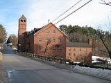
's first waterfalls. There are three other falls in Yarmouth: the second (which is actually a dam
) is just north of the Sparhawk Mill, on Bridge Street; the third, a paper mill (owned by The Forest Paper Company) whose remnants can still be seen, is within the bounds of Royal River Park; and the fourth is another dam, near the intersection of East Elm Street and Melissa Drive.
By 1676, approximately sixty-five people lived in Westcustogo. Soon after, however, conflicts forged by King Philip's War
caused them to abandon their homes and move south.
Some settlers returned to their dwellings in 1679, and within twelve months the region became incorporated as North Yarmouth
, the eighth town of the province
of Maine. Around the same time, saw and gristmill
s at the first falls were rebuilt.
In 1688, while the inhabitants on the eastern side of the river were building a garrison
, they were attacked by Indians, and attempted a defense. They continued the contest until nightfall, when the Indians retired. It was not long before they appeared again, in such force that the thirty-six families of the settlement were forced to flee, abandoning their homes for a second time.
 The unrest kept the area deserted for many years, but by 1715 settlers revisited their homes, by which point they found their fields and the sites of their habitations covered by a young growth of trees. In 1722, a "Committee for the Resettlement of North Yarmouth" was formed in Boston, Massachusetts
. North Yarmouth held its first town meeting on May 14, 1733. The structural frame of the first meeting house
was raised in 1729, and nine years later the first school was built.
Once resettlement began, the town's population began to grow rapidly. By 1764, 1,098 individuals lived in 154 houses. By 1810, the population was 3,295. During a time of peace, settlement began to relocate along the coast and inland.
The town's Main Street gradually became divided into the Upper Village and Lower Falls, the split roughly located around the present-day U.S. Route 1
overpass.
Among the new proprietors at the time were descendants of the Plymouth Pilgrims. Until after the year 1756 the Indians were again very troublesome. In 1725, William and Matthew Scales and Joseph Felt were killed, and the wife and children of the latter was carried into captivity. A grandson of Felt, Joseph Weare, became a noted scout, pursuing the Native Americans at every opportunity. In August 1746, a party of thirty-two Indians secreted themselves near the lower falls for the apparent purpose of surprising Weare's garrison, in the process killing Philip Greely, who came upon them. This was the last act of resistance by the indigenous people to occur within the limits of the town.
Yarmouth constituted the eastern part of North Yarmouth until 1849, when it was set off and incorporated as an independent town. The split occurred due to bickering between the inland, farming-based contingent and the coastal maritime-oriented community. Unable to resolve this difference, the two halves of the town separated into present-day Yarmouth and North Yarmouth.
By 1850, Yarmouth's population was 2,144, and very little changed over the hundred years that followed.
18th- and 19th-century business relied heavily upon a variety of natural resources. Once lumber was cut and sent to market, the land was farmed. Tanneries were built near brooks; potteries and brickyards put to use the natural clay in the area; and mills flourished along the Royal River, providing services such as iron-forging and fulling cloth.
Maritime activities were important from the beginning of the third settlement. Lumber from inland areas was shipped out from the harbor. Vessels were being built by 1740, and by 1818 shipbuilding in the area was in full swing, though Yarmouth's industry peaked in the 1870s, and declined rapidly shortly thereafter. The final large sailing vessel was built in 1890. Almost three hundred vessels were launched by Yarmouth's shipyards in the century between 1790 and 1890.
Rapid growth was experienced again around 1948 when Route 1 was constructed. Two years later, there were 2,699 inhabitants of the town. Interstate 295
was built through the harbor in 1961, and the town grew from 4,854 residents in 1970 to 8,300 thirty-five years later.

); Rufus York's general store
(located in the brick building now occupied by Runge's Oriental Rug store at the western corner of Main and Portland Streets; then Vaughan's Pharmacy from 1945 to 1963, later William H. Rowe's, then Melville Merrill's, and finally Frank Bucknam's drugstore
s); James Parsons' grocery store
(located next to the then-post office
); Cornelius Shaw's Cash Market; Leon Doughty's stove and hardware store, L.A. Doughty & Co. (located across from Shaws' but eventually moved onto Shaws' side of the street, into the building occupied today by Goffs, when his business expanded); William Freeman's hairdressing salon (located above Doughty's); Cyrus Curtis' Saturday Evening Post publishers; and Susan Kinghorn's millinery shop (located at the eastern corner of Main and Portland Streets).
 Businesses in the Upper Village and the area around the intersection of Main and Elm Street, which officially became known as Yarmouthville in 1882, included William Marston's dry goods
store; L.R. Cook's drugstore; J.O. Durgan's daguerreotype
salon (located just to the west of the Yarmouth Crossing on the northern side of the street; later Gad Hitchcock's coffin and casket showroom); Coombs Bros. (Albert and George) candy
and grocery store (located at the corner of Main and South Streets); Elmer Ring's "washerette" (he also ran a hardware store, a heating and plumbing service, and a coal yard); Harold "Snap" Moxcey's barbershop; John A. Griffin's hardware store; Andy's Handy Store (original proprietor Leland "Andy" Anderson's business, which he set up in 1935, still exists today; formerly a nail mill, then Arthur and Harry Storer's hardware store, Storer Bros.); Sam York's grocery store; George Jefford's harness shop; Isaac Johnson's barbershop (located above Jefford's); Adelaide Abbott's millinery shop; Jeremiah Mitchell's tavern
(a site now occupied by Latchstring Park); and Joel Brooks' pottery.
The section of town between the Upper Village and Lower Falls was known as Brickyard Hollow, named for John Collins' brickyard. A post office also existed, to the east of the present-day American Legion
Hall.
On January 2, 2009, twenty-six businesses located at 500 Route 1 were destroyed in an arson
attack. The entire block, located near to the point at which Route 1 passes over Main Street, was pulled down shortly thereafter. Damage was estimated to be between $2 million and $4 million. Everett Stickney, of Exeter, New Hampshire
, was convicted of starting the fire, along with another one in York, Maine
, later that evening. On November 12, 2009, Stickney was sentenced to an eleven-and-a-half-year prison
term and ordered to pay $3.7 million in compensation
. The building was replaced in 2008 and several businesses have moved in.
).
, the large map-making company, with its headquarters, located on Route 1 to the north of the town, housing the world's largest revolving and rotating globe
.
 The town has four schools: two elementary (William H. Rowe School, built 1955, and rebuilt in 2003, Yarmouth Elementary School, built 1968 and named Yarmouth Intermediate School until 1992); one middle school (Harrison Middle School, built 1992); and one high school (Yarmouth High School
, built 1961, and rebuilt in 2002), as well as North Yarmouth Academy (commonly abbreviated to "N.Y.A."), a private college preparatory school established in 1814. On October 17, 1998, the academy's ice arena was renamed the "Travis Roy Arena" in honor of Travis Roy
, an alumnus
of NYA, who was rendered a quadriplegic after an injury he sustained while playing for Boston University men's ice hockey
team in 1995.
Yarmouth's two elementary schools are unique in that the William H. Rowe School caters to students in kindergarten and the first grade, while Yarmouth Elementary educates second through fourth graders. Yarmouth High School was named #297 in the 1,000 Best High Schools in the US by Newsweek in 2005 and #289 in 2006.
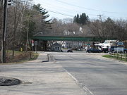
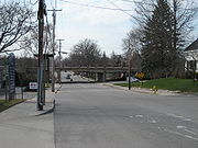
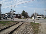 Interstate 295
runs elevated through Yarmouth and has two exits (15 and 17) in the town. Route 1 and State Routes 88
and 115
also run through the town. The town also has two railroad junctions: Royal Junction (midway along Greely Road) and Yarmouth Junction (to the west of East Elm Street). The two railroads passing through the town are Guilford Rail System's Maine Central Railroad
and the St. Lawrence and Atlantic Railroad
(formerly Grand Trunk Railway
).
who was killed by a drunk driver
in August 1993. It runs parallel to Route 1, connects to the Royal River Park, which is also home to a recreational path, and finishes at Forest Falls Drive.
, Sacred Heart Catholic
, and the First Baptist
. The other three are White Pine Community, St. Bartholomew's Episcopal
, and Nazarene
.
The First Parish Congregational was originally known as Ledge Church and was located facing Casco Bay
at the intersection of Route 88 and Gilman Road. That structure, which was founded on November 18, 1730, was torn down in 1836, sixteen years after it was abandoned by the Parish. The second, larger church was built in 1818, at the western corner of Main and Bridge Streets, but it was abandoned in 1868 and torn down in 1879. The present church, designed by Portland architect George N. Harding, was built on the other side of Main Street in 1867 and dedicated
the following year. It was added to the National Register of Historic Places
in 1995. A plaque commemorating the 275th anniversary of the church was laid on November 18, 2005. The church's steeple is illuminated every night, sometimes in honor of a member or a relative.
, The Notes, and The Falmouth Forecaster (Northern Edition).
The town is home to one radio station: WYAR
, which broadcasts from Cousins Island.

tree that stood by present-day East Main Street (Route 88), at its intersection with Yankee Drive, between 1793 and 2010. At 110 feet in height, it was, between 1997 and the date of its felling, the oldest and largest of its kind in New England
.The National Register of Big Trees: 2000-01 The tree, which partially stood in the front yard of a private residence, also had a 20-foot circumference and (until mid-2008) a 93-foot crown spread.
Cumberland County, Maine
Cumberland County is a county located in the U.S. state of Maine. As of 2010, the population was 281,674. Its county seat is Portland, and is the most populous of the sixteen Maine counties, as well as the most affluent. Cumberland County has the deepest and second largest body of water in the...
, Maine
Maine
Maine is a state in the New England region of the northeastern United States, bordered by the Atlantic Ocean to the east and south, New Hampshire to the west, and the Canadian provinces of Quebec to the northwest and New Brunswick to the northeast. Maine is both the northernmost and easternmost...
, United States, located approximately ten to fifteen miles north of Portland
Portland, Maine
Portland is the largest city in Maine and is the county seat of Cumberland County. The 2010 city population was 66,194, growing 3 percent since the census of 2000...
. Its population was 8,349 at the 2010 census.
Yarmouth is part of the Portland–South Portland
South Portland, Maine
South Portland is a city in Cumberland County, Maine, United States, and is the fourth-largest city in the state. Founded in 1895, as of the 2010 census, the city population was 25,002. Known for its working waterfront, South Portland is situated on Portland Harbor and overlooks the skyline of...
-Biddeford
Biddeford, Maine
Biddeford is a town in York County, Maine, United States. It is the largest town in the county, and is the sixth-largest in the state. It is the most southerly incorporated town in the state and the principal commercial center of York County. The population was 21,277 at the 2010 census...
Metropolitan Statistical Area
Portland-South Portland-Biddeford metropolitan area
The Portland–South Portland–Biddeford Metropolitan Statistical Area, also known as Greater Portland, as defined by the United States Census Bureau, is an area consisting of three counties in Maine, anchored by the city of Portland and the smaller cities of South Portland and Biddeford...
.
Geography
According to the United States Census BureauUnited States Census Bureau
The United States Census Bureau is the government agency that is responsible for the United States Census. It also gathers other national demographic and economic data...
, the town has a total area of 22.8 square miles (59.1 km²), of which 13.3 square miles (34.4 km²) is land and 9.4 square miles (24.3 km²) (41.44%) is water.
Yarmouth is nearly square in form, and is bisected by the Royal River
Royal River
The Royal River is a small river, long, in southern Maine, United States. The river originates in Sabbathday Pond in New Gloucester and flows northeasterly into Auburn and then southerly through New Gloucester, Gray and North Yarmouth into Casco Bay at Yarmouth. The river is bridged by...
. Cousins River
Cousins River
The Cousins River is a , primarily tidal river in southern Maine. Rising in the town of Freeport at the junction of Harvey Brook and Merrill Brook, it flows south and forms, for most of its course, the boundary between Freeport and Yarmouth. It ends at the Royal River just west of that river's...
separates it from Freeport to the north-east. Freeport and Pownal
Pownal, Maine
Pownal is a town in Cumberland County, Maine, United States. The population was 1,491 at the 2000 census. It is part of the Portland–South Portland–Biddeford, Maine Metropolitan Statistical Area. Pownal is home to Bradbury Mountain State Park....
bound it to the east, North Yarmouth to the north, Cumberland
Cumberland, Maine
Cumberland is a town in Cumberland County, Maine, United States. The population was 7,211 at the 2010 census. It is part of the Portland–South Portland–Biddeford, Maine Metropolitan Statistical Area.-History:...
to the west and Casco Bay
Casco Bay
Casco Bay is an inlet of the Gulf of Maine on the southern coast of Maine, New England, United States. Its easternmost approach is Cape Small and its westernmost approach is Two Lights in Cape Elizabeth...
to the south. Also included as part of the town are Cousins Island, Lane's Island
Lane's Island
Lane's Island is an island which is part of the town of Vinalhaven in Knox County, Maine. It is approximately 45 acres in size and connected by causeway to mainland Vinalhaven. About 2/3 of the island is protected by a nature preserve. It is named after Captain Timothy Lane, an early European...
, Great and Little Mosier, Littlejohn and Crab islands.
Demographics
As of the censusCensus
A census is the procedure of systematically acquiring and recording information about the members of a given population. It is a regularly occurring and official count of a particular population. The term is used mostly in connection with national population and housing censuses; other common...
of 2000, there were 8,360 people, 3,432 households, and 2,306 families residing in the town. The population density
Population density
Population density is a measurement of population per unit area or unit volume. It is frequently applied to living organisms, and particularly to humans...
was 626.7 people per square mile (242.0/km²). There were 3,704 housing units at an average density of 277.7 per square mile (107.2/km²). The racial makeup of the town was 98.49% White, 0.37% Black or African American
Race (United States Census)
Race and ethnicity in the United States Census, as defined by the Federal Office of Management and Budget and the United States Census Bureau, are self-identification data items in which residents choose the race or races with which they most closely identify, and indicate whether or not they are...
, 0.04% Native American, 0.36% Asian, 0.02% Pacific Islander, 0.22% from other races
Race (United States Census)
Race and ethnicity in the United States Census, as defined by the Federal Office of Management and Budget and the United States Census Bureau, are self-identification data items in which residents choose the race or races with which they most closely identify, and indicate whether or not they are...
, and 0.50% from two or more races. Hispanic or Latino of any race were 0.59% of the population.
There were 3,432 households out of which 33% had children under the age of 18 living with them, 57.2% were married couples
Marriage
Marriage is a social union or legal contract between people that creates kinship. It is an institution in which interpersonal relationships, usually intimate and sexual, are acknowledged in a variety of ways, depending on the culture or subculture in which it is found...
living together, 7.7% had a female householder with no husband present, and 32.8% were non-families. 27.4% of all households were made up of individuals and 10.7% had someone living alone who was 65 years of age or older. The average household size was 2.41 and the average family size was 2.96.
In the town the population was spread out with 24.6% under the age of 18, 5.4% from 18 to 24, 26.3% from 25 to 44, 29.0% from 45 to 64, and 14.6% who were 65 years of age or older. The median age was 42 years. For every 100 females there were 92.5 males. For every 100 females age 18 and over, there were 86.6 males.
The median income for a household in the town was $58,030, and the median income for a family was $73,234. Males had a median income of $48,456 versus $34,075 for females. The per capita income
Per capita income
Per capita income or income per person is a measure of mean income within an economic aggregate, such as a country or city. It is calculated by taking a measure of all sources of income in the aggregate and dividing it by the total population...
for the town was $34,317. About 4.0% of families and 4.4% of the population were below the poverty line, including 5.2% of those under age 18 and 4.3% of those age 65 or over.
History
Traces of human occupation in the Yarmouth area date to about 2,000 BC. During the years prior to the arrival of the Europeans, many Native AmericanNative Americans in the United States
Native Americans in the United States are the indigenous peoples in North America within the boundaries of the present-day continental United States, parts of Alaska, and the island state of Hawaii. They are composed of numerous, distinct tribes, states, and ethnic groups, many of which survive as...
cultures are believed to have existed in the area.
Native Americans in the United States
Native Americans in the United States are the indigenous peoples in North America within the boundaries of the present-day continental United States, parts of Alaska, and the island state of Hawaii. They are composed of numerous, distinct tribes, states, and ethnic groups, many of which survive as...
s "Westcustogo" - a name preserved by an inn of the same name on Princes Point Road at its intersection with Lafayette Street. (The building is no longer an inn, but its name remains on its front.) John Cousins had arrived a year or more earlier than Royall, occupying the neck of land between the branches of the stream which has since been called Cousins River, and owning the island now bearing his name.
In 1674, the first sawmill
Sawmill
A sawmill is a facility where logs are cut into boards.-Sawmill process:A sawmill's basic operation is much like those of hundreds of years ago; a log enters on one end and dimensional lumber exits on the other end....
was built at the Royal River
Royal River
The Royal River is a small river, long, in southern Maine, United States. The river originates in Sabbathday Pond in New Gloucester and flows northeasterly into Auburn and then southerly through New Gloucester, Gray and North Yarmouth into Casco Bay at Yarmouth. The river is bridged by...
's first waterfalls. There are three other falls in Yarmouth: the second (which is actually a dam
Dam
A dam is a barrier that impounds water or underground streams. Dams generally serve the primary purpose of retaining water, while other structures such as floodgates or levees are used to manage or prevent water flow into specific land regions. Hydropower and pumped-storage hydroelectricity are...
) is just north of the Sparhawk Mill, on Bridge Street; the third, a paper mill (owned by The Forest Paper Company) whose remnants can still be seen, is within the bounds of Royal River Park; and the fourth is another dam, near the intersection of East Elm Street and Melissa Drive.
By 1676, approximately sixty-five people lived in Westcustogo. Soon after, however, conflicts forged by King Philip's War
King Philip's War
King Philip's War, sometimes called Metacom's War, Metacomet's War, or Metacom's Rebellion, was an armed conflict between Native American inhabitants of present-day southern New England and English colonists and their Native American allies in 1675–76. The war is named after the main leader of the...
caused them to abandon their homes and move south.
Some settlers returned to their dwellings in 1679, and within twelve months the region became incorporated as North Yarmouth
North Yarmouth, Maine
North Yarmouth is a town in Cumberland County, Maine, United States. The population was 3,565 at the 2010 census. It is part of the Portland–South Portland–Biddeford Metropolitan Statistical Area.-Geography:...
, the eighth town of the province
Province
A province is a territorial unit, almost always an administrative division, within a country or state.-Etymology:The English word "province" is attested since about 1330 and derives from the 13th-century Old French "province," which itself comes from the Latin word "provincia," which referred to...
of Maine. Around the same time, saw and gristmill
Gristmill
The terms gristmill or grist mill can refer either to a building in which grain is ground into flour, or to the grinding mechanism itself.- Early history :...
s at the first falls were rebuilt.
In 1688, while the inhabitants on the eastern side of the river were building a garrison
Garrison
Garrison is the collective term for a body of troops stationed in a particular location, originally to guard it, but now often simply using it as a home base....
, they were attacked by Indians, and attempted a defense. They continued the contest until nightfall, when the Indians retired. It was not long before they appeared again, in such force that the thirty-six families of the settlement were forced to flee, abandoning their homes for a second time.
Massachusetts
The Commonwealth of Massachusetts is a state in the New England region of the northeastern United States of America. It is bordered by Rhode Island and Connecticut to the south, New York to the west, and Vermont and New Hampshire to the north; at its east lies the Atlantic Ocean. As of the 2010...
. North Yarmouth held its first town meeting on May 14, 1733. The structural frame of the first meeting house
Meeting house
A meeting house describes a building where a public meeting takes place. This includes secular buildings which function like a town or city hall, and buildings used for religious meetings, particularly of some non-conformist Christian denominations....
was raised in 1729, and nine years later the first school was built.
Once resettlement began, the town's population began to grow rapidly. By 1764, 1,098 individuals lived in 154 houses. By 1810, the population was 3,295. During a time of peace, settlement began to relocate along the coast and inland.
The town's Main Street gradually became divided into the Upper Village and Lower Falls, the split roughly located around the present-day U.S. Route 1
U.S. Route 1 in Maine
In the U.S. state of Maine, U.S. Route 1 is a major north–south state highway serving the eastern part of the state. It parallels the Atlantic Ocean from New Hampshire north through Portland, Brunswick, and Belfast to Calais, and then the St. Croix River and the rest of the Canadian border...
overpass.
Among the new proprietors at the time were descendants of the Plymouth Pilgrims. Until after the year 1756 the Indians were again very troublesome. In 1725, William and Matthew Scales and Joseph Felt were killed, and the wife and children of the latter was carried into captivity. A grandson of Felt, Joseph Weare, became a noted scout, pursuing the Native Americans at every opportunity. In August 1746, a party of thirty-two Indians secreted themselves near the lower falls for the apparent purpose of surprising Weare's garrison, in the process killing Philip Greely, who came upon them. This was the last act of resistance by the indigenous people to occur within the limits of the town.
Yarmouth constituted the eastern part of North Yarmouth until 1849, when it was set off and incorporated as an independent town. The split occurred due to bickering between the inland, farming-based contingent and the coastal maritime-oriented community. Unable to resolve this difference, the two halves of the town separated into present-day Yarmouth and North Yarmouth.
By 1850, Yarmouth's population was 2,144, and very little changed over the hundred years that followed.
18th- and 19th-century business relied heavily upon a variety of natural resources. Once lumber was cut and sent to market, the land was farmed. Tanneries were built near brooks; potteries and brickyards put to use the natural clay in the area; and mills flourished along the Royal River, providing services such as iron-forging and fulling cloth.
Maritime activities were important from the beginning of the third settlement. Lumber from inland areas was shipped out from the harbor. Vessels were being built by 1740, and by 1818 shipbuilding in the area was in full swing, though Yarmouth's industry peaked in the 1870s, and declined rapidly shortly thereafter. The final large sailing vessel was built in 1890. Almost three hundred vessels were launched by Yarmouth's shipyards in the century between 1790 and 1890.
Rapid growth was experienced again around 1948 when Route 1 was constructed. Two years later, there were 2,699 inhabitants of the town. Interstate 295
Interstate 295 (Maine)
Interstate 295 is a -long connector in the U.S. state of Maine from I-95 in Scarborough to I-95 in West Gardiner.-Route description:...
was built through the harbor in 1961, and the town grew from 4,854 residents in 1970 to 8,300 thirty-five years later.
Businesses
19th- and 20th-century business that existed on Main Street in Yarmouth's Lower Falls section included Coombs (now Goffs hardware storeHardware store
Hardware stores, sometimes known as DIY stores, sell household hardware including: fasteners, hand tools, power tools, keys, locks, hinges, chains, plumbing supplies, electrical supplies, cleaning products, housewares, tools, utensils, paint, and lawn and garden products directly to consumers for...
); Rufus York's general store
General store
A general store, general merchandise store, or village shop is a rural or small town store that carries a general line of merchandise. It carries a broad selection of merchandise, sometimes in a small space, where people from the town and surrounding rural areas come to purchase all their general...
(located in the brick building now occupied by Runge's Oriental Rug store at the western corner of Main and Portland Streets; then Vaughan's Pharmacy from 1945 to 1963, later William H. Rowe's, then Melville Merrill's, and finally Frank Bucknam's drugstore
Pharmacy
Pharmacy is the health profession that links the health sciences with the chemical sciences and it is charged with ensuring the safe and effective use of pharmaceutical drugs...
s); James Parsons' grocery store
Grocery store
A grocery store is a store that retails food. A grocer, the owner of a grocery store, stocks different kinds of foods from assorted places and cultures, and sells these "groceries" to customers. Large grocery stores that stock products other than food, such as clothing or household items, are...
(located next to the then-post office
Post office
A post office is a facility forming part of a postal system for the posting, receipt, sorting, handling, transmission or delivery of mail.Post offices offer mail-related services such as post office boxes, postage and packaging supplies...
); Cornelius Shaw's Cash Market; Leon Doughty's stove and hardware store, L.A. Doughty & Co. (located across from Shaws' but eventually moved onto Shaws' side of the street, into the building occupied today by Goffs, when his business expanded); William Freeman's hairdressing salon (located above Doughty's); Cyrus Curtis' Saturday Evening Post publishers; and Susan Kinghorn's millinery shop (located at the eastern corner of Main and Portland Streets).
Dry goods
Dry goods are products such as textiles, ready-to-wear clothing, and sundries. In U.S. retailing, a dry goods store carries consumer goods that are distinct from those carried by hardware stores and grocery stores, though "dry goods" as a term for textiles has been dated back to 1742 in England or...
store; L.R. Cook's drugstore; J.O. Durgan's daguerreotype
Daguerreotype
The daguerreotype was the first commercially successful photographic process. The image is a direct positive made in the camera on a silvered copper plate....
salon (located just to the west of the Yarmouth Crossing on the northern side of the street; later Gad Hitchcock's coffin and casket showroom); Coombs Bros. (Albert and George) candy
Candy
Candy, specifically sugar candy, is a confection made from a concentrated solution of sugar in water, to which flavorings and colorants are added...
and grocery store (located at the corner of Main and South Streets); Elmer Ring's "washerette" (he also ran a hardware store, a heating and plumbing service, and a coal yard); Harold "Snap" Moxcey's barbershop; John A. Griffin's hardware store; Andy's Handy Store (original proprietor Leland "Andy" Anderson's business, which he set up in 1935, still exists today; formerly a nail mill, then Arthur and Harry Storer's hardware store, Storer Bros.); Sam York's grocery store; George Jefford's harness shop; Isaac Johnson's barbershop (located above Jefford's); Adelaide Abbott's millinery shop; Jeremiah Mitchell's tavern
Tavern
A tavern is a place of business where people gather to drink alcoholic beverages and be served food, and in some cases, where travelers receive lodging....
(a site now occupied by Latchstring Park); and Joel Brooks' pottery.
The section of town between the Upper Village and Lower Falls was known as Brickyard Hollow, named for John Collins' brickyard. A post office also existed, to the east of the present-day American Legion
American Legion
The American Legion is a mutual-aid organization of veterans of the United States armed forces chartered by the United States Congress. It was founded to benefit those veterans who served during a wartime period as defined by Congress...
Hall.
On January 2, 2009, twenty-six businesses located at 500 Route 1 were destroyed in an arson
Arson
Arson is the crime of intentionally or maliciously setting fire to structures or wildland areas. It may be distinguished from other causes such as spontaneous combustion and natural wildfires...
attack. The entire block, located near to the point at which Route 1 passes over Main Street, was pulled down shortly thereafter. Damage was estimated to be between $2 million and $4 million. Everett Stickney, of Exeter, New Hampshire
Exeter, New Hampshire
Exeter is a town in Rockingham County, New Hampshire, United States. The town's population was 14,306 at the 2010 census. Exeter was the county seat until 1997, when county offices were moved to neighboring Brentwood...
, was convicted of starting the fire, along with another one in York, Maine
York, Maine
York is a town in York County, Maine, United States at the southwest corner of the state. The population in the 2000 census was 12,854. Situated beside the Atlantic Ocean on the Gulf of Maine, York is a well-known summer resort. It is home to three 18-hole golf clubs, three sandy beaches, and...
, later that evening. On November 12, 2009, Stickney was sentenced to an eleven-and-a-half-year prison
Prison
A prison is a place in which people are physically confined and, usually, deprived of a range of personal freedoms. Imprisonment or incarceration is a legal penalty that may be imposed by the state for the commission of a crime...
term and ordered to pay $3.7 million in compensation
Damages
In law, damages is an award, typically of money, to be paid to a person as compensation for loss or injury; grammatically, it is a singular noun, not plural.- Compensatory damages :...
. The building was replaced in 2008 and several businesses have moved in.
Yarmouth today
Modern-day Yarmouth is mostly residential in character, with commercial development scattered throughout the town, particularly along Route 1 and Main Street (State Route 115Maine State Route 115
State Route 115 is a state highway in southern Maine, United States. It runs west to east for just over miles, from U.S. Route 302/State Route 35 in North Windham to State Route 88 in Yarmouth.-Route:...
).
Economy
Yarmouth is home of DeLormeDeLorme
DeLorme is a major vendor of business-to-business and consumer mapping and GPS products and technologies. It is based in Yarmouth, Maine, United States....
, the large map-making company, with its headquarters, located on Route 1 to the north of the town, housing the world's largest revolving and rotating globe
Globe
A globe is a three-dimensional scale model of Earth or other spheroid celestial body such as a planet, star, or moon...
.
Education
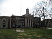
Yarmouth High School (Maine)
Yarmouth High School is a four-year public high school in Yarmouth, Maine, as part of the Yarmouth Schools district.Yarmouth High School in a newly finished and renovated building consists of a 500-seat auditorium, a student union/cafeteria, and a new office area that has guidance counselors, the...
, built 1961, and rebuilt in 2002), as well as North Yarmouth Academy (commonly abbreviated to "N.Y.A."), a private college preparatory school established in 1814. On October 17, 1998, the academy's ice arena was renamed the "Travis Roy Arena" in honor of Travis Roy
Travis Roy
Travis Roy is an American former college ice hockey player.Roy attended Yarmouth High School as a freshman, then transferred to nearby North Yarmouth Academy in order to pursue an athletic scholarship...
, an alumnus
Alumnus
An alumnus , according to the American Heritage Dictionary, is "a graduate of a school, college, or university." An alumnus can also be a former member, employee, contributor or inmate as well as a former student. In addition, an alumna is "a female graduate or former student of a school, college,...
of NYA, who was rendered a quadriplegic after an injury he sustained while playing for Boston University men's ice hockey
Boston University men's ice hockey
The Boston University Terriers men’s ice hockey program is one of the most storied teams in NCAA Division I hockey, playing its first ever game in 1918 and winning five national championships, while making twenty-one appearances in the Frozen Four....
team in 1995.
Yarmouth's two elementary schools are unique in that the William H. Rowe School caters to students in kindergarten and the first grade, while Yarmouth Elementary educates second through fourth graders. Yarmouth High School was named #297 in the 1,000 Best High Schools in the US by Newsweek in 2005 and #289 in 2006.
Transportation
Interstate 295 (Maine)
Interstate 295 is a -long connector in the U.S. state of Maine from I-95 in Scarborough to I-95 in West Gardiner.-Route description:...
runs elevated through Yarmouth and has two exits (15 and 17) in the town. Route 1 and State Routes 88
Maine State Route 88
State Route 88 is a state highway in southern Maine, United States. It runs south to north for just over miles, from U.S. Route 1 in Falmouth to U.S. Route 1 in Yarmouth. It runs to the east of Route 1, and its speed limit is 35 mph, whereas that of Route 1 is 45-50 mph north of Bucknam...
and 115
Maine State Route 115
State Route 115 is a state highway in southern Maine, United States. It runs west to east for just over miles, from U.S. Route 302/State Route 35 in North Windham to State Route 88 in Yarmouth.-Route:...
also run through the town. The town also has two railroad junctions: Royal Junction (midway along Greely Road) and Yarmouth Junction (to the west of East Elm Street). The two railroads passing through the town are Guilford Rail System's Maine Central Railroad
Maine Central Railroad
The Maine Central Railroad Company was a railroad in central and southern Maine. It was chartered in 1856 and began operations in 1862. It operated a mainline between South Portland, Maine, east to the Canada-U.S...
and the St. Lawrence and Atlantic Railroad
St. Lawrence and Atlantic Railroad
The St. Lawrence and Atlantic Railroad , known as St-Laurent et Atlantique Quebec in Canada, is a short line railroad operating between Portland, Maine on the Atlantic Ocean and Montreal, Quebec on the St. Lawrence River. It crosses the Canada-U.S...
(formerly Grand Trunk Railway
Grand Trunk Railway
The Grand Trunk Railway was a railway system which operated in the Canadian provinces of Quebec and Ontario, as well as the American states of Connecticut, Maine, Michigan, Massachusetts, New Hampshire, and Vermont. The railway was operated from headquarters in Montreal, Quebec; however, corporate...
).
Recreation
The Beth Condon Memorial Pathway is a pedestrian and bicycle path that originates on the western side of the Portland Street and Route 1 intersection and is named after a Yarmouth High School sophomoreSophomore
Sophomore is a term used in the United States to describe a student in the second year of study at high school or university.The word is also used as a synonym for "second", for the second album or EP released by a musician or group, the second movie of a director, or the second season of a...
who was killed by a drunk driver
Driving under the influence
Driving under the influence is the act of driving a motor vehicle with blood levels of alcohol in excess of a legal limit...
in August 1993. It runs parallel to Route 1, connects to the Royal River Park, which is also home to a recreational path, and finishes at Forest Falls Drive.
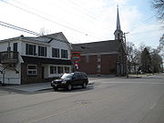
Churches
There are seven churches in Yarmouth. Four of these are located on Main Street; they are (from east to west): the First Universalist, the First Parish CongregationalCongregational church
Congregational churches are Protestant Christian churches practicing Congregationalist church governance, in which each congregation independently and autonomously runs its own affairs....
, Sacred Heart Catholic
Roman Catholic Church
The Catholic Church, also known as the Roman Catholic Church, is the world's largest Christian church, with over a billion members. Led by the Pope, it defines its mission as spreading the gospel of Jesus Christ, administering the sacraments and exercising charity...
, and the First Baptist
Baptist
Baptists comprise a group of Christian denominations and churches that subscribe to a doctrine that baptism should be performed only for professing believers , and that it must be done by immersion...
. The other three are White Pine Community, St. Bartholomew's Episcopal
Episcopal Church (United States)
The Episcopal Church is a mainline Anglican Christian church found mainly in the United States , but also in Honduras, Taiwan, Colombia, Ecuador, Haiti, the Dominican Republic, Venezuela, the British Virgin Islands and parts of Europe...
, and Nazarene
Nazarene (sect)
The Nazarene sect is used in two contexts:* Firstly of the New Testament early church where in Acts 24:5 Paul is accused before Felix at Caesarea by Tertullus of being "a ringleader of the sect of the Nazarenes."...
.
The First Parish Congregational was originally known as Ledge Church and was located facing Casco Bay
Casco Bay
Casco Bay is an inlet of the Gulf of Maine on the southern coast of Maine, New England, United States. Its easternmost approach is Cape Small and its westernmost approach is Two Lights in Cape Elizabeth...
at the intersection of Route 88 and Gilman Road. That structure, which was founded on November 18, 1730, was torn down in 1836, sixteen years after it was abandoned by the Parish. The second, larger church was built in 1818, at the western corner of Main and Bridge Streets, but it was abandoned in 1868 and torn down in 1879. The present church, designed by Portland architect George N. Harding, was built on the other side of Main Street in 1867 and dedicated
Dedication
Dedication is the act of consecrating an altar, temple, church or other sacred building. It also refers to the inscription of books or other artifacts when these are specifically addressed or presented to a particular person. This practice, which once was used to gain the patronage and support of...
the following year. It was added to the National Register of Historic Places
National Register of Historic Places
The National Register of Historic Places is the United States government's official list of districts, sites, buildings, structures, and objects deemed worthy of preservation...
in 1995. A plaque commemorating the 275th anniversary of the church was laid on November 18, 2005. The church's steeple is illuminated every night, sometimes in honor of a member or a relative.
Media
Yarmouth news is reported regularly in a number of different newspapers including the Portland Press HeraldPortland Press Herald
The Portland Press Herald publish daily newspapers in Portland, Maine, USA...
, The Notes, and The Falmouth Forecaster (Northern Edition).
The town is home to one radio station: WYAR
WYAR
WYAR is a non-commercial radio station broadcasting an Educational format. Located in Yarmouth, Maine, USA, with the transmitter and tower located on nearby Cousins Island, the station serves the Portland, Maine and Lewiston-Auburn, Maine area...
, which broadcasts from Cousins Island.
The Yarmouth Clam Festival
Established in 1965, the Yarmouth Clam Festival is an annual three-day event which takes place in the town during the third weekend in July, attracting around 120,000 people. The festival features a parade, food, carnival rides, crafts, a clam-shucking contest, a five-mile run, and a world-class bike race."Herbie"
"Herbie" was an elmElm
Elms are deciduous and semi-deciduous trees comprising the genus Ulmus in the plant family Ulmaceae. The dozens of species are found in temperate and tropical-montane regions of North America and Eurasia, ranging southward into Indonesia. Elms are components of many kinds of natural forests...
tree that stood by present-day East Main Street (Route 88), at its intersection with Yankee Drive, between 1793 and 2010. At 110 feet in height, it was, between 1997 and the date of its felling, the oldest and largest of its kind in New England
New England
New England is a region in the northeastern corner of the United States consisting of the six states of Maine, New Hampshire, Vermont, Massachusetts, Rhode Island, and Connecticut...
.The National Register of Big Trees: 2000-01 The tree, which partially stood in the front yard of a private residence, also had a 20-foot circumference and (until mid-2008) a 93-foot crown spread.
Notable people
- Charles Augustus AikenCharles Augustus Aiken-Biography:He was born in Manchester, Vermont in 1827 to John Aiken and Harriet Adams Aiken. He graduated from Dartmouth College in 1846, and went on to Andover Theological Seminary, where he graduated in 1853. He married Sarah Noyes on October 17, 1854, and was ordained a pastor of the...
, clergyman and academic. - F. Lee Bailey, famous lawyer in the OJ caseO. J. Simpson murder caseThe O. J. Simpson murder case was a criminal trial held in Los Angeles County, California Superior Court from January 29 to October 3, 1995. Former American football star and actor O. J...
- Hanley DenningSafe Passage (Maine)Safe Passage or Camino Seguro is a non-profit organization that provides school enrollment and after-school support for poor children whose families scavenge the Guatemala City Garbage Dump in Guatemala City. Safe Passage was founded in 1999 by the late Hanley Denning. The organization assists over...
, founder of Safe PassageSafe Passage (Maine)Safe Passage or Camino Seguro is a non-profit organization that provides school enrollment and after-school support for poor children whose families scavenge the Guatemala City Garbage Dump in Guatemala City. Safe Passage was founded in 1999 by the late Hanley Denning. The organization assists over...
. - Leon GormanLeon GormanLeon Gorman is the former president and current Chairman of the Board of L.L. Bean.-Career:A graduate of Bowdoin College, Gorman began working at the company after Navy destroyer service and a trainee job a Filene's department store. Gorman became president in 1967 after his grandfather Leon...
, former president and current Chairman of the Board of L.L.Bean. - Pat LaMarchePat LaMarchePatricia Helen "Pat" LaMarche is an American political figure and activist with the Green Party; she was the party's vice-presidential candidate in the 2004 U.S...
, Green Party politician. - James B. Longley, Jr.James B. Longley, Jr.James B. "Jim" Longley, Jr. is a former member of the U.S. House of Representatives. He is a Republican politician from Maine....
, former congressmen. - Eric WeinrichEric WeinrichEric John Weinrich is an American former professional ice hockey defenseman who played 17 seasons in the National Hockey League with the New Jersey Devils, Hartford Whalers, Chicago Blackhawks, Montreal Canadiens, Boston Bruins, Philadelphia Flyers, St. Louis Blues and Vancouver Canucks...
, defenseman with the American Hockey LeagueAmerican Hockey LeagueThe American Hockey League is a 30-team professional ice hockey league based in the United States and Canada that serves as the primary developmental circuit for the National Hockey League...
.