

Main Eastern Highway
Encyclopedia
The Main Eastern Highway is the life line of the high range townships of the Travancore region of Kerala
Kerala
or Keralam is an Indian state located on the Malabar coast of south-west India. It was created on 1 November 1956 by the States Reorganisation Act by combining various Malayalam speaking regions....
state, India
India
India , officially the Republic of India , is a country in South Asia. It is the seventh-largest country by geographical area, the second-most populous country with over 1.2 billion people, and the most populous democracy in the world...
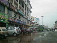
. It is also known as Punalur
Punalur
Punalur is a city situvated near the Tamil Nadu Kerala Border in Kollam district in the southern state of Kerala, India. It is the pioneer in starting industrial revolution in Kerala by establishing Punalur Paper Mills, the first industry in kerala. It is situated in the banks of the river Kallada...
-Pathanamthitta
Pathanamthitta district
Pathanamthitta district is the youngest district located in the southern part of the state of Kerala, India. The district headquarters is in Pathanamthitta town. The district is surrounded by Kottayam, Idukki, Alappuzha and Kollam districts. It has a border with the state of Tamil Nadu in the east...
-Thodupuzha
Thodupuzha
Thodupuzha is a town and a municipality in Idukki district in the Indian state of Kerala, spread over an area of 35.43 km2. It is 62 km from Ernakulam. Geographical Classification of Thodupuzha Region is Midland or Idanad....
-Muvattupuzha
Muvattupuzha
Muvattupuzha is a municipality in Ernakulam district in the Indian state of Kerala. It is a junction of three districts namely Ernakulam, Kottayam and Idukki. The town is bordered by Kottayam district on southern side and Idukki district on eastern side approximately 20 km from the town...
Highway. Main Eastern Highway is categorized as State Highway - 08 ( SH-08 ) of Kerala. It is the second longest State Highway of Kerala covering a distance of 153.6 km. The districts it passes through are Kollam
Kollam district
-Climate:Kollam's temperature is almost steady throughout the year. The average temperature ranges from 25 to 32 degrees Celsius. Summer usually runs from March until May; the monsoon begins by June and ends by September. Kollam receives an annual average rainfall of around...
, Pathanamthitta
Pathanamthitta district
Pathanamthitta district is the youngest district located in the southern part of the state of Kerala, India. The district headquarters is in Pathanamthitta town. The district is surrounded by Kottayam, Idukki, Alappuzha and Kollam districts. It has a border with the state of Tamil Nadu in the east...
, Kottayam
Kottayam district
Kottayam is one of the 14 districts in the state of Kerala, India. The district has its headquarters at Kottayam town, located at 9.36° N and 76.17° E. According to the 1991 census, it is the first district to achieve highest literacy rate in the whole of India...
, Idukki
Idukki district
Idukki district is one among the 14 districts of Kerala state, India. The district headquarters is located at in Painavu.It is the second least populous district in Kerala, after Wayanad .-Etymology:...
and Ernakulam
Ernakulam district
-Economy:Agriculture constitutes the most important segment of the district’s economy and it is the biggest source of employment. Of the geographical 235319 hectares, crops are grown in 0 hectares. Coconut is the principal crop followed by rubber, paddy, and tapioca...
.
It interconnects the townships of Punalur, Pathanapuram, Konni, Pathanamthitta, Ranni, Manimala, Ponkunnam, Pala, Thodupuzha and Muvattupuzha.
The Route map
PunalurPunalur
Punalur is a city situvated near the Tamil Nadu Kerala Border in Kollam district in the southern state of Kerala, India. It is the pioneer in starting industrial revolution in Kerala by establishing Punalur Paper Mills, the first industry in kerala. It is situated in the banks of the river Kallada...
(starts from Km 44/900 of NH 208) - Pallimukku(TB) junction (joins SH 05) - Koodal junction - Konni junction - Kumbazha
Kumbazha
Kumbazha is a main junction in Pathanamthitta City Suburbs, located in Kerala state, India. The Achenkovil river flows through Kumbazha.Kumbazha Jn...
Jn Pathanamthitta
Pathanamthitta district
Pathanamthitta district is the youngest district located in the southern part of the state of Kerala, India. The district headquarters is in Pathanamthitta town. The district is surrounded by Kottayam, Idukki, Alappuzha and Kollam districts. It has a border with the state of Tamil Nadu in the east...
(meets T.K.Road / SH - 07) Ranni
Ranni
Ranni , sometimes spelled Ranny, is one of the 5 Taluks in the Pathanamthitta district of Kerala, in India. According to the Census of India 2001, the population was 207,782. The taluk headquarters is a small township on both sides of the Pamba River. Ranni is also one of the largest taluks in...
market - Makkapuzha - Ponthanpuzha - Manimala bridge - Cheruvally - Ponkunnam junction (Kottayam - Kumily
Kumily
Kumily is a town in the Cardamom Hills near Thekkady and the Periyar Tiger Reserve, in the Idukki District of Kerala State in South India. It is a major tourist destination and a spices trading center....
road (NH 220) crosses and overlaps for 0.4 km) - Elamgulam - Pala town - Thodupuzha
Thodupuzha
Thodupuzha is a town and a municipality in Idukki district in the Indian state of Kerala, spread over an area of 35.43 km2. It is 62 km from Ernakulam. Geographical Classification of Thodupuzha Region is Midland or Idanad....
- Vazhakulam - Nirmala College junction - Muvattupuzha (joins MC Road -SH 01)
The Significance
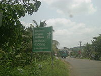
The economy of the High-Ranges of South and Central Kerala largely depends on the Main Eastern Highway. The main trunk road to SabarimalaSabarimala
Sabarimala is a Hindu pilgrimage center located in the Western Ghat mountain ranges of Pathanamthitta District in Kerala. It is the largest annual pilgrimage in India with an estimated 45–50 million devotees visiting every year. Sabarimala is believed to be the place where the Hindu God Ayyappan...
, Kerala's Largest Pilgrim Centre starts from Main Eastern Highway near Pathanamthitta
Pathanamthitta district
Pathanamthitta district is the youngest district located in the southern part of the state of Kerala, India. The district headquarters is in Pathanamthitta town. The district is surrounded by Kottayam, Idukki, Alappuzha and Kollam districts. It has a border with the state of Tamil Nadu in the east...
. Though it is the shortest route to Thrissur and Northern Kerala townships from Punalur, (the hill town of Kollam District) and in turn from the Tamil Nadu townships Tenkasi and Tirunelveli, it is not developed to its capacity. It acts as a parallel road to the Main Central Road. (M.C.Road/SH-01). It is also the Shortest route to the Kerala State Capital Thiruvananthapuram from Kumali and other major townships of Idukki district viz Kattappana, Thodupuzha etc.
Districts connected by Main Eastern Highway
- Kollam
- Pathanamthitta
- Kottayam
- Idukki
- Ernakulam
Townships on the Main Eastern Highway
- Punalur
- Pathanapuram
- Konni
- Kumbazha
- Mylapra
- Ranni
- Ponkunnam
- Pala
- Thodupuzha
- Muvattupuzha
See also
- M. C. Road
- Roads in KeralaRoads in KeralaKerala, southern most state of India has a good network of roads. It has eight National Highways, number of State Highways and many district roads.-Agency Wise Distribution of Road Length during 2009-10:...
- List of State Highways in Kerala